Sabres, Landes
| Sabres | |
|---|---|
| Commune | |
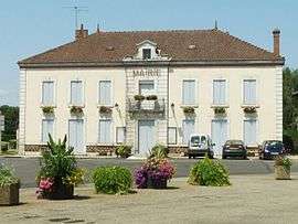 Town hall | |
 Sabres Location within Nouvelle-Aquitaine region  Sabres | |
| Coordinates: 44°08′56″N 0°44′19″W / 44.1489°N 0.7386°WCoordinates: 44°08′56″N 0°44′19″W / 44.1489°N 0.7386°W | |
| Country | France |
| Region | Nouvelle-Aquitaine |
| Department | Landes |
| Arrondissement | Mont-de-Marsan |
| Canton | Haute Lande Armagnac |
| Intercommunality | Haute Lande |
| Government | |
| • Mayor (2014–2020) | Gérard Moreau |
| Area1 | 160.13 km2 (61.83 sq mi) |
| Population (2013)2 | 1,210 |
| • Density | 7.6/km2 (20/sq mi) |
| Time zone | UTC+1 (CET) |
| • Summer (DST) | UTC+2 (CEST) |
| INSEE/Postal code | 40246 /40630 |
| Elevation |
58–107 m (190–351 ft) (avg. 76 m or 249 ft) |
|
1 French Land Register data, which excludes lakes, ponds, glaciers > 1 km2 (0.386 sq mi or 247 acres) and river estuaries. 2 Population without double counting: residents of multiple communes (e.g., students and military personnel) only counted once. | |
Sabres is a commune in the Landes department in Nouvelle-Aquitaine in southwestern France.
Population
| Historical population | ||
|---|---|---|
| Year | Pop. | ±% |
| 1793 | 1,911 | — |
| 1806 | 1,679 | −12.1% |
| 1821 | 1,920 | +14.4% |
| 1831 | 2,456 | +27.9% |
| 1841 | 2,524 | +2.8% |
| 1851 | 2,540 | +0.6% |
| 1861 | 2,525 | −0.6% |
| 1872 | 2,573 | +1.9% |
| 1881 | 2,540 | −1.3% |
| 1891 | 2,585 | +1.8% |
| 1901 | 2,506 | −3.1% |
| 1911 | 2,402 | −4.2% |
| 1921 | 2,143 | −10.8% |
| 1931 | 2,006 | −6.4% |
| 1946 | 1,590 | −20.7% |
| 1954 | 1,503 | −5.5% |
| 1962 | 1,309 | −12.9% |
| 1968 | 1,143 | −12.7% |
| 1968 | 1,143 | +0.0% |
| 1975 | 1,105 | −3.3% |
| 1982 | 1,058 | −4.3% |
| 1990 | 1,096 | +3.6% |
| 1999 | 1,107 | +1.0% |
| 2008 | 1,196 | +8.0% |
| 2013 | 1,210 | +1.2% |
See also
References
| Wikimedia Commons has media related to Sabres (Landes). |
This article is issued from
Wikipedia.
The text is licensed under Creative Commons - Attribution - Sharealike.
Additional terms may apply for the media files.