Carcarès-Sainte-Croix
| Carcarès-Sainte-Croix | |
|---|---|
| Commune | |
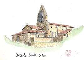 Watercolor of the church | |
 Carcarès-Sainte-Croix Location within Nouvelle-Aquitaine region  Carcarès-Sainte-Croix | |
| Coordinates: 43°50′33″N 0°47′24″W / 43.8425°N 0.79°WCoordinates: 43°50′33″N 0°47′24″W / 43.8425°N 0.79°W | |
| Country | France |
| Region | Nouvelle-Aquitaine |
| Department | Landes |
| Arrondissement | Dax |
| Canton | Pays morcenais tarusate |
| Intercommunality | Pays Tarusate |
| Government | |
| • Mayor (2014–2020) | Philippe Dubourg |
| Area1 | 15.57 km2 (6.01 sq mi) |
| Population (2013)2 | 512 |
| • Density | 33/km2 (85/sq mi) |
| Time zone | UTC+1 (CET) |
| • Summer (DST) | UTC+2 (CEST) |
| INSEE/Postal code | 40066 /40400 |
| Elevation |
14–74 m (46–243 ft) (avg. 34 m or 112 ft) |
|
1 French Land Register data, which excludes lakes, ponds, glaciers > 1 km2 (0.386 sq mi or 247 acres) and river estuaries. 2 Population without double counting: residents of multiple communes (e.g., students and military personnel) only counted once. | |
Carcarès-Sainte-Croix is a commune in the Landes department in Nouvelle-Aquitaine in southwestern France.
Population
| Historical population | ||
|---|---|---|
| Year | Pop. | ±% |
| 1793 | 441 | — |
| 1806 | 368 | −16.6% |
| 1821 | 376 | +2.2% |
| 1831 | 418 | +11.2% |
| 1841 | 507 | +21.3% |
| 1851 | 592 | +16.8% |
| 1861 | 612 | +3.4% |
| 1872 | 585 | −4.4% |
| 1881 | 570 | −2.6% |
| 1891 | 578 | +1.4% |
| 1901 | 560 | −3.1% |
| 1911 | 533 | −4.8% |
| 1921 | 576 | +8.1% |
| 1931 | 424 | −26.4% |
| 1946 | 417 | −1.7% |
| 1954 | 400 | −4.1% |
| 1962 | 410 | +2.5% |
| 1968 | 405 | −1.2% |
| 1975 | 379 | −6.4% |
| 1982 | 407 | +7.4% |
| 1990 | 426 | +4.7% |
| 1999 | 434 | +1.9% |
| 2008 | 478 | +10.1% |
| 2013 | 512 | +7.1% |
See also
References
| Wikimedia Commons has media related to Carcarès-Sainte-Croix. |
This article is issued from
Wikipedia.
The text is licensed under Creative Commons - Attribution - Sharealike.
Additional terms may apply for the media files.