Saint-Cricq-du-Gave
| Saint-Cricq-du-Gave | |
|---|---|
| Commune | |
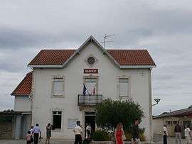 Town hall | |
 Saint-Cricq-du-Gave Location within Nouvelle-Aquitaine region  Saint-Cricq-du-Gave | |
| Coordinates: 43°32′05″N 1°00′43″W / 43.5347°N 1.0119°WCoordinates: 43°32′05″N 1°00′43″W / 43.5347°N 1.0119°W | |
| Country | France |
| Region | Nouvelle-Aquitaine |
| Department | Landes |
| Arrondissement | Dax |
| Canton | Orthe et Arrigans |
| Intercommunality | Pays d'Orthe |
| Government | |
| • Mayor (2014–2020) | Thierry Etcheberts |
| Area1 | 8.7 km2 (3.4 sq mi) |
| Population (2013)2 | 380 |
| • Density | 44/km2 (110/sq mi) |
| Time zone | UTC+1 (CET) |
| • Summer (DST) | UTC+2 (CEST) |
| INSEE/Postal code | 40254 /40300 |
| Elevation |
6–143 m (20–469 ft) (avg. 13 m or 43 ft) |
|
1 French Land Register data, which excludes lakes, ponds, glaciers > 1 km2 (0.386 sq mi or 247 acres) and river estuaries. 2 Population without double counting: residents of multiple communes (e.g., students and military personnel) only counted once. | |
Saint-Cricq-du-Gave is a commune in the Landes department in Nouvelle-Aquitaine in southwestern France.
Population
| Historical population | ||
|---|---|---|
| Year | Pop. | ±% |
| 1793 | 504 | — |
| 1806 | 556 | +10.3% |
| 1821 | 629 | +13.1% |
| 1831 | 649 | +3.2% |
| 1841 | 620 | −4.5% |
| 1851 | 662 | +6.8% |
| 1861 | 627 | −5.3% |
| 1872 | 583 | −7.0% |
| 1881 | 588 | +0.9% |
| 1891 | 544 | −7.5% |
| 1901 | 533 | −2.0% |
| 1911 | 503 | −5.6% |
| 1921 | 413 | −17.9% |
| 1931 | 365 | −11.6% |
| 1946 | 363 | −0.5% |
| 1954 | 323 | −11.0% |
| 1962 | 337 | +4.3% |
| 1968 | 323 | −4.2% |
| 1975 | 309 | −4.3% |
| 1982 | 297 | −3.9% |
| 1990 | 304 | +2.4% |
| 1999 | 264 | −13.2% |
| 2008 | 355 | +34.5% |
| 2013 | 380 | +7.0% |
See also
References
| Wikimedia Commons has media related to Saint-Cricq-du-Gave. |
This article is issued from
Wikipedia.
The text is licensed under Creative Commons - Attribution - Sharealike.
Additional terms may apply for the media files.