Arue, Landes
| Arue | |
|---|---|
| Commune | |
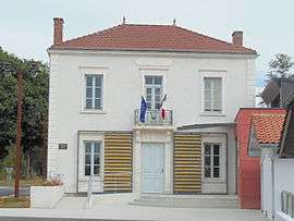 Town hall | |
 Arue Location within Nouvelle-Aquitaine region  Arue | |
| Coordinates: 44°03′40″N 0°21′01″W / 44.0611°N 0.3503°WCoordinates: 44°03′40″N 0°21′01″W / 44.0611°N 0.3503°W | |
| Country | France |
| Region | Nouvelle-Aquitaine |
| Department | Landes |
| Arrondissement | Mont-de-Marsan |
| Canton | Haute Lande Armagnac |
| Intercommunality | CC Landes Armagnac |
| Government | |
| • Mayor (2017-2020) | Frédéric Duprat |
| Area1 | 48.11 km2 (18.58 sq mi) |
| Population (2015)2 | 335 |
| • Density | 7.0/km2 (18/sq mi) |
| Time zone | UTC+1 (CET) |
| • Summer (DST) | UTC+2 (CEST) |
| INSEE/Postal code | 40014 /40120 |
| Elevation | 47–113 m (154–371 ft) |
|
1 French Land Register data, which excludes lakes, ponds, glaciers > 1 km2 (0.386 sq mi or 247 acres) and river estuaries. 2 Population without double counting: residents of multiple communes (e.g., students and military personnel) only counted once. | |
Arue (Occitan: Arua) is a commune of the Landes department in Nouvelle-Aquitaine in southwestern France.
Population
| Historical population | ||
|---|---|---|
| Year | Pop. | ±% |
| 1962 | 379 | — |
| 1968 | 425 | +12.1% |
| 1975 | 347 | −18.4% |
| 1982 | 294 | −15.3% |
| 1990 | 290 | −1.4% |
| 1999 | 286 | −1.4% |
| 2006 | 295 | +3.1% |
| 2009 | 305 | +3.4% |
| 2015 | 335 | +9.8% |
See also
References
| Wikimedia Commons has media related to Arue (Landes). |
This article is issued from
Wikipedia.
The text is licensed under Creative Commons - Attribution - Sharealike.
Additional terms may apply for the media files.