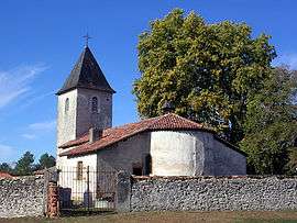
Canenx-et-Réaut
| Canenx-et-Réaut | |
|---|---|
| Commune | |
 | |
 Canenx-et-Réaut Location within Nouvelle-Aquitaine region  Canenx-et-Réaut | |
| Coordinates: 44°00′28″N 0°26′29″W / 44.0078°N 0.4414°WCoordinates: 44°00′28″N 0°26′29″W / 44.0078°N 0.4414°W | |
| Country | France |
| Region | Nouvelle-Aquitaine |
| Department | Landes |
| Arrondissement | Mont-de-Marsan |
| Canton | Haute Lande Armagnac |
| Intercommunality | Pays d'Albret |
| Government | |
| • Mayor (2014–2020) | Jean-Michel Guillaume |
| Area1 | 28.07 km2 (10.84 sq mi) |
| Population (2013)2 | 167 |
| • Density | 5.9/km2 (15/sq mi) |
| Time zone | UTC+1 (CET) |
| • Summer (DST) | UTC+2 (CEST) |
| INSEE/Postal code | 40064 /40090 |
| Elevation |
38–108 m (125–354 ft) (avg. 76 m or 249 ft) |
|
1 French Land Register data, which excludes lakes, ponds, glaciers > 1 km2 (0.386 sq mi or 247 acres) and river estuaries. 2 Population without double counting: residents of multiple communes (e.g., students and military personnel) only counted once. | |
Canenx-et-Réaut is a commune in the Landes department in Nouvelle-Aquitaine in southwestern France.
Population
| Historical population | ||
|---|---|---|
| Year | Pop. | ±% |
| 1793 | 390 | — |
| 1806 | 311 | −20.3% |
| 1821 | 455 | +46.3% |
| 1831 | 482 | +5.9% |
| 1841 | 486 | +0.8% |
| 1851 | 471 | −3.1% |
| 1861 | 458 | −2.8% |
| 1872 | 505 | +10.3% |
| 1881 | 527 | +4.4% |
| 1891 | 517 | −1.9% |
| 1901 | 501 | −3.1% |
| 1911 | 504 | +0.6% |
| 1921 | 380 | −24.6% |
| 1931 | 359 | −5.5% |
| 1946 | 258 | −28.1% |
| 1954 | 269 | +4.3% |
| 1962 | 248 | −7.8% |
| 1968 | 182 | −26.6% |
| 1975 | 136 | −25.3% |
| 1982 | 112 | −17.6% |
| 1990 | 153 | +36.6% |
| 1999 | 135 | −11.8% |
| 2008 | 166 | +23.0% |
| 2013 | 167 | +0.6% |
See also
References
| Wikimedia Commons has media related to Canenx-et-Réaut. |
This article is issued from
Wikipedia.
The text is licensed under Creative Commons - Attribution - Sharealike.
Additional terms may apply for the media files.