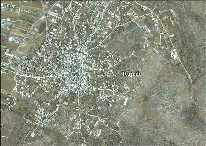
Rujeib
| Rujeib | |
|---|---|
| Other transcription(s) | |
| • Arabic | روجيب |
| • Also spelled | Rujib (unofficial) |
 | |
 Rujeib Location of Rujeib within Palestine | |
| Coordinates: 32°11′27″N 35°17′34″E / 32.19083°N 35.29278°ECoordinates: 32°11′27″N 35°17′34″E / 32.19083°N 35.29278°E | |
| Palestine grid | 177/177 |
| Governorate | Nablus |
| Government | |
| • Type | Village council |
| Population (2006) | |
| • Jurisdiction | 3,915 |
| Name meaning | either from personal name, or for a prop for a tree,[1] |
Rujeib (Arabic: روجيب) is a Palestinian town in the Nablus Governorate in northern West Bank, located 3 kilometers southeast of Nablus. According to the Palestinian Central Bureau of Statistics (PCBS), the town had a population of 3,915 inhabitants in mid-year 2006.[2]
Location
Rujeib is located 4.3 km south east of Nablus. It is bordered by Beit Furik to the east, ‘Awarta to the south, and Nablus to the north and west.[3]
History
There was a human habitation here during the Chalcolithic era.[4][5]
Sherds from the Late Bronze Age/Iron Age I,[5] Hellenistic,[5][6][7] Roman[5][6] and Byzantine[5][6] eras have been found here.
It has been suggested that Rujeib was the Crusader village Ragabam, which was one of the villages exchanged with Bethany by King Baldwin I and given as a fief to the Church of the Holy Sepulchre.[8][9] Pottery from the Crusader era have also been found here.[5]
Ottoman era
In 1517, the village was included in the Ottoman empire with the rest of Palestine, and in the 1596 tax-records it appeared as Rujib, located in the Nahiya of Jabal Qubal in the Nablus Sanjak. The population was 16 households and 1 bachelors, all Muslim. They paid a fixed tax rate of 33,3% on agricultural products, such as wheat, barley, summer crops, olive trees, goats and beehives, a press for olive oil or grape syrup, in addition to occasional revenues and a fixed tax for people of Nablus area; a total of 3,600 Akçe.[10]
In 1838, Raujib was noted in the El-Beitawy district, east of Nablus, together with Beita, Haudela and Awarta.[11] In 1850/51 de Saulcy noted Roujib on a lower hill than Beit Dejan.[12]
In 1870, Victor Guérin noted that Rujeib was a "village of three hundred inhabitants more, on a hill whose flanks were formerly, in several places, exploited as a quarry. Cactus hedges serve as enclosures for some gardens."[13]
In 1882, the Palestine Exploration Fund's "Survey of Western Palestine", Rujib was described as "A village of moderate size to the east of the plain so named, with a few olives round it."[14]
British Mandate era
In the 1922 census of Palestine conducted by the British Mandate authorities, Rujib had a population of 250 Muslims,[15] increasing in the 1931 census to 277 Muslims, in 58 houses.[16]
In the 1945 statistics, Rujeib had a population of 390 Muslims[17] while the total land area was 7,038 dunams, according to an official land and population survey.[18] Of this, 235 dunams were used for plantations and irrigable land, 3,410 for cereals,[19] while 30 dunams were classified as built-up areas.[20]
Jordanian era
In the wake of the 1948 Arab–Israeli War, and after the 1949 Armistice Agreements, Rujeib came under Jordanian rule.
In 1961, the population of Rujeib was 628 persons.[21]
Post 1967
After the Six-Day War in 1967, Rujeib came under Israeli occupation. The population in the 1967 census conducted by Israel was 831, of whom 30 originated from the Israeli territory.[22]
After the 1995 accord 28% of village land is defined as Area B land, while the remaining 72% is defined as Area C. Israel has confiscated 169 dunams of land from Rujeib for construction of the Israeli settlement of Itamar. In addition, Israel has also confiscated land from Awarta, Beit Furik and Yanun for Itamar.[23]
References
- ↑ Palmer, 1881, p. 189
- ↑ Projected Mid -Year Population for Nablus Governorate by Locality 2004- 2006 Palestinian Central Bureau of Statistics
- ↑ Rujeib village profile, ARIJ, p. 4
- ↑ Jaroš and Deckert, 1977, p. 28
- 1 2 3 4 5 6 Bull and Campbell, 1968, p. 31
- 1 2 3 Finkelstein et al, 1997, p. 709
- ↑ Jaroš and Deckert, 1977, p. 44
- ↑ Conder and Kitchener, 1883, SWP III, p. 11
- ↑ Conder, 1890, p. 33 NB: Conder mistakenly places Rujeib on SWP map 14
- ↑ Hütteroth and Abdulfattah, 1977, p. 135
- ↑ Robinson and Smith, 1841, vol 3, pp. 94, 103, 2nd Appendix, p. 128
- ↑ Saulcy, 1854, vol 1, p. 99
- ↑ Guérin, 1874, pp. 462 -463
- ↑ Conder and Kitchener, 1882, SWP II, p. 168
- ↑ Barron, 1923, Table IX, p. 24
- ↑ Mills, 1932, p. 64
- ↑ Government of Palestine, Department of Statistics, 1945, p. 19
- ↑ Government of Palestine, Department of Statistics. Village Statistics, April, 1945. Quoted in Hadawi, 1970, p. 61
- ↑ Government of Palestine, Department of Statistics. Village Statistics, April, 1945. Quoted in Hadawi, 1970, p. 107
- ↑ Government of Palestine, Department of Statistics. Village Statistics, April, 1945. Quoted in Hadawi, 1970, p. 157
- ↑ Government of Jordan, Department of Statistics, 1964, p. 26
- ↑ Perlmann, Joel (November 2011 – February 2012). "The 1967 Census of the West Bank and Gaza Strip: A Digitized Version" (PDF). Levy Economics Institute. Retrieved 25 January 2018.
- ↑ Rujeib village profile, ARIJ, p. 14
Bibliography
- Barron, J.B., ed. (1923). Palestine: Report and General Abstracts of the Census of 1922. Government of Palestine.
- Bull, Robert J.; Edward F. Campbell (1968). "The Sixth Campaign at Balâṭah (Shechem)". Bulletin of the American Schools of Oriental Research. 190: 2–41. JSTOR 1356191.
- Conder, C.R.; Kitchener, H.H. (1882). The Survey of Western Palestine: Memoirs of the Topography, Orography, Hydrography, and Archaeology. 2. London: Committee of the Palestine Exploration Fund.
- Conder, C.R.; Kitchener, H.H. (1883). The Survey of Western Palestine: Memoirs of the Topography, Orography, Hydrography, and Archaeology. 3. London: Committee of the Palestine Exploration Fund.
- Conder, C.R. (1890). "Norman Palestine". Quarterly statement - Palestine Exploration Fund. 22: 29–37.
- Finkelstein, I.; Lederman, Zvi, eds. (1997). Highlands of many cultures. Tel Aviv: Institute of Archaeology of Tel Aviv University Publications Section. ISBN 965-440-007-3.
- Government of Jordan, Department of Statistics (1964). First Census of Population and Housing. Volume I: Final Tables; General Characteristics of the Population (PDF).
- Government of Palestine, Department of Statistics (1945). Village Statistics, April, 1945.
- Guérin, V. (1874). Description Géographique Historique et Archéologique de la Palestine (in French). 2: Samarie, pt. 1. Paris: L'Imprimerie Nationale.
- Hadawi, S. (1970). Village Statistics of 1945: A Classification of Land and Area ownership in Palestine. Palestine Liberation Organization Research Center.
- Hütteroth, Wolf-Dieter; Abdulfattah, Kamal (1977). Historical Geography of Palestine, Transjordan and Southern Syria in the Late 16th Century. Erlanger Geographische Arbeiten, Sonderband 5. Erlangen, Germany: Vorstand der Fränkischen Geographischen Gesellschaft. ISBN 3-920405-41-2.
- Jaroš, K.; Deckert B. (1977). "Studien zur Sichem Ära" (PDF). University of Zurich: 1–83. ISBN 3-7278-0180-8.
- Mills, E., ed. (1932). Census of Palestine 1931. Population of Villages, Towns and Administrative Areas. Jerusalem: Government of Palestine.
- Palmer, E.H. (1881). The Survey of Western Palestine: Arabic and English Name Lists Collected During the Survey by Lieutenants Conder and Kitchener, R. E. Transliterated and Explained by E.H. Palmer. Committee of the Palestine Exploration Fund.
- Robinson, E.; Smith, E. (1841). Biblical Researches in Palestine, Mount Sinai and Arabia Petraea: A Journal of Travels in the year 1838. 3. Boston: Crocker & Brewster.
- Saulcy, L.F. de (1854). Narrative of a journey round the Dead Sea, and in the Bible lands, in 1850 and 1851. 1, new edition. London: R. Bentley.
External links
- Welcome to Rujeib
- Rujeib Welcome to Palestine
- Survey of Western Palestine, Map 11: IAA, Wikimedia commons
- Rujeib village profile, Applied Research Institute–Jerusalem (ARIJ)
- Rujeib (aerial photo), ARIJ
- Development Priorities and Needs in Rujeib, ARIJ
