Huwara
| Huwara | |
|---|---|
| Other transcription(s) | |
| • Arabic | حُوّاره |
| • Also spelled |
Howwarah (official) Huwara (unofficial) |
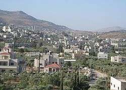 Huwara | |
 Huwara Location of Huwara within Palestine | |
| Coordinates: 32°09′09″N 35°15′24″E / 32.15250°N 35.25667°ECoordinates: 32°09′09″N 35°15′24″E / 32.15250°N 35.25667°E | |
| Palestine grid | 174/173 |
| Governorate | Nablus |
| Government | |
| • Type | Municipality |
| Area | |
| • Jurisdiction | 7,982 dunams (7.982 km2 or 3.082 sq mi) |
| Population (2007)[1] | |
| • Jurisdiction | 5,570 |
| Name meaning | "White marl"[2] |
Huwara (Arabic: حُوّاره, ḥuwwarah, ![]()
Location
Huwwara is located 7.28 kilometers (4.52 mi) south of Nablus. It is bordered by Awarta, Odala and Beita to the east, Za’tara and Yasuf to the south, Jamma'in and Einabus to the west, and Asira al-Qibliya and Burin to the north.[5]
History
Huwara is an ancient site, and cisterns and tombs in rock have been found, together with remains of columns.[6]
In the 12th and 13th centuries, Hawara was inhabited by Muslims.[7] Finkelstein did not find any sherds predating the Ottoman era.[8]
Ottoman era
The village was incorporated into the Ottoman Empire in 1517 with all of Palestine, and in 1596 it appeared in the tax registers as being in the Nahiya of Jabal Qubal, part of Nablus Sanjak. It had a population of 87 households, all Muslim. The villagers paid a fixed tax rate of 33,3% on various products, such as wheat, barley, summer crops, olives, goats and/or beehives, and a press for olives or grapes, in addition to "occasional revenues"; a total of 14,000 akçe.[9]
In 1838, Robinson described Huwara as a "large and old village".[10] It was also noted as a Muslim village, in Jurat Merda, south of Nablus.[11]
In the 1850s the Ottoman rulers withdrew their soldiers from the district (to be used in the Crimean War), and hence open hostility could ensue between different Palestinian factions.[12] In 1853, Huwara was engaged in a battle with the neighboring villages of Quza and Beita which left ten men and seven women dead.[13]
The French explorer Victor Guérin visited the village in 1870. He found the village, (which he called Haouarah), to have about 800 inhabitants, and that it was divided into two districts, each administered by a sheikh. A wali was dedicated to Abou en-Nebyh Sahin.[14]
In 1882, the Palestine Exploration Fund's Survey of Western Palestine described Huwarah as a village "of stone and mud at the foot of Gerizim, just over the main road. It has an appearance of antiquity, and covers a considerable extent of ground".[15]
British Mandate period
In the 1922 census of Palestine conducted by the British Mandate authorities, Huwara had a population of 921, all Muslims,[16] increasing slightly in the 1931 census, where Huwara (together with the smaller location Bir Quza) had 240 occupied houses and a population of 955, still all Muslims.[17]
In the 1945 statistics Huwwara had a population of 1,300, all Muslims,[18] with 7,982 dunams of land, according to an official land and population survey.[19] Of this, 607 dunams were plantations and irrigable land, 4,858 used for cereals,[20] while 129 dunams were built-up land.[21]
The first elementary school was established in 1947. Huwara Elementary as well as secondary schools serves infants from neighboring villages up to the present time.
Jordanian era

In the wake of the 1948 Arab–Israeli War, and after the 1949 Armistice Agreements, Huwara came under Jordanian rule. The first elementary school was converted into secondary school in 1962. The first female elementary school was established in 1957.
The Jordanian census of 1961 found 1,966 inhabitants.[22]
Post-1967
Since the 1967 Six-Day War, Huwara has been under Israeli occupation.
After the 1995 accords, 38% of Huwwara land is defined as Area B, the remaining 62% is defined as Area C.[23] Israel has confiscated 282 dunam of Huwwara land for the Israeli settlement of Yitzhar.[24]
Huwara has been the target of price tag attacks, random acts violence by Israeli Jewish settlers. According to the International Middle East Media Center (IMEMC), in April 2010 settlers torched three Palestinian vehicles in Huwara,[25] while on 27 February 2011, in a price-tag attack against the evacuation of Havat Gilad, settlers threw molotov cocktails at a house in the village.[26] In March 2012 a Star of David was sprayed on a village mosque.[27] In March 2013, in another price-tag attack, Jewish settlers descended on Huwara in the hours after the Borovsky killing. They attacked a bus carrying Palestinian schoolgirls with stones, shattering a wind-shield and wounding the driver.[28]
In October 2014, during the olive harvest season,[29] a fire razed to the ground huge swathes of Palestinian-owned agricultural land between the village of Hawara, near Nablus and the Yitzhar settlement in the West Bank, destroying over a hundred olive trees.[30] Although the cause of the fire has been contested, the mayor of Huwara claimed masked men from nearby Yitzhar and surrounding settlements set the fire by pouring incendiary fluids on the trees[30] and that the Israeli occupation forces prevented Palestinian citizens from reaching the lands in order to extinguish the fire. Later on, the Israeli forces allowed the civil defence from the adjacent Palestinian village of Burin to extinguish the fire, but only after it had expanded to an even larger area .[31] The burning and damaging of olive trees is an ongoing-concern of the United Nations,[25] a pattern the New York Times call "price tag" attacks.[32] The United Nations has reported that by 2013 "...Israeli settlers damaged or destroyed nearly 11,000 olive trees owned by the Palestinians in the occupied West Bank."[29][33]
North of Huwara, was the Huwwara Checkpoint, one of the Israeli checkpoints around Nablus, dismanteld in 2011 in order to ease traffic between Nablus and Ramallah.[34]
Its location on the main road, used by both Israelis from four Israeli settlements in the Nablus area and Palestinians from the Nablus area, is a controlling factor of the life in Huwara. The town has many businesses located on the road, which is controlled by the Israeli army to ensure free passage to Jews and Arabs.[35]
Protests and attacks
On May 18, 2017, an Israeli settler from Itamar driving through Huwara was attacked by stone throwers. The settler used his firearm, killing one and wounding another.[36]
References
- ↑ 2007 PCBS Census Archived 2010-12-10 at the Wayback Machine.. Palestinian Central Bureau of Statistics. p. 110
- ↑ Palmer, 1881, p. 229
- 1 2 Rix, 1907, p. 25
- ↑ "Projected Mid -Year Population for Nablus Governorate by Locality 2004- 2006". Palestinian Central Bureau of Statistics. Archived from the original on 2008-02-07. Retrieved 2007-10-06.
- ↑ Huwwara Town Profile, ARIJ, p. 4
- ↑ Dauphin, 1998, p. 804
- ↑ Ellenblum, 2003, pp. 244, 263
- ↑ Finkelstein, 1997, p. 686-9
- ↑ Hütteroth and Abdulfattah, 1977, p. 132
- ↑ Robinson and Smith, 1841, vol 3, p. 93
- ↑ Robinson and Smith, 1841, vol 3, Appendix 2, p. 127
- ↑ Schölch, 1993, pp. 211-227
- ↑ Finn, 1878, p. 298, cited in Avneri, 1984, p. 20
- ↑ Guérin, 1874, p. 460
- ↑ Conder and Kitchener, 1882, SWP II, p. 284
- ↑ Barron, 1923, Table IX, Sub-district of Nablus, p. 25
- ↑ Mills, 1932, p. 62
- ↑ Government of Palestine, Department of Statistics, 1945, p. 18
- ↑ Government of Palestine, Department of Statistics. Village Statistics, April, 1945. Quoted in Hadawi, 1970, p. 60
- ↑ Government of Palestine, Department of Statistics. Village Statistics, April, 1945. Quoted in Hadawi, 1970, p. 106
- ↑ Government of Palestine, Department of Statistics. Village Statistics, April, 1945. Quoted in Hadawi, 1970, p. 156
- ↑ Government of Jordan, Department of Statistics, 1964, p. 25
- ↑ Huwwara Town Profile, ARIJ, p. 15
- ↑ Huwwara Town Profile, ARIJ, p. 16
- 1 2 Bannoura, Saed (13 May 2010), "Settler Torch Olive Orchard In Silwan", International Middle East Media Center
- ↑ Yair Altman, Price tag: Palestinian cars vandalized in Hebron.' in Ynet, 1 March 2011
- ↑ Israeli firefighters: West Bank mosque fire likely arson, May, 06, 2010, Haaretz
- ↑ Settlers throw stones, burn fields after terror attack, Itamar Fleishman, 04.30.13, Ynet
- 1 2 Booth, William (22 October 2014). "In West Bank, Palestinians gird for settler attacks on olive trees". Kfar Yassug, West Bank. Retrieved 23 January 2015.
- 1 2 Kinder, Tabatha (24 October 2014). "Palestine: Jewish Settlers Torch 100 of World's Oldest Olive Trees". International Business News. Retrieved 22 January 2015.
- ↑ "Settlers burn 100 olive trees near Nablus in the occupied West Bank". Middle East Monitor. 23 October 2014. Retrieved 22 January 2015.
- ↑ Kershner, Isabel (3 October 2011). "Mosque Set on Fire in Northern Israel". New York Times. Jerusalem. Retrieved 23 January 2015.
- ↑ "Nearly 11,000 Palestinian-owned trees damaged by Israeli settlers in 2013", United Nations Information System on the Question of Palestine (UNISPAL), retrieved 23 January 2015
- ↑ Sandercock, Josie; et al. (2004). Peace Under Fire: Israel/Palestine and the International Solidarity Movement. Verso. p. 110. ISBN 1-84467-501-7.
- ↑ Friedman, Robert I. (2001-12-06). "And Darkness Covered the Land". The Nation. Retrieved 2007-09-13.
- ↑ Video: Palestinians Surrounded Settler’s Car Before He Opened Fire, Yotam Berger, May 18, 2017, Haaretz
Bibliography
- Avneri, Arieh L. (1984). The Claim of Dispossession: Jewish Land-settlement and the Arabs, 1878-1948. Transaction Publishers. ISBN 0-87855-964-7.
- Barron, J. B., ed. (1923). Palestine: Report and General Abstracts of the Census of 1922. Government of Palestine.
- Conder, C.R.; Kitchener, H.H. (1882). The Survey of Western Palestine: Memoirs of the Topography, Orography, Hydrography, and Archaeology. 2. London: Committee of the Palestine Exploration Fund.
- Dauphin, Claudine (1998). La Palestine byzantine, Peuplement et Populations. BAR International Series 726 (in French). III : Catalogue. Oxford: Archeopress. ISBN 0860549054.
- Ellenblum, Ronnie (2003). Frankish Rural Settlement in the Latin Kingdom of Jerusalem. Cambridge University Press. ISBN 9780521521871.
- Finkelstein, I.; Lederman, Zvi, eds. (1997). Highlands of many cultures. Tel Aviv: Institute of Archaeology of Tel Aviv University Publications Section. ISBN 965-440-007-3.
- Finn, J. (1878). E.A. Finn, ed. Stirring Times: Or Records from Jerusalem Consular Chronicles of 1853 to 1856. 1. London.
- Government of Jordan, Department of Statistics (1964). First Census of Population and Housing. Volume I: Final Tables; General Characteristics of the Population (PDF).
- Government of Palestine, Department of Statistics (1945). Village Statistics, April, 1945.
- Guérin, V. (1874). Description Géographique Historique et Archéologique de la Palestine (in French). 2: Samarie, pt. 1. Paris: L'Imprimerie Nationale.
- Hadawi, S. (1970). Village Statistics of 1945: A Classification of Land and Area ownership in Palestine. Palestine Liberation Organization Research Center.
- Hütteroth, Wolf-Dieter; Abdulfattah, Kamal (1977). Historical Geography of Palestine, Transjordan and Southern Syria in the Late 16th Century. Erlanger Geographische Arbeiten, Sonderband 5. Erlangen, Germany: Vorstand der Fränkischen Geographischen Gesellschaft. ISBN 3-920405-41-2.
- Mills, E., ed. (1932). Census of Palestine 1931. Population of Villages, Towns and Administrative Areas. Jerusalem: Government of Palestine.
- Palmer, E.H. (1881). The Survey of Western Palestine: Arabic and English Name Lists Collected During the Survey by Lieutenants Conder and Kitchener, R. E. Transliterated and Explained by E.H. Palmer. Committee of the Palestine Exploration Fund.
- Robinson, E.; Smith, E. (1841). Biblical Researches in Palestine, Mount Sinai and Arabia Petraea: A Journal of Travels in the year 1838. 3. Boston: Crocker & Brewster.
- Rix, Herbert (1907). Tent and Testament: A Camping Tour in Palestine. New York, London: Scribner. p. 25.
- Saulcy, L.F. de (1854). Narrative of a journey round the Dead Sea, and in the Bible lands, in 1850 and 1851. 1, new edition. London: R. Bentley. (Saulcy, 1854, vol 1, p. 102)
- Schölch, Alexander (1993). Palestine in Transformation, 1856-1882: Studies in Social, Economic, and Political Development. Institute for Palestine Studies. ISBN 0-88728-234-2.
External links
- Welcome To Huwwara
- Huwara, Welcome to Palestine
- Survey of Western Palestine, Map 14: IAA, Wikimedia commons
- Howwarah Municipality
- Huwwara Town Profile, Applied Research Institute–Jerusalem (ARIJ)
- Huwwara, aerial photo, ARIJ
