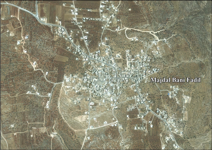
Majdal Bani Fadil
| Majdal Bani Fadil | |
|---|---|
| Other transcription(s) | |
| • Arabic | مجدل بني فاضل |
 Majdal Bani Fadil | |
 Majdal Bani Fadil Location of Majdal Bani Fadil within Palestine | |
| Coordinates: 32°05′01″N 35°21′46″E / 32.08361°N 35.36278°ECoordinates: 32°05′01″N 35°21′46″E / 32.08361°N 35.36278°E | |
| Palestine grid | 184/165 |
| Governorate | Nablus |
| Government | |
| • Type | Village council |
| • Head of Municipality | Walid Othman |
| Area | |
| • Jurisdiction | 28,000 dunams (28.0 km2 or 10.8 sq mi) |
| Population (2007) | |
| • Jurisdiction | 2,382 |
| Name meaning | The watch tower of the Beni Fadil (an Arab clan)[1] |
Majdal Bani Fadil (Arabic: مجدل بني فاضل) is a Palestinian town in the Nablus Governorate in northern West Bank, located 23 kilometers (14 mi) southeast of Nablus. According to the Palestinian Central Bureau of Statistics (PCBS), the town had a population of 2,382 inhabitants in 2007.[2]
Majdal Bani Fadil is under the local administration of a nine-member village council headed by Walid Othman.[3] Most of the village's residents are from the Othman and Zayn ad-Din clans. The main economic activities are herding and agriculture, specifically olives, grapes, prunes and figs. The main road connecting Majdal Bani Fadil to Ramallah and Nablus and Jericho has been closed off to the village since 2000 during the Second Intifada.[4]
Location
Majdal Bani Fadil is located east of Qusra, north of Duma, west of Al-Jiftlik and south of Jurish.[5]
History
Sherds from Iron Age II, Hellenistic/Roman, Byzantine, Crusader/Ayyubid and Mamluk eras have been found here.[6][7]
Ottoman era
In 1517, the village was included in the Ottoman empire with the rest of Palestine, and potsherds from the early Ottoman period have been found here.[6] It appeared in the 1596 tax-records as Majdal, located in the Nahiya of Jabal Qubal of the Liwa of Nablus. The population was 18 households, all Muslim. They paid a fixed tax rate of 33,3% on agricultural products, such as wheat, barley, summer crops, olive trees, goats and beehives, in addition to occasional revenues and a fixed tax for people of Nablus area; a total of 1,450 akçe.[8]
In 1838 Edward Robinson noted Mejdel Beni Fadil located in El-Beitawy district, east of Nablus.[9]
In 1870 Guérin noted: "I found here two small and ancient columns. Numerous cisterns, caverns, and rock-cut tombs prove the antiquity of the site, the ancient name of which was doubtless Migdal. I also examined a very curious excavation here, called el Kaf. It is of square form, and measures 26 feet 2 inches on each side. It is three-quarters fallen in, and offers this peculiarity-that those portions of wall still visible are provided on the inside with small niches, some triangular and some vaulted, cut at equal distances and in rows."[10] He further remarked that in the little mosque called Nabi Yahia, there were two antique reused columns.[11]
In 1882, the Palestine Exploration Fund's Survey of Western Palestine (SWP) described it as "a small village on the top of a hill, with olives on the south and west, and a small sacred place on the south-east. On the east are caves, and there are tombs and rock-cut cisterns near the village."[12]
British Mandate era
In the 1922 census of Palestine conducted by the British Mandate authorities, Majdal had a population of 199 Muslims,[13] increasing in the 1931 census to 310, still all Muslims, in a total of 70 houses.[14]
In the 1945 statistics Majdal Bani Fadil had a population of 430 Muslims[15] and a total of 28,022 dunams of land, according to an official land and population survey.[16] Of this, 1,131 dunams were plantations and irrigable land, 6,994 used for cereals,[17] while 36 dunams were built-up land.[18]
Jordanian era
In the wake of the 1948 Arab–Israeli War, and after the 1949 Armistice Agreements, Majdal Bani Fadil came under Jordanian rule.
The Jordanian census of 1961 found 628 inhabitants in Majdal Bani Fadil.[19]
Post-1967
After the Six-Day War in 1967, Majdal Bani Fadil has been under Israeli occupation. The population of Majdal Bani Fadil in the 1967 census conducted by Israel was 629, of whom 1 originated from the Israeli territory.[20]
After the 1995 accords, 18% of village land is classified as Area B (partial Palestinian control), while the remaining 82% is Area C (full Israeli control)[21]
References
- ↑ Palmer, 1881, p. 257
- ↑ 2007 PCBS Census Archived 2010-12-10 at the Wayback Machine.. Palestinian Central Bureau of Statistics (PCBS). 2008.
- ↑ Council Members. Majdal Bani Fadil Council.
- ↑ Majdal Bani Fadil Village. POICA, 2010-07-02.
- ↑ Majdal Bani Fadil Village Profile, ARIJ, p. 4
- 1 2 Finkelstein et al, 1997, p. 787
- ↑ Dauphin, 1998, p. 850
- ↑ Hütteroth and Abdulfattah, 1977, p. 133
- ↑ Robinson and Smith, 1841, vol 3, Appendix 2, p. 128
- ↑ Guérin, 1875, pp. 9-10, as given in Conder and Kitchener, 1882, SWP II, p. 402
- ↑ Guérin, 1875, pp. 9-10
- ↑ Conder and Kitchener, 1882, SWP II, pp. 386-387
- ↑ Barron, 1923, Table IX, Sub-district of Nablus, p. 25
- ↑ Mills, 1932, p. 63
- ↑ Government of Palestine, Department of Statistics, 1945, p. 19
- ↑ Government of Palestine, Department of Statistics. Village Statistics, April, 1945. Quoted in Hadawi, 1970, p. 60
- ↑ Government of Palestine, Department of Statistics. Village Statistics, April, 1945. Quoted in Hadawi, 1970, p. 107
- ↑ Government of Palestine, Department of Statistics. Village Statistics, April, 1945. Quoted in Hadawi, 1970, p. 157
- ↑ Government of Jordan, Department of Statistics, 1964, p. 26
- ↑ Perlmann, Joel (November 2011 – February 2012). "The 1967 Census of the West Bank and Gaza Strip: A Digitized Version" (PDF). Levy Economics Institute. Retrieved 25 January 2018.
- ↑ Majdal Bani Fadil Village Profile, ARIJ, p. 14
Bibliography
- Barron, J.B., ed. (1923). Palestine: Report and General Abstracts of the Census of 1922. Government of Palestine.
- Conder, C.R.; Kitchener, H.H. (1882). The Survey of Western Palestine: Memoirs of the Topography, Orography, Hydrography, and Archaeology. 2. London: Committee of the Palestine Exploration Fund. (p. 402)
- Dauphin, Claudine (1998). La Palestine byzantine, Peuplement et Populations. BAR International Series 726 (in French). III : Catalogue. Oxford: Archeopress. ISBN 0-860549-05-4.
- Finkelstein, I.; Lederman, Zvi, eds. (1997). Highlands of many cultures. 1. Tel Aviv: Institute of Archaeology of Tel Aviv University Publications Section. ISBN 965-440-007-3.
- Government of Jordan, Department of Statistics (1964). First Census of Population and Housing. Volume I: Final Tables; General Characteristics of the Population (PDF).
- Government of Palestine, Department of Statistics (1945). Village Statistics, April, 1945.
- Guérin, V. (1875). Description Géographique Historique et Archéologique de la Palestine (in French). 2: Samarie, pt. 2. Paris: L'Imprimerie Nationale.
- Hadawi, S. (1970). Village Statistics of 1945: A Classification of Land and Area ownership in Palestine. Palestine Liberation Organization Research Center.
- Hütteroth, Wolf-Dieter; Abdulfattah, Kamal (1977). Historical Geography of Palestine, Transjordan and Southern Syria in the Late 16th Century. Erlanger Geographische Arbeiten, Sonderband 5. Erlangen, Germany: Vorstand der Fränkischen Geographischen Gesellschaft. ISBN 3-920405-41-2.
- Mills, E., ed. (1932). Census of Palestine 1931. Population of Villages, Towns and Administrative Areas. Jerusalem: Government of Palestine.
- Palmer, E.H. (1881). The Survey of Western Palestine: Arabic and English Name Lists Collected During the Survey by Lieutenants Conder and Kitchener, R. E. Transliterated and Explained by E.H. Palmer. Committee of the Palestine Exploration Fund.
- Robinson, E.; Smith, E. (1841). Biblical Researches in Palestine, Mount Sinai and Arabia Petraea: A Journal of Travels in the year 1838. 3. Boston: Crocker & Brewster.
External links
- Welcome To Majdal Bani Fadil
- Majdal Bani Fadil, Welcome to Palestine
- Survey of Western Palestine, Map 15: IAA, Wikimedia commons
- Majdal Bani Fadil Village Profile, Applied Research Institute–Jerusalem, ARIJ
- Majdal Bani Fadil, aerial photo, ARIJ
- Development Priorities and Needs in Majdal Bani Fadil, ARIJ
