Sarra, Nablus
| Sarra | |
|---|---|
| Other transcription(s) | |
| • Arabic | صره |
| • Also spelled | Sorra (unofficial) |
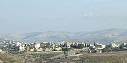 Sarra in the front. Behind on the left is Burqa | |
 Sarra Location of Sarra within Palestine | |
| Coordinates: 32°12′36″N 35°11′27″E / 32.21000°N 35.19083°ECoordinates: 32°12′36″N 35°11′27″E / 32.21000°N 35.19083°E | |
| Palestine grid | 168/179 |
| Governorate | Nablus |
| Government | |
| • Type | Village council |
| Population (2006) | |
| • Jurisdiction | 2,892 |
| Name meaning | from personal name[1] |
Sarra (Arabic: صره) is a Palestinian town in the Nablus Governorate in northern West Bank, located 11 kilometers southwest of Nablus. According to the Palestinian Central Bureau of Statistics (PCBS), the town had a population of 2,892 inhabitants in mid-year 2006.[2]
Location
Sarra is located 17.8 km west of Nablus. It is bordered by Nablus and Tell to the east, Beit Wazan and Beit Iba to the north, Jit to the west, and Tell to the south.[3]
History
Ottoman era
In 1517, the village was included in the Ottoman empire with the rest of Palestine, and it appeared in the 1596 tax-records as Sarra, located in the Nahiya of Jabal Qubal of the Liwa of Nablus. The population was 19 households and 10 bachelor, all Muslim. They paid a fixed tax rate of 33,3% on agricultural products, such as wheat, barley, summer crops, olive trees, goats and beehives, in addition to occasional revenues and a fixed tax for people of Nablus area; a total of 1,549 akçe.[4]
During the 1834 Peasants' revolt in Palestine, Musa Bek Toukan besieged Qasim al-Ahmad at Kuriet Surra, but Qasim al-Ahmad broke free, and pursued his besieging forces all the way back to Nablus.[5]
In 1838, Surra was located in the District of Jurat 'Amra, south of Nablus.[6][7]
In 1863 Victor Guérin found it to have 500 inhabitants.[8]
In 1882, the Palestine Exploration Fund's Survey of Western Palestine described Surra as: "A small village in a hollow, with a spring on the south east, surrounded by olives."[9]
British Mandate era
In the 1922 census of Palestine conducted by the British Mandate authorities, Sarra had a population of 277 Muslims,[10] increasing in the 1931 census to 382 Muslims, in a total of 106 houses.[11]
In the 1945 statistics the population was 540 Muslims,[12] while the total land area was 5,928 dunams, according to an official land and population survey.[13] Of this, 540 dunams were for plantations and irrigable land, 3,513 for cereals,[14] while 34 dunams were classified as built-up areas.[15]
Jordanian era
In the wake of the 1948 Arab–Israeli War, and after the 1949 Armistice Agreements, Surra came under Jordanian rule.
The Jordanian census of 1961 found 767 inhabitants.[16]
Post-1967
After the Six-Day War in 1967, Surra has been under Israeli occupation along with the rest of the Palestinian territories.
After the 1995 accords 42% of the village land is defined to be Area A, 43% in Area B, while the remaining 15% in Area C.[17]
Sarra has suffered from several reported Israeli price tag attacks:
- 4 March 2011: Israeli settlers from Shvut Rachel damaged roughly 500 olive trees belonging to the village, and stoned homes, apparently in reprisal for the dismantling of several mobile homes.[18]
- 25 July 2011: Settlers torched the farmlands of the village, after Israeli soldiers intervened to stop Israeli peace activists from preventing a group of settlers from uprooting trees, according to IMEMC.[19]
References
- ↑ Palmer, 1881, p. 192
- ↑ Projected Mid -Year Population for Nablus Governorate by Locality 2004- 2006 Palestinian Central Bureau of Statistics
- ↑ Sarra village profile, ARIJ, p. 4
- ↑ Hütteroth and Abdulfattah, 1977, p. 134
- ↑ Macalister and Masterman, 1906, p. 36
- ↑ Robinson and Smith, 1841, vol 3, Appendix 2, p. 127
- ↑ Robinson and Smith, 1841, vol 3, p. 138
- ↑ Guérin, 1875, p. 181
- ↑ Conder and Kitchener, 1882, SWP II, p. 164
- ↑ Barron, 1923, Table IX, p. 24
- ↑ Mills, 1932, p. 65
- ↑ Government of Palestine, Department of Statistics, 1945, p. 19
- ↑ Government of Palestine, Department of Statistics. Village Statistics, April, 1945. Quoted in Hadawi, 1970, p. 61
- ↑ Government of Palestine, Department of Statistics. Village Statistics, April, 1945. Quoted in Hadawi, 1970, p. 107
- ↑ Government of Palestine, Department of Statistics. Village Statistics, April, 1945. Quoted in Hadawi, 1970, p. 157
- ↑ Government of Jordan, Department of Statistics, 1964, p. 26
- ↑ Sarra village profile, ARIJ, p. 15
- ↑ Ahmad Jaradat, 'Israeli Settler Violence Report: March and April 2011,' in Alternative Information Center, 12 June 2011: 'On 4 March, settlers from Shvut Rachel in the southeast Nablus District damaged around 500 olive trees belonging to families from the village of Sorra. According to the Palestinian settlement file office in the northern West Bank, "the settlers attacked in the early morning hours, damaging and uprooting about 500 olive trees. Some of the settlers also entered the village and stoned homes". These attacks are part of the settlers’ "price tag" plan, announced against Palestinians in the West Bank. The plan was ostensibly launched because the Israeli army dismantled several mobile houses in some outposts and settlements in West Bank, including the outpost of Giv’at Gil’ad in the North.' "Archived copy". Archived from the original on November 24, 2011. Retrieved 2012-09-14.
- ↑ Saed Bannoura, 'Settlers Torch Palestinian Farmlands Near Nablus,' IMEMC 26 July 2011.
Bibliography
- Barron, J.B., ed. (1923). Palestine: Report and General Abstracts of the Census of 1922. Government of Palestine.
- Conder, C.R.; Kitchener, H.H. (1882). The Survey of Western Palestine: Memoirs of the Topography, Orography, Hydrography, and Archaeology. 2. London: Committee of the Palestine Exploration Fund.
- Government of Jordan, Department of Statistics (1964). First Census of Population and Housing. Volume I: Final Tables; General Characteristics of the Population (PDF).
- Government of Palestine, Department of Statistics (1945). Village Statistics, April, 1945.
- Guérin, V. (1875). Description Géographique Historique et Archéologique de la Palestine (in French). 2: Samarie, pt. 2. Paris: L'Imprimerie Nationale.
- Hadawi, S. (1970). Village Statistics of 1945: A Classification of Land and Area ownership in Palestine. Palestine Liberation Organization Research Center.
- Hütteroth, Wolf-Dieter; Abdulfattah, Kamal (1977). Historical Geography of Palestine, Transjordan and Southern Syria in the Late 16th Century. Erlanger Geographische Arbeiten, Sonderband 5. Erlangen, Germany: Vorstand der Fränkischen Geographischen Gesellschaft. ISBN 3-920405-41-2.
- Macalister, R. A. Stewart; Masterman, E. W. G. (1906). "Occasional Papers on the Modern inhabitants of Palestine, part III". Quarterly statement - Palestine Exploration Fund. 38: 33–50.
- Mills, E., ed. (1932). Census of Palestine 1931. Population of Villages, Towns and Administrative Areas. Jerusalem: Government of Palestine.
- Palmer, E.H. (1881). The Survey of Western Palestine: Arabic and English Name Lists Collected During the Survey by Lieutenants Conder and Kitchener, R. E. Transliterated and Explained by E.H. Palmer. Committee of the Palestine Exploration Fund.
- Robinson, E.; Smith, E. (1841). Biblical Researches in Palestine, Mount Sinai and Arabia Petraea: A Journal of Travels in the year 1838. 3. Boston: Crocker & Brewster.
External links
- Welcome to Sarra
- Sarra, Welcome to Palestine
- Survey of Western Palestine, Map 11: IAA, Wikimedia commons
- Sarra village profile, Applied Research Institute–Jerusalem (ARIJ)
- Sarra, aerial photo, ARIJ
- Sarra village
