Rural Municipality of Rosthern No. 403
| Rosthern No. 403 | |
|---|---|
| Rural Municipality | |
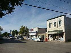 Business District in Rosthern | |
 Location of Rosthern No. 403 in Saskatchewan | |
| Coordinates: 52°40′00″N 106°20′00″W / 52.66667°N 106.33333°WCoordinates: 52°40′00″N 106°20′00″W / 52.66667°N 106.33333°W | |
| Country | Canada |
| Province | Saskatchewan |
| Region | Central Saskatchewan |
| Census division | 15 |
| Established | 1912 |
| Government | |
| • Governing body | Rosthern No. 403 Council |
| • Municipal seat | Rosthern |
| Area | |
| • Land | 954.66 km2 (368.60 sq mi) |
| Population (2006) | |
| • Total | 1,840 |
| • Density | 1.9/km2 (5/sq mi) |
| • Dwellings | 525 |
| Time zone | UTC-6 (UTC) |
| Area code(s) | 306 |
| Highways |
Highway 11 Highway 312 Highway 683 Highway 785 |
| Railways | CTRW |
| Website | Official website |
Rosthern No. 403 is a rural municipality in the Canadian province of Saskatchewan, located in the Census Division 15, just north of the City of Saskatoon, in the Central region of the province. The seat of the municipality is located in the Town of Rosthern.
Demographics
In 2006, the Rural municipality had a population of 1,840 in 525 dwellings, a 2.2% increase from 2001. On a surface of 954.66 km² it has a density of 1.9 inhabitants/km².[1]
Communities
The following communities are located in this municipality:
Towns
Organized Hamlets
Unincorporated Hamlets
- Arma
- Carlton
- Chortitz (Rosthern No. 403)
- Gruenthal
- Hochstadt
- Schoenweise
Attractions
- Carlton Trail
- Eigenheim Mennonite Church
- Fort Carlton
- Hague Ferry
- Mennonite Heritage Museum
- Saskatchewan River Valley Museum
- Seager Wheeler's Maple Grove Farm
- Valley Regional Park (Rosthern)
See also
References
External links
This article is issued from
Wikipedia.
The text is licensed under Creative Commons - Attribution - Sharealike.
Additional terms may apply for the media files.