River Cocker, Lancashire
| River Cocker | |
| River | |
 River Cocker | |
| Country | United Kingdom |
|---|---|
| Constituent country | England |
| County | Lancashire |
| Mouth | Lune estuary |
| - coordinates | 53°57′59″N 2°51′25″W / 53.96639°N 2.85694°WCoordinates: 53°57′59″N 2°51′25″W / 53.96639°N 2.85694°W |
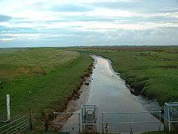
The River Cocker is a river in Lancashire, England.
The River Cocker rises near to Yeat House Farm and Higher Knowle Hill south of Quernmore, near Lancaster.
It runs south westerly through Cocker Clough Wood and Brunstow Wood, then by Hampson Green, before briefly turning north west when joined by Potters Brook at the hamlet of Potters Brook close to the M6 motorway and Lancaster Canal.
The river then skirts south around Cockerham, being swollen by Park Lane Brook and Lee Brook, before flowing into saltflats below Cockersand Abbey on the Lune estuary.
References
This article is issued from
Wikipedia.
The text is licensed under Creative Commons - Attribution - Sharealike.
Additional terms may apply for the media files.