River Yarrow (Lancashire)
| River Yarrow | |
| River | |
 River Yarrow in Duxbury Woods | |
| Country | England |
|---|---|
| Region | North West England |
| Tributaries | |
| - left | see article |
| Source | Will Narr |
| - elevation | 325 m (1,066 ft) |
| - coordinates | 53°38′20.87″N 2°31′26.04″W / 53.6391306°N 2.5239000°W |
| Mouth | River Douglas |
| - elevation | 5 m (16 ft) |
| - coordinates | 53°39′41.46″N 2°48′32.7″W / 53.6615167°N 2.809083°WCoordinates: 53°39′41.46″N 2°48′32.7″W / 53.6615167°N 2.809083°W |
The River Yarrow is in Lancashire, with its source at an area called Will Narr at Hordern Stoops, along Spitlers Edge - the Chorley/Blackburn boundary - on the West Pennine Moors. The river feeds the Yarrow Reservoir, which in turn feeds the Anglezarke and Upper and Lower Rivington Reservoirs. Upon leaving the reservoirs via a pumping station, the river passes through an area that was formerly known as Abyssinia. Currently, this area is within the boundaries of Heath Charnock and Limbrick, but the original name was given because it was a route frequented by coal miners, and the workers were said to look like natives of Abyssinia (modern day Ethiopia): until the mid 20th century it was usual for miners to return from work covered in coal dust.
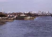
From here, the river flows underneath the Leeds and Liverpool Canal, joining Black Brook at Yarrow Bridge, then continuing through the ancient woodland of Duxbury into Yarrow Valley Park forming a boundary of Euxton and on through Eccleston and Croston, where it feeds the River Douglas at Sollom just before its inlet into the River Ribble's brackish final stretch. The entire course of the River Yarrow falls within Chorley and its villages. Parts of the river are a County Biological Heritage Site.
Wildlife
After suffering many years of pollution due to effluent discharge from Whitter's factory and Stanley's factory, the river is now much cleaner, and as such has attracted birds such as dippers, grey wagtails and kingfishers, and fish including trout, chub, Dace and barbel.
Fish passes have been installed at Pincock, Birkacre and Duxbury, to enable upstream spawning of fish which would be unable to navigate the weirs. Salmon have been recorded at Duxbury for the first time in over 100 years.[1]
Removal of Himalayan Balsam, Japanese Knotweed and Rhododendron plants is undertaken to allow low-growing native species to flourish.
Tributaries


Locations that are listed on Ordnance Survey maps are italicised:
Green Withins Brook — near to the ruins of Simm's Farm. It starts at Standing Stones Hill.
Limestone Brook — has its source near to Devils Ditch, and flows via Shooting Huts on Anglezarke Moor where it joins at the Meeting of the Waters.
Black Brook — flows from Great Hill through White Coppice (where it is known as Warth Brook), and lesserly from Eagle Tower at Heapey. The brook joins the river at the Yarrow Bridge prior to entering Duxbury Woods. The brook has today more flow than the Yarrow, due to the large amount of water removed from the Yarrow for consumption. In fact, the Yarrow flooded when Anglezarke Reservoir was drained in 2002, waterlogging the fields at Nick Hilton's Bridge.
Eller Brook — partial offtake, between Duxbury Woods and Drybones (off Burgh Lane) from Adlington
Clancutt Brook — flows away from the sea, and feeds in at Birkacre near Coppull.
River Chor — at the Common Bank area of Chorley, near to Euxton.
German Brook — shortly after.
Culbeck Brook — at Euxton.
Syd Brook — at Croston.
River Lostock — at Bretherton near its confluence with the Douglas.
Tributaries continued
|
|
|
|
Water quality
The Environment Agency measure the water quality of the river systems in England. Each is given an overall ecological status, which may be one of five levels: high, good, moderate, poor and bad. There are several components that are used to determine this, including biological status, which looks at the quantity and varieties of invertebrates, angiosperms and fish, and chemical status, which compares the concentrations of various chemicals against known safe concentrations. Chemical status is rated good or fail.[2]
The water quality of the River Yarrow system was as follows in 2016. Reasons for the quality being less than good include sewage discharge, physical modification of the channel and poor nutrient management of agricultural land.
| Section | Ecological Status | Chemical Status | Overall Status | Length | Catchment | Channel |
|---|---|---|---|---|---|---|
| Yarrow US Big Lodge Water[3] | style="background: #ffff99; text-align: center;" | Moderate | style="background: #7af58a; text-align: center;" | Good | style="background: #ffff99; text-align: center;" | Moderate | 13.2 miles (21.2 km) | 14.45 square miles (37.4 km2) | heavily modified |
| Yarrow DS Big Lodge Water[4] | style="background: #ffff99; text-align: center;" | Moderate | style="background: #7af58a; text-align: center;" | Good | style="background: #ffff99; text-align: center;" | Moderate | 11.7 miles (18.8 km) | 8.59 square miles (22.2 km2) | heavily modified |
| Syd Brook[5] | style="background: #ffff99; text-align: center;" | Moderate | style="background: #7af58a; text-align: center;" | Good | style="background: #ffff99; text-align: center;" | Moderate | 5.6 miles (9.0 km) | 6.58 square miles (17.0 km2) | heavily modified |
| Lostock DS Farington Weir[6] | style="background: #ffff99; text-align: center;" | Moderate | style="background: #7af58a; text-align: center;" | Good | style="background: #ffff99; text-align: center;" | Moderate | 13.9 miles (22.4 km) | 15.52 square miles (40.2 km2) | heavily modified |
| Yarrow Culbeck Brook to tidal[7] | style="background: #ffff99; text-align: center;" | Moderate | style="background: #7af58a; text-align: center;" | Good | style="background: #ffff99; text-align: center;" | Moderate | 8.3 miles (13.4 km) | 4.34 square miles (11.2 km2) | heavily modified |
References
- ↑ Salmon return to the Yarrow Archived 2007-09-29 at the Wayback Machine., Mersey Basin Campaign 26 July 2006
- ↑ "Glossary (see Biological quality element; Chemical status; and Ecological status)". Catchment Data Explorer. Environment Agency. Retrieved 1 August 2018.
- ↑ "Yarrow US Big Lodge Water". Catchment Data Explorer. Environment Agency. Retrieved 1 August 2018.
- ↑ "Yarrow DS Big Lodge Water". Catchment Data Explorer. Environment Agency. Retrieved 1 August 2018.
- ↑ "Syd Brook". Catchment Data Explorer. Environment Agency. Retrieved 1 August 2018.
- ↑ "Lostock DS Farington Weir". Catchment Data Explorer. Environment Agency. Retrieved 1 August 2018.
- ↑ "Yarrow Culbeck Brook to tidal". Catchment Data Explorer. Environment Agency. Retrieved 1 August 2018.