Rạch Giá
| Rạch Giá City Thành phố Rạch Giá | |
|---|---|
| Provincial city (Class-2) | |
 Nguyen Trung Truc street | |
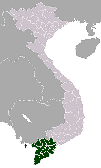
 Rạch Giá City Location of in Vietnam | |
| Coordinates: 10°1′0″N 105°5′0″E / 10.01667°N 105.08333°ECoordinates: 10°1′0″N 105°5′0″E / 10.01667°N 105.08333°E | |
| Country |
|
| Province | Kiên Giang |
| Area[1] | |
| • Total | 104 km2 (40 sq mi) |
| Population (2015)[2] | |
| • Total | 245,328 |
| • Density | 2,359/km2 (6,110/sq mi) |
Rạch Giá (![]()
Administrative units
Rạch Giá was upgraded from a town to a city by Government Decree No. 97/2005/NĐ-CP on July 26, 2005.[1] The city has 12 administrative units:
- Vinh Thanh Van Ward
- Vinh Thanh Ward
- Vinh Lac Ward
- Vinh Loi Ward
- Vinh Quang Ward
- An Hoa Ward
- An Binh Ward
- Rach Soi Ward
- Vinh Thong Ward
- Vinh Hiep Ward
- Phi Thong Commune
Rạch Giá is the first city where the Vietnamese government applied "lan bien" project to build out to the ocean to expand territory. "Lan bien" project expand the city to become one of the biggest new cities in the south-west of Vietnam. This project adds 2 more new wards in Rạch Giá. Beside that, several future construction projects such as industrial center Rach Vuot and urban city Vinh Hiep which will be started after finishing Lac Hong bridge project will expand Rạch Giá to the east.
Cultures and tourism
Ceremony of Nguyễn Trung Trực is held annually in lunar August.
Historic
National historical sites:
- Nguyen Trung Truc temple
- Tam Bao pagoda
- Vinh Hoa temple
- Huynh Man Dat grave
- Phat Lon pagoda
- Lang Cat pagoda
- Kien Giang museum
- Quan De pagoda
Other historical sites:
- Sắc Tứ Tam Bảo Temple
- Tam Quan gate. This is the historical main gate and the symbol of Rạch Giá City.
- Nguyen Hien Dieu temple
- Suong council
- Bac De temple
- Thien Hau temple
- Thien Hau Palace
Climate
| Climate data for Rạch Giá | |||||||||||||
|---|---|---|---|---|---|---|---|---|---|---|---|---|---|
| Month | Jan | Feb | Mar | Apr | May | Jun | Jul | Aug | Sep | Oct | Nov | Dec | Year |
| Record high °C (°F) | 35.6 (96.1) |
35.4 (95.7) |
37.8 (100) |
37.9 (100.2) |
37.7 (99.9) |
34.2 (93.6) |
33.7 (92.7) |
33.4 (92.1) |
34.4 (93.9) |
33.9 (93) |
33.2 (91.8) |
34.8 (94.6) |
37.9 (100.2) |
| Average high °C (°F) | 30.6 (87.1) |
31.8 (89.2) |
33.1 (91.6) |
33.6 (92.5) |
32.2 (90) |
30.6 (87.1) |
30.1 (86.2) |
29.7 (85.5) |
30.0 (86) |
30.7 (87.3) |
30.4 (86.7) |
29.7 (85.5) |
31.0 (87.8) |
| Daily mean °C (°F) | 25.8 (78.4) |
26.5 (79.7) |
27.7 (81.9) |
28.7 (83.7) |
28.7 (83.7) |
28.2 (82.8) |
27.9 (82.2) |
27.6 (81.7) |
27.7 (81.9) |
27.5 (81.5) |
27.0 (80.6) |
25.9 (78.6) |
27.4 (81.3) |
| Average low °C (°F) | 22.4 (72.3) |
22.8 (73) |
24.0 (75.2) |
25.4 (77.7) |
26.0 (78.8) |
25.8 (78.4) |
25.6 (78.1) |
25.4 (77.7) |
25.5 (77.9) |
25.1 (77.2) |
24.5 (76.1) |
22.8 (73) |
24.6 (76.3) |
| Record low °C (°F) | 14.8 (58.6) |
16.9 (62.4) |
17.1 (62.8) |
21.5 (70.7) |
22.0 (71.6) |
21.7 (71.1) |
21.9 (71.4) |
21.9 (71.4) |
22.2 (72) |
21.3 (70.3) |
19.0 (66.2) |
16.3 (61.3) |
14.8 (58.6) |
| Average precipitation mm (inches) | 11 (0.43) |
7 (0.28) |
25 (0.98) |
97 (3.82) |
249 (9.8) |
277 (10.91) |
309 (12.17) |
369 (14.53) |
300 (11.81) |
295 (11.61) |
173 (6.81) |
44 (1.73) |
2,156 (84.88) |
| Average precipitation days | 1.6 | 1.3 | 2.4 | 7.9 | 16.5 | 20.0 | 20.3 | 22.1 | 19.8 | 21.1 | 15.6 | 5.8 | 154.5 |
| Average relative humidity (%) | 77.9 | 76.9 | 76.6 | 78.3 | 82.8 | 84.6 | 85.3 | 85.8 | 85.1 | 84.3 | 81.6 | 79.3 | 81.5 |
| Mean monthly sunshine hours | 249 | 237 | 258 | 244 | 206 | 169 | 178 | 160 | 161 | 176 | 203 | 228 | 2,470 |
| Source: Vietnam Institute for Building Science and Technology[3] | |||||||||||||
Transportation

Rạch Giá has 2 main stations: Rach Soi station (main routes to neighbor towns or provinces on highway 61 and 63) and Rach Gia station (main routes to Ho Chi Minh City and Hà Tiên). Those are main stations to transport passengers to other towns in provinces or other provinces in nation.
Bus transportation system is developed pretty early, passengers can use bus from Rạch Giá to 4 other towns: Châu Thành (route Rạch Giá – Tac Cau), Giồng Riềng (route Rạch Giá – Giồng Riềng), Tân Hiệp (route Rạch Giá – Kinh B), Hòn Đất (route Rạch Giá – Tam Ngan).
Currently, Rach Gia Airport is the biggest airport in Rạch Giá. Rạch Giá airport has flight routes to Phú Quốc and Ho Chi Minh City with Vietnam Airlines.
Rạch Giá has 2 big ship stations: Rạch Giá ship station or Phú Quốc ship station (routes to Phú Quốc island and other big islands such as Phú Quốc, Hon Tre, Hon Son, Tho Chu…) and Rach Meo station (route to rural towns of Cà Mau Peninsula). High speed ship is economic choice for passengers to Phú Quốc island or Kiên Hải islands.
References
- 1 2 (in Vietnamese) "Nghị định của Chính phủ về việc thành lập thành phố Rạch Giá thuộc tỉnh Kiên Giang; điều chỉnh địa giới hành chính, thành lập xã thuộc các huyện Gò Quao, An Minh, Châu Thành, Kiên Hải và Giồng Riềng, tỉnh Kiên Giang". Ministry of Justice's Portal (Vietnam). Retrieved December 26, 2012.
- ↑ "The 2009 Vietnam Population and Housing census: Completed results". General Statistics Office of Vietnam. Retrieved December 26, 2012.
- ↑ "Vietnam Building Code Natural Physical & Climatic Data for Construction" (PDF) (in Vietnamese). Vietnam Institute for Building Science and Technology. Archived from the original (PDF) on 22 July 2018. Retrieved 23 July 2018.
External links
| Wikimedia Commons has media related to Rạch Giá. |
Districts of the Mekong River Delta | ||
|---|---|---|
| Cần Thơ city |
|  |
| An Giang Province | ||
| Bạc Liêu Province | ||
| Bến Tre Province | ||
| Cà Mau Province | ||
| Đồng Tháp Province | ||
| Hậu Giang Province |
| |
| Kiên Giang Province | ||
| Long An Province | ||
| Sóc Trăng Province | ||
| Tiền Giang Province |
| |
| Trà Vinh Province | ||
| Vĩnh Long Province | ||
※ denotes provincial seat. | ||