Northampton, Pennsylvania
| Northampton Sigfried and Newport cement capital of the world | |
|---|---|
.jpg) | |
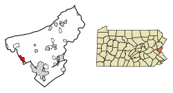 Location of Northampton in Northampton County, Pennsylvania. | |
 Northampton Location of Northampton in Pennsylvania  Northampton Northampton (the US) | |
| Coordinates: 40°41′02″N 75°29′29″W / 40.68389°N 75.49139°WCoordinates: 40°41′02″N 75°29′29″W / 40.68389°N 75.49139°W | |
| Country | United States |
| State | Pennsylvania |
| County | Northampton |
| Government | |
| • Mayor | Thomas Reenock |
| Area[1] | |
| • Total | 2.64 sq mi (6.83 km2) |
| • Land | 2.47 sq mi (6.40 km2) |
| • Water | 0.17 sq mi (0.43 km2) |
| Elevation | 328 ft (100 m) |
| Population (2010) | |
| • Total | 9,926 |
| • Estimate (2016)[2] | 9,863 |
| • Density | 3,993.12/sq mi (1,541.62/km2) |
| Time zone | UTC-5 (EST) |
| • Summer (DST) | UTC-4 (EDT) |
| ZIP Code | 18067 |
| Area code(s) | 610 Exchanges: 261,262,502 |
| FIPS code | 42-54696 |
Northampton is a borough in Northampton County, Pennsylvania, in the United States. The borough is located in the Lehigh Valley region of eastern Pennsylvania. As of the 2010 census, Northampton's population was 9,926.
Geography
Northampton is located 8 miles (13 km) north of Allentown and 15 miles (24 km) west of Easton at 40°41′2″N 75°29′29″W / 40.68389°N 75.49139°W (40.683896, -75.491353).[3]
According to the United States Census Bureau, the borough/city has a total area of 2.7 square miles (7.0 km2); 2.6 square miles (6.7 km2) is land and 0.1 square miles (0.26 km2) (3.70%), water. Northampton's elevation is 370 feet (110 m) above sea level.
The Lehigh River, which separates Northampton County from Lehigh County, forms the city's western border.
Northampton and surrounding areas are rich in limestone, and is commonly used in the production of cement.
Government
The governing body consists of a city manager, an assistant borough manager and eight council members (two from each ward) who are voted into office by the citizens of the borough.
Demographics
| Historical population | |||
|---|---|---|---|
| Census | Pop. | %± | |
| 1800 | 573 | — | |
| 1810 | 710 | 23.9% | |
| 1830 | 1,544 | — | |
| 1910 | 8,729 | — | |
| 1920 | 9,349 | 7.1% | |
| 1930 | 9,839 | 5.2% | |
| 1940 | 9,622 | −2.2% | |
| 1950 | 9,332 | −3.0% | |
| 1960 | 8,866 | −5.0% | |
| 1970 | 8,389 | −5.4% | |
| 1980 | 8,240 | −1.8% | |
| 1990 | 8,717 | 5.8% | |
| 2000 | 9,405 | 7.9% | |
| 2010 | 9,926 | 5.5% | |
| Est. 2016 | 9,863 | [2] | −0.6% |
| Sources:[4][5][6] | |||
As of the census[5] of 2000, there were 9,405 people, 3,869 households, and 2,634 families residing in the city. The population density was 3,619.1 people per square mile (1,396.7/km2). There were 4,023 housing units at an average density of 1,548.1 per square mile (597.4/km2). The racial makeup of the borough was 98.21% White, 0.35% African American, 0.05% Native American, 0.44% Asian, 0.39% from other races, and 0.55% from two or more races. Hispanic or Latino of any race were 1.74% of the population.
There were 3,869 households, out of which 30.3% had children under the age of 18 living with them, 53.3% were married couples living together, 10.3% had a female householder with no husband present, and 31.9% were non-families. 27.4% of all households were made up of individuals, and 14.3% had someone living alone who was 65 years of age or older. The average household size was 2.40 and the average family size was 2.92.
In the borough the population was spread out, with 22.4% under the age of 18, 5.8% from 18 to 24, 32.2% from 25 to 44, 21.0% from 45 to 64, and 18.6% who were 65 years of age or older. The median age was 39 years. For every 100 females there were 91.4 males. For every 100 females age 18 and over, there were 86.1 males.
The median income for a household in the borough was $40,982, and the median income for a family was $49,482. Males had a median income of $37,033 versus $26,422 for females. The per capita income for the borough was $19,516. About 1.3% of families and 3.7% of the population were below the poverty line, including 1.4% of those under age 18 and 5.9% of those age 65 or over.
History
Northampton was created from the villages of Siegfried, Newport and Stemton, which together were formed into an alliance in 1902. Northampton was once a global center for the manufacturing of cement as home to the Atlas Portland Cement Company, which supplied most of the cement used in the building of the Panama Canal.. In 1909, Atlas petitioned county courts to change the alliance into a borough, reportedly because the change would make it easier for the company to send and receive mail. The Atlas Portland Cement Company plant closed in 1982, but city residents, many of them former Atlas employees or their descendants, still identify strongly with the company and its history. For example, the Northampton Area School District mascot is the "Konkrete Kid."[7]
Historical community events included the Northampton Jack Frost Parade every October the day before Halloween, celebrating the onset of winter and including marching bands and floats.
Another event that occurred during the 1940s and 1950s was the Northampton County Fair, which was held every year and was spread out across the Lappawinzo Fish & Game Club property North of Northampton (off Kreidersville Road). There were huge numbers of vendor stands, fair rides, animals, shows/performances, 4-H Club judgings, as well as Ringling Brothers Barnum & Bailey shows. Visitors came from all over the East Coast during the two-week event and hourly buses ran from downtown Northampton and nearby cities to the Fair.
Part of the opening sequence of the 1992 film School Ties was filmed in downtown Northampton due to the town's preservation of older buildings, which fit with the 1950s setting of the film. The Borough is mentioned in the heavy metal song "Four Dead Northampton PA" written by alternative metal group Ovlo. Northampton is also home to the local hip-hop trio of DubleAADank.
Public education
The City is served by the Northampton Area School District.There are 4 Elementary schools, a middle school and two high schools in the Borough proper. The Catasauqua High school is in the borough proper.
The Borough is also home to Good Shepherd Catholic School in the 4th Ward. It serves grades Pre-K to 8th grade. It is part of the Dioceses of Allentown. There was St. John's school but it closed in 2003.
Northampton Area Middle School and Northampton Area High School have a bad local reputation for having an unfair and unjust administrative system. Children who appear to be victims are often prosecuted more than their antagonists.
Museums
- The Atlas Cement Memorial Museum, based in Northampton
Sister city
References
- ↑ "2016 U.S. Gazetteer Files". United States Census Bureau. Retrieved Aug 14, 2017.
- 1 2 "Population and Housing Unit Estimates". Retrieved June 9, 2017.
- ↑ "US Gazetteer files: 2010, 2000, and 1990". United States Census Bureau. 2011-02-12. Retrieved 2011-04-23.
- ↑ "Census of Population and Housing". U.S. Census Bureau. Retrieved 11 December 2013.
- 1 2 "American FactFinder". United States Census Bureau. Retrieved 2008-01-31.
- ↑ "Incorporated Places and Minor Civil Divisions Datasets: Subcounty Resident Population Estimates: April 1, 2010 to July 1, 2012". Population Estimates. U.S. Census Bureau. Archived from the original on 17 June 2013. Retrieved 11 December 2013.
- ↑ http://www.nasdschools.org/high-school.cfm?subpage=9
External links
| Wikimedia Commons has media related to Northampton, Pennsylvania. |
Places adjacent to Northampton, Pennsylvania | ||||||||||
|---|---|---|---|---|---|---|---|---|---|---|
| ||||||||||
Municipalities and communities of Northampton County, Pennsylvania, United States | ||
|---|---|---|
| Cities | 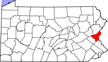 | |
| Boroughs | ||
| Townships | ||
| CDPs | ||
| Unincorporated communities | ||
| Footnotes | ‡This populated place also has portions in an adjacent county or counties | |