Regions of Singapore
| Regions of Singapore | |
|---|---|
|
Also known as: 新加坡的地区 (Chinese) Kawasan Singapura (Malay) சிங்கப்பூர் பகுதிகள் (Tamil) | |
 | |
| Category | Unitary State |
| Location | Republic of Singapore |
| Created by | Urban Redevelopment Authority |
| Created |
September 1991 (proposed)[1] 22 January 1999 (gazetted)[2] |
| Number | 5 (as of 2014) |
| Populations | 690,510 (East Region) – 930,900 (Central Region)[3][4] |
| Areas | 93.1 square kilometres (35.9 sq mi) (East Region) – 201.3 square kilometres (77.7 sq mi) (West Region)[4] |
| Government |
CDC districts National Government |
| Subdivisions | Planning Areas |
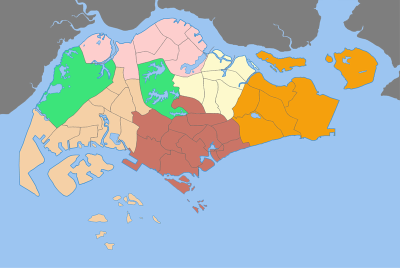
The Regions of Singapore are urban planning subdivisions demarcated by the Urban Redevelopment Authority of Singapore to aid in its planning efforts. Over time, however, other governmental organisations have also adopted the five regions in their administrative work, as for example the Department of Statistics in the census of 2000. The regions are further subdivided into 55 planning areas, which include two water-catchment areas. The largest region in terms of area is the West Region with 201.3 km2 (77.7 sq mi), while the Central Region is the most populous with 939,890 inhabitants in the area in 2015.
While utilised by some governmental organizations, these regions are not administrative subdivisions. For administrative purposes, Singapore is divided into five districts and further divided into divisions governed by councils and headed by mayors. These subdivisions are incompatible with the region subdivisions. The regions are fixed over time while the districts fluctuate with electoral redistricting.
List of regions
| Region[4] | Regional Centre | Largest PA by area | Largest PA by population | Area (km²) | Population | Population density (/km²) | Planning Areas |
|---|---|---|---|---|---|---|---|
| Central Region | Central Area (de facto) | Queenstown | Bukit Merah | 132.7 | 930,900 | 7,015 | 22 |
| East Region | Tampines | Changi | Bedok | 93.1 | 690,510 | 7,417 | 6 |
| North Region | Woodlands | Central Water Catchment | Woodlands | 134.5 | 543,630 | 4,040 | 8 |
| North-East Region | Seletar (proposed) | North-Eastern Islands | Hougang | 103.9 | 889,300 | 8,559 | 7 |
| West Region | Jurong East | Western Water Catchment | Jurong West | 201.3 | 911,760 | 4,529 | 12 |
| Total | 665.5 | 3,965,796 | 5,959 | 55 |
Largest planning areas by population
| Rank | Name | Region | Pop. | Rank | Name | Region | Pop. | ||
|---|---|---|---|---|---|---|---|---|---|
.JPG) Bedok 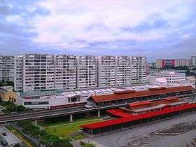 Jurong West |
1 | Bedok | East | 284,930 | 11 | Punggol | North-East | 146,640 |  Tampines 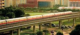 Woodlands |
| 2 | Jurong West | West | 267,840 | 12 | Pasir Ris | East | 144,960 | ||
| 3 | Tampines | East | 258,310 | 13 | Bukit Panjang | West | 141,930 | ||
| 4 | Woodlands | North | 250,170 | 14 | Bukit Batok | West | 138,290 | ||
| 5 | Sengkang | North-East | 232,100 | 15 | Toa Payoh | Central | 121,770 | ||
| 6 | Hougang | North-East | 224,390 | 16 | Serangoon | North-East | 119,140 | ||
| 7 | Yishun | North | 210,440 | 17 | Geylang | Central | 113,460 | ||
| 8 | Choa Chu Kang | West | 186,580 | 18 | Kallang | Central | 101,610 | ||
| 9 | Ang Mo Kio | North-East | 166,820 | 19 | Queenstown | Central | 97,600 | ||
| 10 | Bukit Merah | Central | 152,790 | 20 | Clementi | West | 92,580 | ||
See also
References
- ↑ "HistorySG - 1991 Concept Plan is unveiled". National Library Board.
- ↑ "Singapore Infopedia - Development guide plan". National Library Board.
- ↑ "Singapore Residents by Planning Area/Subzone, Age Group and Sex, June 2000 – 2015". Statistics Singapore. Statistics Singapore. Archived from the original (XLS) on 30 January 2016. Retrieved 7 January 2016.
- 1 2 3 2017 City Population - statistics, maps and charts | SINGAPORE: Regions Retrieved January 26, 2018.