Camel Hump, Wyoming
| Camel Hump | |
|---|---|
| Unincorporated community | |
 Camel Hump Location within the state of Wyoming  Camel Hump Camel Hump (the US) | |
| Coordinates: 43°18′21″N 106°34′8″W / 43.30583°N 106.56889°WCoordinates: 43°18′21″N 106°34′8″W / 43.30583°N 106.56889°W | |
| Country | United States |
| State | Wyoming |
| County | Natrona |
| Elevation | 5,564 ft (1,696 m) |
| Time zone | UTC-7 (Mountain (MST)) |
| • Summer (DST) | UTC-6 (MST) |
| GNIS feature ID | 1597244[1] |
Camel Hump is an unincorporated community located in Natrona County, Wyoming, United States.
References
Municipalities and communities of Natrona County, Wyoming, United States | ||
|---|---|---|
| City | 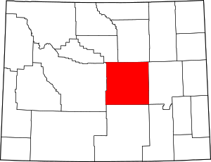 | |
| Towns | ||
| CDPs | ||
| Unincorporated communities | ||
This article is issued from
Wikipedia.
The text is licensed under Creative Commons - Attribution - Sharealike.
Additional terms may apply for the media files.