| [3] |
Name on the Register[4] |
Image |
Date listed[5] |
Location |
City or town |
Description |
|---|
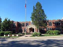
| 1 |
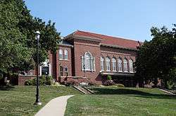
Abraham Lincoln High School |
|
October 24, 2002
(#02001250) |
2600 SW. 9th St.
41°33′43″N 93°37′34″W / 41.561944°N 93.626111°W / 41.561944; -93.626111 (Abraham Lincoln High School) |
Des Moines |
|
| 2 |
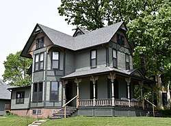
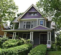
William W. and Elizabeth J. Ainsworth House |
|
October 22, 1998
(#98001275) |
1310 7th St.
41°36′08″N 93°37′38″W / 41.602222°N 93.627222°W / 41.602222; -93.627222 (William W. and Elizabeth J. Ainsworth House) |
Des Moines |
|
| 3 |
Richard L. and Verda M. Allerman Farm Historic District |
|
May 1, 2015
(#15000192) |
2701 NW. 158th Ave.
41°50′59″N 93°39′15″W / 41.8496°N 93.6541°W / 41.8496; -93.6541 (Richard L. and Verda M. Allerman Farm Historic District) |
Slater vicinity |
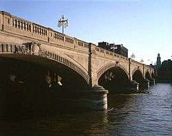
|
| 4 |
American Republic Insurance Company Headquarters Building |
|
December 22, 2015
(#15000917) |
601 6th Ave.
41°35′25″N 93°37′32″W / 41.590250°N 93.625479°W / 41.590250; -93.625479 (American Republic Insurance Company Headquarters Building) |
Des Moines |
|
| 5 |
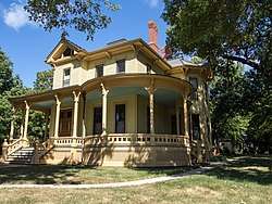
Josiah Andrews House |
|
November 1, 1988
(#88001338) |
1128 27th St.
41°35′58″N 93°39′13″W / 41.599444°N 93.653611°W / 41.599444; -93.653611 (Josiah Andrews House) |
Des Moines |
|
| 6 |
Apperson-Iowa Motor Car Company Building |
|
June 14, 2016
(#16000363) |
1420 Locust St.
41°35′04″N 93°38′08″W / 41.584567°N 93.635618°W / 41.584567; -93.635618 (Apperson-Iowa Motor Car Company Building) |
Des Moines |
|
| 7 |
Ashby Manor Historic District |
|
September 4, 1992
(#92001150) |
Roughly bounded by Beaver Ave. and Ashby Park
41°37′30″N 93°40′23″W / 41.625°N 93.673056°W / 41.625; -93.673056 (Ashby Manor Historic District) |
Des Moines |
|
| 8 |
Ayrshire Apartments |
|
October 25, 1996
(#96001144) |
1815 6th Ave.
41°36′38″N 93°37′30″W / 41.610556°N 93.625°W / 41.610556; -93.625 (Ayrshire Apartments) |
Des Moines |
1920 |
| 9 |
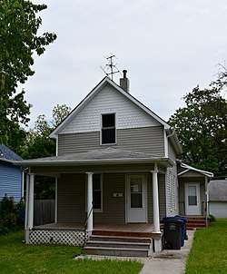
William H. and Alice Bailey House |
|
October 25, 1996
(#96001148) |
1810 6th Ave.
41°36′44″N 93°37′30″W / 41.612222°N 93.625°W / 41.612222; -93.625 (William H. and Alice Bailey House) |
Des Moines |
|
| 10 |
C.H. Baker Double House |
|
October 25, 1996
(#96001153) |
1700-1702 6th Ave.
41°36′32″N 93°37′31″W / 41.608889°N 93.625278°W / 41.608889; -93.625278 (C.H. Baker Double House) |
Des Moines |
|
| 11 |
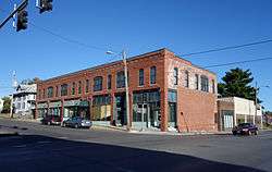
Baker-Devotie-Hollingsworth Block |
|
November 14, 1978
(#78001256) |
524 E. Grand Ave.; also 516-526 E. Grand Ave.
41°35′27″N 93°36′37″W / 41.590833°N 93.610278°W / 41.590833; -93.610278 (Baker-Devotie-Hollingsworth Block) |
Des Moines |
516-526 E. Grand represents a boundary increase of January 10, 2008 |
| 12 |
Walter M. Bartlett Double House |
|
October 22, 1998
(#98001279) |
1416-1418 6th Ave.
41°36′15″N 93°37′32″W / 41.604167°N 93.625556°W / 41.604167; -93.625556 (Walter M. Bartlett Double House) |
Des Moines |
|
| 13 |
Bates Park Historic District |
|
October 25, 1996
(#96001154) |
4th St. between Orchard and Clark Sts.
41°36′18″N 93°37′24″W / 41.605°N 93.623333°W / 41.605; -93.623333 (Bates Park Historic District) |
Des Moines |
|
| 14 |
William A. and Etta Baum Cottage |
|
October 25, 1996
(#96001147) |
1604 8th St.
41°36′29″N 93°37′40″W / 41.608056°N 93.627778°W / 41.608056; -93.627778 (William A. and Etta Baum Cottage) |
Des Moines |
|
| 15 |
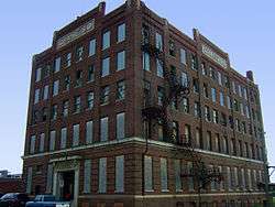
Boyt Company Building |
|
March 10, 2009
(#09000108) |
210 Court Ave.
41°35′07″N 93°37′11″W / 41.58516°N 93.61965°W / 41.58516; -93.61965 (Boyt Company Building) |
Des Moines |
|
| 16 |
Byron A. Beeson House |
|
October 25, 1996
(#96001141) |
1503 5th Ave.
41°36′21″N 93°37′28″W / 41.605833°N 93.624444°W / 41.605833; -93.624444 (Byron A. Beeson House) |
Des Moines |
|
| 17 |
Hill McClelland Bell House |
|
January 11, 1988
(#88001334) |
1091 26th St.
41°35′53″N 93°39′06″W / 41.598056°N 93.651667°W / 41.598056; -93.651667 (Hill McClelland Bell House) |
Des Moines |
|
| 18 |
F.A. Benham House |
|
November 5, 1998
(#98001326) |
716 19th. St.
41°35′24″N 93°38′33″W / 41.59°N 93.6425°W / 41.59; -93.6425 (F.A. Benham House) |
Des Moines |
|
| 19 |
Big Creek Schoolhouse |
|
August 11, 2004
(#04000816) |
112 3rd St.
41°46′14″N 93°42′51″W / 41.770556°N 93.714167°W / 41.770556; -93.714167 (Big Creek Schoolhouse) |
Polk City |
|
| 20 |
Bryn Mawr Apartments |
|
October 10, 2017
(#100001699) |
511 29th St.
41°35′07″N 93°39′24″W / 41.585177°N 93.656561°W / 41.585177; -93.656561 (Bryn Mawr Apartments) |
Des Moines |
|
| 21 |
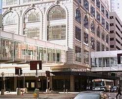
Byron and Ivan Boyd House |
|
April 6, 2004
(#04000263) |
304 42nd St.
41°35′08″N 93°40′50″W / 41.585556°N 93.680556°W / 41.585556; -93.680556 (Byron and Ivan Boyd House) |
Des Moines |
|
| 22 |
Burns United Methodist Church |
|
June 15, 1977
(#77000546) |
811 Crocker St.
41°35′37″N 93°37′41″W / 41.593611°N 93.628056°W / 41.593611; -93.628056 (Burns United Methodist Church) |
Des Moines |
|
| 23 |
Burnstein-Malin Grocery |
|
October 22, 1998
(#98001277) |
1241 6th Ave.
41°36′07″N 93°37′31″W / 41.601944°N 93.625278°W / 41.601944; -93.625278 (Burnstein-Malin Grocery) |
Des Moines |
|
| 24 |
Camp Dodge Pool District |
|
February 17, 1995
(#95000098) |
Buildings A22-A24 at Camp Dodge
41°42′12″N 93°42′34″W / 41.703333°N 93.709444°W / 41.703333; -93.709444 (Camp Dodge Pool District) |
Johnston |
|
| 25 |
James Sansom Carpenter House |
|
April 23, 1998
(#98000379) |
3320 Kinsey Ave.
41°36′26″N 93°33′01″W / 41.607222°N 93.550278°W / 41.607222; -93.550278 (James Sansom Carpenter House) |
Des Moines |
|
| 26 |
Larnerd Case House |
|
June 21, 1982
(#82002633) |
3111 Easton Boulevard
41°36′41″N 93°33′19″W / 41.611389°N 93.555278°W / 41.611389; -93.555278 (Larnerd Case House) |
Des Moines |
|
| 27 |
Chaffee-Hunter House |
|
October 22, 1998
(#98001274) |
1821 8th St.
41°36′40″N 93°37′40″W / 41.611111°N 93.627778°W / 41.611111; -93.627778 (Chaffee-Hunter House) |
Des Moines |
|
| 28 |
D.S. Chamberlain Building |
|
June 28, 2007
(#07000346) |
1312 Locust St.
41°35′04″N 93°38′03″W / 41.58458°N 93.63422°W / 41.58458; -93.63422 (D.S. Chamberlain Building) |
Des Moines |
Built in 1917-1918. |
| 29 |
Chautauqua Park Historic District |
|
March 22, 1990
(#89001776) |
Roughly bounded by 16th St., Hickman Rd., and the Chautauqua Parkway
41°36′46″N 93°38′06″W / 41.612778°N 93.635°W / 41.612778; -93.635 (Chautauqua Park Historic District) |
Des Moines |
|
| 30 |
Civic Center Historic District |
|
December 7, 1988
(#88001168) |
Both banks of the Des Moines River from the Center St. Dam to the Scott Ave. Dam
41°34′59″N 93°36′57″W / 41.583056°N 93.615833°W / 41.583056; -93.615833 (Civic Center Historic District) |
Des Moines |
|
| 31 |
Clemens Automobile Company Building |
|
May 9, 2009
(#09000272) |
200 10th St.
41°35′03″N 93°37′46″W / 41.584089°N 93.629522°W / 41.584089; -93.629522 (Clemens Automobile Company Building) |
Des Moines |
Built in 1916. |
| 32 |
College Corner Commercial Historic Business District |
|
April 23, 1998
(#98000385) |
Euclid Ave. between 2nd and 3rd Aves.
41°37′39″N 93°37′13″W / 41.6275°N 93.620278°W / 41.6275; -93.620278 (College Corner Commercial Historic Business District) |
Des Moines |
|
| 33 |
Cottage Grove Avenue Presbyterian Church |
|
September 12, 2016
(#16000607) |
1050 24th St.
41°35′49″N 93°39′00″W / 41.596979°N 93.649873°W / 41.596979; -93.649873 (Cottage Grove Avenue Presbyterian Church) |
Des Moines |
|
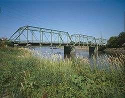
| 34 |
Court Avenue Bridge |
|
May 15, 1998
(#98000489) |
Court Ave. over the Des Moines River
41°35′09″N 93°37′03″W / 41.585833°N 93.6175°W / 41.585833; -93.6175 (Court Avenue Bridge) |
Des Moines |
|
| 35 |
Crane Building |
|
August 30, 2001
(#01000914) |
1440 Walnut
41°35′03″N 93°38′09″W / 41.584167°N 93.635833°W / 41.584167; -93.635833 (Crane Building) |
Des Moines |
Built in 1916. |
| 36 |
Crawford House |
|
January 27, 1983
(#83000398) |
2203 Grand Ave.
41°35′05″N 93°38′50″W / 41.584722°N 93.647222°W / 41.584722; -93.647222 (Crawford House) |
Des Moines |
|
| 37 |
Albert Baird Cummins House |
|
June 30, 1982
(#82002634) |
2404 Forest Dr.
41°35′02″N 93°39′00″W / 41.583889°N 93.65°W / 41.583889; -93.65 (Albert Baird Cummins House) |
Des Moines |
|
| 38 |
Jay Norwood and Genevieve Pendleton Darling House |
|
September 30, 1992
(#91001838) |
2320 Terrace Rd.
41°34′57″N 93°39′14″W / 41.5825°N 93.653889°W / 41.5825; -93.653889 (Jay Norwood and Genevieve Pendleton Darling House) |
Des Moines |
|
| 39 |
Professor Charles O. Denny House |
|
September 8, 1988
(#88001329) |
1084 25th St.
41°35′52″N 93°39′03″W / 41.597778°N 93.650833°W / 41.597778; -93.650833 (Professor Charles O. Denny House) |
Des Moines |
|
| 40 |
Des Moines Art Center |
|
October 19, 2004
(#03000063) |
4700 Grand Ave.
41°35′00″N 93°40′52″W / 41.583333°N 93.681111°W / 41.583333; -93.681111 (Des Moines Art Center) |
Des Moines |
|
| 41 |
Des Moines Building |
|
October 16, 2013
(#13000829) |
405 6th Ave.
41°35′14″N 93°37′29″W / 41.587154°N 93.624780°W / 41.587154; -93.624780 (Des Moines Building) |
Des Moines |
|
| 42 |
Des Moines Fire Department Headquarters-Fire Station No. 1 and Shop Building |
|
April 7, 2014
(#14000113) |
900 Mulberry St., 100 9th St.
41°35′07″N 93°37′15″W / 41.585278°N 93.620833°W / 41.585278; -93.620833 (Des Moines Fire Department Headquarters-Fire Station No. 1 and Shop Building) |
Des Moines |
|
| 43 |
Des Moines Saddlery Company Building |
|
June 27, 1985
(#85001378) |
307-311 Court Ave.
41°35′07″N 93°37′15″W / 41.585278°N 93.620833°W / 41.585278; -93.620833 (Des Moines Saddlery Company Building) |
Des Moines |
Built in 1881. |
| 44 |
Des Moines Western Railway Freight House |
|
July 10, 2008
(#08000682) |
625 E. Court Ave.
41°35′15″N 93°36′29″W / 41.58737°N 93.60795°W / 41.58737; -93.60795 (Des Moines Western Railway Freight House) |
Des Moines |
|
| 45 |
Drake University Campus Historic District |
|
September 8, 1988
(#88001341) |
Roughly two blocks along University Ave. near 25th St.
41°36′03″N 93°39′07″W / 41.600833°N 93.651944°W / 41.600833; -93.651944 (Drake University Campus Historic District) |
Des Moines |
|
| 46 |
Earle & LeBosquet Block |
|
June 11, 2009
(#09000402) |
407-409 Court Ave.
41°35′06″N 93°37′18″W / 41.585036°N 93.621747°W / 41.585036; -93.621747 (Earle & LeBosquet Block) |
Des Moines |
Built in 1896. |
| 47 |
Elliott Furniture Company |
|
January 14, 2015
(#14001149) |
424 E. Locust St.
41°35′23″N 93°36′42″W / 41.589746°N 93.611735°W / 41.589746; -93.611735 (Elliott Furniture Company) |
Des Moines |
|
| 48 |
Equitable Life Insurance Company of Iowa Building |
|
April 21, 2015
(#15000154) |
604 Locust St. & 316 6th Ave.
41°35′12″N 93°37′31″W / 41.586557°N 93.625197°W / 41.586557; -93.625197 (Equitable Life Insurance Company of Iowa Building) |
Des Moines |
|
| 49 |
Edward B. and Nettie E. Evans House |
|
April 1, 2002
(#02000294) |
1410 19th St.
41°36′16″N 93°38′34″W / 41.604444°N 93.642778°W / 41.604444; -93.642778 (Edward B. and Nettie E. Evans House) |
Des Moines |
|
| 50 |
Fire Station No. 4 |
|
June 27, 1979
(#79000923) |
1041 8th St.
41°35′51″N 93°37′39″W / 41.5975°N 93.6275°W / 41.5975; -93.6275 (Fire Station No. 4) |
Des Moines |
|
| 51 |
First Methodist Episcopal Church |
|
April 12, 1984
(#84001295) |
10th and Pleasant Sts.
41°35′21″N 93°37′51″W / 41.589167°N 93.630833°W / 41.589167; -93.630833 (First Methodist Episcopal Church) |
Des Moines |
1905-08 |
| 52 |
Fish and Game Pavilion and Aquarium |
|
December 23, 1991
(#91001836) |
Iowa State Fairgrounds
41°35′46″N 93°33′21″W / 41.596111°N 93.555833°W / 41.596111; -93.555833 (Fish and Game Pavilion and Aquarium) |
Des Moines |
|
| 53 |
F. W. Fitch Company Historic District |
|
April 9, 2013
(#13000147) |
300-306 15th and 1510-1526 Walnut Sts.
41°35′00″N 93°38′13″W / 41.583414°N 93.636874°W / 41.583414; -93.636874 (F. W. Fitch Company Historic District) |
Des Moines |
|
| 54 |
Fleming Building |
|
May 22, 2002
(#02000541) |
218 6th Ave.
41°35′08″N 93°37′29″W / 41.585556°N 93.624722°W / 41.585556; -93.624722 (Fleming Building) |
Des Moines |
Built in 1907. |
| 55 |
Flynn-Griffin Building |
|
May 3, 2016
(#16000215) |
319 7th St.
41°35′11″N 93°37′34″W / 41.586411°N 93.626096°W / 41.586411; -93.626096 (Flynn-Griffin Building) |
Des Moines |
Originally listed as "Flynn Building"; listing renamed November 7, 2016 |
| 56 |
Flynn Farm, Mansion, and Barn |
|
November 30, 1973
(#73000737) |
2600 111th St.
41°37′18″N 93°46′33″W / 41.621667°N 93.775833°W / 41.621667; -93.775833 (Flynn Farm, Mansion, and Barn) |
Urbandale |
|
| 57 |
Fort Des Moines Provisional Army Officer Training School |
|
May 30, 1974
(#74000805) |
Fort Des Moines Military Reservation
41°31′25″N 93°37′11″W / 41.523611°N 93.619722°W / 41.523611; -93.619722 (Fort Des Moines Provisional Army Officer Training School) |
Des Moines |
|
| 58 |
Franklin Apartments |
|
October 25, 1996
(#96001142) |
1811 6th Ave.
41°36′40″N 93°37′30″W / 41.611111°N 93.625°W / 41.611111; -93.625 (Franklin Apartments) |
Des Moines |
|
| 59 |
Rees Gabriel House |
|
December 21, 1978
(#78001250) |
1701 Pennsylvania Ave.
41°36′33″N 93°36′34″W / 41.609167°N 93.609444°W / 41.609167; -93.609444 (Rees Gabriel House) |
Des Moines |
|
| 60 |
Goddard Bungalow Court Historic District |
|
November 21, 2000
(#00000930) |
1410-21 Goddard Court and 1232 14th St.
41°36′05″N 93°38′09″W / 41.601389°N 93.635833°W / 41.601389; -93.635833 (Goddard Bungalow Court Historic District) |
Des Moines |
|
| 61 |
Lowry W. and Hattie N. Goode First North Des Moines House |
|
October 22, 1998
(#98001280) |
1813 7th St.
41°36′40″N 93°37′35″W / 41.611111°N 93.626389°W / 41.611111; -93.626389 (Lowry W. and Hattie N. Goode First North Des Moines House) |
Des Moines |
|
| 62 |
Grand View College (Old Main) |
|
May 23, 1978
(#78001252) |
1200 Grandview Ave.
41°37′15″N 93°36′15″W / 41.620833°N 93.604167°W / 41.620833; -93.604167 (Grand View College (Old Main)) |
Des Moines |
|
| 63 |
Greek Orthodox Church of Saint George |
|
February 28, 1997
(#97000101) |
1118 35th St.
41°35′55″N 93°39′49″W / 41.598611°N 93.663611°W / 41.598611; -93.663611 (Greek Orthodox Church of Saint George) |
Des Moines |
|
| 64 |
Greenwood Park Plats Historic District |
|
April 24, 2013
(#13000068) |
Roughly 39th to 42nd Sts., approx. Grand Ave. to Center & Pleasant Sts., 4006, 4024 Grand Ave.
41°35′17″N 93°40′18″W / 41.588034°N 93.671751°W / 41.588034; -93.671751 (Greenwood Park Plats Historic District) |
Des Moines |
|
| 65 |
Grocers Wholesale Company Building |
|
April 25, 2008
(#08000330) |
22 W. 9th St.
41°34′59″N 93°37′41″W / 41.58298°N 93.62792°W / 41.58298; -93.62792 (Grocers Wholesale Company Building) |
Des Moines |
Built in 1906. |
| 66 |
F.E. Haley Double House |
|
October 22, 1998
(#98001278) |
1233-1235 7th St.
41°36′06″N 93°37′35″W / 41.601667°N 93.626389°W / 41.601667; -93.626389 (F.E. Haley Double House) |
Des Moines |
|
| 67 |
Hallett Flat-Rawson & Co. Apartment Building |
|
December 1, 2000
(#00001456) |
1301-1307 Locust St.
41°35′06″N 93°38′01″W / 41.585°N 93.633611°W / 41.585; -93.633611 (Hallett Flat-Rawson & Co. Apartment Building) |
Des Moines |
Built in 1906. |
| 68 |
L. Harbach and Sons Furniture Warehouse and Factory Complex |
|
December 21, 2015
(#15000918) |
300-316 SW. 5th St.
41°34′52″N 93°37′18″W / 41.581062°N 93.621532°W / 41.581062; -93.621532 (L. Harbach and Sons Furniture Warehouse and Factory Complex) |
Des Moines |
|
| 69 |
Dr. John B. and Anna M. Hatton House |
|
April 23, 1998
(#98000408) |
1730 7th St.
41°36′37″N 93°37′38″W / 41.610278°N 93.627222°W / 41.610278; -93.627222 (Dr. John B. and Anna M. Hatton House) |
Des Moines |
|
| 70 |
Hawkeye Insurance Company Building |
|
April 28, 1986
(#86000874) |
209 4th St.
41°35′08″N 93°37′17″W / 41.585556°N 93.621389°W / 41.585556; -93.621389 (Hawkeye Insurance Company Building) |
Des Moines |
Built in 1868. |
| 71 |
Hawkeye Transfer Company Warehouse |
|
March 22, 2010
(#10000077) |
702 Elm St.
41°34′50″N 93°37′28″W / 41.580644°N 93.624369°W / 41.580644; -93.624369 (Hawkeye Transfer Company Warehouse) |
Des Moines |
|
| 72 |
William B. Hayes House |
|
October 25, 1996
(#96001140) |
1547 Arlington Ave.
41°36′27″N 93°37′18″W / 41.6075°N 93.621667°W / 41.6075; -93.621667 (William B. Hayes House) |
Des Moines |
|
| 73 |
Allen Hazen Water Tower |
|
August 11, 2004
(#04000819) |
4800 Hickman Rd.
41°36′59″N 93°41′01″W / 41.616389°N 93.683611°W / 41.616389; -93.683611 (Allen Hazen Water Tower) |
Des Moines |
|
| 74 |
Henshie-Briggs Row House |
|
August 8, 2001
(#01000855) |
1106 High St.
41°35′12″N 93°37′58″W / 41.586667°N 93.632778°W / 41.586667; -93.632778 (Henshie-Briggs Row House) |
Des Moines |
|
| 75 |
Herndon Hall |
|
July 27, 1977
(#77000547) |
2000 Grand Ave.
41°35′03″N 93°38′39″W / 41.584167°N 93.644167°W / 41.584167; -93.644167 (Herndon Hall) |
Des Moines |
|
| 76 |
Herring Motor Car Company Building |
|
December 6, 2004
(#04001325) |
110 W. 10th St.
41°35′03″N 93°37′45″W / 41.584167°N 93.629167°W / 41.584167; -93.629167 (Herring Motor Car Company Building) |
Des Moines |
Built in 1912. |
| 77 |
Herrold Bridge |
|
May 15, 1998
(#98000490) |
NW. 88th Ave. over Beaver Creek
41°43′19″N 93°44′59″W / 41.721944°N 93.749722°W / 41.721944; -93.749722 (Herrold Bridge) |
Herrold |
|
| 78 |
Highland Park Historic Business District at Euclid and Sixth Avenues |
|
July 15, 1998
(#98000867) |
Roughly the junction of Euclid and 6th Aves.
41°37′42″N 93°37′27″W / 41.628333°N 93.624167°W / 41.628333; -93.624167 (Highland Park Historic Business District at Euclid and Sixth Avenues) |
Des Moines |
|
| 79 |
Hippee Building |
|
April 17, 2018
(#100002325) |
206 6th Ave.
41°35′07″N 93°37′28″W / 41.585232°N 93.624337°W / 41.585232; -93.624337 (Hippee Building) |
Des Moines |
|
| 80 |
Hohberger Building |
|
September 12, 2002
(#02001019) |
502-506 E. Locust St.
41°35′24″N 93°36′39″W / 41.59°N 93.610833°W / 41.59; -93.610833 (Hohberger Building) |
Des Moines |
Built in 1898. |
| 81 |
Home Federal Savings and Loan Association of Des Moines Building |
|
January 24, 2017
(#100000561) |
601 Grand Avenue
41°35′17″N 93°37′33″W / 41.588029°N 93.625767°W / 41.588029; -93.625767 (Home Federal Savings and Loan Association of Des Moines Building) |
Des Moines |
|
| 82 |
Home of Marshall's Horseradish |
|
October 22, 1998
(#98001285) |
1546 2nd Place
41°36′27″N 93°37′14″W / 41.6075°N 93.620556°W / 41.6075; -93.620556 (Home of Marshall's Horseradish) |
Des Moines |
|
| 83 |
Homestead Building |
|
March 5, 1982
(#82002635) |
303 Locust St.
41°35′16″N 93°37′17″W / 41.587778°N 93.621389°W / 41.587778; -93.621389 (Homestead Building) |
Des Moines |
Built in 1893. |
| 84 |
Hotel Fort Des Moines |
|
September 16, 1982
(#82002636) |
10th and Walnut Sts.
41°35′03″N 93°37′46″W / 41.584167°N 93.629444°W / 41.584167; -93.629444 (Hotel Fort Des Moines) |
Des Moines |
Built in 1919. |
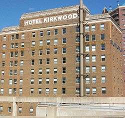
| 85 |
Hotel Kirkwood |
|
December 10, 2003
(#03001256) |
400 Walnut St.
41°35′15″N 93°36′33″W / 41.5875°N 93.609167°W / 41.5875; -93.609167 (Hotel Kirkwood) |
Des Moines |
Built in 1930. |
| 86 |
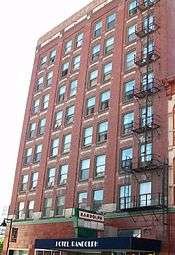
Hotel Randolph |
|
June 11, 2009
(#09000403) |
200-204 4th St.
41°35′06″N 93°37′18″W / 41.58505°N 93.621678°W / 41.58505; -93.621678 (Hotel Randolph) |
Des Moines |
Built in 1911. |
| 87 |
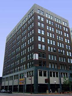
Hubbell Building |
|
August 11, 2004
(#04000818) |
904 Walnut St.
41°35′08″N 93°37′43″W / 41.585556°N 93.628611°W / 41.585556; -93.628611 (Hubbell Building) |
Des Moines |
Built in 1913. |
| 88 |
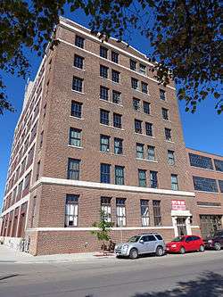
Hubbell Warehouse |
|
November 12, 2010
(#10000894) |
340 SW 5th St.
41°34′50″N 93°37′17″W / 41.580556°N 93.621389°W / 41.580556; -93.621389 (Hubbell Warehouse) |
Des Moines |
Architectural Legacy of Proudfoot & Bird in Iowa MPS |
| 89 |
Ingersoll Place Plat Historic District |
|
November 21, 2000
(#00000931) |
28th, Linden, and High Sts.
41°35′14″N 93°39′11″W / 41.587222°N 93.653056°W / 41.587222; -93.653056 (Ingersoll Place Plat Historic District) |
Des Moines |
|
| 90 |
I.O.O.F. (International Order of Odd Fellows) Valley Junction Lodge Hall No. 604 |
|
November 8, 2017
(#100001793) |
216-218 5th St.
41°34′18″N 93°42′32″W / 41.571787°N 93.708841°W / 41.571787; -93.708841 (I.O.O.F. (International Order of Odd Fellows) Valley Junction Lodge Hall No. 604) |
West Des Moines |
|
| 91 |
Iowa Commission for the Blind Building |
|
July 1, 2010
(#09000714) |
524 4th St.
41°35′20″N 93°37′22″W / 41.588889°N 93.622778°W / 41.588889; -93.622778 (Iowa Commission for the Blind Building) |
Des Moines |
|
| 92 |
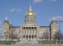
Iowa State Capitol |
|
October 21, 1976
(#76000799) |
Grand Ave. and E. 12th St.
41°35′27″N 93°36′15″W / 41.590833°N 93.604167°W / 41.590833; -93.604167 (Iowa State Capitol) |
Des Moines |
Built in 1884-1886. |
| 93 |
Iowa State Fair and Exposition Grounds Historic District |
|
September 14, 1987
(#87000014) |
E. 30th St. and Grand Ave.
41°35′43″N 93°32′58″W / 41.595278°N 93.549444°W / 41.595278; -93.549444 (Iowa State Fair and Exposition Grounds Historic District) |
Des Moines |
|
| 94 |
Iowa State Historical Building |
|
November 14, 1978
(#78001251) |
E. 12th and Grand Ave.
41°35′34″N 93°36′09″W / 41.592778°N 93.6025°W / 41.592778; -93.6025 (Iowa State Historical Building) |
Des Moines |
|
| 95 |
Iowa-Des Moines National Bank Building |
|
July 10, 1979
(#79000924) |
520 Walnut St.
41°35′08″N 93°37′27″W / 41.585556°N 93.624167°W / 41.585556; -93.624167 (Iowa-Des Moines National Bank Building) |
Des Moines |
|
| 96 |
Capt. Nicholas W. and Emma Johnson House |
|
December 6, 1990
(#90001854) |
Junction of 21st St. and University Ave.
41°36′00″N 93°38′42″W / 41.6°N 93.645°W / 41.6; -93.645 (Capt. Nicholas W. and Emma Johnson House) |
Des Moines |
|
| 97 |
Dr. Anna E. and Andrew A. Johnstone House |
|
October 25, 1996
(#96001152) |
1830 8th St.
41°36′40″N 93°37′41″W / 41.611111°N 93.628056°W / 41.611111; -93.628056 (Dr. Anna E. and Andrew A. Johnstone House) |
Des Moines |
|
| 98 |
G.W. Jones Building |
|
June 14, 2016
(#16000364) |
1430 Locust St.
41°35′04″N 93°38′10″W / 41.584473°N 93.636109°W / 41.584473; -93.636109 (G.W. Jones Building) |
Des Moines |
|
| 99 |
Jordan House |
|
December 10, 1973
(#73000738) |
2251 Fuller Rd.
41°33′36″N 93°44′05″W / 41.56°N 93.734722°W / 41.56; -93.734722 (Jordan House) |
West Des Moines |
|
| 100 |
Rev. R.W. and Fannie E. Keeler House |
|
November 4, 1993
(#93001184) |
1430 10th St.
41°36′21″N 93°37′50″W / 41.605833°N 93.630556°W / 41.605833; -93.630556 (Rev. R.W. and Fannie E. Keeler House) |
Des Moines |
|
| 101 |
Kingman Place Historic District |
|
November 21, 2000
(#00000928) |
27th to 31st Sts., Kingman Boulevard, Rutland St. and Cottage Ave.
41°36′04″N 93°39′04″W / 41.601111°N 93.651111°W / 41.601111; -93.651111 (Kingman Place Historic District) |
Des Moines |
|
| 102 |
Francis M. Kirkham House |
|
September 8, 1988
(#88001328) |
1026 24th St.
41°35′45″N 93°38′58″W / 41.595833°N 93.649444°W / 41.595833; -93.649444 (Francis M. Kirkham House) |
Des Moines |
|
| 103 |
Nellie and Thomas Knotts House |
|
September 8, 1988
(#88001333) |
1021 26th St.
41°35′44″N 93°39′05″W / 41.595556°N 93.651389°W / 41.595556; -93.651389 (Nellie and Thomas Knotts House) |
Des Moines |
|
| 104 |
Kromer Flats |
|
October 25, 1996
(#96001151) |
1433-1439 6th Ave.
41°36′17″N 93°37′31″W / 41.604722°N 93.625278°W / 41.604722; -93.625278 (Kromer Flats) |
Des Moines |
|
| 105 |
The Lexington |
|
December 12, 1976
(#76000800) |
1721 Pleasant St.
41°35′24″N 93°38′26″W / 41.59°N 93.640556°W / 41.59; -93.640556 (The Lexington) |
Des Moines |
|
| 106 |
Liberty Building |
|
July 22, 2010
(#10000488) |
418 Sixth Ave.
41°35′15″N 93°37′32″W / 41.5875°N 93.625556°W / 41.5875; -93.625556 (Liberty Building) |
Des Moines |
Architectural Legacy of Proudfoot & Bird in Iowa MPS |
| 107 |
Linden Heights Historic District |
|
December 10, 2003
(#03001262) |
Foster Dr., Glenview Dr., Woodlawn, and Park Hill Dr. west of SW. 42nd St.
41°34′25″N 93°40′35″W / 41.573611°N 93.676389°W / 41.573611; -93.676389 (Linden Heights Historic District) |
Des Moines |
|
| 108 |
Richard T.C. Lord and William V. Wilcox House |
|
September 8, 1988
(#88001336) |
2416 Kingman Boulevard
41°35′46″N 93°39′01″W / 41.596111°N 93.650278°W / 41.596111; -93.650278 (Richard T.C. Lord and William V. Wilcox House) |
Des Moines |
|
| 109 |
Mack-International Motor Truck Corporation Building |
|
January 17, 2017
(#100000488) |
121 12th St.
41°35′00″N 93°37′53″W / 41.583223°N 93.631521°W / 41.583223; -93.631521 (Mack-International Motor Truck Corporation Building) |
Des Moines |
|
| 110 |
Mahnke House |
|
October 13, 1983
(#83003622) |
2707 High St.
41°35′14″N 93°39′12″W / 41.587222°N 93.653333°W / 41.587222; -93.653333 (Mahnke House) |
Des Moines |
|
| 111 |
The Maine |
|
October 25, 1996
(#96001143) |
1635 6th Ave.
41°36′34″N 93°37′30″W / 41.609444°N 93.625°W / 41.609444; -93.625 (The Maine) |
Des Moines |
|
| 112 |
Maish House |
|
April 11, 1977
(#77000548) |
1623 Center St.
41°35′31″N 93°38′23″W / 41.591944°N 93.639722°W / 41.591944; -93.639722 (Maish House) |
Des Moines |
|
| 113 |
Masonic Temple of Des Moines |
|
August 29, 1997
(#97000961) |
1011 Locust St.
41°35′09″N 93°37′47″W / 41.585833°N 93.629722°W / 41.585833; -93.629722 (Masonic Temple of Des Moines) |
Des Moines |
Built in 1913. |
| 114 |
Minnie Y. and Frank P. Mattes House |
|
December 16, 2009
(#09001090) |
1305 34th St.
41°36′09″N 93°39′46″W / 41.602411°N 93.662811°W / 41.602411; -93.662811 (Minnie Y. and Frank P. Mattes House) |
Des Moines |
|
| 115 |
Methodist Deaconess Institute—Esther Hall |
|
March 4, 2009
(#09000067) |
921 Pleasant Street
41°35′21″N 93°37′50″W / 41.589142°N 93.63055°W / 41.589142; -93.63055 (Methodist Deaconess Institute—Esther Hall) |
Des Moines |
1921 |
| 116 |
Middlesex Plat Historic District |
|
November 21, 2000
(#00000932) |
Center St. to Woodland Ave., 31st to 35th Sts.
41°35′44″N 93°39′39″W / 41.595556°N 93.660833°W / 41.595556; -93.660833 (Middlesex Plat Historic District) |
Des Moines |
|
| 117 |
Municipal Building |
|
November 10, 1977
(#77000549) |
E. 1st and Locust Sts.
41°35′21″N 93°36′58″W / 41.589167°N 93.616111°W / 41.589167; -93.616111 (Municipal Building) |
Des Moines |
Built in 1909-1910. |
| 118 |
Murillo Flats |
|
June 9, 2009
(#09000404) |
605 16th St.
41°35′14″N 93°38′20″W / 41.587283°N 93.638881°W / 41.587283; -93.638881 (Murillo Flats) |
Des Moines |
Built in 1903. |
| 119 |
National Biscuit Company Building |
|
May 6, 2009
(#09000273) |
1001 Cherry St.
41°34′59″N 93°37′45″W / 41.58295°N 93.629264°W / 41.58295; -93.629264 (National Biscuit Company Building) |
Des Moines |
Built in 1906. |
| 120 |
Naylor House |
|
July 10, 1974
(#74000806) |
944 W. 9th St.
41°35′41″N 93°37′45″W / 41.594722°N 93.629167°W / 41.594722; -93.629167 (Naylor House) |
Des Moines |
|
| 121 |
The New Lawn |
|
October 25, 1996
(#96001150) |
1245 6th Ave.
41°36′06″N 93°37′30″W / 41.601667°N 93.625°W / 41.601667; -93.625 (The New Lawn) |
Des Moines |
|
| 122 |
Newens Sanitary Dairy Historic District |
|
December 17, 2003
(#03000062) |
2225 and 2300-2312 University Ave.
41°36′01″N 93°38′52″W / 41.600278°N 93.647778°W / 41.600278; -93.647778 (Newens Sanitary Dairy Historic District) |
Des Moines |
|
| 123 |
Norman Apartment Building |
|
September 8, 1988
(#88001327) |
3103 University Ave.
41°36′02″N 93°39′34″W / 41.600556°N 93.659444°W / 41.600556; -93.659444 (Norman Apartment Building) |
Des Moines |
|
| 124 |
Northwestern Hotel |
|
January 12, 1984
(#84001300) |
321 E. Walnut
41°35′17″N 93°36′43″W / 41.588056°N 93.611944°W / 41.588056; -93.611944 (Northwestern Hotel) |
Des Moines |
|
| 125 |
The Oaklands Historic District |
|
October 25, 1996
(#96001155) |
Oakland and Arlington Aves. between Franklin and College Aves.
41°36′34″N 93°37′22″W / 41.609444°N 93.622778°W / 41.609444; -93.622778 (The Oaklands Historic District) |
Des Moines |
|
| 126 |
F. F. Odenweller-James P. and Nettie Morey House |
|
November 1, 1988
(#88001337) |
1115 27th St.
41°36′08″N 93°39′26″W / 41.602222°N 93.657222°W / 41.602222; -93.657222 (F. F. Odenweller-James P. and Nettie Morey House) |
Des Moines |
|
| 127 |
Owl's Head Historic District |
|
October 11, 1978
(#78001253) |
Ridge Rd., Forest Dr., and 28th and 29th Sts.
41°34′57″N 93°39′18″W / 41.5825°N 93.655°W / 41.5825; -93.655 (Owl's Head Historic District) |
Des Moines |
|
| 128 |
George B. Peak House |
|
November 14, 1978
(#78001254) |
1080 22nd St.
41°35′52″N 93°38′48″W / 41.597778°N 93.646667°W / 41.597778; -93.646667 (George B. Peak House) |
Des Moines |
|
| 129 |
Perry and Brainard Block |
|
October 25, 1996
(#96001149) |
1601 6th Ave.
41°36′29″N 93°37′31″W / 41.608056°N 93.625278°W / 41.608056; -93.625278 (Perry and Brainard Block) |
Des Moines |
Built in 1888. |
| 130 |
Plymouth Place |
|
April 14, 2015
(#15000140) |
4111 Ingersoll Ave.
41°35′13″N 93°40′25″W / 41.586934°N 93.673579°W / 41.586934; -93.673579 (Plymouth Place) |
Des Moines |
|
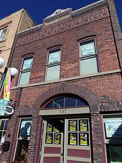
| 131 |
Polk County Courthouse |
|
April 30, 1979
(#79000925) |
6th and Mulberry Sts.
41°35′05″N 93°37′23″W / 41.584722°N 93.623056°W / 41.584722; -93.623056 (Polk County Courthouse) |
Des Moines |
Built in 1900. |
| 132 |
Polk County Homestead and Trust Company Addition Historic District |
|
October 4, 2016
(#16000687) |
Both sides of 7th & 8th Sts., S. of Franklin & N. of College Aves.
41°36′34″N 93°37′39″W / 41.609438°N 93.627500°W / 41.609438; -93.627500 (Polk County Homestead and Trust Company Addition Historic District) |
Des Moines |
|
| 133 |
Prospect Park Second Plat Historic District |
|
April 23, 1998
(#98000375) |
Roughly along the Des Moines River south to Franklin Ave., between 6th Ave. and 9th St.
41°36′45″N 93°37′39″W / 41.6125°N 93.6275°W / 41.6125; -93.6275 (Prospect Park Second Plat Historic District) |
Des Moines |
|
| 134 |
Public Library of Des Moines |
|
July 25, 1977
(#77000550) |
Locust St.
41°35′15″N 93°37′07″W / 41.5875°N 93.618611°W / 41.5875; -93.618611 (Public Library of Des Moines) |
Des Moines |
Built in 1903. |
| 135 |
Register and Tribune Building |
|
June 21, 2016
(#16000385) |
715 Locust St.
41°35′12″N 93°37′38″W / 41.586676°N 93.627179°W / 41.586676; -93.627179 (Register and Tribune Building) |
Des Moines |
|
| 136 |
Anson O. Reynolds House |
|
September 8, 1988
(#88001331) |
1022 26th St.
41°35′44″N 93°39′07″W / 41.595556°N 93.651944°W / 41.595556; -93.651944 (Anson O. Reynolds House) |
Des Moines |
|
| 137 |
Seth Richards Commercial Block |
|
March 11, 2005
(#01001460) |
300-310 Court Ave.
41°35′07″N 93°36′30″W / 41.585278°N 93.608333°W / 41.585278; -93.608333 (Seth Richards Commercial Block) |
Des Moines |
Built in 1889. |
| 138 |
Riverview Park Plat Historic District |
|
October 25, 1996
(#96001157) |
Arlington Ave. between Franklin and 6th Aves.
41°36′43″N 93°37′24″W / 41.611944°N 93.623333°W / 41.611944; -93.623333 (Riverview Park Plat Historic District) |
Des Moines |
|
| 139 |
Ralph Rollins House |
|
November 14, 1978
(#78001255) |
2801 Fleur Dr.
41°33′36″N 93°38′38″W / 41.56°N 93.643889°W / 41.56; -93.643889 (Ralph Rollins House) |
Des Moines |
|
| 140 |
Rumely-Des Moines Drug Company Building |
|
November 16, 1989
(#89002008) |
110 SW. 4th St.
41°34′58″N 93°37′16″W / 41.582778°N 93.621111°W / 41.582778; -93.621111 (Rumely-Des Moines Drug Company Building) |
Des Moines |
Built in 1903. |
| 141 |
St. Ambrose Cathedral and Rectory |
|
March 30, 1979
(#79000927) |
607 High St.
41°35′19″N 93°37′32″W / 41.588611°N 93.625556°W / 41.588611; -93.625556 (St. Ambrose Cathedral and Rectory) |
Des Moines |
Built in 1891. |
| 142 |
Saint John's Roman Catholic Church |
|
September 8, 1987
(#87001497) |
1915 University Ave.
41°35′30″N 93°38′35″W / 41.591667°N 93.643056°W / 41.591667; -93.643056 (Saint John's Roman Catholic Church) |
Des Moines |
|
| 143 |
St. Paul's Episcopal Church |
|
March 31, 2010
(#10000129) |
815 High St.
41°35′17″N 93°37′44″W / 41.588042°N 93.629°W / 41.588042; -93.629 (St. Paul's Episcopal Church) |
Des Moines |
|
| 144 |
Salisbury House |
|
July 20, 1977
(#77000551) |
4025 Tonawanda Dr.
41°34′46″N 93°40′17″W / 41.579444°N 93.671389°W / 41.579444; -93.671389 (Salisbury House) |
Des Moines |
Built in 1927-1928. |
| 145 |
Sargent's Garage |
|
October 22, 1998
(#98001276) |
510 College Ave.
41°36′27″N 93°37′31″W / 41.6075°N 93.625278°W / 41.6075; -93.625278 (Sargent's Garage) |
Des Moines |
|
| 146 |
Savery Hotel |
|
November 5, 1998
(#98001324) |
401 Locust St.
41°35′15″N 93°37′22″W / 41.5875°N 93.622778°W / 41.5875; -93.622778 (Savery Hotel) |
Des Moines |
Built in 1919. |
| 147 |
Julius Scheibe Cottage |
|
October 22, 1998
(#98001281) |
815 College Ave.
41°36′28″N 93°37′42″W / 41.607778°N 93.628333°W / 41.607778; -93.628333 (Julius Scheibe Cottage) |
Des Moines |
|
| 148 |
Schmitt and Henry Manufacturing Company |
|
March 17, 2010
(#10000078) |
309 SW 8th St.
41°34′50″N 93°37′31″W / 41.580683°N 93.625303°W / 41.580683; -93.625303 (Schmitt and Henry Manufacturing Company) |
Des Moines |
|
| 149 |
Mary A. and Caleb D. Scott House |
|
September 8, 1988
(#88001332) |
1014 26th St.
41°35′44″N 93°39′07″W / 41.595556°N 93.651944°W / 41.595556; -93.651944 (Mary A. and Caleb D. Scott House) |
Des Moines |
|
| 150 |
Scottish Rite Consistory Building |
|
February 9, 1983
(#83000399) |
6th Ave. and Park St.
41°35′29″N 93°37′30″W / 41.591389°N 93.625°W / 41.591389; -93.625 (Scottish Rite Consistory Building) |
Des Moines |
1926-27 |
| 151 |
Sherman Hill Historic District |
|
January 25, 1979
(#79000926) |
Roughly bounded by Woodland Ave., 19th, School, and 15th Sts.; also generally between 15th St., Woodland Ave., Martin Luther King Jr. Parkway and Interstate 235
41°35′28″N 93°38′25″W / 41.591111°N 93.640278°W / 41.591111; -93.640278 (Sherman Hill Historic District) |
Des Moines |
Second set of boundaries represents a boundary increase and decrease of March 7, 2012 |
| 152 |
Hoyt Sherman Place |
|
September 19, 1977
(#77000552) |
1501 Woodland Ave.
41°35′19″N 93°38′16″W / 41.588611°N 93.637778°W / 41.588611; -93.637778 (Hoyt Sherman Place) |
Des Moines |
|
| 153 |
Lampson P. Sherman House |
|
September 8, 1988
(#88001335) |
1052 26th St.
41°35′49″N 93°39′07″W / 41.596944°N 93.651944°W / 41.596944; -93.651944 (Lampson P. Sherman House) |
Des Moines |
|
| 154 |
John P. Simmons House |
|
November 1, 1988
(#88001339) |
1113 27th St.
41°36′08″N 93°39′24″W / 41.602222°N 93.656667°W / 41.602222; -93.656667 (John P. Simmons House) |
Des Moines |
|
| 155 |
Sixth and Forest Historic District |
|
October 25, 1996
(#96001156) |
Northeastern and northwestern corners of the junction of 6th and Forest Aves.
41°36′17″N 93°37′32″W / 41.604722°N 93.625556°W / 41.604722; -93.625556 (Sixth and Forest Historic District) |
Des Moines |
|
| 156 |
David W. Smouse Opportunity School |
|
October 24, 2002
(#02001251) |
2820 Center St.
41°35′29″N 93°39′17″W / 41.591389°N 93.654722°W / 41.591389; -93.654722 (David W. Smouse Opportunity School) |
Des Moines |
|
| 157 |
Southeast Water Trough |
|
October 8, 1976
(#76000801) |
SE. 11th and Scott St.
41°34′58″N 93°35′58″W / 41.582778°N 93.599444°W / 41.582778; -93.599444 (Southeast Water Trough) |
Des Moines |
|
| 158 |
Southwest Fifth St. Bridge |
|
May 15, 1998
(#98000487) |
SW. 5th St. over the Raccoon River
41°34′37″N 93°37′10″W / 41.576944°N 93.619444°W / 41.576944; -93.619444 (Southwest Fifth St. Bridge) |
Des Moines |
|
| 159 |
Standard Glass and Paint Company Building |
|
December 6, 2004
(#04001323) |
112 10th St.
41°35′02″N 93°37′42″W / 41.583889°N 93.628333°W / 41.583889; -93.628333 (Standard Glass and Paint Company Building) |
Des Moines |
|
| 160 |
Samuel A. and Margaret Stevenson House |
|
January 3, 1985
(#85000008) |
2940 Cottage Grove Ave.
41°35′54″N 93°39′31″W / 41.598333°N 93.658611°W / 41.598333; -93.658611 (Samuel A. and Margaret Stevenson House) |
Des Moines |
|
| 161 |
Thomas I. Stoner House |
|
February 12, 1992
(#92000006) |
1030 56th St.
41°35′47″N 93°41′37″W / 41.596389°N 93.693611°W / 41.596389; -93.693611 (Thomas I. Stoner House) |
Des Moines |
|
| 162 |
Dr. Richard and Paulina Stuart House |
|
September 8, 1988
(#88001330) |
1060 25th St.
41°35′50″N 93°39′03″W / 41.597222°N 93.650833°W / 41.597222; -93.650833 (Dr. Richard and Paulina Stuart House) |
Des Moines |
|
| 163 |
Studebaker Corporation Branch Office Building |
|
December 15, 2015
(#15000895) |
1436–1442 Locust St.
41°35′03″N 93°38′11″W / 41.584127°N 93.636323°W / 41.584127; -93.636323 (Studebaker Corporation Branch Office Building) |
Des Moines |
|
| 164 |
Sylvan Theater Historic District |
|
August 15, 1995
(#95000965) |
In Greenwood Park on the western side of 45th St., 1 block south of its junction with Grand Ave.
41°34′50″N 93°40′48″W / 41.580556°N 93.68°W / 41.580556; -93.68 (Sylvan Theater Historic District) |
Des Moines |
|
| 165 |
Syndicate Block |
|
October 1, 2001
(#01001059) |
501 E. Locust
41°35′22″N 93°36′38″W / 41.589444°N 93.610556°W / 41.589444; -93.610556 (Syndicate Block) |
Des Moines |
Built in 1883. |
| 166 |
Taft-West Warehouse |
|
December 20, 2006
(#06001162) |
216-222 Court Ave.
41°35′06″N 93°37′17″W / 41.585°N 93.621389°W / 41.585; -93.621389 (Taft-West Warehouse) |
Des Moines |
Built in 1922. |
| 167 |
Teachout Building |
|
April 29, 1999
(#99000491) |
500-502 E. Locust St.
41°35′24″N 93°36′39″W / 41.59°N 93.610833°W / 41.59; -93.610833 (Teachout Building) |
Des Moines |
Built in 1912. |
| 168 |
Terrace Hill |
|
June 14, 1972
(#72000480) |
2300 Grand Ave.
41°35′00″N 93°38′56″W / 41.583333°N 93.648889°W / 41.583333; -93.648889 (Terrace Hill) |
Des Moines |
Declared a National Historic Landmark on July 31, 2003 |
| 169 |
Theodore Roosevelt High School |
|
October 24, 2002
(#02001234) |
4419 Center St.
41°35′34″N 93°40′45″W / 41.592778°N 93.679167°W / 41.592778; -93.679167 (Theodore Roosevelt High School) |
Des Moines |
|
| 170 |
Trent-Beaver House |
|
October 25, 1996
(#96001145) |
1802 6th Ave.
41°36′42″N 93°37′30″W / 41.611667°N 93.625°W / 41.611667; -93.625 (Trent-Beaver House) |
Des Moines |
|
| 171 |
Paul J. and Ida Trier House |
|
November 9, 1988
(#88002148) |
6880 N.W. Beaver Dr.
41°41′10″N 93°41′21″W / 41.686111°N 93.689167°W / 41.686111; -93.689167 (Paul J. and Ida Trier House) |
Johnston |
|
| 172 |
Trinity Methodist Episcopal Church |
|
April 23, 1998
(#98000380) |
1548 8th St.
41°36′28″N 93°37′42″W / 41.607778°N 93.628333°W / 41.607778; -93.628333 (Trinity Methodist Episcopal Church) |
Des Moines |
|
| 173 |
Susie P. Turner Double House |
|
October 22, 1998
(#98001284) |
1420-1422 8th St.
41°36′17″N 93°37′41″W / 41.604722°N 93.628056°W / 41.604722; -93.628056 (Susie P. Turner Double House) |
Des Moines |
|
| 174 |
U.S. Post Office |
|
November 19, 1974
(#74002323) |
2nd and Walnut Sts.
41°35′13″N 93°37′10″W / 41.58684°N 93.61948°W / 41.58684; -93.61948 (U.S. Post Office) |
Des Moines |
|
| 175 |
Universalist Church |
|
September 6, 2005
(#05000253) |
420 4th St.
41°40′16″N 93°21′41″W / 41.671111°N 93.361389°W / 41.671111; -93.361389 (Universalist Church) |
Mitchellville |
|
| 176 |
Mrs. Marian D. Vail-Prof. Charles Noyes Kinney House |
|
November 1, 1988
(#88001340) |
1318 27th St.
41°36′10″N 93°39′13″W / 41.602778°N 93.653611°W / 41.602778; -93.653611 (Mrs. Marian D. Vail-Prof. Charles Noyes Kinney House) |
Des Moines |
|
| 177 |
Valley Junction Commercial Historic District |
|
October 11, 2017
(#100001739) |
100-318 5th St. (even side 300 only) & cross streets
41°34′17″N 93°42′32″W / 41.571330°N 93.708850°W / 41.571330; -93.708850 (Valley Junction Commercial Historic District) |
West Des Moines |
|
| 178 |
Valley Junction-West Des Moines City Hall and Engine House |
|
February 17, 1983
(#83000400) |
137 5th St.
41°34′15″N 93°42′29″W / 41.570833°N 93.708056°W / 41.570833; -93.708056 (Valley Junction-West Des Moines City Hall and Engine House) |
West Des Moines |
Built in 1905. |
| 179 |
Veneman's Bungalow Court Historic District |
|
November 21, 2000
(#00000929) |
1101-115 Droukas Court and 1228 and 1232 E. 12th St.
41°36′03″N 93°36′25″W / 41.600833°N 93.606944°W / 41.600833; -93.606944 (Veneman's Bungalow Court Historic District) |
Des Moines |
|
| 180 |
Henry Wallace House |
|
May 14, 1993
(#93000412) |
756 16th St.
41°35′29″N 93°38′23″W / 41.591389°N 93.639722°W / 41.591389; -93.639722 (Henry Wallace House) |
Des Moines |
|
| 181 |
Walnut Tire and Battery Co.-Globe Publishing Company Building |
|
January 17, 2017
(#100000489) |
1417-1425 Walnut St.
41°35′01″N 93°38′08″W / 41.583612°N 93.635492°W / 41.583612; -93.635492 (Walnut Tire and Battery Co.-Globe Publishing Company Building) |
Des Moines |
|
| 182 |
Warfield, Pratt and Howell Company Warehouse |
|
May 15, 1985
(#85001056) |
100 West Court Ave.
41°35′08″N 93°37′04″W / 41.585556°N 93.617778°W / 41.585556; -93.617778 (Warfield, Pratt and Howell Company Warehouse) |
Des Moines |
|
| 183 |
Washington and Elizabeth Miller Tract-Center-Soll Community Historic District |
|
January 17, 2017
(#100000490) |
Roughly 35th to 38th Sts. between 3500-3607 Grand Ave. to Center St.
41°35′20″N 93°40′03″W / 41.588832°N 93.667438°W / 41.588832; -93.667438 (Washington and Elizabeth Miller Tract-Center-Soll Community Historic District) |
Des Moines |
|
| 184 |
Charles H. and Lena May Weitz House |
|
October 22, 1998
(#98001282) |
1424 5th Ave.
41°36′16″N 93°37′27″W / 41.604444°N 93.624167°W / 41.604444; -93.624167 (Charles H. and Lena May Weitz House) |
Des Moines |
|
| 185 |
West Chester |
|
January 19, 1984
(#84001304) |
3520 Grand Ave.
41°35′02″N 93°39′52″W / 41.583889°N 93.664444°W / 41.583889; -93.664444 (West Chester) |
Des Moines |
|
| 186 |
West Ninth Streetcar Line Historic District |
|
April 23, 1998
(#98000377) |
W. 9th St. from University Ave. to Hickman Rd.
41°36′23″N 93°37′47″W / 41.606389°N 93.629722°W / 41.606389; -93.629722 (West Ninth Streetcar Line Historic District) |
Des Moines |
|
| 187 |
Wherry Block |
|
October 22, 1998
(#98001283) |
1600-1602 6th Ave.
41°36′28″N 93°37′33″W / 41.607778°N 93.625833°W / 41.607778; -93.625833 (Wherry Block) |
Des Moines |
Built in 1887. |
| 188 |
Woodland Place Historic District |
|
November 21, 2000
(#00000927) |
25th to 27th St. to Woodland Ave.
41°35′24″N 93°39′06″W / 41.59°N 93.651667°W / 41.59; -93.651667 (Woodland Place Historic District) |
Des Moines |
|
| 189 |
Youngerman Block |
|
June 10, 2009
(#09000405) |
206-208 4th St.
41°35′07″N 93°37′18″W / 41.585392°N 93.6218°W / 41.585392; -93.6218 (Youngerman Block) |
Des Moines |
Built in 1876. |
| 190 |
Younker Brothers Department Store |
|
March 17, 2010
(#10000079) |
713 Walnut St.
41°35′09″N 93°37′36″W / 41.585783°N 93.626558°W / 41.585783; -93.626558 (Younker Brothers Department Store) |
Des Moines |
Boundary decrease approved June 4, 2018 |
.jpg)
.JPG)
.JPG)
.jpg)

.JPG)
.JPG)