| [3] |
Name on the Register[4] |
Image |
Date listed[5] |
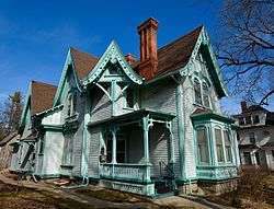
Location |
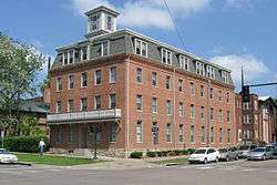
City or town |
Description |
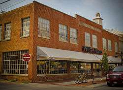
|---|
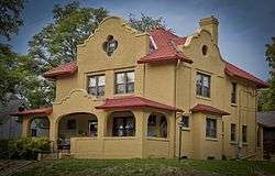
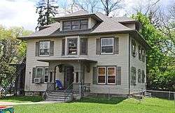
| 1 |
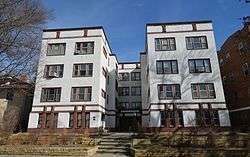
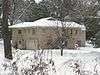
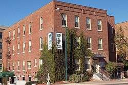
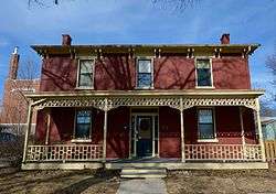
Ned Ashton House |
|
January 26, 2001
(#00001677) |
820 Park Rd.
41°40′20″N 91°33′03″W / 41.672222°N 91.550833°W / 41.672222; -91.550833 (Ned Ashton House) |
Iowa City |
|
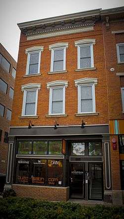
| 2 |
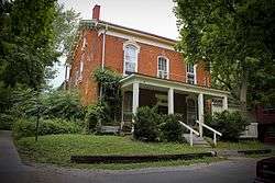
Charles Berryhill House |
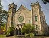
|
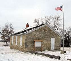
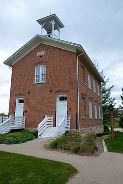
May 31, 1979
(#79000904) |
414 Brown St.
41°40′13″N 91°31′46″W / 41.670278°N 91.529444°W / 41.670278; -91.529444 (Charles Berryhill House) |
Iowa City |
|
| 3 |
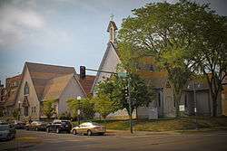
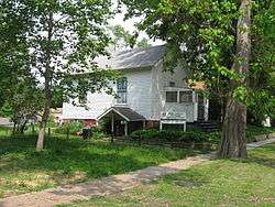
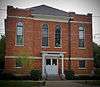
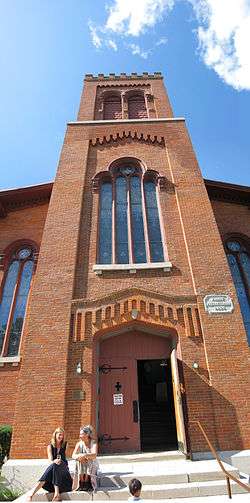
Bethel AME Church |
|
September 27, 2000
(#00000925) |
411 S. Governor St.
41°39′22″N 91°31′23″W / 41.656111°N 91.523056°W / 41.656111; -91.523056 (Bethel AME Church) |
Iowa City |
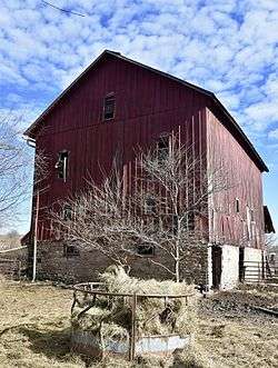
|
| 4 |
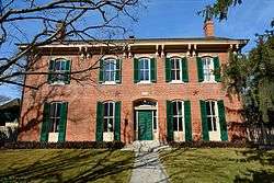
Billingsley-Hills House |
|
January 21, 1983
(#83000376) |
629 Melrose Ave.
41°39′23″N 91°32′54″W / 41.656389°N 91.548333°W / 41.656389; -91.548333 (Billingsley-Hills House) |
Iowa City |
|
| 5 |
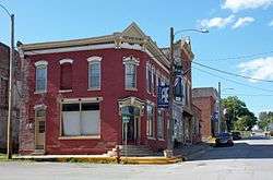
Boerner-Fry Company/Davis Hotel |
|
January 27, 1983
(#83000377) |
332 E. Washington St.
41°39′37″N 91°31′49″W / 41.660278°N 91.530278°W / 41.660278; -91.530278 (Boerner-Fry Company/Davis Hotel) |
Iowa City |
|
| 6 |
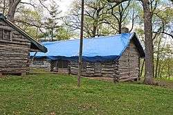
William Bostick House |
|
March 28, 1996
(#96000312) |
115 N. Gilbert St.
41°39′45″N 91°31′50″W / 41.6625°N 91.530556°W / 41.6625; -91.530556 (William Bostick House) |
Iowa City |
|
| 7 |
Bowery Street Grocery Store |
|
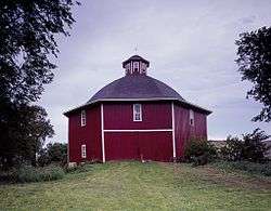
April 7, 2014
(#14000112) |
518 E. Bowery St.
41°39′15″N 91°31′41″W / 41.6542°N 91.5281°W / 41.6542; -91.5281 (Bowery Street Grocery Store) |
Iowa City |
|
| 8 |
Brown Street Historic District |
|
September 23, 1994
(#94001112) |
Roughly Brown St. from west of Linn St. to Governor St. and adjacent parts of intersecting streets
• Boundary increase (listed September 29, 2004, refnum 04001096): the 500-800 blocks of E. Ronalds St.
41°40′15″N 91°31′42″W / 41.670833°N 91.528333°W / 41.670833; -91.528333 (Brown Street Historic District) |
Iowa City |
part of the Iowa City Multiple Property Submission (MPS) |
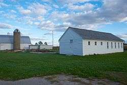
| 9 |
Buresh Farm |
|
April 29, 1977
(#77000533) |
West of Solon off Iowa Highway 382
41°48′35″N 91°33′46″W / 41.809722°N 91.562778°W / 41.809722; -91.562778 (Buresh Farm) |
Solon |
|
| 10 |
Dr. Albert Henry Byfield House |
|
March 23, 2017
(#100000792) |
715 W. Park Rd.
41°40′16″N 91°32′56″W / 41.670977°N 91.548905°W / 41.670977; -91.548905 (Dr. Albert Henry Byfield House) |
Iowa City |
|
| 11 |
Wilbur D. and Hattie Cannon House |
|
October 7, 1994
(#94001198) |
320 Melrose Ave.
41°39′23″N 91°32′42″W / 41.656389°N 91.545°W / 41.656389; -91.545 (Wilbur D. and Hattie Cannon House) |
Iowa City |
|
| 12 |
Thomas C. Carson House |
|
September 9, 1982
(#82002623) |
906 E. College St.
41°39′33″N 91°31′21″W / 41.659167°N 91.5225°W / 41.659167; -91.5225 (Thomas C. Carson House) |
Iowa City |
|
| 13 |
Cavanaugh-Zetek House |
|
September 16, 1977
(#77000527) |
704 Reno St.
41°40′08″N 91°31′05″W / 41.668889°N 91.518056°W / 41.668889; -91.518056 (Cavanaugh-Zetek House) |
Iowa City |
|
| 14 |
Chicago, Rock Island and Pacific Railroad Passenger Station |
|
December 10, 1982
(#82000411) |
115 Wright St.
41°39′13″N 91°32′01″W / 41.653611°N 91.533611°W / 41.653611; -91.533611 (Chicago, Rock Island and Pacific Railroad Passenger Station) |
Iowa City |
|
| 15 |
Clark House |
|
May 16, 1996
(#96000545) |
829 Kirkwood Ave.
41°38′56″N 91°31′22″W / 41.648889°N 91.522778°W / 41.648889; -91.522778 (Clark House) |
Iowa City |
|
| 16 |
Close House |
|
May 31, 1974
(#74000791) |
538 S. Gilbert St.
41°39′16″N 91°31′47″W / 41.654444°N 91.529722°W / 41.654444; -91.529722 (Close House) |
Iowa City |
|
| 17 |
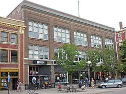
College Block Building |
|
July 23, 1973
(#73000728) |
125 E. College St.
41°39′31″N 91°31′35″W / 41.658611°N 91.526389°W / 41.658611; -91.526389 (College Block Building) |
Iowa City |
|
| 18 |
College Green Historic District |
|
July 9, 1997
(#97000623) |
Roughly bounded by Burlington, Summit, Washington, and Van Buren Sts.
41°39′32″N 91°31′32″W / 41.658889°N 91.525556°W / 41.658889; -91.525556 (College Green Historic District) |
Iowa City |
part of the Iowa City MPS |
| 19 |
Congregational Church of Iowa City |
|
June 18, 1973
(#73000729) |
30 N. Clinton St.
41°39′44″N 91°32′02″W / 41.662222°N 91.533889°W / 41.662222; -91.533889 (Congregational Church of Iowa City) |
Iowa City |
|
| 20 |
Coralville Public School |
|
January 11, 1974
(#74000789) |
402-404 5th St.
41°40′26″N 91°34′12″W / 41.673889°N 91.57°W / 41.673889; -91.57 (Coralville Public School) |
Coralville |
|
| 21 |
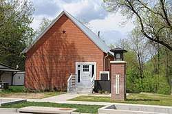
Coralville Union Ecclesiastical Church |
|
April 11, 1977
(#77000526) |
405 2nd Ave.
41°40′22″N 91°33′57″W / 41.672778°N 91.565833°W / 41.672778; -91.565833 (Coralville Union Ecclesiastical Church) |
Coralville |
|
| 22 |
Cottage at Rock and Dubuque Streets |
|
January 3, 1985
(#85000004) |
Route 4, Box 3
41°48′35″N 91°29′40″W / 41.809722°N 91.494444°W / 41.809722; -91.494444 (Cottage at Rock and Dubuque Streets) |
Solon |
|
| 23 |
Czecho Slovakian Association Hall |
|
November 7, 1976
(#76000775) |
524 N. Johnson St.
41°40′02″N 91°31′36″W / 41.667222°N 91.526667°W / 41.667222; -91.526667 (Czecho Slovakian Association Hall) |
Iowa City |
|
| 24 |
East College Street Historic District |
|
July 9, 1997
(#97000624) |
Roughly bounded by Muscatine Ave., Summitt, Washington, and Burlington Sts.
41°39′28″N 91°31′40″W / 41.657778°N 91.527778°W / 41.657778; -91.527778 (East College Street Historic District) |
Iowa City |
part of the Iowa City MPS |
| 25 |
Economy Advertising Company |
|
April 28, 1986
(#86000875) |
119-123 N. Linn
41°39′48″N 91°31′53″W / 41.663333°N 91.531389°W / 41.663333; -91.531389 (Economy Advertising Company) |
Iowa City |
|
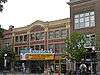
| 26 |
Englert Theatre |
|
August 30, 2001
(#01000911) |
221 E. Washington St.
41°39′35″N 91°31′56″W / 41.659722°N 91.532222°W / 41.659722; -91.532222 (Englert Theatre) |
Iowa City |
|
| 27 |
First Johnson County Asylum |
|
August 31, 1978
(#78001226) |
West of Iowa City
41°39′22″N 91°36′18″W / 41.656111°N 91.605°W / 41.656111; -91.605 (First Johnson County Asylum) |
Iowa City |
|
| 28 |
First Welsh Congregational Church |
|
April 13, 1977
(#77000528) |
5 miles (8.0 km) southwest of Iowa City off Iowa Highway 1
41°36′47″N 91°36′33″W / 41.613056°N 91.609167°W / 41.613056; -91.609167 (First Welsh Congregational Church) |
Iowa City |
|
| 29 |
Arthur Hillyer Ford House |
|
April 10, 1986
(#86000713) |
228 Brown St.
41°40′14″N 91°31′48″W / 41.670556°N 91.53°W / 41.670556; -91.53 (Arthur Hillyer Ford House) |
Iowa City |
|
| 30 |
Franklin Printing House |
|
April 10, 1986
(#86000712) |
115 S. Dubuque
41°39′34″N 91°32′00″W / 41.659444°N 91.533333°W / 41.659444; -91.533333 (Franklin Printing House) |
Iowa City |
|
| 31 |
Gilbert-Linn Street Historic District |
|
April 21, 2005
(#05000366) |
Portions of the 300-600 blocks of N. Gilbert and N. Linn Sts.
41°40′00″N 91°31′49″W / 41.666667°N 91.530278°W / 41.666667; -91.530278 (Gilbert-Linn Street Historic District) |
Iowa City |
part of the Iowa City, Iowa MPS AD |
| 32 |
Emma J. Harvat and Mary E. Stach House |
|
May 11, 2000
(#00000478) |
332 E. Davenport St.
41°40′02″N 91°31′49″W / 41.667222°N 91.530278°W / 41.667222; -91.530278 (Emma J. Harvat and Mary E. Stach House) |
Iowa City |
part of the Iowa City MPS |
| 33 |
Hawthorne Glove and Novelty Company-Shrader Drug Company Building |
|
September 22, 2014
(#14000666) |
529 S. Gilbert St.
41°39′16″N 91°31′49″W / 41.6545°N 91.5304°W / 41.6545; -91.5304 (Hawthorne Glove and Novelty Company-Shrader Drug Company Building) |
Iowa City |
|
| 34 |
Henyon-Kasper-Duffy Barn |
|
January 2, 2004
(#03001348) |
2520 Iowa Highway 1, NE.
41°44′58″N 91°28′20″W / 41.749444°N 91.472222°W / 41.749444; -91.472222 (Henyon-Kasper-Duffy Barn) |
Solon |
|
| 35 |
Jackson-Swisher House and Carriage House |
|
November 10, 1982
(#82000412) |
120 E. Fairchild St.
41°40′02″N 91°32′00″W / 41.667222°N 91.533333°W / 41.667222; -91.533333 (Jackson-Swisher House and Carriage House) |
Iowa City |
|
| 36 |
Jefferson Street Historic District |
|
September 29, 2004
(#04001097) |
Portions of the 100-400 blocks of E. Jefferson St.
41°39′46″N 91°31′51″W / 41.662778°N 91.530833°W / 41.662778; -91.530833 (Jefferson Street Historic District) |
Iowa City |
part of the Iowa City, Iowa MPS AD |
| 37 |
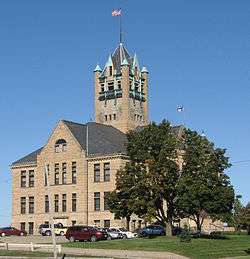
Johnson County Courthouse |
|
March 27, 1975
(#75000692) |
S. Clinton St.
41°39′22″N 91°32′07″W / 41.656111°N 91.535278°W / 41.656111; -91.535278 (Johnson County Courthouse) |
Iowa City |
part of the County Courthouses in Iowa Thematic Resource (TR) (AD) |
| 38 |
Johnson County Poor Farm and Asylum Historic District |
|
September 22, 2014
(#14000668) |
S. side of Melrose & Slothtower Aves.
41°39′26″N 91°36′17″W / 41.6571°N 91.6048°W / 41.6571; -91.6048 (Johnson County Poor Farm and Asylum Historic District) |
Iowa City |
|
| 39 |
Johnson County Savings Bank |
|
September 8, 2017
(#100001580) |
102 S. Clinton St.
41°39′36″N 91°32′05″W / 41.659909°N 91.534631°W / 41.659909; -91.534631 (Johnson County Savings Bank) |
Iowa City |
|
| 40 |
Sylvanus Johnson House |
|
December 6, 1990
(#90001857) |
2155 Prairie du Chien Rd.
41°41′26″N 91°31′31″W / 41.690556°N 91.525278°W / 41.690556; -91.525278 (Sylvanus Johnson House) |
Iowa City |
|
| 41 |
Kirkwood House |
|
September 17, 1974
(#74000792) |
1101 Kirkwood
41°38′57″N 91°31′09″W / 41.649167°N 91.519167°W / 41.649167; -91.519167 (Kirkwood House) |
Iowa City |
|
| 42 |
Letovsky-Rohret House |
|
April 12, 1982
(#82002624) |
515 E. Davenport St.
41°39′55″N 91°31′39″W / 41.665278°N 91.5275°W / 41.665278; -91.5275 (Letovsky-Rohret House) |
Iowa City |
|
| 43 |
Linsay House |
|
August 2, 1977
(#77000529) |
935 E. College
41°39′27″N 91°31′17″W / 41.6575°N 91.521389°W / 41.6575; -91.521389 (Linsay House) |
Iowa City |
|
| 44 |
Longfellow Historic District |
|
September 12, 2002
(#02001023) |
Roughly bounded by Court, Rundell, Sheridan, and the western boundary of Longfellow School
41°39′16″N 91°30′59″W / 41.654444°N 91.516389°W / 41.654444; -91.516389 (Longfellow Historic District) |
Iowa City |
part of the Iowa City, Iowa MPS AD |
| 45 |
James McCollister Farmstead |
|
October 8, 1976
(#76000776) |
Southeast of the junction of U.S. Routes 6 and 218
41°38′03″N 91°31′45″W / 41.634167°N 91.529167°W / 41.634167; -91.529167 (James McCollister Farmstead) |
Iowa City |
|
| 46 |
Melrose Historic District |
|
December 6, 2004
(#04001321) |
Portions of Melrose Ave., Melrose Ct., Melrose Circle, Brookland Park Dr., Brookland Place, and Myrtle Ave.
41°39′21″N 91°32′45″W / 41.655833°N 91.545833°W / 41.655833; -91.545833 (Melrose Historic District) |
Iowa City |
part of the Iowa City, Iowa MPS AD |
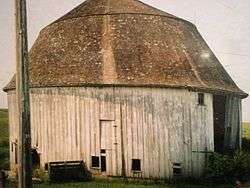
| 47 |
Miller Round Barn |
|
June 30, 1986
(#86001445) |
County Road F62
41°33′38″N 91°37′52″W / 41.560556°N 91.631111°W / 41.560556; -91.631111 (Miller Round Barn) |
Sharon Center |
part of the Iowa Round Barns: The Sixty Year Experiment TR |
| 48 |
Muscatine Avenue Moffitt Cottage Historic District |
|
May 4, 1993
(#93000327) |
1322-1330 Muscatine Ave.
41°39′26″N 91°30′55″W / 41.657222°N 91.515278°W / 41.657222; -91.515278 (Muscatine Avenue Moffitt Cottage Historic District) |
Iowa City |
part of the Small Homes of Howard F. Moffitt in Iowa City and Coralville MPS |
| 49 |
Nicking House |
|
April 21, 1975
(#75000693) |
410 E. Market St.
41°39′49″N 91°31′45″W / 41.663611°N 91.529167°W / 41.663611; -91.529167 (Nicking House) |
Iowa City |
|
| 50 |
North Presbyterian Church |
|
August 28, 1973
(#73000730) |
26 E. Market St.
41°39′50″N 91°32′04″W / 41.663889°N 91.534444°W / 41.663889; -91.534444 (North Presbyterian Church) |
Iowa City |
|
| 51 |
Oakes-Wood House |
|
April 14, 1978
(#78001227) |
1142 E. Court St.
41°39′25″N 91°31′05″W / 41.656944°N 91.518056°W / 41.656944; -91.518056 (Oakes-Wood House) |
Iowa City |
|
| 52 |
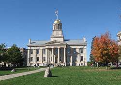
Old Capitol |
|
May 31, 1972
(#72000475) |
University of Iowa campus
41°39′41″N 91°32′08″W / 41.661389°N 91.535556°W / 41.661389; -91.535556 (Old Capitol) |
Iowa City |
|
| 53 |
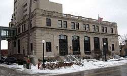
Old Post Office |
|
April 17, 1979
(#79000905) |
28 S. Linn St.
41°39′38″N 91°31′52″W / 41.660556°N 91.531111°W / 41.660556; -91.531111 (Old Post Office) |
Iowa City |
|
| 54 |
Old Settlers' Association of Johnson County Cabins |
|
June 25, 2013
(#13000429) |
Upper City Park Rd. off 100 blk. Park Rd.
41°40′16″N 91°32′32″W / 41.671145°N 91.542152°W / 41.671145; -91.542152 (Old Settlers' Association of Johnson County Cabins) |
Iowa City |
|
| 55 |
Old State Quarry |
|
February 23, 1998
(#97001676) |
0.1 miles (0.16 km) south of the southern end of Rice Ridge Ln., NE., at Coralville Lake
41°45′48″N 91°34′13″W / 41.763333°N 91.570278°W / 41.763333; -91.570278 (Old State Quarry) |
North Liberty |
|
| 56 |
Oxford Commercial Historic District |
|
May 2, 1997
(#97000389) |
Roughly Augusta Ave. between Wilson St. and the Center St. alley
41°43′26″N 91°47′25″W / 41.723889°N 91.790278°W / 41.723889; -91.790278 (Oxford Commercial Historic District) |
Oxford |
|
| 57 |
Park House Hotel |
|
December 11, 1978
(#78001229) |
130 E. Jefferson St.
41°39′46″N 91°32′00″W / 41.662778°N 91.533333°W / 41.662778; -91.533333 (Park House Hotel) |
Iowa City |
|
| 58 |
Paul–Helen Building |
|
April 10, 1986
(#86000708) |
207-215 E. Washington
41°39′35″N 91°31′57″W / 41.659722°N 91.5325°W / 41.659722; -91.5325 (Paul–Helen Building) |
Iowa City |
|
| 59 |
Pentacrest |
|
March 29, 1978
(#78001230) |
Bounded by Clinton, Madison, Jefferson, and Washington Sts.
41°39′41″N 91°32′09″W / 41.661389°N 91.535833°W / 41.661389; -91.535833 (Pentacrest) |
Iowa City |
|
| 60 |
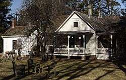
Plum Grove |
|
May 7, 1973
(#73000731) |
1030 Carroll Ave.
41°38′52″N 91°31′28″W / 41.647778°N 91.524444°W / 41.647778; -91.524444 (Plum Grove) |
Iowa City |
|
| 61 |
Polygonal Barn, Lincoln Township |
|
June 30, 1986
(#86001452) |
Off U.S. Route 6
41°35′16″N 91°23′41″W / 41.587778°N 91.394722°W / 41.587778; -91.394722 (Polygonal Barn, Lincoln Township) |
Lincoln Township |
part of the Iowa Round Barns: The Sixty Year Experiment TR |
| 62 |
A.W. Pratt House |
|
February 3, 1983
(#83000378) |
503 Melrose Ave.
41°39′23″N 91°32′45″W / 41.656523°N 91.545937°W / 41.656523; -91.545937 (A.W. Pratt House) |
Iowa City |
|
| 63 |
Samuel and Emma A. Ranshaw House |
|
September 26, 2012
(#12000814) |
515 W. Penn St.
41°45′05″N 91°36′21″W / 41.75148°N 91.605873°W / 41.75148; -91.605873 (Samuel and Emma A. Ranshaw House) |
North Liberty |
|
| 64 |
F.X. Rittenmeyer House |
|
May 31, 1979
(#79000906) |
630 E. Fairchild St.
41°40′01″N 91°31′32″W / 41.666944°N 91.525556°W / 41.666944; -91.525556 (F.X. Rittenmeyer House) |
Iowa City |
|
| 65 |
Roberts Octagon Barn |
|
June 30, 1986
(#86001449) |
County Road W62
41°35′24″N 91°38′07″W / 41.59°N 91.635278°W / 41.59; -91.635278 (Roberts Octagon Barn) |
Sharon Center |
part of the Iowa Round Barns: The Sixty Year Experiment TR |
| 66 |
Rose Hill |
|
April 28, 1992
(#92000425) |
1415 E. Davenport St.
41°39′57″N 91°31′01″W / 41.665833°N 91.516944°W / 41.665833; -91.516944 (Rose Hill) |
Iowa City |
|
| 67 |
Saints Peter and Paul Catholic Church |
|
July 9, 1997
(#97000622) |
1165 NE. Taft Ave.
41°50′57″N 91°27′49″W / 41.849167°N 91.463611°W / 41.849167; -91.463611 (Saints Peter and Paul Catholic Church) |
Solon |
|
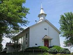
| 68 |
St. John's Lutheran Church |
|
April 5, 1977
(#77000532) |
North of Kalona
41°33′15″N 91°40′03″W / 41.554167°N 91.6675°W / 41.554167; -91.6675 (St. John's Lutheran Church) |
Kalona |
|
| 69 |
St. Mary's Church and Rectory |
|
February 8, 1980
(#80001454) |
220 E. Jefferson St.
41°39′46″N 91°31′54″W / 41.662778°N 91.531667°W / 41.662778; -91.531667 (St. Mary's Church and Rectory) |
Iowa City |
|
| 70 |
St. Mary's Rectory |
|
July 7, 1995
(#95000811) |
610 E. Jefferson St.
41°39′48″N 91°31′54″W / 41.663333°N 91.531667°W / 41.663333; -91.531667 (St. Mary's Rectory) |
Iowa City |
|
| 71 |
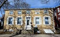
Schindhelm-Drews House |
|
January 28, 1994
(#93001589) |
410 N. Lucas St.
41°39′58″N 91°31′27″W / 41.666111°N 91.524167°W / 41.666111; -91.524167 (Schindhelm-Drews House) |
Iowa City |
|
| 72 |
Secrest Octagon Barn |
|
November 5, 1974
(#74000790) |
West of Downey
41°36′49″N 91°22′13″W / 41.613611°N 91.370278°W / 41.613611; -91.370278 (Secrest Octagon Barn) |
Downey |
part of the Iowa Round Barns: The Sixty Year Experiment TR |
| 73 |
Bohumil Shimek House |
|
December 23, 1991
(#91001837) |
529 Brown St.
41°40′11″N 91°31′37″W / 41.669722°N 91.526944°W / 41.669722; -91.526944 (Bohumil Shimek House) |
Iowa City |
part of the Conservation Movement in Iowa MPS |
| 74 |
Sigma Pi Fraternity House |
|
December 31, 2013
(#13001019) |
108 McLean St.
41°40′10″N 91°32′30″W / 41.669445°N 91.541574°W / 41.669445; -91.541574 (Sigma Pi Fraternity House) |
Iowa City |
|
| 75 |
South Summit Street District |
|
October 9, 1973
(#73000732) |
301-818 S. Summit St.
41°39′16″N 91°31′16″W / 41.654444°N 91.521111°W / 41.654444; -91.521111 (South Summit Street District) |
Iowa City |
|
| 76 |
Stone Academy |
|
January 16, 2001
(#00001653) |
Iowa Highway 1, 2 miles (3.2 km) north of Solon
41°50′20″N 91°30′05″W / 41.838889°N 91.501389°W / 41.838889; -91.501389 (Stone Academy) |
Solon |
|
| 77 |
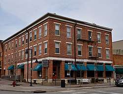
Summit Apartment Building |
|
September 29, 1983
(#83004188) |
228 S. Summit St.
41°39′29″N 91°31′14″W / 41.658056°N 91.520556°W / 41.658056; -91.520556 (Summit Apartment Building) |
Iowa City |
|
| 78 |
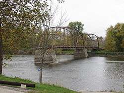
Sutliff Bridge |
|
May 15, 1998
(#98000520) |
Sutliff Rd. over the Cedar River
41°50′23″N 91°23′33″W / 41.839634°N 91.392455°W / 41.839634; -91.392455 (Sutliff Bridge) |
Sutliff |
part of the Highway Bridges of Iowa MPS |
| 79 |
Trinity Episcopal Church |
|
December 31, 1974
(#74000793) |
320 E. College St.
41°39′33″N 91°31′49″W / 41.659167°N 91.530278°W / 41.659167; -91.530278 (Trinity Episcopal Church) |
Iowa City |
|
| 80 |
Union Bakery |
|
December 15, 2015
(#15000893) |
203 N. Linn St.
41°39′50″N 91°31′55″W / 41.663755°N 91.531897°W / 41.663755; -91.531897 (Union Bakery) |
Iowa City |
|
| 81 |
Union Brewery |
|
April 10, 1986
(#86000710) |
127-131 N. Linn St. and 221-227 E. Market St.
41°39′48″N 91°31′54″W / 41.663333°N 91.531667°W / 41.663333; -91.531667 (Union Brewery) |
Iowa City |
|
| 82 |
Vogt House |
|
July 24, 1978
(#78001231) |
800 N. Van Buren St.
41°40′15″N 91°31′42″W / 41.670833°N 91.528333°W / 41.670833; -91.528333 (Vogt House) |
Iowa City |
|
| 83 |
Washington Township Center High School |
|
December 15, 1979
(#79000903) |
Northeast of Amish
41°33′20″N 91°46′12″W / 41.555556°N 91.77°W / 41.555556; -91.77 (Washington Township Center High School) |
Washington Township |
|
| 84 |
Roland and Marilyn Wehner House |
|
September 9, 2013
(#13000691) |
3112 Iowa Highway 1
41°42′29″N 91°28′58″W / 41.708025°N 91.482907°W / 41.708025; -91.482907 (Roland and Marilyn Wehner House) |
Iowa City vicinity |
|
| 85 |
Jacob Wentz House |
|
August 27, 1974
(#74000794) |
219 N. Gilbert St.
41°39′51″N 91°31′48″W / 41.664167°N 91.53°W / 41.664167; -91.53 (Jacob Wentz House) |
Iowa City |
|
| 86 |
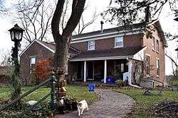
Isaac A. Wetherby House |
|
March 17, 2009
(#09000127) |
611 North Governor Street
41°40′05″N 91°31′23″W / 41.668056°N 91.522917°W / 41.668056; -91.522917 (Isaac A. Wetherby House) |
Iowa City |
Former home of Isaac Augustus Wetherby. |
| 87 |
H.A. White General Store and House |
|
January 12, 1984
(#84001265) |
10 W. Cherry St.
41°45′33″N 91°35′52″W / 41.759167°N 91.597778°W / 41.759167; -91.597778 (H.A. White General Store and House) |
North Liberty |
|
| 88 |
Windrem House |
|
September 13, 1977
(#77000531) |
604 Iowa Ave.
41°39′41″N 91°31′36″W / 41.661389°N 91.526667°W / 41.661389; -91.526667 (Windrem House) |
Iowa City |
|
| 89 |
Woodlawn Historic District |
|
March 26, 1979
(#79000907) |
Irregular pattern along Woodlawn Ave.
41°39′40″N 91°31′10″W / 41.661111°N 91.519444°W / 41.661111; -91.519444 (Woodlawn Historic District) |
Iowa City |
|

.JPG)

.jpg)
_02.JPG)