| [3] |
Name on the Register[4] |
Image |
Date listed[5] |
Location |
City or town |
Description |
|---|
| 1 |
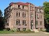
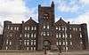
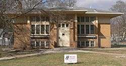
Alhambra Apartments |
|
October 12, 2001
(#01001089) |
801 8th St.
42°29′56″N 96°24′01″W / 42.4988°N 96.40041°W / 42.4988; -96.40041 (Alhambra Apartments) |
Sioux City |
|
| 2 |
Atchison A. Ashby House |
|
September 25, 1998
(#98001207) |
1807 Summit St.
42°30′34″N 96°24′36″W / 42.50947°N 96.40988°W / 42.50947; -96.40988 (Atchison A. Ashby House) |
Sioux City |
|
| 3 |
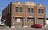
Badgerow Building |
|
March 24, 1982
(#82002646) |
622 4th St.
42°29′38″N 96°24′08″W / 42.49385°N 96.40224°W / 42.49385; -96.40224 (Badgerow Building) |
Sioux City |
|
| 4 |
George A. and Mary Tinkel Bailey House |
|
August 5, 1998
(#98000929) |
423 10th St.
42°28′53″N 95°47′03″W / 42.481389°N 95.784167°W / 42.481389; -95.784167 (George A. and Mary Tinkel Bailey House) |
Correctionville |
|
| 5 |
W.L. and Winnie (Woodfield) Belfrage Farmstead Historic District |
|
November 16, 2017
(#100001819) |
2410 Port Neal Rd.
42°21′32″N 96°21′01″W / 42.358926°N 96.350391°W / 42.358926; -96.350391 (W.L. and Winnie (Woodfield) Belfrage Farmstead Historic District) |
Sergeant Bluff |
|
| 6 |
Benson Archeological Site (13WD50) |
|
April 24, 1984
(#84001611) |
Address Restricted
|
Smithland |
|
| 7 |
Boston Block |
|
January 3, 1985
(#85000010) |
1005-1013 E. 4th St.
42°29′40″N 96°23′50″W / 42.49449°N 96.39734°W / 42.49449; -96.39734 (Boston Block) |
Sioux City |
|
| 8 |
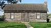
Theophile Bruguier Cabin |
|
August 14, 2000
(#00000918) |
Riverside Park
42°29′48″N 96°28′31″W / 42.496678°N 96.475192°W / 42.496678; -96.475192 (Theophile Bruguier Cabin) |
Sioux City |
|
| 9 |
Elzy G. Burkam House |
|
July 15, 1998
(#98000864) |
1525 Douglas St.
42°30′25″N 96°24′25″W / 42.50693°N 96.40697°W / 42.50693; -96.40697 (Elzy G. Burkam House) |
Sioux City |
|
| 10 |
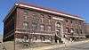
Charles City College Hall |
|
January 21, 1983
(#83000412) |
1501 Morningside Ave.
42°28′31″N 96°21′36″W / 42.475233°N 96.360098°W / 42.475233; -96.360098 (Charles City College Hall) |
Sioux City |
|
| 11 |
Chicago, Milwaukee, St. Paul & Pacific Combination Depot-Hornick |
|
September 6, 1990
(#90001309) |
Main St. south of Railway St.
42°13′51″N 96°05′51″W / 42.230833°N 96.0975°W / 42.230833; -96.0975 (Chicago, Milwaukee, St. Paul & Pacific Combination Depot-Hornick) |
Hornick |
|
| 12 |
Davidson Building |
|
June 25, 1999
(#99000736) |
505 6th St.
42°29′48″N 96°24′17″W / 42.49653°N 96.40471°W / 42.49653; -96.40471 (Davidson Building) |
Sioux City |
|
| 13 |
Evans Block |
|
January 3, 1985
(#85000011) |
1126-28 4th St.
42°29′39″N 96°23′42″W / 42.49403°N 96.39511°W / 42.49403; -96.39511 (Evans Block) |
Sioux City |
|
| 14 |
H.H. Everist House |
|
September 29, 1983
(#83000413) |
37 McDonald Dr.
42°31′08″N 96°24′40″W / 42.51877°N 96.41107°W / 42.51877; -96.41107 (H.H. Everist House) |
Sioux City |
|
| 15 |
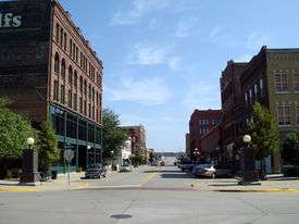
Fourth Street Historic District |
|
August 15, 1995
(#95000966) |
1002-1128 4th St.
42°29′39″N 96°23′46″W / 42.494167°N 96.396111°W / 42.494167; -96.396111 (Fourth Street Historic District) |
Sioux City |
|
| 16 |
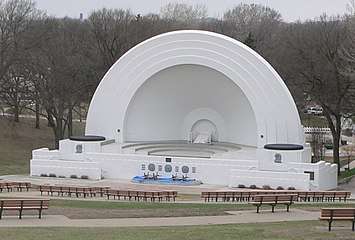
Grandview Park Music Pavilion |
|
February 28, 2011
(#11000053) |
Sits to the east of McDonald St. -- Entrance in 2600 block of McDonald St.
42°31′00″N 96°24′35″W / 42.51673°N 96.40969°W / 42.51673; -96.40969 (Grandview Park Music Pavilion) |
Sioux City |
|
| 17 |
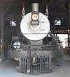
Great Northern Railway Steam Locomotive No. 1355 and Tender 1451 |
|
December 15, 2004
(#04001352) |
3400 Sioux River Rd.
42°31′45″N 96°28′36″W / 42.529167°N 96.476667°W / 42.529167; -96.476667 (Great Northern Railway Steam Locomotive No. 1355 and Tender 1451) |
Sioux City |
|
| 18 |
Holy Trinity Greek Orthodox Church |
|
May 1, 1998
(#98000381) |
900 6th St.
42°29′46″N 96°23′55″W / 42.496111°N 96.398611°W / 42.496111; -96.398611 (Holy Trinity Greek Orthodox Church) |
Sioux City |
|
| 19 |
Dr. Van Buren Knott House |
|
September 8, 1999
(#99001032) |
2323 Nebraska St.
42°30′54″N 96°24′15″W / 42.51493°N 96.4041°W / 42.51493; -96.4041 (Dr. Van Buren Knott House) |
Sioux City |
|
| 20 |
Leeds Junior High School |
|
October 24, 2002
(#02001228) |
3919 Jefferson St.
42°32′15″N 96°22′04″W / 42.5375°N 96.367778°W / 42.5375; -96.367778 (Leeds Junior High School) |
Sioux City |
Demolished ca. 2008[6] |
| 21 |
Lewis System Armored Car and Detective Service Building |
|
October 4, 2016
(#16000689) |
700 Nebraska St.
42°29′51″N 96°24′12″W / 42.497583°N 96.403454°W / 42.497583; -96.403454 (Lewis System Armored Car and Detective Service Building) |
Sioux City |
|
| 22 |
Martin Hotel |
|
January 27, 1983
(#83000414) |
410 Pierce St.
42°29′40″N 96°24′15″W / 42.494444°N 96.404167°W / 42.494444; -96.404167 (Martin Hotel) |
Sioux City |
|
| 23 |
T.S. Martin and Company |
|
July 15, 1998
(#98000865) |
Junction of 4th St. and Nebraska St.
42°29′40″N 96°24′14″W / 42.494444°N 96.40397°W / 42.494444; -96.40397 (T.S. Martin and Company) |
Sioux City |
|
| 24 |
Mary Elizabeth Day Nursery |
|
October 30, 1997
(#97001293) |
814 Court St.
42°29′57″N 96°23′46″W / 42.49922°N 96.39612°W / 42.49922; -96.39612 (Mary Elizabeth Day Nursery) |
Sioux City |
|
| 25 |
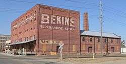
Midland Packing Company |
|
January 25, 1979
(#79000952) |
2001 Leech Ave.
42°29′19″N 96°22′59″W / 42.488611°N 96.383056°W / 42.488611; -96.383056 (Midland Packing Company) |
Sioux City |
Demolished in 2010[7] |
| 26 |
Morningside College Historic District |
|
May 14, 1997
(#97000387) |
Roughly bounded by Vine, Morningside, Garretson, Peters, and S. Paxton Aves. and Sioux Trail
42°28′28″N 96°21′42″W / 42.474444°N 96.361667°W / 42.474444; -96.361667 (Morningside College Historic District) |
Sioux City |
|
| 27 |
Motor Mart Building |
|
April 22, 1993
(#93000330) |
520 Nebraska St.
42°29′46″N 96°24′12″W / 42.49606°N 96.40321°W / 42.49606; -96.40321 (Motor Mart Building) |
Sioux City |
|
| 28 |
Mount Sinai Temple |
|
October 21, 1999
(#99001268) |
1320 Nebraska St.
42°30′18″N 96°24′10″W / 42.505°N 96.402778°W / 42.505; -96.402778 (Mount Sinai Temple) |
Sioux City |
|
| 29 |
Municipal Auditorium |
|
July 27, 2006
(#06000316) |
500 Gordon Dr.
42°29′34″N 96°24′24″W / 42.492778°N 96.406667°W / 42.492778; -96.406667 (Municipal Auditorium) |
Sioux City |
|
| 30 |
Mylius-Eaton House |
|
January 13, 2004
(#03001390) |
2900 Jackson St.
42°31′15″N 96°24′07″W / 42.52093°N 96.4019°W / 42.52093; -96.4019 (Mylius-Eaton House) |
Sioux City |
|
| 31 |
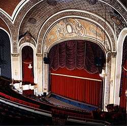
New Orpheum Theatre |
|
August 25, 2000
(#00000919) |
520-28 Pierce St.
42°29′44″N 96°24′17″W / 42.495556°N 96.404722°W / 42.495556; -96.404722 (New Orpheum Theatre) |
Sioux City |
Restored theatre complex that was built in 1927 |
| 32 |
James P. Newton House and Maid Cottage |
|
March 3, 2000
(#00000154) |
2312 Nebraska St.
42°30′53″N 96°24′12″W / 42.5147°N 96.40329°W / 42.5147; -96.40329 (James P. Newton House and Maid Cottage) |
Sioux City |
|
| 33 |
Julius and Anine Oversen House |
|
March 28, 2007
(#07000207) |
2037 S. Lemon St.
42°28′08″N 96°20′33″W / 42.469002°N 96.342551°W / 42.469002; -96.342551 (Julius and Anine Oversen House) |
Sioux City |
|
| 34 |
John Peirce House |
|
December 12, 1978
(#78001273) |
2901 Jackson St.
42°31′15″N 96°24′08″W / 42.520833°N 96.402222°W / 42.520833; -96.402222 (John Peirce House) |
Sioux City |
|
| 35 |
Rose Hill Historic District |
|
September 12, 2002
(#02001022) |
1400-1700 blocks of Douglas St., Grandview Boulevard, and Summit St.
42°30′08″N 96°24′48″W / 42.502222°N 96.413333°W / 42.502222; -96.413333 (Rose Hill Historic District) |
Sioux City |
|
| 36 |
St. Boniface Historic District |
|
November 5, 1998
(#98001322) |
703 W. 5th St., 515 Cook St., and 700 W. 6th St.
42°30′04″N 96°25′03″W / 42.501111°N 96.4175°W / 42.501111; -96.4175 (St. Boniface Historic District) |
Sioux City |
|
| 37 |
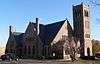
St. Thomas Episcopal Church |
|
September 27, 1984
(#84001612) |
1200 Douglas St.
42°30′11″N 96°24′23″W / 42.503056°N 96.406389°W / 42.503056; -96.406389 (St. Thomas Episcopal Church) |
Sioux City |
|
| 38 |
Arthur and Stella Sanford House |
|
May 9, 2003
(#03000359) |
1925 Summit
42°30′39″N 96°24′36″W / 42.51091°N 96.40996°W / 42.51091; -96.40996 (Arthur and Stella Sanford House) |
Sioux City |
|
| 39 |
Ben and Harriet Schulein House |
|
October 30, 1997
(#97001289) |
2604 Jackson St.
42°31′03″N 96°24′07″W / 42.51741°N 96.40181°W / 42.51741; -96.40181 (Ben and Harriet Schulein House) |
Sioux City |
Built in 1913, this represents William L. Steele's first tentative venture into the Prairie School style of architecture for which he is now best known. |
| 40 |
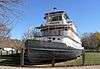
SERGEANT FLOYD |
|
May 5, 1989
(#89001079) |
Missouri River Mile Marker 730
42°30′04″N 96°28′21″W / 42.501111°N 96.4725°W / 42.501111; -96.4725 (SERGEANT FLOYD) |
Sioux City |
|
| 41 |
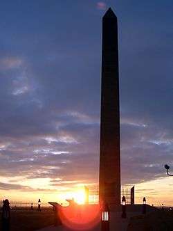
Sergeant Floyd Monument |
|
October 15, 1966
(#66000340) |
Glenn Ave. and Lewis Rd.
42°27′45″N 96°22′39″W / 42.4625°N 96.3775°W / 42.4625; -96.3775 (Sergeant Floyd Monument) |
Sioux City |
|
| 42 |
Simmons Hardware Company Warehouse |
|
April 25, 2008
(#08000332) |
323 Water St.
42°29′38″N 96°24′36″W / 42.49386°N 96.40989°W / 42.49386; -96.40989 (Simmons Hardware Company Warehouse) |
Sioux City |
|
| 43 |
Sioux City Baptist Church |
|
October 22, 1979
(#79000953) |
1301 Nebraska Ave.
42°30′15″N 96°24′14″W / 42.50419°N 96.40398°W / 42.50419; -96.40398 (Sioux City Baptist Church) |
Sioux City |
Built in 1918 by Prairie School architect William L. Steele as the First Congregational Church, it gained NRHP status as Sioux City Baptist, and is now Iglesia Pentecostes Evangelica Principe de Paz. |
| 44 |
Sioux City Central High School and Central Annex |
|
July 23, 1974
(#74000817) |
1212 Nebraska & 1121 Jackson Sts.
42°30′13″N 96°24′10″W / 42.50351°N 96.40285°W / 42.50351; -96.40285 (Sioux City Central High School and Central Annex) |
Sioux City |
Boundary increase and rename, September 19, 2016 |
| 45 |
Sioux City Fire Station Number 3 |
|
May 21, 2008
(#08000444) |
1211 5th St.
42°29′44″N 96°23′40″W / 42.49552°N 96.39433°W / 42.49552; -96.39433 (Sioux City Fire Station Number 3) |
Sioux City |
|
| 46 |
Sioux City Free Public Library |
|
June 2, 1997
(#97000461) |
705 6th St.
42°29′48″N 96°24′06″W / 42.49659°N 96.40155°W / 42.49659; -96.40155 (Sioux City Free Public Library) |
Sioux City |
|
| 47 |
Sioux City Linseed Oil Works |
|
January 10, 2008
(#07001359) |
210 Court St.
42°29′33″N 96°23′46″W / 42.49238°N 96.39609°W / 42.49238; -96.39609 (Sioux City Linseed Oil Works) |
Sioux City |
|
| 48 |
Sioux City Masonic Temple |
|
January 14, 2004
(#03001389) |
820 Nebraska St.
42°29′58″N 96°24′05″W / 42.499444°N 96.401389°W / 42.499444; -96.401389 (Sioux City Masonic Temple) |
Sioux City |
|
| 49 |
Sioux City Public Library (Smith Villa Branch) |
|
May 23, 1983
(#83000415) |
1509 George Ave.
42°30′23″N 96°25′39″W / 42.50642°N 96.42742°W / 42.50642; -96.42742 (Sioux City Public Library (Smith Villa Branch)) |
Sioux City |
|
| 50 |
Sioux City Public Library-North Side Branch |
|
December 7, 2000
(#00001479) |
810 29th St.
42°31′14″N 96°24′01″W / 42.52042°N 96.40028°W / 42.52042; -96.40028 (Sioux City Public Library-North Side Branch) |
Sioux City |
|
| 51 |
Swedish Evangelical Lutheran Augustana Church |
|
May 30, 2006
(#06000444) |
600 Court St.
42°29′48″N 96°23′46″W / 42.49658°N 96.39607°W / 42.49658; -96.39607 (Swedish Evangelical Lutheran Augustana Church) |
Sioux City |
|
| 52 |
United States Post Office and Courthouse |
|
July 17, 2013
(#13000485) |
316–320 6th Street
42°29′46″N 96°24′26″W / 42.496028°N 96.407176°W / 42.496028; -96.407176 (United States Post Office and Courthouse) |
Sioux City |
|
| 53 |
Warrior Hotel |
|
June 27, 1985
(#85001384) |
6th and Nebraska Sts.
42°29′48″N 96°24′14″W / 42.49657°N 96.40391°W / 42.49657; -96.40391 (Warrior Hotel) |
Sioux City |
|
| 54 |
Williges Building |
|
August 31, 2007
(#07000850) |
613-615 Pierce St.
42°29′49″N 96°24′19″W / 42.49697°N 96.40522°W / 42.49697; -96.40522 (Williges Building) |
Sioux City |
|
| 55 |
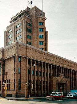
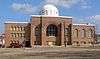
Woodbury County Courthouse |
|
December 18, 1973
(#73000744) |
7th and Douglas Sts.
42°29′50″N 96°24′20″W / 42.497222°N 96.405556°W / 42.497222; -96.405556 (Woodbury County Courthouse) |
Sioux City |
|
_from_SW_1.JPG)
_from_E_1.JPG)
_from_SW_1.JPG)
_from_SE_1.JPG)
_from_SW_1.JPG)
_from_NE_2.JPG)
_from_E_1.JPG)
_from_SW_2.jpg)
_from_W_1.JPG)
_from_SW_2.JPG)
_from_NW_1.JPG)
_from_E_1.JPG)
_from_NE_1.jpg)
_from_E_1.JPG)
_from_W_1.JPG)
_from_SE_2.JPG)
_from_NW_1.JPG)
_from_SE_1.JPG)
_from_E_1.JPG)