| [3] |
Name on the Register[4] |
Image |
Date listed[5] |
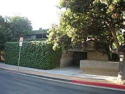
Location |
City or town |
Description |
|---|
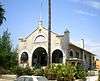
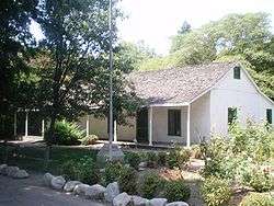
| 1 |
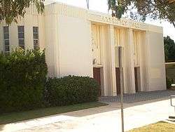
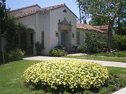
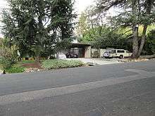
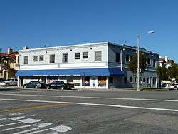
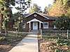
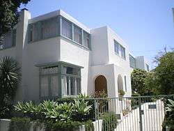
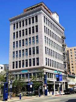
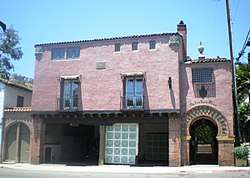
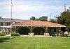
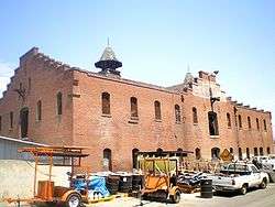
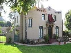
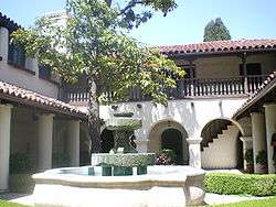
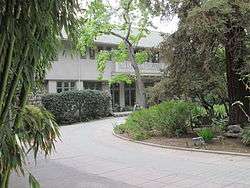
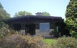
Adamson House |
|
October 28, 1977
(#77000298) |
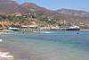
23200 W. Pacific Coast Highway
34°02′04″N 118°40′42″W / 34.034444°N 118.678333°W / 34.034444; -118.678333 (Adamson House) |
Malibu |
|
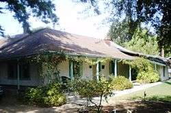
| 2 |
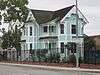
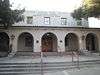
Adobe Flores |
|
June 18, 1973
(#73000404) |
1804 Foothill St.
34°07′11″N 118°08′41″W / 34.119722°N 118.144722°W / 34.119722; -118.144722 (Adobe Flores) |
South Pasadena |
|
| 3 |
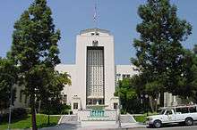
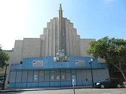
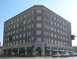
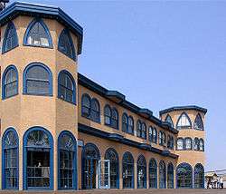
Alexander Theatre |
|
February 16, 1996
(#96000102) |
216 N. Brand Blvd.
34°08′57″N 118°15′12″W / 34.149167°N 118.253333°W / 34.149167; -118.253333 (Alexander Theatre) |
Glendale |
|
| 4 |
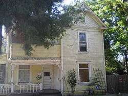
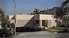
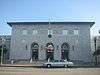
Anderton Court Shops |
|
May 14, 2004
(#03000987) |
332 N.Rodeo Dr.
34°04′06″N 118°24′03″W / 34.068333°N 118.400833°W / 34.068333; -118.400833 (Anderton Court Shops) |
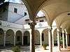
Beverly Hills |
Frank Lloyd Wright |
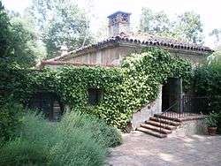
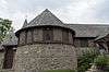
| 5 |
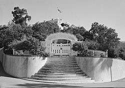
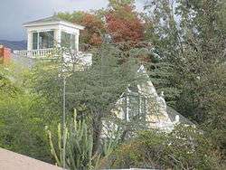
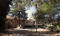
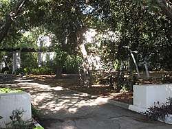
Antelope Valley Indian Museum |
|
February 26, 1987
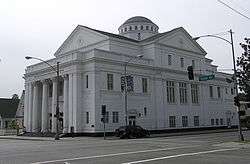
(#87000509) |
15701 East Ave.
34°39′01″N 117°50′56″W / 34.650278°N 117.848889°W / 34.650278; -117.848889 (Antelope Valley Indian Museum) |
Lancaster |
Chalet-style building set into rock formations, originally as a home |
| 6 |
Ard Eevin |
|
November 21, 2006
(#06001087) |
851 W. Mountain St.
34°10′37″N 118°16′13″W / 34.176944°N 118.270278°W / 34.176944; -118.270278 (Ard Eevin) |
Glendale |
|
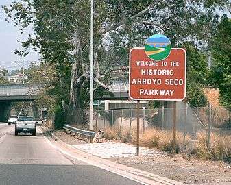
| 7 |
Arroyo Seco Parkway Historic District |
|
February 4, 2011
(#10001198) |
CA 110 from Four Level Interchange in Los Angeles to East Glenarm St. in Pasadena
34°07′39″N 118°08′50″W / 34.1275°N 118.147222°W / 34.1275; -118.147222 (Arroyo Seco Parkway Historic District) |
Downtown Los Angeles to Pasadena |
The Arroyo Seco Parkway Historic District passes through South Pasadena |
| 8 |
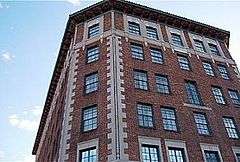
Atchison, Topeka, and Santa Fe Railroad Station |
|
July 15, 1982
(#82002188) |
110 W. 1st St.
34°05′39″N 117°42′58″W / 34.094167°N 117.716111°W / 34.094167; -117.716111 (Atchison, Topeka, and Santa Fe Railroad Station) |
Claremont |
|
| 9 |
Auditorium |
|
October 13, 1983
(#83003499) |
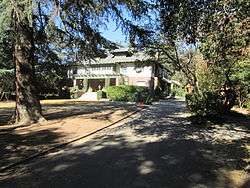
2200 W. Carson
33°49′48″N 118°19′11″W / 33.83°N 118.319722°W / 33.83; -118.319722 (Auditorium) |
Torrance |
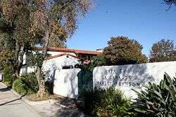
part of the Torrance High School Campus Thematic Resource (TR) |
| 10 |
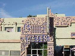
Aztec Hotel |
|
May 22, 1978
(#78000691) |
311 W. Foothill Blvd.
34°09′06″N 118°00′18″W / 34.151667°N 118.005°W / 34.151667; -118.005 (Aztec Hotel) |
Monrovia |
|
| 11 |
Azusa Civic Center |
|
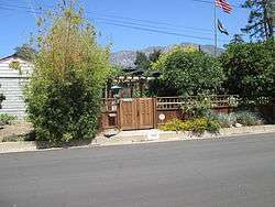
February 21, 2002
(#02000034) |
213 Foothill Blvd.
34°08′03″N 117°54′18″W / 34.134167°N 117.905°W / 34.134167; -117.905 (Azusa Civic Center) |
Azusa |
|
| 12 |
Jonathan Bailey House |
|
August 29, 1977
(#77000304) |
13421 E. Camilla St.
33°59′05″N 118°01′53″W / 33.984722°N 118.031389°W / 33.984722; -118.031389 (Jonathan Bailey House) |
Whittier |
|
| 13 |
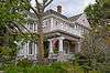
Beverly Hills Women's Club |
|
October 4, 2006
(#06000914) |
1700 Chevy Chase Dr.
34°05′09″N 118°25′47″W / 34.085833°N 118.429722°W / 34.085833; -118.429722 (Beverly Hills Women's Club) |
Beverly Hills |
|
| 14 |
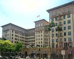
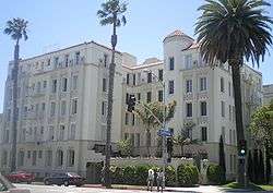
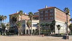
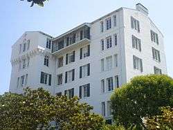
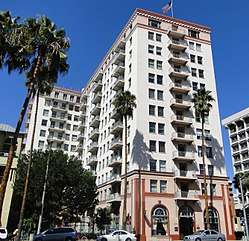
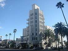
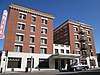
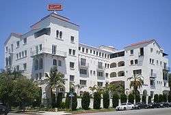
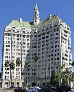
Beverly Wilshire Hotel |
|
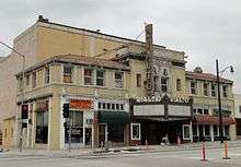
June 12, 1987
(#87000908) |
9528 Wilshire Blvd.
34°04′01″N 118°23′20″W / 34.066944°N 118.388889°W / 34.066944; -118.388889 (Beverly Wilshire Hotel) |
Beverly Hills |
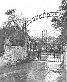
|
| 15 |
CA-LAN-1258 |
|
October 17, 2012
(#12000861) |
Address Restricted
|
Canyon Country |
Part of the Rock Art Sites of the Angeles National Forest, California |
| 16 |
CA-LAN-1302 |
|
October 17, 2012
(#12000862) |
Address Restricted
|
Azusa |
Part of the Rock Art Sites of the Angeles National Forest, California |
| 17 |
CA-LAN-1946 |
|
October 17, 2012
(#12000860) |
Address Restricted
|
Acton |
Part of the Rock Art Sites of the Angeles National Forest, California |
| 18 |
CA-LAN-441 |
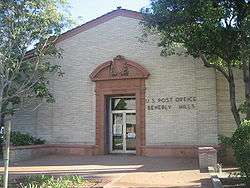
|
October 17, 2012
(#12000863) |
Address Restricted
|
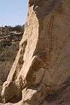
Castaic |
Part of the Rock Art Sites of the Angeles National Forest, California |
| 19 |
CA-LAN-540 |
|
October 17, 2012
(#12000859) |
Address Restricted
|
Agua Dulce |
Part of the Rock Art Sites of the Angeles National Forest, California |
| 20 |
Casa de Parley Johnson |
|
March 20, 1986
(#86000449) |
7749 Florence Ave.
33°57′24″N 118°07′57″W / 33.956667°N 118.1325°W / 33.956667; -118.1325 (Casa de Parley Johnson) |
Downey |
|
| 21 |
Case Study House No. 20 |
|
July 24, 2013
(#13000517) |
2275 N. Santa Rosa Ave.
34°11′05″N 118°08′20″W / 34.184728°N 118.138799°W / 34.184728; -118.138799 (Case Study House No. 20) |
Altadena |
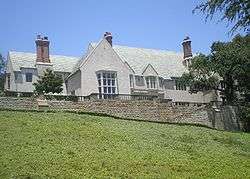
One of the Case Study Houses, built in 1958 for Saul Bass. |
| 22 |
Cedar Avenue Complex |
|
September 30, 1993
(#93001017) |
44843 (44855), 44845 and 44851 Cedar Ave., 606 Lancaster Blvd., and Old Jail (no address)
34°41′58″N 118°08′20″W / 34.699444°N 118.138889°W / 34.699444; -118.138889 (Cedar Avenue Complex) |
Lancaster |
|
| 23 |
Charmont Apartments |
|
July 25, 1996
(#96000777) |
330 California Ave.
34°01′12″N 118°29′58″W / 34.02°N 118.499444°W / 34.02; -118.499444 (Charmont Apartments) |
Santa Monica |
|
| 24 |
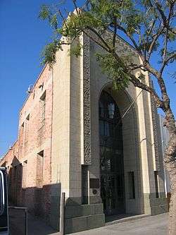
Christian Science Society |
|
July 10, 2017
(#100001281) |
209 E. Whittley Ave.
33°20′39″N 118°19′41″W / 33.344223°N 118.328077°W / 33.344223; -118.328077 (Christian Science Society) |
Avalon |
|
| 25 |
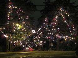
Christmas Tree Lane |
|
September 13, 1990
(#90001444) |
Santa Rosa Ave. between Woodbury Ave. and Altadena Dr.
34°11′25″N 118°08′09″W / 34.190278°N 118.135833°W / 34.190278; -118.135833 (Christmas Tree Lane) |
Altadena |
|
| 26 |
Citizens Publishing Company Building |
|
February 12, 1987
(#87000082) |
9355 Culver Blvd.
34°01′31″N 118°23′35″W / 34.025278°N 118.393056°W / 34.025278; -118.393056 (Citizens Publishing Company Building) |
Culver City |
|
| 27 |
City Hall-City of Burbank |
|
April 18, 1996
(#96000426) |
275 E. Olive Ave.
34°10′55″N 118°18′27″W / 34.181944°N 118.3075°W / 34.181944; -118.3075 (City Hall-City of Burbank) |
Burbank |
|
| 28 |
Clarke Estate |
|
January 4, 1990
(#89002267) |
10211 Pioneer Blvd.
33°56′36″N 118°04′52″W / 33.943333°N 118.081111°W / 33.943333; -118.081111 (Clarke Estate) |
Santa Fe Springs |
|
| 29 |
Club Casa Del Mar |
|
September 29, 2000
(#00001169) |
1910 Ocean Ave.
34°00′23″N 118°29′25″W / 34.006389°N 118.490278°W / 34.006389; -118.490278 (Club Casa Del Mar) |
Santa Monica |
|
| 30 |
Colonial House |
|
April 15, 1982
(#82002190) |
1416 N. Havenhurst Dr.
34°05′45″N 118°21′35″W / 34.095833°N 118.359722°W / 34.095833; -118.359722 (Colonial House) |
West Hollywood |
|
| 31 |
Community Clubhouse |
|
July 23, 2013
(#13000510) |
1200 N. Vista St.
34°05′37″N 118°21′04″W / 34.093744°N 118.351219°W / 34.093744; -118.351219 (Community Clubhouse) |
West Hollywood |
|
| 32 |
Cooper Arms |
|
December 28, 2000
(#00001538) |
455 E. Ocean Blvd.
33°46′01″N 118°11′13″W / 33.766944°N 118.186944°W / 33.766944; -118.186944 (Cooper Arms) |
Long Beach |
|
| 33 |
Crank House |
|
July 23, 1997
(#97000751) |
2186 Crary St.
34°10′21″N 118°06′20″W / 34.1725°N 118.105556°W / 34.1725; -118.105556 (Crank House) |
Altadena |
|
| 34 |
Culver Hotel |
|
April 14, 1997
(#97000296) |
9400 Culver Blvd.
34°01′24″N 118°23′38″W / 34.023333°N 118.393889°W / 34.023333; -118.393889 (Culver Hotel) |
Culver City |
|
| 35 |
James Daniel Derby House |
|
December 14, 1978
(#78000682) |
2535 E. Chevy Chase Dr.
34°09′41″N 118°12′38″W / 34.161389°N 118.210556°W / 34.161389; -118.210556 (James Daniel Derby House) |
Glendale |
|
| 36 |
DeWenter Mansion, Guest House and Grounds |
|
November 5, 1992
(#92001559) |
6100 Brydon Rd.
34°09′07″N 117°45′23″W / 34.151944°N 117.756389°W / 34.151944; -117.756389 (DeWenter Mansion, Guest House and Grounds) |
La Verne |
|
| 37 |
Diamond Apartments |
|
March 26, 1992
(#92000260) |
321 Diamond St.
33°50′39″N 118°23′16″W / 33.844167°N 118.387778°W / 33.844167; -118.387778 (Diamond Apartments) |
Redondo Beach |
|
| 38 |
Doheny Estate/Greystone Mansion |
|
April 23, 1976
(#76000485) |
905 Loma Vista Dr.
34°05′31″N 118°24′01″W / 34.091944°N 118.400278°W / 34.091944; -118.400278 (Doheny Estate/Greystone Mansion) |
Beverly Hills |
|
| 39 |
Dominguez Rancho Adobe |
|
May 28, 1976
(#76000486) |
18127 S. Alameda St.
33°52′01″N 118°13′03″W / 33.866944°N 118.2175°W / 33.866944; -118.2175 (Dominguez Rancho Adobe) |
Compton |
|
| 40 |
Peter Drucker House |
|
December 18, 2017
(#100001890) |
636 Wellesley Dr.
34°06′38″N 117°43′31″W / 34.110526°N 117.725400°W / 34.110526; -117.725400 (Peter Drucker House) |
Claremont |
Home of Peter Drucker |
| 41 |
Edison Historic District |
|
August 13, 1986
(#86001477) |
611, 637, and 500 block of W. Second St.
34°03′28″N 117°45′13″W / 34.057778°N 117.753611°W / 34.057778; -117.753611 (Edison Historic District) |
Pomona |
|
| 42 |
El Molino Viejo |
|
May 6, 1971
(#71000154) |
1120 Old Mill Rd.
34°07′08″N 118°07′41″W / 34.119°N 118.128°W / 34.119; -118.128 (El Molino Viejo) |
San Marino |
Water-driven grist mill built ca. 1816; oldest commercial building in Southern California |
| 43 |
Katherine Emery Estate |
|
January 10, 2011
(#10001118) |
1155 Oak Grove Ave.
34°07′31″N 118°07′38″W / 34.125278°N 118.127222°W / 34.125278; -118.127222 (Katherine Emery Estate) |
San Marino |
|
| 44 |
Episcopal Church of the Ascension |
|
August 19, 1977
(#77000303) |
25 E. Laurel Ave.
34°09′58″N 118°03′04″W / 34.166111°N 118.051111°W / 34.166111; -118.051111 (Episcopal Church of the Ascension) |
Sierra Madre |
|
| 45 |
Gen. Charles S. Farnsworth County Park |
|
February 7, 1997
(#97000027) |
568 E. Mt. Curve Ave.
34°11′59″N 118°07′54″W / 34.199722°N 118.131667°W / 34.199722; -118.131667 (Gen. Charles S. Farnsworth County Park) |
Altadena |
|
| 46 |
Federal Building |
|
April 28, 2015
(#15000169) |
15000 Aviation Blvd.
33°53′42″N 118°22′40″W / 33.8951°N 118.3777°W / 33.8951; -118.3777 (Federal Building) |
Hawthorne |
|
| 47 |
Fern Avenue School |
|
February 20, 1992
(#92000067) |
1314 Fern Ave.
33°50′06″N 118°19′52″W / 33.835°N 118.331111°W / 33.835; -118.331111 (Fern Avenue School) |
Torrance |
|
| 48 |
First Congregational Church of Long Beach |
|
September 25, 2012
(#12000810) |
241 Cedar Ave.
33°46′13″N 118°11′42″W / 33.770416°N 118.195125°W / 33.770416; -118.195125 (First Congregational Church of Long Beach) |
Long Beach |
|
| 49 |
First National Bank of Long Beach |
|
September 13, 1990
(#90001432) |
101-125 Pine Ave.
33°46′06″N 118°11′30″W / 33.768333°N 118.191667°W / 33.768333; -118.191667 (First National Bank of Long Beach) |
Long Beach |
|
| 50 |
Forum |
|
September 24, 2014
(#14000661) |
3900 Manchester Blvd.
33°57′29″N 118°20′31″W / 33.958056°N 118.341944°W / 33.958056; -118.341944 (Forum) |
Inglewood |
|
| 51 |
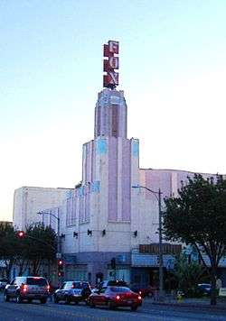
Fox Theatre Inglewood |
|
January 14, 2013
(#12001163) |
115 N. Market St.
33°57′48″N 118°21′08″W / 33.963348°N 118.352348°W / 33.963348; -118.352348 (Fox Theatre Inglewood) |
Inglewood |
|
| 52 |
Fox Wilshire Theatre |
|
April 3, 2012
(#12000164) |
8440 Wilshire Blvd.
34°03′53″N 118°22′30″W / 34.064694°N 118.374964°W / 34.064694; -118.374964 (Fox Wilshire Theatre) |
Beverly Hills |
|
| 53 |
Peter Gano House |
|
September 15, 1983
(#83001194) |
718 Crescent Ave.
33°20′34″N 118°19′20″W / 33.342778°N 118.322222°W / 33.342778; -118.322222 (Peter Gano House) |
Avalon |
|
| 54 |
Garfield House |
|
April 24, 1973
(#73000405) |
1001 Buena Vista St.
34°07′14″N 118°09′21″W / 34.120556°N 118.155833°W / 34.120556; -118.155833 (Garfield House) |
South Pasadena |
|
| 55 |
Glendale Southern Pacific Railroad Depot |
|
May 2, 1997
(#97000376) |
Gardena Ave., junction with W. Cerritos Ave.
34°07′25″N 118°15′29″W / 34.123611°N 118.258056°W / 34.123611; -118.258056 (Glendale Southern Pacific Railroad Depot) |
Glendale |
|
| 56 |
Glendale Young Men's Christian Association |
|
October 21, 1994
(#94001224) |
140 N. Louise St.
34°08′52″N 118°15′04″W / 34.147778°N 118.251111°W / 34.147778; -118.251111 (Glendale Young Men's Christian Association) |
Glendale |
|
| 57 |
Glendora Bougainvillea |
|
February 7, 1978
(#78000683) |
Bennett and Minnesota Aves.
34°08′27″N 117°51′34″W / 34.140833°N 117.859444°W / 34.140833; -117.859444 (Glendora Bougainvillea) |
Glendora |
|
| 58 |
Grand Central Air Terminal |
|
March 27, 2017
(#100000780) |
1310 Air Way
34°09′47″N 118°17′12″W / 34.163135°N 118.286579°W / 34.163135; -118.286579 (Grand Central Air Terminal) |
Glendale |
|
| 59 |
Green-Rankin-Bembridge House |
|
February 10, 2005
(#05000002) |
953 Park Circle Dr.
33°46′45″N 118°12′04″W / 33.779167°N 118.201111°W / 33.779167; -118.201111 (Green-Rankin-Bembridge House) |
Long Beach |
|
| 60 |
Barbara Greenwood Kindergarten |
|
September 18, 1978
(#78000697) |
Hacienda Pl. and McKinley Ave.
34°04′32″N 117°45′19″W / 34.075494°N 117.755318°W / 34.075494; -117.755318 (Barbara Greenwood Kindergarten) |
Pomona |
|
| 61 |
Zane Grey Estate |
|
October 24, 2002
(#02001187) |
396 E. Mariposa St.
34°11′26″N 118°08′30″W / 34.190556°N 118.141667°W / 34.190556; -118.141667 (Zane Grey Estate) |
Altadena |
|
| 62 |
Hacienda Arms Apartments |
|
December 15, 1983
(#83003531) |
8439 Sunset Blvd.
34°05′42″N 118°22′24″W / 34.095°N 118.373333°W / 34.095; -118.373333 (Hacienda Arms Apartments) |
West Hollywood |
|
| 63 |
Olan G. and Aida T. Hafley House |
|
July 12, 2011
(#11000429) |
5561 E. La Pasada St.
33°46′54″N 118°07′30″W / 33.781667°N 118.125°W / 33.781667; -118.125 (Olan G. and Aida T. Hafley House) |
Long Beach |
1953 house designed by Richard Neutra[6][7] |
| 64 |
Hawkins-Nimocks Estate-Patricio Ontiveros Adobe |
|
December 31, 1987
(#82004982) |
12100 Telegraph Rd.
33°56′22″N 118°04′34″W / 33.939444°N 118.076111°W / 33.939444; -118.076111 (Hawkins-Nimocks Estate-Patricio Ontiveros Adobe) |
Santa Fe Springs |
|
| 65 |
Home Economics Building |
|
October 13, 1983
(#83003536) |
2200 W. Carson
33°49′52″N 118°19′16″W / 33.831111°N 118.321111°W / 33.831111; -118.321111 (Home Economics Building) |
Torrance |
part of the Torrance High School Campus TR |
| 66 |
Hoover Hotel |
|
February 1, 2002
(#02000074) |
7035 Greenleaf Ave.
33°58′41″N 118°02′10″W / 33.978056°N 118.036111°W / 33.978056; -118.036111 (Hoover Hotel) |
Whittier |
|
| 67 |
Horatio West Court |
|
April 11, 1977
(#77000302) |
140 Hollister Ave.
34°00′12″N 118°29′10″W / 34.003333°N 118.486111°W / 34.003333; -118.486111 (Horatio West Court) |
Santa Monica |
Irving Gill |
| 68 |
Hotel Glendale |
|
October 7, 1994
(#94001197) |
701 E. Broadway
34°08′48″N 118°14′45″W / 34.146667°N 118.245833°W / 34.146667; -118.245833 (Hotel Glendale) |
Glendale |
|
| 69 |
Edwin Hubble House |
|
December 8, 1976
(#76000494) |
1340 Woodstock Rd.
34°07′23″N 118°07′12″W / 34.123056°N 118.12°W / 34.123056; -118.12 (Edwin Hubble House) |
San Marino |
|
| 70 |
Humaliwo |
|
September 1, 1976
(#76000492) |
Address Restricted
|
Malibu |
|
| 71 |
Intercultural Council Houses |
|
April 7, 2015
(#15000121) |
Bounded by Blanchard Pl., Claremont Blvd., E. 1st & Brooks Sts.
34°05′45″N 117°42′18″W / 34.0958°N 117.7050°W / 34.0958; -117.7050 (Intercultural Council Houses) |
Claremont |
|
| 72 |
Darius David Johnston House |
|
November 2, 1978
(#78000693) |
12426 Mapledale St.
33°53′54″N 118°04′02″W / 33.898333°N 118.067222°W / 33.898333; -118.067222 (Darius David Johnston House) |
Norwalk |
|
| 73 |
Orin Jordan House |
|
July 28, 1980
(#80000815) |
8310 S. Comstock Ave.
33°57′40″N 118°01′59″W / 33.961111°N 118.033056°W / 33.961111; -118.033056 (Orin Jordan House) |
Whittier |
|
| 74 |
Karasik House |
|
December 22, 2011
(#11000933) |
436 Spalding Dr.
34°03′28″N 118°24′32″W / 34.057786°N 118.408883°W / 34.057786; -118.408883 (Karasik House) |
Beverly Hills |
|
| 75 |
Keyes Bungalow |
|
November 14, 1978
(#78000678) |
1337 E. Boston St.
34°10′57″N 118°07′22″W / 34.1825°N 118.122778°W / 34.1825; -118.122778 (Keyes Bungalow) |
Altadena |
|
| 76 |
Killingsworth, Brady, & Smith |
|
July 15, 2009
(#09000515) |
3827-3837 Long Beach Blvd.
33°49′41″N 118°11′23″W / 33.828056°N 118.189656°W / 33.828056; -118.189656 (Killingsworth, Brady, & Smith) |
Long Beach |
|
| 77 |
La Casa Alvarado |
|
April 19, 1978
(#78000698) |
1459 Old Settlers Lane
34°04′26″N 117°45′19″W / 34.073889°N 117.755278°W / 34.073889; -117.755278 (La Casa Alvarado) |
Pomona |
|
| 78 |
La Casa Primera de Rancho San Jose |
|
April 3, 1975
(#75000436) |
1569 N. Park Ave.
34°04′30″N 117°45′15″W / 34.075°N 117.754167°W / 34.075; -117.754167 (La Casa Primera de Rancho San Jose) |
Pomona |
|
| 79 |
La Laguna de San Gabriel |
|
January 11, 2017
(#100000462) |
300 W. Wells St.
34°05′01″N 118°06′16″W / 34.083558°N 118.104390°W / 34.083558; -118.104390 (La Laguna de San Gabriel) |
San Gabriel |
|
| 80 |
La Puente Valley Woman's Club |
|
April 29, 1999
(#99000482) |
200 N. First St.
34°01′19″N 117°57′05″W / 34.021944°N 117.951389°W / 34.021944; -117.951389 (La Puente Valley Woman's Club) |
La Puente |
|
| 81 |
Lanterman House |
|
December 29, 1994
(#94001504) |
4420 Encinas Dr.
34°12′16″N 118°12′20″W / 34.204444°N 118.205556°W / 34.204444; -118.205556 (Lanterman House) |
La Cañada Flintridge |
|
| 82 |
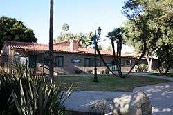
Leonis Adobe |
|
May 29, 1975
(#75000433) |
23537 Calabasas Rd.
34°09′26″N 118°38′24″W / 34.157192°N 118.639881°W / 34.157192; -118.639881 (Leonis Adobe) |
Calabasas |
|
| 83 |
Lincoln Park Historic District |
|
April 9, 2004
(#03001347) |
Roughly bounded by McKinley Ave., Towne Ave., Pasadena St. and Garey Ave.
34°04′14″N 117°44′42″W / 34.070466°N 117.745087°W / 34.070466; -117.745087 (Lincoln Park Historic District) |
Pomona |
|
| 84 |
Abraham Lincoln Elementary School |
|
August 3, 1989
(#89000935) |
1200 N. Gordon Ave.
34°04′13″N 117°45′08″W / 34.070278°N 117.752222°W / 34.070278; -117.752222 (Abraham Lincoln Elementary School) |
Pomona |
|
| 85 |
Harold Lloyd Estate |
|
February 9, 1984
(#84000876) |
1740 Green Acres Drive
34°05′17″N 118°25′37″W / 34.088106°N 118.426939°W / 34.088106; -118.426939 (Harold Lloyd Estate) |
Beverly Hills |
|
| 86 |
Long Beach Professional Building |
|
August 3, 2005
(#05000773) |
117 E. 8th St.
33°46′36″N 118°11′32″W / 33.776667°N 118.192222°W / 33.776667; -118.192222 (Long Beach Professional Building) |
Long Beach |
|
| 87 |
Howard Longley House |
|
April 16, 1974
(#74000527) |
1005 Buena Vista St.
34°07′14″N 118°09′19″W / 34.120556°N 118.155278°W / 34.120556; -118.155278 (Howard Longley House) |
South Pasadena |
|
| 88 |
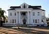
Lopez Adobe |
|
May 6, 1971
(#71000157) |
1100 Pico St.
34°16′55″N 118°26′33″W / 34.281944°N 118.4425°W / 34.281944; -118.4425 (Lopez Adobe) |
San Fernando |
|
| 89 |
Los Cerritos Ranch House |
|
April 15, 1970
(#70000135) |
4600 Virginia Rd.
33°50′22″N 118°11′42″W / 33.839444°N 118.195°W / 33.839444; -118.195 (Los Cerritos Ranch House) |
Long Beach |
|
| 90 |
Lynwood Pacific Electric Railway Depot |
|
September 25, 1974
(#74000524) |
11453 Long Beach Blvd.
33°55′32″N 118°12′34″W / 33.925556°N 118.209444°W / 33.925556; -118.209444 (Lynwood Pacific Electric Railway Depot) |
Lynwood |
|
| 91 |
Main Building |
|
October 13, 1983
(#83003538) |
2200 W. Carson
33°49′51″N 118°19′13″W / 33.830833°N 118.320278°W / 33.830833; -118.320278 (Main Building) |
Torrance |
part of the Torrance High School Campus TR |
| 92 |
Malibu Historic District |
|
January 29, 2018
(#100002022) |
Roughly along Pacific Coast from E of Malibu Pier to Malibu Colony privacy fence
34°02′13″N 118°40′35″W / 34.037083°N 118.67651°W / 34.037083; -118.67651 (Malibu Historic District) |
Malibu |
|
| 93 |
Mayfair Hotel |
|
July 31, 2017
(#100001382) |
115 E. 3rd St.
34°03′26″N 117°44′59″W / 34.057148°N 117.749776°W / 34.057148; -117.749776 (Mayfair Hotel) |
Pomona |
|
| 94 |
McNally's Windemere Ranch Headquarters |
|
July 20, 1978
(#78000684) |
San Esteban and San Cristobal Dr.
33°53′53″N 118°01′28″W / 33.898056°N 118.024444°W / 33.898056; -118.024444 (McNally's Windemere Ranch Headquarters) |
La Mirada |
|
| 95 |
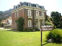
Andrew McNally House |
|
March 27, 2007
(#07000245) |
654 E. Mariposa St.
34°11′20″N 118°08′10″W / 34.188889°N 118.136111°W / 34.188889; -118.136111 (Andrew McNally House) |
Altadena |
|
| 96 |
Middough Brothers-Insurance Exchange Building |
|
February 5, 2003
(#03000002) |
205 E. Broadway
33°46′09″N 118°11′24″W / 33.769167°N 118.19°W / 33.769167; -118.19 (Middough Brothers-Insurance Exchange Building) |
Long Beach |
|
| 97 |
Miltimore House |
|
March 24, 1972
(#72000235) |
1301 S. Chelten Way
34°06′41″N 118°08′30″W / 34.111389°N 118.141667°W / 34.111389; -118.141667 (Miltimore House) |
South Pasadena |
|
| 98 |
Montebello Woman's Club |
|
March 31, 1995
(#95000266) |
201 S. Park Ave.
34°00′35″N 118°06′17″W / 34.009722°N 118.104722°W / 34.009722; -118.104722 (Montebello Woman's Club) |
Montebello |
|
| 99 |
Mount Lowe Railway |
|
January 6, 1993
(#92001522) |
North of Altadena in Angeles NF
34°12′40″N 118°07′14″W / 34.211111°N 118.120556°W / 34.211111; -118.120556 (Mount Lowe Railway) |
Altadena |
Boundary increase 2015-01-14 |
| 100 |
National Bank of Whittier Building |
|
December 30, 1982
(#82000969) |
13002 E. Philadelphia St.
33°58′44″N 118°02′10″W / 33.978889°N 118.036111°W / 33.978889; -118.036111 (National Bank of Whittier Building) |
Whittier |
|
| 101 |
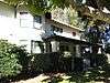
North Harper Avenue Historic District |
|
June 28, 1996
(#96000694) |
Roughly, N. Harper Ave. between Fountain and De Longpre Aves.
34°05′42″N 118°22′04″W / 34.095°N 118.367778°W / 34.095; -118.367778 (North Harper Avenue Historic District) |
West Hollywood |
Pictured: Casa Granada, 1334-6 N Harper |
| 102 |
Oaklawn Bridge and Waiting Station |
|
July 16, 1973
(#73000406) |
Between Oaklawn and Fair Oaks Aves.
34°07′08″N 118°09′08″W / 34.118889°N 118.152222°W / 34.118889; -118.152222 (Oaklawn Bridge and Waiting Station) |
South Pasadena |
|
| 103 |
The Oaks |
|
April 6, 1978
(#78000692) |
250 N. Primrose Ave.
34°09′22″N 118°00′07″W / 34.156111°N 118.001944°W / 34.156111; -118.001944 (The Oaks) |
Monrovia |
|
| 104 |
Pacific Electric Railroad Bridge |
|
July 13, 1989
(#89000854) |
Torrance Blvd. and Bow St.
33°50′15″N 118°18′39″W / 33.8375°N 118.310833°W / 33.8375; -118.310833 (Pacific Electric Railroad Bridge) |
Torrance |
|
| 105 |
Pacific Electric Railway Company Substation No. 8 |
|
November 9, 1977
(#77000295) |
2245 N. Lake Ave.
34°11′04″N 118°07′55″W / 34.184444°N 118.131944°W / 34.184444; -118.131944 (Pacific Electric Railway Company Substation No. 8) |
Altadena |
|
| 106 |
Paddison Ranch Buildings |
|
June 23, 1978
(#78000694) |
11951 Imperial Hwy.
33°55′05″N 118°04′35″W / 33.918056°N 118.076389°W / 33.918056; -118.076389 (Paddison Ranch Buildings) |
Norwalk |
|
| 107 |
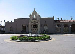
Padua Hills Theatre |
|
January 23, 1998
(#97001660) |
4467 Via Padova
34°09′04″N 117°42′03″W / 34.151111°N 117.700833°W / 34.151111; -117.700833 (Padua Hills Theatre) |
Claremont |
|
| 108 |
Ygnacio Palomares Adobe |
|
March 24, 1971
(#71000156) |
Corner of Arrow Hwy. and Orange Grove Ave.
34°05′30″N 117°44′30″W / 34.091667°N 117.741667°W / 34.091667; -117.741667 (Ygnacio Palomares Adobe) |
Pomona |
|
| 109 |
Palos Verdes Public Library and Art Gallery |
|
April 7, 1995
(#95000388) |
2400 Via Campesina
• Farnham Martin's Park boundary increase (listed April 16, 1996, refnum 96000393): 2400 Via Campesina
33°47′58″N 118°23′13″W / 33.799444°N 118.386944°W / 33.799444; -118.386944 (Palos Verdes Public Library and Art Gallery) |
Palos Verdes Estates |
|
| 110 |
Pan American National Bank of East Los Angeles |
|
March 27, 2017
(#100000782) |
3620-3626 E. 1st St.
34°02′10″N 118°11′18″W / 34.035997°N 118.188311°W / 34.035997; -118.188311 (Pan American National Bank of East Los Angeles) |
East Los Angeles |
|
| 111 |
Parkhurst Building |
|
November 17, 1978
(#78000699) |
185 Pier Ave.
33°59′55″N 118°28′45″W / 33.998611°N 118.479167°W / 33.998611; -118.479167 (Parkhurst Building) |
Santa Monica |
|
| 112 |
Patio del Moro |
|
September 11, 1986
(#86002418) |
8225-8237 Fountain Ave.
34°05′41″N 118°22′03″W / 34.094722°N 118.3675°W / 34.094722; -118.3675 (Patio del Moro) |
West Hollywood |
|
| 113 |
John Carlton Pegler House |
|
October 20, 1988
(#88002019) |
419 E. Highland Ave.
34°09′56″N 118°02′44″W / 34.165556°N 118.045556°W / 34.165556; -118.045556 (John Carlton Pegler House) |
Sierra Madre |
|
| 114 |
Phillips Mansion |
|
November 6, 1974
(#74000525) |
2640 W. Pomona Blvd.
34°03′22″N 117°47′44″W / 34.056111°N 117.795556°W / 34.056111; -117.795556 (Phillips Mansion) |
Pomona |
|
| 115 |
Pio Pico Casa |
|
June 19, 1973
(#73000408) |
6003 Pioneer Blvd.
33°59′37″N 118°04′51″W / 33.993611°N 118.080833°W / 33.993611; -118.080833 (Pio Pico Casa) |
Whittier |
|
| 116 |
Pitzer House |
|
September 4, 1986
(#86002192) |
4353 N. Towne
34°07′17″N 117°44′10″W / 34.121389°N 117.736111°W / 34.121389; -117.736111 (Pitzer House) |
Claremont |
|
| 117 |
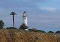
Point Vicente Light |
|
October 31, 1980
(#80000808) |
Rancho Palos Verdes
33°44′31″N 118°24′31″W / 33.741944°N 118.408611°W / 33.741944; -118.408611 (Point Vicente Light) |
Rancho Palos Verdes |
|
| 118 |
Pomona City Stables |
|
October 6, 2004
(#04001109) |
636 W. Monterey Ave.
34°03′33″N 117°45′31″W / 34.059167°N 117.758611°W / 34.059167; -117.758611 (Pomona City Stables) |
Pomona |
|
| 119 |
Pomona Fox Theater |
|
February 19, 1982
(#82002201) |
102-144 3rd St.
34°03′24″N 117°44′59″W / 34.056667°N 117.749722°W / 34.056667; -117.749722 (Pomona Fox Theater) |
Pomona |
|
| 120 |
Pomona YMCA Building |
|
March 6, 1986
(#86000408) |
350 N. Garey Ave.
34°03′36″N 117°44′56″W / 34.06°N 117.748889°W / 34.06; -117.748889 (Pomona YMCA Building) |
Pomona |
|
| 121 |
Puvunga Indian Village Sites |
|
January 21, 1974
(#74000521) |
Address Restricted
• Boundary increase (listed May 22, 1982, refnum 82000429): Address Restricted
|
Long Beach |
|
| 122 |
Queen Anne Cottage and Coach Barn |
|
October 31, 1980
(#80000804) |
301 N. Baldwin Ave.
34°08′27″N 118°03′09″W / 34.140833°N 118.0525°W / 34.140833; -118.0525 (Queen Anne Cottage and Coach Barn) |
Arcadia |
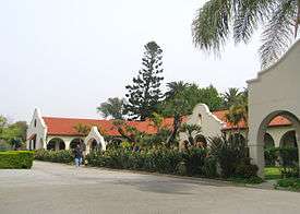
Located in the Los Angeles County Arboretum and Botanic Garden |
| 123 |
Rancho Los Alamitos |
|
July 7, 1981
(#81000153) |
6400 Bixby Hill Rd.
33°46′38″N 118°06′19″W / 33.777222°N 118.105278°W / 33.777222; -118.105278 (Rancho Los Alamitos) |
Long Beach |
|
| 124 |
Redondo Beach Original Townsite Historic District |
|
June 30, 1988
(#88000970) |
N. Gertruda Ave., Carnelian St., N. Guadalupe Ave. and Diamond St.
33°50′48″N 118°23′08″W / 33.846667°N 118.385556°W / 33.846667; -118.385556 (Redondo Beach Original Townsite Historic District) |
Redondo Beach |
|
| 125 |
Redondo Beach Public Library |
|
March 12, 1981
(#81000158) |
309 Esplanade St.
33°50′16″N 118°23′20″W / 33.837778°N 118.388889°W / 33.837778; -118.388889 (Redondo Beach Public Library) |
Redondo Beach |
|
| 126 |
Jennie A. Reeve House |
|
June 21, 1984
(#84000883) |
4260 Country Club Dr.
33°50′03″N 118°11′41″W / 33.834167°N 118.194722°W / 33.834167; -118.194722 (Jennie A. Reeve House) |
Long Beach |
|
| 127 |
Helen Goodwin Renwick House |
|
June 7, 2016
(#16000322) |
211 N. College Ave.
34°05′45″N 117°42′54″W / 34.095851°N 117.715009°W / 34.095851; -117.715009 (Helen Goodwin Renwick House) |
Claremont |
|
| 128 |
Rialto Theatre |
|
May 24, 1978
(#78000700) |
1019-1023 Fair Oaks Ave.
34°06′50″N 118°08′59″W / 34.113889°N 118.149722°W / 34.113889; -118.149722 (Rialto Theatre) |
South Pasadena |
|
| 129 |
Ridge Route |
|
September 25, 1997
(#97001113) |
Along Old Ridge Rte., roughly bounded by Sandberg and Canton Canyon (also extends into Kern County)
34°37′56″N 118°41′49″W / 34.632222°N 118.696944°W / 34.632222; -118.696944 (Ridge Route) |
Castaic |
|
| 130 |
James C. Rives House |
|
May 22, 1978
(#78000681) |
10921 S. Paramount Blvd.
33°56′42″N 118°08′10″W / 33.945°N 118.136111°W / 33.945; -118.136111 (James C. Rives House) |
Downey |
Actual address is 10933. |
| 131 |
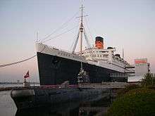
RMS QUEEN MARY |
|
April 15, 1993
(#92001714) |
Pier J, 1126 Queensway Hwy.
33°45′10″N 118°11′23″W / 33.752778°N 118.189722°W / 33.752778; -118.189722 (RMS QUEEN MARY) |
Long Beach |
|
| 132 |
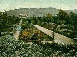
Virginia Robinson Estate |
|
November 15, 1978
(#78000679) |
1008 Elden Way
34°05′11″N 118°25′00″W / 34.086389°N 118.416667°W / 34.086389; -118.416667 (Virginia Robinson Estate) |
Beverly Hills |
public gardens & house museum |
| 133 |
Rockhaven Sanitarium Historic District |
|
June 9, 2016
(#16000355) |
2713 Honolulu Ave. bounded by Pleasure Way, Hermosa & Honolulu Aves.
34°12′41″N 118°14′18″W / 34.211308°N 118.238459°W / 34.211308; -118.238459 (Rockhaven Sanitarium Historic District) |
Glendale |
|
| 134 |
Ronda |
|
February 28, 1985
(#85000356) |
1400-1414 Havenhurst Dr.
34°05′48″N 118°21′59″W / 34.096667°N 118.366389°W / 34.096667; -118.366389 (Ronda) |
West Hollywood |
|
| 135 |
John A. Rowland House |
|
July 16, 1973
(#73000403) |
16021 E. Gale Ave.
34°00′39″N 117°57′24″W / 34.010833°N 117.956667°W / 34.010833; -117.956667 (John A. Rowland House) |
Industry |
House built by pioneer John A. Rowland in 1855 |
| 136 |
Rubel Castle Historic District |
|
October 7, 2013
(#13000810) |
844 N. Live Oak Ave.
34°09′01″N 117°51′17″W / 34.150278°N 117.854722°W / 34.150278; -117.854722 (Rubel Castle Historic District) |
Glendora |
|
| 137 |
Russian Village District |
|
December 28, 1978
(#78000680) |
290-370 S. Mills Ave. and 480 Cucamonga Ave.
34°05′25″N 117°42′25″W / 34.090278°N 117.706944°W / 34.090278; -117.706944 (Russian Village District) |
Claremont |
|
| 138 |
Saddle Rock Ranch Pictograph Site |
|
February 12, 1982
(#82004617) |
Address Restricted
|
Malibu |
|
| 139 |
San Dimas Hotel |
|
March 16, 1972
(#72000233) |
121 San Dimas Ave.
34°06′27″N 117°48′23″W / 34.1075°N 117.806389°W / 34.1075; -117.806389 (San Dimas Hotel) |
San Dimas |
|
| 140 |
San Gabriel Mission |
|
May 6, 1971
(#71000158) |
Junipero St. and W. Mission Dr.
34°05′52″N 118°06′22″W / 34.097778°N 118.106111°W / 34.097778; -118.106111 (San Gabriel Mission) |
San Gabriel |
|
| 141 |
San Rafael Rancho |
|
December 12, 1976
(#76000487) |
Bonita Dr.
34°10′49″N 118°13′55″W / 34.180278°N 118.231944°W / 34.180278; -118.231944 (San Rafael Rancho) |
Glendale |
|
| 142 |
Santa Monica Looff Hippodrome |
|
February 27, 1987
(#87000766) |
276 Santa Monica Pier
34°00′36″N 118°29′43″W / 34.01°N 118.495278°W / 34.01; -118.495278 (Santa Monica Looff Hippodrome) |
Santa Monica |
|
| 143 |
J.W. Schaffer House |
|
April 19, 2016
(#16000174) |
527 Whiting Woods Rd.
34°12′54″N 118°14′58″W / 34.214903°N 118.249476°W / 34.214903; -118.249476 (J.W. Schaffer House) |
Glendale |
|
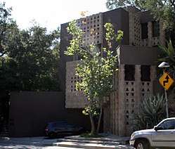
| 144 |
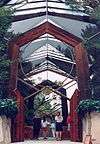
R. M. Schindler House |
|
July 14, 1971
(#71000150) |
833 N. Kings Rd.
34°05′11″N 118°22′16″W / 34.086389°N 118.371111°W / 34.086389; -118.371111 (R. M. Schindler House) |
West Hollywood |
|
| 145 |
Scripps College for Women |
|
September 20, 1984
(#84000887) |
Columbia and 10th St.
34°06′18″N 117°42′30″W / 34.105°N 117.708333°W / 34.105; -117.708333 (Scripps College for Women) |
Claremont |
|
| 146 |
Scripps Hall |
|
July 28, 1999
(#99000893) |
209 E. Mariposa St.
34°11′34″N 118°08′38″W / 34.192778°N 118.143889°W / 34.192778; -118.143889 (Scripps Hall) |
Altadena |
|
| 147 |
Second Church of Christ Scientist |
|
April 1, 2005
(#05000212) |
655 Cedar Ave.
33°44′55″N 118°11′35″W / 33.748611°N 118.193056°W / 33.748611; -118.193056 (Second Church of Christ Scientist) |
Long Beach |
|
| 148 |
Upton Sinclair House |
|
November 11, 1971
(#71000153) |
464 N. Myrtle Ave.
34°09′44″N 118°00′00″W / 34.162222°N 118.0°W / 34.162222; -118.0 (Upton Sinclair House) |
Monrovia |
|
| 149 |
South Pasadena Historic District |
|
July 21, 1982
(#82002202) |
Roughly bounded by Mission and El Centro Sts., and Fairview and Meridian Aves.
34°07′01″N 118°09′23″W / 34.116944°N 118.156389°W / 34.116944; -118.156389 (South Pasadena Historic District) |
South Pasadena |
|
| 150 |
Southern Pacific Railroad Depot, Whittier |
|
March 29, 2005
(#04001105) |
7333 Greenleaf Ave.
33°58′28″N 118°02′15″W / 33.974444°N 118.0375°W / 33.974444; -118.0375 (Southern Pacific Railroad Depot, Whittier) |
Whittier |
Depot was originally listed in 1978 at its original location and was removed from the Register on October 1, 2004. It was returned to the Register at its new location in 2005. |
| 151 |
Sovereign Hotel |
|
October 24, 1997
(#97001236) |
205 Washington Ave.
34°01′13″N 118°30′07″W / 34.020278°N 118.501944°W / 34.020278; -118.501944 (Sovereign Hotel) |
Santa Monica |
|
| 152 |
Standard Oil Building |
|
June 9, 1980
(#80000816) |
7257 Bright Ave.
33°58′33″N 118°02′08″W / 33.975833°N 118.035556°W / 33.975833; -118.035556 (Standard Oil Building) |
Whittier |
|
| 153 |
Stevens House |
|
October 9, 2009
(#09000802) |
23524 Malibu Colony Rd.
34°01′55″N 118°41′14″W / 34.031839°N 118.687214°W / 34.031839; -118.687214 (Stevens House) |
Malibu |
|
| 154 |
Charles E. Straight House |
|
July 8, 1992
(#92000833) |
4333 Emerald Ave.
34°07′03″N 117°46′04″W / 34.1175°N 117.767778°W / 34.1175; -117.767778 (Charles E. Straight House) |
La Verne |
|
| 155 |
Sunset Tower |
|
May 30, 1980
(#80000812) |
8358 Sunset Blvd.
34°05′42″N 118°22′17″W / 34.095°N 118.371389°W / 34.095; -118.371389 (Sunset Tower) |
West Hollywood |
|
| 156 |
Sweetser Residence |
|
September 5, 1985
(#85001984) |
417 E. Beryl St.
33°50′57″N 118°23′16″W / 33.849167°N 118.387778°W / 33.849167; -118.387778 (Sweetser Residence) |
Redondo Beach |
|
| 157 |
The Tank Site-(CA-LAN-1) |
|
December 17, 2015
(#15000912) |
Address Restricted
|
Topanga Canyon |
|
| 158 |
Temple Mansion |
|
December 2, 1974
(#74000518) |
15415 E. Don Julian Rd.
34°01′12″N 117°57′53″W / 34.02°N 117.964722°W / 34.02; -117.964722 (Temple Mansion) |
Industry |
|
| 159 |
Franklin Rosborough "Frank" Thomas House |
|
February 3, 2015
(#14001233) |
758 Flintridge Ave.
34°11′15″N 118°11′35″W / 34.1874°N 118.1930°W / 34.1874; -118.1930 (Franklin Rosborough "Frank" Thomas House) |
La Canada Flintridge |
Home built in 1949 for Disney animator Frank Thomas[8] |
| 160 |
Torrance School |
|
October 13, 1983
(#83003542) |
2200 W. Carson
33°49′41″N 118°19′06″W / 33.828056°N 118.318333°W / 33.828056; -118.318333 (Torrance School) |
Torrance |
part of the Torrance High School Campus TR |
| 161 |
Joseph and Carrie Torrey House |
|
April 23, 2018
(#100002319) |
711 Daisy Ave.
33°46′32″N 118°11′59″W / 33.775677°N 118.199629°W / 33.775677; -118.199629 (Joseph and Carrie Torrey House) |
Long Beach |
|
| 162 |
Tuna Club of Avalon |
|
April 2, 1991
(#91000338) |
100 St. Catherine Way, Catalina Island
33°20′44″N 118°19′35″W / 33.345556°N 118.326389°W / 33.345556; -118.326389 (Tuna Club of Avalon) |
Avalon |
|
| 163 |
US Post Office-Beverly Hills Main |
|
January 11, 1985
(#85000126) |
469 N. Crescent Dr.
34°04′19″N 118°24′08″W / 34.071944°N 118.402222°W / 34.071944; -118.402222 (US Post Office-Beverly Hills Main) |
Beverly Hills |
part of the US Post Office in California 1900-1941 TR |
| 164 |
US Post Office-Burbank Downtown Station |
|
January 11, 1985
(#85000127) |
125 E. Olive Ave.
34°10′48″N 118°18′34″W / 34.18°N 118.309444°W / 34.18; -118.309444 (US Post Office-Burbank Downtown Station) |
Burbank |
part of the US Post Office in California 1900-1941 TR |
| 165 |
US Post Office-Glendale Main |
|
January 11, 1985
(#85000128) |
313 E. Broadway St.
34°08′54″N 118°15′07″W / 34.148333°N 118.251944°W / 34.148333; -118.251944 (US Post Office-Glendale Main) |
Glendale |
part of the US Post Office in California 1900-1941 TR |
| 166 |
US Post Office-Long Beach Main |
|
January 11, 1985
(#85000129) |
300 Long Beach Blvd.
33°46′22″N 118°11′20″W / 33.772778°N 118.188889°W / 33.772778; -118.188889 (US Post Office-Long Beach Main) |
Long Beach |
part of the US Post Office in California 1900-1941 TR |
| 167 |
Walter D. Valentine Cottage B |
|
July 24, 2017
(#100001337) |
1419 E. Palm St.
34°11′39″N 118°07′16″W / 34.194211°N 118.121156°W / 34.194211; -118.121156 (Walter D. Valentine Cottage B) |
Altadena |
|
| 168 |
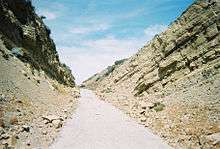
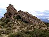
Vasquez Rocks |
|
June 22, 1972
(#72000228) |
Agua Dulce Rd.
34°29′07″N 118°19′28″W / 34.485278°N 118.324444°W / 34.485278; -118.324444 (Vasquez Rocks) |
Agua Dulce |
|
| 169 |
Villa Carlotta |
|
June 17, 2014
(#14000303) |
234 E. Mendocino St.
34°11′22″N 118°08′40″W / 34.189423°N 118.144506°W / 34.189423; -118.144506 (Villa Carlotta) |
Altadena |
|
| 170 |
Villa Francesca |
|
October 2, 1986
(#86002796) |
1 Peppertree Dr.
33°44′26″N 118°22′09″W / 33.740556°N 118.369167°W / 33.740556; -118.369167 (Villa Francesca) |
Rancho Palos Verdes |
|
| 171 |
Villa Riviera |
|
July 25, 1996
(#96000778) |
800 E. Ocean Blvd.
33°45′59″N 118°10′54″W / 33.766389°N 118.181667°W / 33.766389; -118.181667 (Villa Riviera) |
Long Beach |
|
| 172 |
Washington Building |
|
May 28, 1991
(#91000635) |
9720-9732 Washington Blvd.
34°01′19″N 118°23′44″W / 34.021944°N 118.395556°W / 34.021944; -118.395556 (Washington Building) |
Culver City |
|
| 173 |
Wayfarers Chapel |
|
July 11, 2005
(#05000210) |
5755 Palos Verdes Dr. S
33°44′41″N 118°22′33″W / 33.744722°N 118.375833°W / 33.744722; -118.375833 (Wayfarers Chapel) |
Rancho Palos Verdes |
Lloyd Wright |
| 174 |
Henry Weaver House |
|
December 27, 1989
(#89002114) |
142 Adelaide Dr.
34°01′40″N 118°30′47″W / 34.027778°N 118.513056°W / 34.027778; -118.513056 (Henry Weaver House) |
Santa Monica |
|
| 175 |
Well No. 4, Pico Canyon Oil Field |
|
November 13, 1966
(#66000212) |
9.5 miles (15.3 km) north of San Fernando, west of US 99
34°22′10″N 118°37′49″W / 34.369444°N 118.630278°W / 34.369444; -118.630278 (Well No. 4, Pico Canyon Oil Field) |
Mentryville |
|
| 176 |
Michael White Adobe |
|
September 30, 2014
(#14000797) |
2701 Huntington Dr.
34°07′36″N 118°05′58″W / 34.126584°N 118.099392°W / 34.126584; -118.099392 (Michael White Adobe) |
San Marino |
|
| 177 |
The Willmore |
|
May 20, 1999
(#99000579) |
315 W. Third St.
33°46′15″N 118°11′40″W / 33.770833°N 118.194444°W / 33.770833; -118.194444 (The Willmore) |
Long Beach |
|
| 178 |
Woman's Club of Redondo Beach |
|
April 19, 1984
(#84000900) |
400 S. Broadway
33°50′12″N 118°23′06″W / 33.836667°N 118.385°W / 33.836667; -118.385 (Woman's Club of Redondo Beach) |
Redondo Beach |
|
| 179 |
Woodbury-Story House |
|
December 30, 1993
(#93001463) |
2606 N. Madison Ave.
34°11′21″N 118°08′00″W / 34.189167°N 118.133333°W / 34.189167; -118.133333 (Woodbury-Story House) |
Altadena |
|
| 180 |
Workman Adobe |
|
November 20, 1974
(#74000519) |
15415 Don Julian Rd.
34°01′12″N 117°57′51″W / 34.02°N 117.964167°W / 34.02; -117.964167 (Workman Adobe) |
Industry |
|
| 181 |
Workman Family Cemetery |
|
November 20, 1974
(#74000520) |
15415 E. Don Julian Rd.
34°01′07″N 117°57′45″W / 34.018611°N 117.9625°W / 34.018611; -117.9625 (Workman Family Cemetery) |
Industry |
|
| 182 |
Lloyd Wright Home and Studio |
|
April 6, 1987
(#87000562) |
858 N. Doheny Dr.
34°05′12″N 118°23′37″W / 34.086667°N 118.393611°W / 34.086667; -118.393611 (Lloyd Wright Home and Studio) |
West Hollywood |
Lloyd Wright |
| 183 |
William Wrigley, Jr. Summer Cottage |
|
August 15, 1985
(#85001785) |
76 Wrigley Rd.
33°20′28″N 118°19′13″W / 33.341111°N 118.320278°W / 33.341111; -118.320278 (William Wrigley, Jr. Summer Cottage) |
Avalon |
|
| 184 |
Wynyate |
|
April 24, 1973
(#73000407) |
851 Lyndon St.
34°06′39″N 118°09′28″W / 34.110833°N 118.157778°W / 34.110833; -118.157778 (Wynyate) |
South Pasadena |
|
| 185 |
Zumbrota (yacht) |
|
March 20, 2017
(#100000762) |
13755 Fiji Way
33°58′21″N 118°26′47″W / 33.972550°N 118.446439°W / 33.972550; -118.446439 (Zumbrota (yacht)) |
Marina Del Rey |
|
.jpg)
.jpg)
%2C_West_Hollywood.JPG)
.jpg)

.JPG)
.JPG)
.jpg)
%2C_San_Fernando%2C_CA.JPG)
.jpg)
.jpg)
.jpg)
.jpg)
.jpg)
%2C_1922_b.jpg)
.jpg)
.jpg)