Danube, New York
| Danube, New York | |
|---|---|
| Town | |
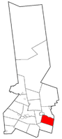 Location within Herkimer County | |
 Danube Location within Herkimer County  Danube Danube (the US) | |
| Coordinates: 42°59′17″N 74°48′9″W / 42.98806°N 74.80250°WCoordinates: 42°59′17″N 74°48′9″W / 42.98806°N 74.80250°W | |
| Country | United States |
| State | New York |
| County | Herkimer |
| Government | |
| • Type | Town Council |
| • Town Supervisor | Rick Mosher |
| • Town Council |
Members' List
|
| Area[1] | |
| • Total | 29.61 sq mi (76.70 km2) |
| • Land | 29.35 sq mi (76.03 km2) |
| • Water | 0.26 sq mi (0.67 km2) |
| Elevation | 443 ft (135 m) |
| Population (2010) | |
| • Total | 1,039 |
| • Estimate (2016)[2] | 1,023 |
| • Density | 34.85/sq mi (13.46/km2) |
| Time zone | UTC-5 (Eastern (EST)) |
| • Summer (DST) | UTC-4 (EDT) |
| FIPS code | 36-043-19686 |
| GNIS feature ID | 0978885 |
| Website |
www |
Danube is a town in Herkimer County, New York, United States. The population was 1,039 at the 2010 census.[3] Early Palatine German immigrants in the eighteenth century named the town after the Danube River[4] in Europe.
The town is in southeastern Herkimer County, southeast of the city of Little Falls and south of the Mohawk River.
History
The town was first settled by Europeans around 1730 on the territories of Lindsey's (1730) and Van Horne's (1731) patents. The town was within the territory of the Mohawk people.
In coordination with the colonial government the Mohawk had allowed a fortified settlement east of here. They had agreed in 1712 to allow some settlement by Palatine Germans in exchange for Queen Anne helping with their defense against the French and Indian allies. Fort Schuyler was constructed south of the Mohawk River near one of their major settlements at the time.
The town of Danube was formed in 1817 from the town of Minden (in Montgomery County). Part of Danube was taken off in 1828 to form the town of Stark.
The Herkimer Home and Mohawk Upper Castle Historic District are listed on the National Register of Historic Places.[5]
Notable residents
- King Hendrick, Mohawk leader, lived in Canajoharie, what was also known to the English as the Upper Indian Castle. The site of the village is a National Historic Landmark.
- Nicholas Herkimer, German descendant, had his house here; he became a New York state militia general during the Revolutionary War and died due to wounds incurred in the Battle of Oriskany.
- John Herkimer, his nephew, judge, soldier and New York congressman
- William Sickles, Medal of Honor winner, Civil War
Geography
According to the United States Census Bureau, the town has a total area of 29.6 square miles (76.7 km2), of which 29.3 square miles (76.0 km2) are land and 0.3 square miles (0.7 km2), or 0.87%, are water.[3]
The east town line is the border of Montgomery County. The north town line is marked by the Mohawk River and the Erie Canal.
The New York State Thruway (Interstate 90) passes across the north part of the town. New York State Route 5S is an east-west highway that parallels the Thruway. New York State Route 169 intersects NY-5S and the Thruway in the northwest part of Danube.
Demographics
| Historical population | |||
|---|---|---|---|
| Census | Pop. | %± | |
| 1820 | 3,187 | — | |
| 1830 | 1,723 | −45.9% | |
| 1840 | 1,960 | 13.8% | |
| 1850 | 1,730 | −11.7% | |
| 1860 | 1,711 | −1.1% | |
| 1870 | 1,324 | −22.6% | |
| 1880 | 1,235 | −6.7% | |
| 1890 | 1,116 | −9.6% | |
| 1900 | 1,043 | −6.5% | |
| 1910 | 941 | −9.8% | |
| 1920 | 746 | −20.7% | |
| 1930 | 790 | 5.9% | |
| 1940 | 849 | 7.5% | |
| 1950 | 847 | −0.2% | |
| 1960 | 911 | 7.6% | |
| 1970 | 1,015 | 11.4% | |
| 1980 | 1,081 | 6.5% | |
| 1990 | 1,077 | −0.4% | |
| 2000 | 1,098 | 1.9% | |
| 2010 | 1,039 | −5.4% | |
| Est. 2016 | 1,023 | [2] | −1.5% |
| U.S. Decennial Census[6] | |||
As of the census[7] of 2000, there were 1,098 people, 398 households, and 280 families residing in the town. The population density was 37.4 people per square mile (14.4/km²). There were 442 housing units at an average density of 15.0 per square mile (5.8/km²). The racial makeup of the town was 96.90% White, 0.82% African American, 0.36% Native American, 0.91% Asian, 0.09% from other races, and 0.91% from two or more races. Hispanic or Latino of any race were 0.91% of the population.
There were 398 households out of which 35.9% had children under the age of 18 living with them, 52.8% were married couples living together, 9.3% had a female householder with no husband present, and 29.6% were non-families. 23.6% of all households were made up of individuals and 9.8% had someone living alone who was 65 years of age or older. The average household size was 2.76 and the average family size was 3.22.
In the town, the population was spread out with 31.1% under the age of 18, 6.6% from 18 to 24, 28.8% from 25 to 44, 22.8% from 45 to 64, and 10.8% who were 65 years of age or older. The median age was 35 years. For every 100 females, there were 111.6 males. For every 100 females age 18 and over, there were 112.0 males.
The median income for a household in the town was $31,815, and the median income for a family was $32,500. Males had a median income of $28,661 versus $20,000 for females. The per capita income for the town was $13,572. About 15.5% of families and 18.4% of the population were below the poverty line, including 27.8% of those under age 18 and 6.2% of those age 65 or over.
Communities
- Danube – A location in the north part of the town on NY-5S.
- Davys Corners – A location in the northeast corner of the town.
- Fink Basin – A hamlet near the Mohawk River by NY-169
- Herkimer Home State Historic Site – The home of Nicholas Herkimer is near Fink Basin and the Mohawk River.
- Indian Castle – A hamlet in the northeast part of the town, east of Danube village.
- Newville-- A hamlet in the southwest part of the town on County Road 32. The Zoller-Frasier Round Barn was added to the National Register of Historic Places in 1984.[8]
References
- ↑ "2016 U.S. Gazetteer Files". United States Census Bureau. Retrieved Jul 5, 2017.
- 1 2 "Population and Housing Unit Estimates". Retrieved June 9, 2017.
- 1 2 "Geographic Identifiers: 2010 Census Summary File 1 (G001): Danube town, Herkimer County, New York". American Factfinder. U.S. Census Bureau. Retrieved November 28, 2017.
- ↑ Gannett, Henry (1905). The Origin of Certain Place Names in the United States. Govt. Print. Off. p. 99.
- ↑ National Park Service (2010-07-09). "National Register Information System". National Register of Historic Places. National Park Service.
- ↑ "Census of Population and Housing". Census.gov. Archived from the original on May 12, 2015. Retrieved June 4, 2015.
- ↑ "American FactFinder". United States Census Bureau. Archived from the original on 2013-09-11. Retrieved 2008-01-31.
- ↑ National Park Service (2009-03-13). "National Register Information System". National Register of Historic Places. National Park Service.
External links
- Town of Danube official website
- Early history of Danube, NY
- Historical information: Danube, NY
- Herkimer County Historical Society website
- Danube Town Court
Municipalities and communities of Herkimer County, New York, United States | ||
|---|---|---|
| City | 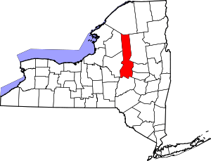 | |
| Towns | ||
| Villages | ||
| CDPs | ||
| Other hamlets |
| |
| Footnotes | ‡This populated place also has portions in an adjacent county or counties | |