Copake Falls, New York
| Copake Falls, New York | |
|---|---|
| Hamlet & Census-designated place | |
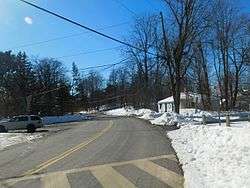 New York State Route 344 in Copake Falls. | |
 Copake Falls Location within the state of New York | |
| Coordinates: 42°7′10″N 73°31′30″W / 42.11944°N 73.52500°WCoordinates: 42°7′10″N 73°31′30″W / 42.11944°N 73.52500°W | |
| Country | United States |
| State | New York |
| County | Columbia |
| Town | Copake |
| Area | |
| • Total | 0.22 sq mi (0.58 km2) |
| • Land | 0.22 sq mi (0.58 km2) |
| • Water | 0 sq mi (0 km2) |
| Elevation | 650 ft (200 m) |
| Time zone | UTC-5 (Eastern (EST)) |
| • Summer (DST) | UTC-4 (EDT) |
| ZIP code | 12517 |
| FIPS code | 36-18113 |
| GNIS code | 0947409 |
Copake Falls is a hamlet and census-designated place (CDP) in Columbia County, New York, United States. The hamlet, once known as Copake Iron Works, is in the eastern part of the town of Copake, 1.5 miles (2.4 km) west of the Massachusetts state line. The CDP was designated after the 2010 census, so no population figure is yet available.
The former Copake Falls Methodist Episcopal Church was added to the National Register of Historic Places in 2012.[1]
Geography
Copake Falls is located along Bashbish Brook at the western foot of the Taconic Mountains, a range that runs along the New York-Massachusetts border. The Copake Falls area of Taconic State Park, with campsites and hiking trails, is directly east of the hamlet, and Bash Bish Falls, the highest waterfall in Massachusetts, is located 2 miles (3 km) to the east via New York State Route 344.
A portion of the hamlet comprises the Copake Iron Works Historic District, part of the National Register of Historic Places.
New York State Route 22 forms the western edge of the Copake Falls CDP and leads north 4 miles (6 km) to Hillsdale and south 2 miles (3 km) to Copake hamlet.
According to the United States Census Bureau, the Copake Falls CDP has a total area of 0.22 square miles (0.58 km2), all land.[2]
See also
References
- ↑ "National Register of Historic Places Listings". Weekly List of Actions Taken on Properties: 8/06/12 through 8/10/12. National Park Service. 2012-08-17.
- ↑ "2014 U.S. Gazetteer Files: Places: New York". U.S. Census Bureau, Geography Division. Retrieved December 12, 2014.
External links
| Wikimedia Commons has media related to Copake Falls, New York. |
Municipalities and communities of Columbia County, New York, United States | ||
|---|---|---|
| City | 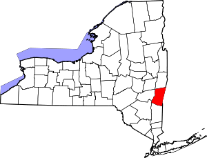 | |
| Towns | ||
| Villages | ||
| CDPs | ||
| Other hamlets | ||
| Footnotes | ‡This populated place also has portions in an adjacent county or counties | |