NOAA-20
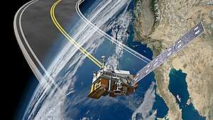 Artist Illustration of the NOAA-20 Satellite | |
| Mission type | Earth Science & Meteorology |
|---|---|
| Operator | NOAA |
| COSPAR ID | 2017-073A |
| SATCAT no. | 43013 |
| Website | http://www.jpss.noaa.gov/ |
| Mission duration |
Planned: 7 years[1] Elapsed: 10 months, 24 days |
| Spacecraft properties | |
| Spacecraft | Joint Polar Satellite System-1 |
| Bus | BCP-2000 |
| Manufacturer | Ball Aerospace |
| Launch mass | 2294 kg |
| BOL mass | 2294 kg |
| Dry mass | 1929 kg |
| Payload mass | 578 kg |
| Dimensions | 1.3 m x 1.3 m x 4.2 m |
| Power | 1864 W |
| Start of mission | |
| Launch date | 18 November 2017 |
| Rocket | Delta II 7920-10 configuration |
| Launch site | Vandenberg AFB SLC-2W |
| Contractor | United Launch Alliance |
| Orbital parameters | |
| Reference system | Geocentric |
| Regime | Sun-synchronous |
| Semi-major axis | 7,197 kilometers (4,472 mi)[2] |
| Eccentricity | 0.0002619[3] |
| Perigee | 824.3 kilometers (512.2 mi)[2] |
| Apogee | 827.8 kilometers (514.4 mi)[2] |
| Inclination | 98.7116 degrees[3] |
| Period | 101.3 minutes[2] |
| RAAN | 271.7368 degrees[3] |
| Argument of perigee | 95.6830 degrees[3] |
| Mean anomaly | 359.8949[3] |
| Mean motion | 14.218[3] |
| Epoch | 30 November 2017 10:00:00 UTC[3] |
| Revolution no. | 185[3] |
|
Joint Polar Satellite System | |
NOAA-20, designated JPSS-1 prior to launch, is the first of the United States National Oceanic and Atmospheric Administration's latest generation of U.S. polar-orbiting, non-geosynchronous, environmental satellites called the Joint Polar Satellite System. NOAA-20 was launched on November 18, 2017 and joined the Suomi National Polar-orbiting Partnership satellite in the same orbit. NOAA-20 operates about 50 minutes ahead of Suomi NPP, allowing important overlap in observational coverage. Circling the Earth from pole-to-pole, it crosses the equator about 14 times daily, providing full global coverage twice a day. This will give meteorologists information on "atmospheric temperature and moisture, clouds, sea-surface temperature, ocean color, sea ice cover, volcanic ash, and fire detection" so as to enhance weather forecasting including hurricane tracking, post-hurricane recovery by detailing storm damage and mapping of power outages.[4][5]
The project incorporates five instruments, and these are substantially upgraded since previous satellite equipment. The project's greater-detailed observations will provide better predictions and emphasize climate behavior in cases like El Niño and La Nina.[4]
The project's satellite bus and Ozone Mapping and Profiler equipment, was designed by Ball Aerospace. The Visible Infrared Imaging Radiometer Suite and the Common Ground System were built by Raytheon, and the Cross-track Infrared Sounder was by Harris. The Advanced Technology Microwave Sounder and the Clouds and the Earth’s Radiant Energy System instrument were built by Northrop Grumman Aerospace Systems.[4]
Launch
The NOAA-20 launch was delayed several times. When the contract was awarded in 2010, launch was scheduled for 2014.[6] By 2011, launch had slipped to 2016, and by 2012 that had slipped to 2017.[7][8] In August 2016, following environmental testing, launch slipped from January 20, 2017 to March 16, 2017 due to problems with ATMS and the ground system.[9] In January 2017, launch was delayed from March 2017 to the fourth quarter of fiscal year 2017, or July to September for the same reasons.[10] The launch was delayed from September 2017 to November 10, 2017 to provide extra time for engineers to complete testing of the spacecraft and electronics as well as the Advanced Technology Microwave Sounder (ATMS).[11]
It also experienced several brief launch delays in the final weeks before launch. Originally scheduled to launch on November 10, 2017, it was delayed to the 14th following the discovery of a faulty battery on the Delta 2 launch vehicle.[12] The launch was then delayed to November 15, 2017 due to boats being in the launch safety zone minutes before the launch and due to a bad reading on the first stage of the launch vehicle.[13] It was delayed a 3rd time to November 18 due to high winds.[14]
NOAA-20 successfully launched on November 18, 2017.[4] It represented the penultimate, and 99th consecutive successful launch of the Delta 2 rocket. It was launched along with 5 CubeSats that conducted research in "3D-printed polymers for in-space manufacturing, weather data collection, bit flip memory testing, radar calibration and the effects of space radiation on electronic components".[15]
Between Nov 29, 2017, when ATMS produced its "first light" image and Jan 5, 2018 when VIIRS and OMPS produced theirs, the satellite went through activation, outgassing and decontamination on the path to operation.[16]
On May 30, 2018, after six months of on-orbit checkout, NOAA declared the spacecraft fully operational.[17]
Instruments
NOAA-20 Sensors/Instruments:[1]
- Visible Infrared Imaging Radiometer Suite (VIIRS)
- takes global visible and infrared observations of land, ocean, and atmosphere parameters at high temporal resolution. Developed from the MODIS instrument flown on the Aqua and Terra Earth Observing System satellites, it has significantly better performance than the AVHRR radiometer previously flown on NOAA satellites.[18]
- Cross-track Infrared Sounder (CrIS)
- will produce high-resolution, three-dimensional temperature, pressure, and moisture profiles. These profiles will be used to enhance weather forecasting models, and will facilitate both short- and long-term weather forecasting. Over longer timescales, they will help improve understanding of climate phenomena such as El Niño and La Niña. This is a brand-new instrument with breakthrough performance.[19] CrIS represents a significant enhancement over NOAA's legacy infrared sounder—High Resolution Infrared Radiation Sounders (HIRS) and is meant to be a counterpart to the Infrared Atmospheric Sounding Interferometer (IASI).
- Advanced Technology Microwave Sounder (ATMS)
- a cross-track scanner with 22 channels, provides sounding observations needed to retrieve atmospheric temperature and moisture profiles for civilian operational weather forecasting as well as continuity of these measurements for climate monitoring purposes. It is a lighter-weight version of the previous AMSU and MHS instruments flown on previous NOAA and NASA satellites with no new performance capabilities.[20]
- Ozone Mapping and Profiler Suite (OMPS)
- an advanced suite of three hyperspectral instruments, extends the 25-plus year total-ozone and ozone-profile records. These records are used by ozone-assessment researchers and policy makers to track the health of the ozone layer. The improved vertical resolution of OMPS data products allows for better testing and monitoring of the complex chemistry involved in ozone destruction near the troposphere. OMPS products, when combined with cloud predictions, also help produce better ultraviolet index forecasts.[21] OMPS carries on a long tradition of space borne measurements of ozone beginning in 1970 with the Nimbus 4 satellite and continuing with the Solar Backscatter Ultraviolet (SBUV and SBUV/2), Total Ozone Mapping Spectrometer (TOMS) and Ozone Monitoring Instrument (OMI) instruments on various NASA, NOAA, and international satellites. Over the more than 30-year period in which these instruments have been operating, they have provided a very detailed and important long-term record of the global distribution of ozone.
- Clouds and the Earth's Radiant Energy System (CERES)
- senses both solar-reflected and Earth-emitted radiation from the top of the atmosphere to the Earth's surface. Cloud properties are determined using simultaneous measurements by other JPSS instruments such as the VIIRS and will lead to a better understanding of the role of clouds and the energy cycle in global climate change.[22]
References
- 1 2 "Joint Polar Satellite System: Mission and Instruments". NASA. Retrieved 14 November 2017.
- 1 2 3 4 "JPSS 1 Satellite details 2017-073A NORAD 43013". N2YO. 21 November 2017. Retrieved 21 November 2017.
- 1 2 3 4 5 6 7 8 "NASA Official Two-line Element Set". NASA. 1 December 2017. Retrieved 1 December 2017.
- 1 2 3 4 Russell, Kenneth (18 November 2017). "NASA, ULA Launch JPSS 1 Weather Satellite for NOAA". Retrieved 19 December 2017.
- ↑ Russell, Kendall (27 October 2017). "Next-Gen Weather Satellite JPSS 1 Readies for Launch". Retrieved 19 December 2017.
- ↑ Cole, Steve. "NASA Awards Contract For JPSS-1 Spacecraft". Retrieved 19 December 2017.
- ↑ "BALL AEROSPACE MAKES PROGRESS FOR NASA'S JOINT POLAR SATELLITE SYSTEM-1 SPACECRAFT". Retrieved 19 December 2017.
- ↑ "BALL AEROSPACE INCORPORATES ENHANCED DATA COMMUNICATION FOR JPSS-1 SATELLITE". Retrieved 19 December 2017.
- ↑ Foust, Jeff (30 August 2016). "Instrument, ground systems problems blamed for JPSS-1 launch delay". Retrieved 19 December 2017.
- ↑ Foust, Jeff (4 January 2017). "JPSS-1 launch date slips again". Retrieved 19 December 2017.
- ↑ Smith, Marcia (7 September 2017). "JPSS-1 now scheduled for launch in November". Retrieved 19 December 2017.
- ↑ Foust, Jeff (7 November 2017). "Battery problem delays JPSS-1 launch". Retrieved 19 December 2017.
- ↑ Lewin, Sarah. "Rocket Issue Delays Launch of Advanced New JPSS-1 Weather Satellite". Space.com. Retrieved 14 November 2017.
- ↑ Malik, Tariq (15 November 2017). "High Winds Delay Launch of Advanced Weather Satellite JPSS-1". Retrieved 19 December 2017.
- ↑ Ray, Justin. "NASA gives the Delta 2 rocket a new lease on life". SpaceFlightNow. Retrieved 17 July 2012.
- ↑ "NOAA-20 First Light Images". Retrieved 12 February 2018.
- ↑ Foust, Jeff (30 May 2018). "NOAA declares first JPSS weather satellite operational". Spacenews. Retrieved 8 June 2018.
- ↑ "The Visible Infrared Imaging Radiometer Suite." NASA Goddard Spaceflight Center. Retrieved: 22 June 2017.
- ↑ "The Cross-track Infrared Sounder." NASA Goddard Spaceflight Center. Retrieved: 22 June 2017.
- ↑ The Advanced Technology Microwave Sounder NASA Goddard Spaceflight Center. Retrieved: 22 June 2017.
- ↑ "Ozone Mapper Profiler Suite." NASA Goddard Spaceflight Center. Retrieved: 22 June 2017.
- ↑ "Clouds and Earth's Radiant Energy System." NASA Goddard Spaceflight Center. Retrieved: 22 June 2017.