Mulford Farmhouse
|
Mulford Farmhouse | |
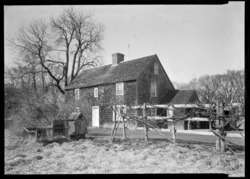 HABS image of the Mulford Farmhouse | |
| Location | Mulford Farmhouse, East Hampton, New York |
|---|---|
| Coordinates | 40°57′24″N 72°11′28″W / 40.9566°N 72.1911°WCoordinates: 40°57′24″N 72°11′28″W / 40.9566°N 72.1911°W |
| Architect | Josiah Hobart, builder/owner |
| Part of | East Hampton Village District |
| NRHP reference # | 74001309[1] |
| Designated CP | May 2, 1974 |
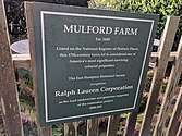
Mulford Farm in East Hampton, Long Island, New York, is one of America's most significant, intact English colonial farmsteads. The farmhouse was built in 1680 by High Sheriff Josiah Hobart, an important early official of the first New York Royal Province government. Samuel "Fish Hook" Mulford bought the property in 1712 when Mr. Hobart died. He had the barn built in 1721.[2] The property is listed on the National Register of Historic Places.
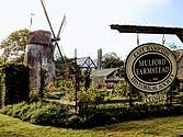
The Mulford Farm site is interpreted as the year 1790, and includes the house, barn, spinning dependency, privy, smokehouse and garden. It is owned by the East Hampton Historical Society and operated as a living museum.[2] Next to it is the Home Sweet Home colonial museum which has the Pantigo windmill behind it.
The museum is located at 10 James Lane, off Montauk Highway, East Hampton, New York. It is open from Memorial Day weekend through Columbus Day weekend.
 Farmstead sign
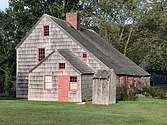
 Mulford Farm in East Hampton
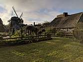 English colonial farmsteads, the Pantigo Windmill abuts the farm.
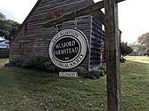 Mulford Farm colonial farmsteads.
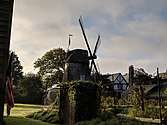 Farm in East Hampton, Long Island
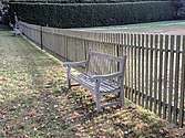 Mulford Farm seats
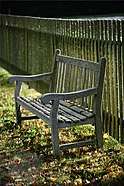 An arbor of trees line the street with memorial markers and contemplation benches.
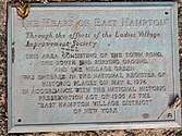 Mulford Farm in East Hampton is Landmarked
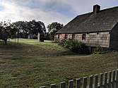 Mulford Farm Privy is in center/left
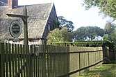 Home Sweet Home Museum
References
- ↑ National Park Service (1900-01-01). "National Register Information System". National Register of Historic Places. National Park Service. 1984a
- 1 2 East Hampton Historical Society News, Volume 16, Number 1, 1992
External links
![]()
| Topics |   | |
|---|---|---|
| Lists by county |
| |
| Lists by city | ||
| Other lists | ||
| ||