Mount Chual
| Mount Chual | |
|---|---|
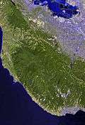
 Mount Chual Location in California  Mount Chual Mount Chual (the US) | |
| Highest point | |
| Elevation | 3,562 ft (1,086 m) NGVD 29[1] |
| Coordinates | 37°07′09″N 121°50′05″W / 37.1191139°N 121.8346754°WCoordinates: 37°07′09″N 121°50′05″W / 37.1191139°N 121.8346754°W [2] |
| Geography | |
| Location | Santa Clara County, California, United States |
| Parent range | Santa Cruz Mountains |
| Topo map | USGS Loma Prieta |
Mount Chual is a prominent peak in the Santa Cruz Mountains in southwest Santa Clara County, California, United States. The landmark lies 10 mi (16 km) west of Morgan Hill, and approximately 0.8 mi (1 km) northeast of Loma Prieta. It is the third highest peak in the Santa Cruz Mountains. Several tributaries to Llagas Creek originate on the southern and eastern flanks of the peak.
History
The name of the mountain first appeared on a Mexican-era map of New Almaden in 1848 as Picacho de Chual. The word "chual" refers in Spanish to the edible plant, chenopodium californicum, the common pigweed or goosefoot (a form of wild lettuce).[3][4]
The summit has a radio communications facility, operating since 1965.[5][6] The peak and surrounding land is currently owned by the Santa Clara Valley Open Space Authority.[7]
See also
References
- ↑ "Mount Chual". ListsOfJohn.com. Retrieved 2017-08-05.
- ↑ "Mount Chual". Geographic Names Information System. United States Geological Survey. Retrieved 2017-08-05.
- ↑ Nellie Van de Grift Sanchez (1914). "Spanish and Indian Place Names of California : Their Meaning and Their Romance". A.M. Robertson, San Francisco, California. p. 157.
- ↑ William Oliver Bright (1998). "1500 California Place Names: Their Origin and Meaning". University of California Press. p. 39.
- ↑ "Mount Chual Tower History". Santa Clara Valley Repeater Society. Retrieved 2017-08-05.
- ↑ "Mount Chual Communications Tower". ComSites West, Inc. Retrieved 2017-08-05.
- ↑ "Mount Chual Properties". Santa Clara Valley Open Space Authority. Retrieved 2017-08-05.