Manabo, Abra
| Manabo | ||
|---|---|---|
| Municipality | ||
| Municipality of Manabo | ||
| ||
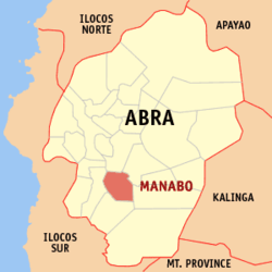 Map of Abra with Manabo highlighted | ||
.svg.png) Manabo Location within the Philippines | ||
| Coordinates: 17°26′N 120°42′E / 17.43°N 120.7°ECoordinates: 17°26′N 120°42′E / 17.43°N 120.7°E | ||
| Country |
| |
| Region | Cordillera Administrative Region (CAR) | |
| Province | Abra | |
| District | Lone District | |
| Barangays | 11 (see Barangays) | |
| Government [1] | ||
| • Type | Sangguniang Bayan | |
| • Mayor | Darrel O. Domasing | |
| • Electorate | 7,154 voters (2016) | |
| Area [2] | ||
| • Total | 110.95 km2 (42.84 sq mi) | |
| Population (2015 census)[3] | ||
| • Total | 10,761 | |
| • Density | 97/km2 (250/sq mi) | |
| Time zone | UTC+8 (PST) | |
| ZIP code | 2810 | |
| PSGC | 140116000 | |
| IDD : area code | +63 (0)74 | |
| Climate type | Tropical rainforest climate | |
| Income class | 5th municipal income class | |
| Revenue (₱) | 55,382,153.91 (2016) | |
| Native languages |
Itneg language Ilocano Tagalog | |

Manabo, officially the Municipality of Manabo, (Ilokano: Ili ti Manabo; Tagalog: Bayan ng Manabo), is a 5th class municipality in the province of Abra, Philippines. According to the 2015 census, it has a population of 10,761 people.[3]
Etymology
Upon hearing that a gobernadorcillo (the Spanish-era equivalent of a governor) was coming through the river from Cervantes, the natives in present-day Manabo welcomed him with a landing pad made of bamboo and a feast of meat, fruit and wine. On his departure later, the natives were so enthusiastic in seeing him off that they overloaded the bamboo landing pad and collapsed, in which everyone shouted, "Manabo! Manabo!" The Spanish gobernadorcillo, amused with the event, named the place "Manabo".
Geography
Manabo is located at 17°26′N 120°42′E / 17.43°N 120.7°E.
According to the Philippine Statistics Authority, the municipality has a land area of 110.95 square kilometres (42.84 sq mi) [2] constituting 2.66% of the 4,165.25-square-kilometre- (1,608.21 sq mi) total area of Abra.
Barangays
Manabo is politically subdivided into 11 barangays.[4]
| PSGC | Barangay | Population | ±% p.a. | |||
|---|---|---|---|---|---|---|
| 2015[3] | 2010[5] | |||||
| 140116004 | Ayyeng (Poblacion) | 14.9% | 1,602 | 1,567 | 0.42% | |
| 140116014 | Catacdegan Nuevo | 5.2% | 564 | 600 | −1.17% | |
| 140116002 | Catacdegan Viejo | 3.6% | 384 | 473 | −3.89% | |
| 140116003 | Luzong | 9.8% | 1,058 | 1,031 | 0.49% | |
| 140116005 | San Jose Norte | 5.2% | 556 | 604 | −1.56% | |
| 140116006 | San Jose Sur | 5.0% | 537 | 535 | 0.07% | |
| 140116007 | San Juan Norte | 5.6% | 601 | 632 | −0.95% | |
| 140116008 | San Juan Sur | 6.4% | 692 | 724 | −0.86% | |
| 140116011 | San Ramon East | 23.4% | 2,513 | 2,185 | 2.70% | |
| 140116012 | San Ramon West | 16.9% | 1,814 | 1,960 | −1.46% | |
| 140116013 | Santo Tomas | 4.1% | 440 | 445 | −0.21% | |
| Total | 10,761 | 10,756 | 0.01% | |||
Demographics
| Population census of Manabo | ||
|---|---|---|
| Year | Pop. | ±% p.a. |
| 1918 | 2,318 | — |
| 1939 | 3,571 | +2.08% |
| 1948 | 3,658 | +0.27% |
| 1960 | 4,111 | +0.98% |
| 1970 | 6,009 | +3.86% |
| 1975 | 5,384 | −2.18% |
| 1980 | 6,590 | +4.12% |
| 1990 | 7,797 | +1.70% |
| 1995 | 8,633 | +1.93% |
| 2000 | 9,643 | +2.40% |
| 2007 | 10,538 | +1.23% |
| 2010 | 10,756 | +0.75% |
| 2015 | 10,761 | +0.01% |
| Source: Philippine Statistics Authority[3][5][6][7] | ||
In the 2015 census, Manabo had a population of 10,761.[3] The population density was 97 inhabitants per square kilometre (250/sq mi).
References
- ↑ "Municipality". Quezon City, Philippines: Department of the Interior and Local Government. Retrieved 31 May 2013.
- 1 2 "Province: Abra". PSGC Interactive. Quezon City, Philippines: Philippine Statistics Authority. Retrieved 12 November 2016.
- 1 2 3 4 5 Census of Population (2015). "Cordillera Administrative Region (CAR)". Total Population by Province, City, Municipality and Barangay. PSA. Retrieved 20 June 2016.
- ↑ "Municipal: Manabo, Abra". PSGC Interactive. Quezon City, Philippines: Philippine Statistics Authority. Retrieved 8 January 2016.
- 1 2 Census of Population and Housing (2010). "Cordillera Administrative Region (CAR)". Total Population by Province, City, Municipality and Barangay. NSO. Retrieved 29 June 2016.
- ↑ Censuses of Population (1903–2007). "Cordillera Administrative Region (CAR)". Table 1. Population Enumerated in Various Censuses by Province/Highly Urbanized City: 1903 to 2007. NSO.
- ↑ "Province of Abra". Municipality Population Data. Local Water Utilities Administration Research Division. Retrieved 17 December 2016.
External links
| Wikimedia Commons has media related to Manabo, Abra. |
Places adjacent to Manabo, Abra | ||||||||||
|---|---|---|---|---|---|---|---|---|---|---|
| ||||||||||
Bangued (capital) | |
| Municipalities | |
| Barangays | |