List of mountains in Albania

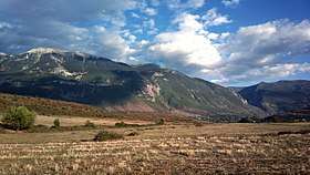
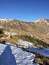
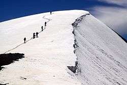
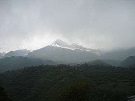
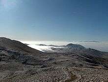
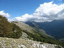
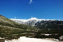
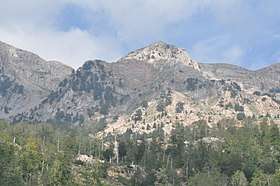
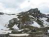
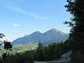
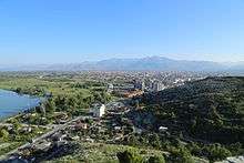
With an average elevation of 708 metres (2,323 ft) above sea level, Albania is one of the most mountainous countries in the world.[1] It has a mountainous terrain that covers more than 70% of its total territory. There are many peaks reaching heights of more than 2,000 metres (6,600 ft).

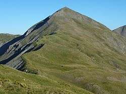
Albania can be divided into four main regions: Northern Range, Central Range, Southern Range and Western Lowlands. The most notable topographical features are the Ceraunian Mountains, Dinaric Alps, Korab Mountains, Pindus Mountains and the Skanderbeg Mountains.[2] The highest peak is Korab standing at 2,764 metres (9,068 ft) elevation above sea level on the border with the Republic of Macedonia. It is one of only two summits in Europe, which is the highest peak for more than one country.[3] It is also the 18th most prominent mountain peak in Europe.[4]

List of mountains in Albania

Image Name Height Location
Korab2,764 metres (9,068 ft)41°47′28″N 23°32′52″E / 41.79111°N 23.54778°E / 41.79111; 23.54778
Jezerca2,649 metres (8,691 ft)42°26′30″N 19°48′45″E / 42.44167°N 19.81250°E / 42.44167; 19.81250
Gryka e Hapët2,625 metres (8,612 ft)42°24′31.32″N 19°54′16.56″E / 42.4087000°N 19.9046000°E / 42.4087000; 19.9046000
Radohima2,568 metres (8,425 ft)42°25′38″N 19°43′33″E / 42.42722°N 19.72583°E / 42.42722; 19.72583
Maja e Kollatës2,556 metres (8,386 ft)42°29′1″N 19°54′34″E / 42.48361°N 19.90944°E / 42.48361; 19.90944
Kollata e Keqe2,534 metres (8,314 ft)42°29′6″N 19°53′50″E / 42.48500°N 19.89722°E / 42.48500; 19.89722
Maja Rosit2,524 metres (8,281 ft)42°28′46″N 19°51′2″E / 42.47944°N 19.85056°E / 42.47944; 19.85056
Gramos2,520 metres (8,270 ft)40°20′0″N 20°45′0″E / 40.33333°N 20.75000°E / 40.33333; 20.75000
Gjallica2,485 metres (8,153 ft)42°0′42″N 20°28′11″E / 42.01167°N 20.46972°E / 42.01167; 20.46972
Nemërçkë2,485 metres (8,153 ft)40°7′27″N 20°25′57″E / 40.12417°N 20.43250°E / 40.12417; 20.43250
Tomorr2,415 metres (7,923 ft)40°42′0″N 20°8′0″E / 40.70000°N 20.13333°E / 40.70000; 20.13333
Shkëlzen2,407 metres (7,897 ft)42°27′25″N 20°7′41″E / 42.45694°N 20.12806°E / 42.45694; 20.12806
Maja e Thatë2,406 metres (7,894 ft)42°28′6″N 19°52′8″E / 42.46833°N 19.86889°E / 42.46833; 19.86889
Bogiçaj2,404 metres (7,887 ft)42°33′2″N 20°5′18″E / 42.55056°N 20.08833°E / 42.55056; 20.08833
Koritnik2,393 metres (7,851 ft)42°5′0″N 20°34′0″E / 42.08333°N 20.56667°E / 42.08333; 20.56667
Ostrovicë2,383 metres (7,818 ft)40°34′48″N 20°27′0″E / 40.58000°N 20.45000°E / 40.58000; 20.45000
Deshat2,383 metres (7,818 ft)41°37′48″N 20°32′24″E / 41.63000°N 20.54000°E / 41.63000; 20.54000
Valamara2,373 metres (7,785 ft)40°47′38″N 20°27′55″E / 40.79389°N 20.46528°E / 40.79389; 20.46528
Tromedja2,366 metres (7,762 ft)42°33′21″N 20°4′44″E / 42.55583°N 20.07889°E / 42.55583; 20.07889
Mali i Gramës2,345 metres (7,694 ft)41°43′52″N 20°29′36″E / 41.73111°N 20.49333°E / 41.73111; 20.49333
Mali i Thatë2,287 metres (7,503 ft)40°53′0″N 20°50′0″E / 40.88333°N 20.83333°E / 40.88333; 20.83333
Shebenik2,261 metres (7,418 ft)41°13′1″N 20°27′46″E / 41.21694°N 20.46278°E / 41.21694; 20.46278
Jabllanica2,257 metres (7,405 ft)41°17′7.78″N 20°31′43.72″E / 41.2854944°N 20.5288111°E / 41.2854944; 20.5288111
Dejë2,245 metres (7,365 ft)41°42′13″N 20°9′32″E / 41.70361°N 20.15889°E / 41.70361; 20.15889
Arapi2,217 metres (7,274 ft)42°26′45″N 19°45′21″E / 42.44583°N 19.75583°E / 42.44583; 19.75583
Kallabaku2,174 metres (7,133 ft)41°54′58″N 20°33′58″E / 41.91611°N 20.56611°E / 41.91611; 20.56611
Lunxhëria2,155 metres (7,070 ft)40°8′22″N 20°14′34″E / 40.13944°N 20.24278°E / 40.13944; 20.24278
Kunora e Lurës2,119 metres (6,952 ft)41°47′3″N 20°10′54″E / 41.78417°N 20.18167°E / 41.78417; 20.18167
Miceku2,099 metres (6,886 ft)41°34′9″N 20°11′16″E / 41.56917°N 20.18778°E / 41.56917; 20.18778
Dhëmbel2,080 metres (6,820 ft)40°11′35.52″N 20°18′51.12″E / 40.1932000°N 20.3142000°E / 40.1932000; 20.3142000
Çika2,045 metres (6,709 ft)40°12′0″N 19°37′0″E / 40.20000°N 19.61667°E / 40.20000; 19.61667
Mali i Lopës2,020 metres (6,630 ft)41°27′57″N 20°14′27″E / 41.46583°N 20.24083°E / 41.46583; 20.24083
Munella1,991 metres (6,532 ft)42°12′38″N 20°31′24″E / 42.21056°N 20.52333°E / 42.21056; 20.52333
Pashtrik1,986 metres (6,516 ft)42°12′38″N 20°31′24″E / 42.21056°N 20.52333°E / 42.21056; 20.52333
Dajti1,613 metres (5,292 ft)41°21′57″N 19°55′32″E / 41.36583°N 19.92556°E / 41.36583; 19.92556
Maranaj1,567 metres (5,141 ft)42°11′30″N 19°35′50″E / 42.19167°N 19.59722°E / 42.19167; 19.59722
Shpirag1,197 metres (3,927 ft)40°40′3″N 19°51′57″E / 40.66750°N 19.86583°E / 40.66750; 19.86583

See also

References

  1. "The genus Pinguicula (Lentibulariaceae) in Albania – a critical review" (PDF). academia.edu. p. 15.
  2. "Albania mountains | peakery". peakery.com. Retrieved 2018-04-02.
  3. "The King of the Mountains" (PDF). dmwcorg.tk. p. 24. At 2764 meters Korab peak is one of only two summits in Europe which are the highest point for more than one country.
  4. "EUROPE ULTRA-PROMINENCES 99 Peaks with Prominence of 1,500 meters or greater". peaklist.org.
This article is issued from Wikipedia. The text is licensed under Creative Commons - Attribution - Sharealike. Additional terms may apply for the media files.