Koritnik
| Koritnik | |
|---|---|
 Mount Koritnik on the left from Pashtrik | |
| Highest point | |
| Elevation | 2,396 m (7,861 ft) [1] |
| Listing | Ultra |
| Coordinates | 42°5′0″N 20°34′0″E / 42.08333°N 20.56667°ECoordinates: 42°5′0″N 20°34′0″E / 42.08333°N 20.56667°E |
| Geography | |
| Location | Kukës, Albania |
| Parent range | Korab Mountains[2] |
| Geology | |
| Age of rock | Triassic[3] |
| Mountain type | Limestone |
Koritnik (Albanian: Maja e Koritnikut) is a wooded, limestone mountain, located in northeastern Albania and southwest Kosovo between the cities of Kukës and Prizren.[4] The mountain is entirely surrounded by branches of the White Drin river. The highest point of Koritnik massif, Maja e Pikëllimës reaches an elevation of 2,393 metres (7,851 ft) above the Adriatic. Gryka e Vanavës (English: Vanave Gorge) separates the mountain from Gjallica. The gorge has a length of 3.5 km (2.2 mi) and a width of 30 m (0.019 mi), and a deepth of about 300 m (0.19 mi).[5]
The massif falls within the Balkan mixed forests terrestrial ecoregion of the Palearctic Temperate broadleaf and mixed forest. The slopes of the mountain meadows are mostly covered with coniferous forests. The Koritnik mountain because of its high pastures contains a population of 60 chamois.
Koritnik falls within the Korab-Koritnik Nature Park, forming the European Green Belt. It has been recognised as a Important Plant Areas of international importance by Plantlife.[6]
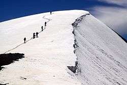 Snow on the peak |
 View from the mountain |
 Forests of Koritnik |
See also
| Wikimedia Commons has media related to Koritnik. |
References
- ↑ "TREGUES SIPAS QARQEVE INDICATORS BY PREFECTURES" (PDF). Archived from the original (PDF) on 2011-07-24. Retrieved 2011-01-12.
- ↑ "STRATEGJIA TERRITORIALE E NJËSISË VENDORE KUKËS" (PDF). kukesi.gov.al. p. 14.
- ↑ Kosovo: Sehenswürdigkeiten und Schönheiten (Dr. Dragan Ćukić ed.). Uros Maksimovic. pp. 11–12.
- ↑ Quaternary Glaciations - Extent and Chronology: Part I: Europe. Elsevier. p. 383. ISBN 9780080540146.
- ↑ "Kanioni i Vanave". akzm.gov.al (in Albanian).
- ↑ IUCN, World Wide Fund for Nature, Plantlife. "Important Plant Areas of the south and east Mediterranean region" (PDF). portals.iucn.org. p. 75.