List of crossings of the River Thames
This is a list of crossings of the River Thames comprising over 200 bridges, 27 tunnels, six public ferries, one cable car link, and one ford. Historic achievements, explanatory notes and proposed crossings are also included.
Barrier and boundary
Until sufficient crossings were established, the river provided a formidable barrier for most of its course – in post-Roman Britain during the Dark Ages Belgic-Celtic tribal lands and Anglo-Saxon kingdoms and subdivisions were defined by which side of the river they were on. When English counties were established, the river formed a boundary between the counties on either side. After rising in Gloucestershire, the river flows between, on the north bank, the historic counties of Oxfordshire, Buckinghamshire, Middlesex and Essex; and on the south bank, the counties of Wiltshire, Berkshire, Surrey, and Kent. However the many permanent crossings that have been built over the centuries have changed the dynamics and made cross-river development and shared responsibilities more practicable.
In 1911 Caversham, on the north bank, was transferred into Berkshire. In 1965, with the creation of Greater London, the London Borough of Richmond upon Thames united areas formerly in Middlesex and Surrey; and at the same time two urban districts in Middlesex (united in 1974) became part of Surrey. Further changes in 1974 moved some of the boundaries away from the river. For example, much of the north west of Berkshire including Wallingford, Abingdon and Wantage became part of Oxfordshire, and some southern parts of Buckinghamshire became part of Berkshire, including Slough, Eton and Wraysbury. The number of county councils has dwindled (as well as their area) in south-east and central southern England in favour of increased localisation.[1] Despite these changes, in the sports of rowing and skiffing the river banks are still referred to by their traditional county names, and in sports such as football and cricket historic county areas are sometimes used.[2]
History of crossings
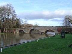
Many of the present road bridges over the river are on the sites of earlier fords, ferries and wooden structures. The earliest known major crossings of the Thames by the Romans were at London Bridge and Staines Bridge. At Folly Bridge in Oxford the remains of an original Saxon structure can be seen, and medieval stone structures such as Wallingford Bridge, Newbridge and Abingdon Bridge are still in use. Kingston's growth is believed to stem from its having the only crossing between London Bridge and Staines until the beginning of the 18th century. Proposals to build bridges across the Thames at Lambeth and Putney in around 1670 were defeated by the Rulers of the Company of Watermen, since it would mean ruin for the 60,000 rivermen who provided ferry services and also provided a pool of naval reserve.[3]
_by_Claes_Van_Visscher.jpg)
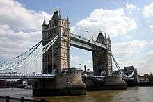
During the 18th century many stone and brick road bridges were built from new or to replace existing structures in London and further up the river. These included Westminster Bridge, Putney Bridge, Datchet Bridge, Windsor Bridge and Sonning Bridge. Several central London road bridges were built in the 19th century, most conspicuously Tower Bridge, the only bascule bridge on the river, designed to allow ocean-going ships to pass beneath it. The most recent road bridge sites are the bypasses at Isis Bridge and Marlow By-pass Bridge and the motorway bridges, most notably the two on the M25: Queen Elizabeth Bridge and M25 Runnymede Bridge.
The development of the railway resulted in a spate of bridge building in the 19th century, including Blackfriars Railway Bridge and Charing Cross (Hungerford) Railway Bridge in central London, and the spectacular railway bridges by Isambard Kingdom Brunel at Maidenhead, Gatehampton and Moulsford.
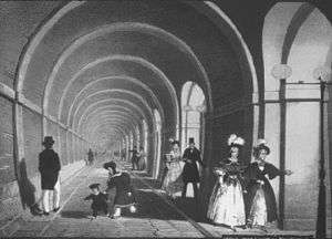
The world's first underwater tunnel was the Thames Tunnel by Marc Brunel built in 1843 and used to carry the East London Line. The Tower Subway was the first railway under the Thames, which was followed by all the deep-level tube lines. Two road tunnels were built in East London at the end of the 19th century, the Blackwall Tunnel and the Rotherhithe Tunnel; and the latest tunnel is the Dartford Crossing.
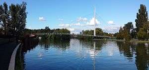
Many foot crossings were established across the weirs that were built on the non-tidal river, and some of these remained when the locks were built – for example at Benson Lock. Others were replaced by a footbridge when the weir was removed, as at Hart's Weir Footbridge. Around the year 2000, several footbridges were added, either as part of the Thames Path or in commemoration of the Millennium. These include Temple Footbridge, Bloomers Hole Footbridge, the Hungerford Footbridges and the Millennium Bridge, all of which have distinctive designs.
Some ferries still operate on the river. The Woolwich Ferry carries cars and passengers across the river in the Thames Gateway and links the North Circular and South Circular roads. Upstream are smaller pedestrian ferries, for example Hampton Ferry and Shepperton to Weybridge Ferry; the latter is the only non-permanent crossing that remains on the Thames Path.
Note on the listing
The list starts at the downstream (estuary) end and follows the river upstream towards the source. A few of the crossings listed are public pedestrian crossings using walkways across lock gates and bridges above or adjacent to the adjoining weirs. Most of the other locks on the River Thames also have walkways across their lock gates and weirs, but these either do not completely cross the river, or are restricted to authorised personnel only, and are therefore not listed. Crossings listed in italics are inaccessible to the public. Besides the ferry crossings listed, there are commuter boat services operating along the river in London, and tourist boat services operating both in London and upstream. Whilst the principal purpose of these services is not to carry people across the river, it may be possible to use them to do so.
North Sea to London
| Crossing | Type | Co-ordinates | Date opened | Notes |
|---|---|---|---|---|
| Gravesend–Tilbury Ferry | Passenger ferry | 51°26′55″N 0°22′3″E / 51.44861°N 0.36750°E | 1571 or before[4] | |
| High Speed 1 tunnels | Rail tunnel | 51°27′46″N 0°17′37″E / 51.46278°N 0.29361°E | 2007 | Two 2.5 km tunnels, 7.15 m internal diameter, between West Thurrock (Essex) and Swanscombe (Kent) |
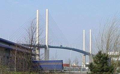
| Queen Elizabeth II Bridge | Road bridge | 51°27′52″N 0°15′31″E / 51.46444°N 0.25861°E | 1991 | Cable-stayed bridge - the southbound element of the Dartford Crossing |
| Dartford Tunnels | Road tunnels | 51°27′55″N 0°15′27″E / 51.46528°N 0.25750°E | 1963 and 1980 | The northbound element of the Dartford Crossing |
| Dartford Cable Tunnel | Utility tunnel | 51°28′5″N 0°14′58″E / 51.46806°N 0.24944°E | 2005 | Carrying electrical cable; accessible by authorised personnel only |
Proposed
A Lower Thames Crossing is proposed, at or east of the Dartford Crossing. Three options were announced in April 2009.
East London
| Crossing | Type | Co-ordinates | Date opened | Notes |
|---|---|---|---|---|
| Docklands Light Railway tunnel | Rail tunnel | 51°29′55″N 0°4′31″E / 51.49861°N 0.07528°E | 2009 | Between King George V and Woolwich Arsenal stations |
| Woolwich foot tunnel | Pedestrian tunnel | 51°29′47″N 0°3′45″E / 51.49639°N 0.06250°E | 1912 | |
| Woolwich Ferry | Vehicle ferry | 51°29′47″N 0°3′44″E / 51.49639°N 0.06222°E | 1889 | |
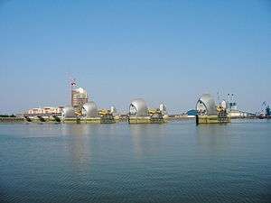
| Thames Barrier | Flood barrier with pedestrian tunnel | 51°29′49″N 0°2′14″E / 51.49694°N 0.03722°E | 1984 | Service tunnel accessible by authorised personnel only |
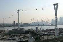
| Emirates Air Line | Gondola lift | 51°30′05″N 0°0′45″E / 51.50139°N 0.01250°E | 2012 | |
| Millennium Dome electricity cable tunnel | Utility tunnel | 1999[5] | Accessible by authorised personnel only | |
| Jubilee line tunnels | Rail tunnel | 51°30′17″N 0°0′31″E / 51.50472°N 0.00861°E | 1999 | Between North Greenwich and Canning Town stations. |
| Blackwall Tunnel (eastern) | Road tunnel | 51°30′19″N 0°0′7″W / 51.50528°N 0.00194°W | 1967 | For southbound vehicular traffic only |
| Blackwall Tunnel (western) | Road tunnel | 51°30′13″N 0°0′14″W / 51.50361°N 0.00389°W | 1897 | For northbound vehicular traffic only |
| Jubilee line tunnels | Rail tunnel | 51°30′1″N 0°0′19″W / 51.50028°N 0.00528°W | 1999 | Between Canary Wharf and North Greenwich stations. |
| Greenwich foot tunnel | Pedestrian tunnel | 51°29′6″N 0°0′35″W / 51.48500°N 0.00972°W | 1902 | |
| Docklands Light Railway tunnel | Rail tunnel | 51°29′5″N 0°0′37″W / 51.48472°N 0.01028°W | 1999 | Between Island Gardens and Cutty Sark stations. |
| Jubilee line tunnels | Rail tunnel | 51°30′2″N 0°1′48″W / 51.50056°N 0.03000°W | 1999 | Between Canada Water and Canary Wharf stations. |
| Canary Wharf – Rotherhithe Ferry | Passenger ferry | 51°30′19″N 0°1′47″W / 51.50528°N 0.02972°W | ||
| Rotherhithe Tunnel | Road tunnel | 51°30′23″N 0°2′55″W / 51.50639°N 0.04861°W | 1908 | Single carriageway in each direction, with footways on each side. Built originally for horse-drawn carriages. Pedestrians, riders, cyclists are permitted, but advised to use alternatives due to fumes and speed. |
| Thames Tunnel | Rail tunnel | 51°30′11″N 0°3′16″W / 51.50306°N 0.05444°W | 1843 | The world's first underwater tunnel, linking Wapping to Rotherhithe. Originally designed as a road tunnel for horse-drawn traffic, the necessary access ramps were never built and it was opened as a pedestrian tunnel. It was converted to a rail tunnel, reopening in 1869 and becoming part of the London Overground network in 2010. |
Proposed or under construction
- A new rail tunnel is being constructed between Plumstead and North Woolwich as part of Crossrail 1.[6]
- The Silvertown Tunnel is a proposed tunnel to relieve the Blackwall Tunnels between the Greenwich Peninsula and West Silvertown.
- The Gallions Reach Crossing is a proposed tunnel or bridge, between Beckton and Thamesmead.[7]
- The Belvedere Crossing is a proposed tunnel or bridge, between Belvedere and Rainham.[7]
- A pedestrian and cycle bridge between Rotherhithe and Canary Wharf has been proposed.
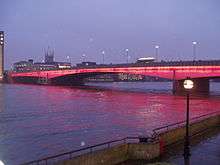
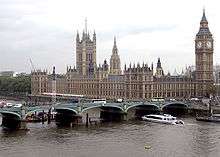
Central London
Former
- At least two Emergency Thames Bridges were erected as a precaution against enemy action during World War II. The first of these bridges was built from Victoria Embankment to County Hall, London and was constructed in 1942 [8] before being demolished in 1948.[9] The second such bridge was constructed at Millbank outside the Tate Britain in 1942 [10] before also being dismantled in 1948.[11]
Planned
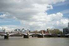
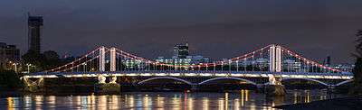
South West London


Planned
- Diamond Jubilee Footbridge, a pedestrian bridge adjacent to Battersea Railway Bridge, granted planning permission in 2013.
London to Windsor


Former
- The Datchet Bridge, built in 1707, was demolished in 1848, and replaced by the Albert and Victoria bridges.
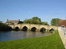
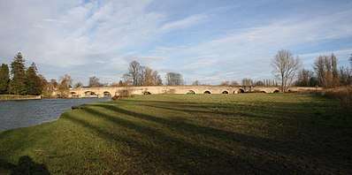
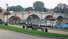
Windsor to Reading


Reading to Oxford

Oxford to Cricklade

Cricklade to the source
Not all of the bridges above Cricklade are listed below. For example, there are a number of small agricultural bridges allowing access between fields, and bridges to properties in Ashton Keynes that are not mentioned.
The river splits as it passes through Ashton Keynes. An alternative route to that listed above crosses High Bridge at 51°38′13″N 1°55′46″W / 51.63694°N 1.92944°W and Three Bridges at 51°38′18″N 1°56′21″W / 51.63833°N 1.93917°W.
See also
| Wikimedia Commons has media related to Crossings of the River Thames. |
References
- ↑ For example Berkshire County Council and Middlesex County Council were abolished and smaller authorities have been created in the counties adjoining the Thames, from the Borough of Swindon unitary authority to Medway Council on the Thames Estuary.
- ↑ e.g. Buckinghamshire County Cricket Club, Middlesex County Football Association and Middlesex County Cricket Club
- ↑ "Parishes: Putney - British History Online". www.british-history.ac.uk.
- ↑ Map drawn by a one-time Portreve (Mayor) of Gravesend, William Bourne, and included in The Book of Gravesham Sydney Harker, 1979 ISBN 0 86023 091 0]
- ↑ Field, Gary (January 2000). "Monitoring settlement in London Clay". Converting Today. Archived from the original on 2012-07-29. Retrieved 22 April 2012.
- ↑ "Hochtief and Vinci win last Crossrail tunnels". The Construction Index. Retrieved 22 April 2012.
- 1 2 "Gallions Reach and Belvedere river crossings - Consultation report and responses to key issues raised" (PDF). Transport for London. March 2016.
- ↑ "Emergency Thames Bridge: Victoria Embankment to County Hall, construction work in progress". City of London Corporation. Archived from the original on 6 November 2015. Retrieved 28 March 2013.
- ↑ "Emergency Thames Bridge: Victoria Embankment to County Hall, demolition work in progress". City of London Corporation. Archived from the original on 6 November 2015. Retrieved 28 March 2013.
- ↑ "Emergency Thames Bridge: Millbank site, construction work in progress". City of London Corporation. Archived from the original on 6 November 2015. Retrieved 28 March 2013.
- ↑ "Emergency Thames Bridge: Millbank site, structure is dismantled". City of London Corporation. Archived from the original on 6 November 2015. Retrieved 28 March 2013.
- ↑ "London bridge designs unveiled". 21 July 2015 – via www.bbc.co.uk.
- ↑ Thacker, Fred. S. (1920). "The Thames Highway". 2, Locks and Weirs: 77
Further reading
- Tucker, Joan (2012). Ferries of the Upper Thames. Amberley Publishing. ISBN 9781848689671