Licuan-Baay, Abra
| Licuan-Baay | |
|---|---|
| Municipality | |
| Municipality of Licuan-Baay | |
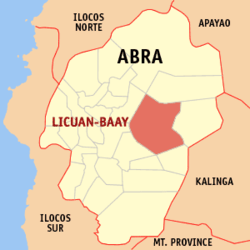 Map of Abra with Licuan-Baay highlighted | |
.svg.png) Licuan-Baay Location within the Philippines | |
| Coordinates: 17°37′N 120°53′E / 17.61°N 120.89°ECoordinates: 17°37′N 120°53′E / 17.61°N 120.89°E | |
| Country |
|
| Region | Cordillera Administrative Region (CAR) |
| Province | Abra |
| District | Lone District |
| Barangays | 11 (see Barangays) |
| Government [1] | |
| • Type | Sangguniang Bayan |
| • Mayor | Alejo S. Domingo |
| • Electorate | 4,194 voters (2016) |
| Area [2] | |
| • Total | 256.42 km2 (99.00 sq mi) |
| Population (2015 census)[3] | |
| • Total | 4,689 |
| • Density | 18/km2 (47/sq mi) |
| Time zone | UTC+8 (PST) |
| ZIP code | 2819 |
| PSGC | 140113000 |
| IDD : area code | +63 (0)74 |
| Climate type | Tropical rainforest climate |
| Income class | 5th municipal income class |
| Revenue (₱) | 71,223,168.75 (2016) |
| Native languages |
Itneg language Ilocano Tagalog |
Licuan-Baay, officially the Municipality of Licuan-Baay, (Ilokano: Ili ti Licuan-Baay; Tagalog: Bayan ng Licuan-Baay), is a 5th class municipality in the province of Abra, Philippines. According to the 2015 census, it has a population of 4,689 people.[3]
Geography
Licuan-Baay is located at 17°37′N 120°53′E / 17.61°N 120.89°E.
According to the Philippine Statistics Authority, the municipality has a land area of 256.42 square kilometres (99.00 sq mi) [2] constituting 6.16% of the 4,165.25-square-kilometre- (1,608.21 sq mi) total area of Abra.
Barangays
Licuan-Baay is politically subdivided into 11 barangays.[4]
| PSGC | Barangay | Population | ±% p.a. | |||
|---|---|---|---|---|---|---|
| 2015[3] | 2010[5] | |||||
| 140113001 | Bonglo (Patagui) | 6.8% | 319 | 261 | 3.89% | |
| 140113002 | Bulbulala | 8.0% | 374 | 363 | 0.57% | |
| 140113003 | Cawayan | 9.4% | 443 | 483 | −1.63% | |
| 140113004 | Domenglay | 9.4% | 441 | 417 | 1.07% | |
| 140113005 | Lenneng | 8.4% | 395 | 359 | 1.84% | |
| 140113006 | Mapisla | 8.5% | 398 | 518 | −4.89% | |
| 140113007 | Mogao | 6.0% | 281 | 349 | −4.04% | |
| 140113008 | Nalbuan | 16.6% | 778 | 852 | −1.72% | |
| 140113009 | Poblacion | 9.3% | 434 | 379 | 2.61% | |
| 140113010 | Subagan | 10.9% | 510 | 525 | −0.55% | |
| 140113011 | Tumalip | 6.7% | 316 | 358 | −2.35% | |
| Total | 4,689 | 4,864 | −0.70% | |||
Demographics
| Population census of Licuan‑Baay | ||
|---|---|---|
| Year | Pop. | ±% p.a. |
| 1939 | 1,379 | — |
| 1948 | 1,477 | +0.77% |
| 1960 | 2,066 | +2.84% |
| 1970 | 2,821 | +3.16% |
| 1975 | 3,144 | +2.20% |
| 1980 | 3,094 | −0.32% |
| 1990 | 3,697 | +1.80% |
| 1995 | 3,866 | +0.84% |
| 2000 | 3,812 | −0.30% |
| 2007 | 3,990 | +0.63% |
| 2010 | 4,864 | +7.47% |
| 2015 | 4,689 | −0.70% |
| Source: Philippine Statistics Authority[3][5][6][7] | ||
In the 2015 census, Licuan‑Baay had a population of 4,689.[3] The population density was 18 inhabitants per square kilometre (47/sq mi).
References
- ↑ "Municipality". Quezon City, Philippines: Department of the Interior and Local Government. Retrieved 31 May 2013.
- 1 2 "Province: Abra". PSGC Interactive. Quezon City, Philippines: Philippine Statistics Authority. Retrieved 12 November 2016.
- 1 2 3 4 5 Census of Population (2015). "Cordillera Administrative Region (CAR)". Total Population by Province, City, Municipality and Barangay. PSA. Retrieved 20 June 2016.
- ↑ "Municipal: Licuan-Baay, Abra". PSGC Interactive. Quezon City, Philippines: Philippine Statistics Authority. Retrieved 8 January 2016.
- 1 2 Census of Population and Housing (2010). "Cordillera Administrative Region (CAR)". Total Population by Province, City, Municipality and Barangay. NSO. Retrieved 29 June 2016.
- ↑ Censuses of Population (1903–2007). "Cordillera Administrative Region (CAR)". Table 1. Population Enumerated in Various Censuses by Province/Highly Urbanized City: 1903 to 2007. NSO.
- ↑ "Province of Abra". Municipality Population Data. Local Water Utilities Administration Research Division. Retrieved 17 December 2016.
External links
| Wikimedia Commons has media related to Licuan-Baay, Abra. |
Places adjacent to Licuan-Baay, Abra | ||||||||||
|---|---|---|---|---|---|---|---|---|---|---|
| ||||||||||
Bangued (capital) | |
| Municipalities | |
| Barangays | |
This article is issued from
Wikipedia.
The text is licensed under Creative Commons - Attribution - Sharealike.
Additional terms may apply for the media files.