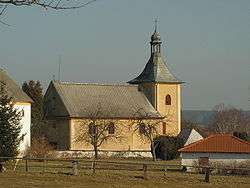
Leština u Světlé
| Leština u Světlé | |
|---|---|
| Municipality | |
 | |
 Leština u Světlé | |
| Coordinates: 49°45′57″N 15°23′45″E / 49.76583°N 15.39583°ECoordinates: 49°45′57″N 15°23′45″E / 49.76583°N 15.39583°E | |
| Country |
|
| Region | Vysočina |
| District | Havlíčkův Brod |
| Area | |
| • Total | 18.2 km2 (7.0 sq mi) |
| Elevation | 455 m (1,493 ft) |
| Population (1.1.2014) | |
| • Total | 599 |
| • Density | 33/km2 (85/sq mi) |
| Postal code | 582 86 |
| Website | http://mesta.obce.cz/vyhledat.asp?id_org=8054 |
Leština u Světlé is a village and municipality (obec) in Havlíčkův Brod District in the Vysočina Region of the Czech Republic.
The municipality covers an area of 18.2 square kilometres (7.0 sq mi), and has a population of 636.
Leština u Světlé lies approximately 23 kilometres (14 mi) north-west of Havlíčkův Brod, 44 km (27 mi) north of Jihlava, and 79 km (49 mi) south-east of Prague.
References
| Wikimedia Commons has media related to Leština u Světlé. |
This article is issued from
Wikipedia.
The text is licensed under Creative Commons - Attribution - Sharealike.
Additional terms may apply for the media files.