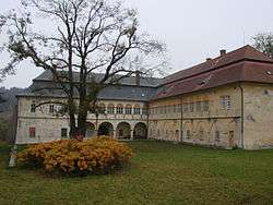
Ždírec nad Doubravou
| Ždírec nad Doubravou | |||
|---|---|---|---|
| Town | |||
 | |||
| |||
 Ždírec nad Doubravou | |||
| Coordinates: 49°41′46″N 15°48′42″E / 49.69611°N 15.81167°ECoordinates: 49°41′46″N 15°48′42″E / 49.69611°N 15.81167°E | |||
| Country |
| ||
| Region | Vysočina | ||
| District | Havlíčkův Brod | ||
| Area | |||
| • Total | 26.74 km2 (10.32 sq mi) | ||
| Elevation | 545 m (1,788 ft) | ||
| Population (1.1.2014) | |||
| • Total | 3,174 | ||
| • Density | 120/km2 (310/sq mi) | ||
| Postal code | 58263 | ||
| Website | http://www.zdirec.cz | ||


Ždírec nad Doubravou is a town in Havlíčkův Brod District in the Vysočina Region of the Czech Republic.
The town covers an area of 26.74 square kilometres (10.32 sq mi), and has a population of 3,100 (as at 1 August 2009).
Ždírec nad Doubravou lies approximately 20 kilometres (12 mi) north-east of Havlíčkův Brod, 37 km (23 mi) north-east of Jihlava, and 109 km (68 mi) south-east of Prague.
References
| Wikimedia Commons has media related to Ždírec nad Doubravou. |
This article is issued from
Wikipedia.
The text is licensed under Creative Commons - Attribution - Sharealike.
Additional terms may apply for the media files.