Druhanov
| Druhanov | |||
|---|---|---|---|
| Municipality | |||
 | |||
| |||
 Druhanov | |||
| Coordinates: 49°41′53″N 15°24′38″E / 49.69806°N 15.41056°ECoordinates: 49°41′53″N 15°24′38″E / 49.69806°N 15.41056°E | |||
| Country |
| ||
| Region | Vysočina | ||
| District | Havlíčkův Brod | ||
| Area | |||
| • Total | 3.91 km2 (1.51 sq mi) | ||
| Elevation | 496 m (1,627 ft) | ||
| Population (1.1.2014) | |||
| • Total | 161 | ||
| • Density | 41/km2 (110/sq mi) | ||
| Postal code | 582 91 | ||
| Website | http://www.sweb.cz/druhanov/ | ||

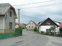
Druhanov is a village and municipality (obec) in Havlíčkův Brod District in the Vysočina Region of the Czech Republic.
The municipality covers an area of 3.91 square kilometres (1.51 sq mi), and has a population of 156 (as at 3 July 2006).
Druhanov lies approximately 16 kilometres (10 mi) north-west of Havlíčkův Brod, 36 km (22 mi) north of Jihlava, and 84 km (52 mi) south-east of Prague.
References
| Wikimedia Commons has media related to Druhanov. |
This article is issued from
Wikipedia.
The text is licensed under Creative Commons - Attribution - Sharealike.
Additional terms may apply for the media files.