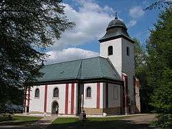
Horní Paseka
| Horní Paseka | |
|---|---|
| Municipality | |
 | |
 Horní Paseka | |
| Coordinates: 49°37′34″N 15°15′58″E / 49.62611°N 15.26611°ECoordinates: 49°37′34″N 15°15′58″E / 49.62611°N 15.26611°E | |
| Country |
|
| Region | Vysočina |
| District | Havlíčkův Brod |
| Area | |
| • Total | 9.34 km2 (3.61 sq mi) |
| Elevation | 596 m (1,955 ft) |
| Population (1.1.2014) | |
| • Total | 68 |
| • Density | 7.3/km2 (19/sq mi) |
| Postal code | 584 01 |
| Website | http://www.sweb.cz/hornipaseka |
Horní Paseka is a village and municipality (obec) in Havlíčkův Brod District in the Vysočina Region of the Czech Republic.
The municipality covers an area of 9.34 square kilometres (3.61 sq mi), and has a population of 68 (as at 28 August 2006).
Horní Paseka lies approximately 23 kilometres (14 mi) west of Havlíčkův Brod, 35 km (22 mi) north-west of Jihlava, and 80 km (50 mi) south-east of Prague.
References
| Wikimedia Commons has media related to Horní Paseka. |
This article is issued from
Wikipedia.
The text is licensed under Creative Commons - Attribution - Sharealike.
Additional terms may apply for the media files.