Kuzumaki, Iwate
| Kuzumaki 葛巻町 | |||
|---|---|---|---|
| Town | |||
 Kuzumaki Town Hall | |||
| |||
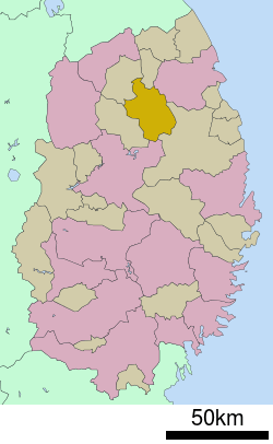 Location of Kuzumaki in Iwate Prefecture | |||
 Kuzumaki Location of Kuzumaki in Iwate Prefecture | |||
| Coordinates: 40°02′23.4″N 141°26′11.4″E / 40.039833°N 141.436500°ECoordinates: 40°02′23.4″N 141°26′11.4″E / 40.039833°N 141.436500°E | |||
| Country | Japan | ||
| Region | Tōhoku | ||
| Prefecture | Iwate | ||
| District | Iwate | ||
| Area | |||
| • Total | 434.99 km2 (167.95 sq mi) | ||
| Population (October 2016) | |||
| • Total | 6,149 | ||
| • Density | 14.1/km2 (37/sq mi) | ||
| Time zone | UTC+9 (Japan Standard Time) | ||
| City symbols | |||
| • Tree | Silver birch | ||
| • Flower | Hagi | ||
| • Bird | Copper pheasant | ||
| Phone number | 0195-66-2111 | ||
| Address | Kuzumaki dai-16 jiwari 1-1, Kuzumaki-machi, Iwate-gun, Iwate-ken 028-5494 | ||
| Website | http://www.town.kuzumaki.iwate.jp/ | ||


Kuzumaki (葛巻町 Kuzumaki-machi) is a town located in Iwate Prefecture, Japan. As of 1 October 2016, the town had an estimated population of 6,149, and a population density of 14.1 persons per km2. The total area of the town is 434.96 square kilometres (167.94 sq mi). The town uses many alternative energy sources, producing a surplus of energy, including wind power and biomass.[1]
Geography
Kuzumaki is located in a basin in north-central Iwate Prefecture with an average elevation of 400 meters, surrounded by the 1000 meter mountains of the Kitakami Mountains. Approximately 60% of the town area is mountains and forests.[2] The Mabechi River flows through the town.
Neighboring municipalities
Climate
Kuzumaki has a humid continental climate (Köppen climate classification Dfb) characterized by mild summers and cold winters. The average annual temperature in Kuzumaki is 7.0 °C. The average annual rainfall is 1434 mm with September as the wettest month and February as the driest month. The temperatures are highest on average in August, at around 20.2 °C, and lowest in January, at around -5.1 °C.[3]
Demographics
Per Japanese census data,[4] the population of Kuzumaki has declined over the past 40 years, and is now only half of what it was in 1970.
| Census Year | Population |
|---|---|
| 1970 | 14,135 |
| 1980 | 11,972 |
| 1990 | 10,364 |
| 2000 | 8,725 |
| 2010 | 7,307 |
History
The area of present-day Kuzumaki was part of ancient Mutsu Province. It was under the control of the Nambu clan from the Muromachi period, and was part of Hachinohe Domain under the Edo period Tokugawa shogunate. The area was noted for its horse ranches.
The villages of Kuzumaki and Ekari within Kita-Kunohe District and the village of Tabe within Iwate District were created on April 1, 1889, with the establishment of the municipality system. Kita-Kunohe District and Minami-Kunohe Districts merged to form Kunohe District on April 1, 1897. Kuzumaki was raised to town status on December 25, 1940. On July 1, 1948, Kuzumaki and Isashi were transferred to Iwate District. Kuzumaki annexed neighboring Ekari and Tabe on July 15, 1955.
Economy
The local economy is based on agriculture, including dairy products and wine production.
Education
Kuzumaki has five public elementary schools and three public middle schools operated by the town government, and one public high school operated by the Iwate Prefectural Board of Education.
Transportation
Railway
- Kuzumaki is not served by any passenger railway connections.
Highway
- Japan National Route 281 – Kuzumaki-Kogen roadside station
- Japan National Route 340
References
- ↑ Masters, Coco. "A Japanese Town That Kicked the Oil Habit." Time. December 22, 2008. Retrieved on December 25, 2008.
- ↑ Kuzumaki official home page, land usage (in Japanese)
- ↑ Kuzumaki climate data
- ↑ Kuzumaki population statistics
External links
![]()
- Official Website (in Japanese)