Nishiwaga, Iwate
| Nishiwaga 西和賀町 | |||
|---|---|---|---|
| Town | |||
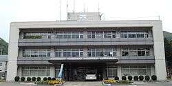 Nishiwaga Town Hall | |||
| |||
 Location of Nishiwaga in Iwate Prefecture | |||
 Nishiwaga | |||
| Coordinates: 39°26′4.5″N 140°45′0.1″E / 39.434583°N 140.750028°ECoordinates: 39°26′4.5″N 140°45′0.1″E / 39.434583°N 140.750028°E | |||
| Country | Japan | ||
| Region | Tōhoku | ||
| Prefecture | Iwate | ||
| District | Waga | ||
| Area | |||
| • Total | 590.74 km2 (228.09 sq mi) | ||
| Population (October 2016) | |||
| • Total | 5,746 | ||
| • Density | 9.73/km2 (25.2/sq mi) | ||
| Time zone | UTC+9 (Japan Standard Time) | ||
| City symbols | |||
| • Tree | Buna | ||
| • Flower | Katakuri | ||
| • Bird | Copper pheasant | ||
| Phone number | 0197-82-2111 | ||
| Address | Kawajiri 40-jiwari 40-71, Nishiwaga-machi, Waga-gun, Iwate 029-5512 | ||
| Website | http://www.town.nishiwaga.lg.jp/ | ||


Nishiwaga (西和賀町 Nishiwaga-machi) is a town in Iwate Prefecture, Japan. As of 1 October 2016, the town had an estimated population of 5,746, and a population density of 9.73 persons per km2. The total area of the town is 590.89 square kilometres (228.14 sq mi).[1] The total area was 825.97 square kilometres (318.91 sq mi).[2]
Geography
Nishiwaga is located in the far southwestern corner of Iwate Prefecture, in the river valley of the Waga River, surrounded by the 1000-meter peaks of the Ōu Mountains on three sides. The area is noted for its extremely heavy snowfall in winter. The Yuda Dam is located in Nishiwaga and the Yuda Onsenkyō Prefectural Natural Park is located completely within its borders.[3]
Neighboring municipalities
- Iwate Prefecture
- Akita Prefecture
Climate
Nishiwaga has a humid continental climate (Köppen Dfa) characterized by mild summers and cold winters with heavy snowfall. The average annual temperature in Nishiwaga is 8.9 °C. The average annual rainfall is 1561 mm with September as the wettest month and February as the driest month. The temperatures are highest on average in August, at around 21.3 °C, and lowest in January, at around -4.1 °C.[4]
Demographics
Per Japanese census data,[5] the population of Nishiwaga has declined over the past 40 years, and is now less than half of what it was in 1970.
| Census Year | Population |
|---|---|
| 1970 | 12,667 |
| 1980 | 9,989 |
| 1990 | 8,973 |
| 2000 | 7,375 |
| 2010 | 6,601 |
History
Waga District was under the control of the Nanbu clan of Morioka Domain during the Edo period. The villages of Yuda and Sawauchi were established with the Meiji period establishment of the municipalities system on April 1, 1889. Yuda was elevated to town status on August 1, 1964.
Nishiwaga was founded on November 1, 2005 from the merger of the town of Yuda and the village of Sawauchi. This merger occurred under pressure from the national government of Japan and in the face of steady but significant depopulating trends in rural Japan in general. The new town's name came as the result of a competition open to entries from all residents of the former Yuda Town and Sawauchi Village, in preparation for the merger. The final decision was made by a vote of representatives from both municipalities. The chosen name, literally "West-Waga Town," reflects the status of the new town as comprising the western portion of Waga District.
Economy
The local economy is based on agriculture and forestry, and seasonal tourism.
Education
Nishiwaga has two public elementary schools and two public junior high schools operated by the town government, and one public high school operated by the Iwate Prefectural Board of Education.
Transportation
Rail
- East Japan Railway Company (JR East) – Kitakami Line
Road
Local attractions
Nishiwaga has many natural onsen hot springs ("yukko" in the local dialect). There are several natural hot springs baths operated by the municipality, and inexpensive monthly passes are available to residents. There is also a hot spring heated sand bath ("suna-yukko") at one of the sites. Many traditional bed and breakfast inns operate in these areas, usually with their own private hot spring facilities, some of which are open to day visitors for a fee.
The area is also home to rare old-growth beech forests found in few other places in Japan.
The Waga River, a major tributary of the Kitakami River and from which the county and current town derive their names, originates high up in the folds of Waga-dake, a 1,440 metres (4,720 ft) peak along the Ou Range which forms the prefectural boundary between Iwate Prefecture (on the eastern, Nishiwaga side) and Akita Prefecture (to the west).
The mountains of Nishiwaga Town have drawn interest from local hikers and outdoors enthusiasts, as well as hikers and ecotourists from as far away as Tokyo. In the southeastern section of Nishiwaga Town the Waga River is restrained by the Yuda Dam, which creates a variable depth man-made lake called Kinshu Lake.
References
- ↑ Nishiwaga town official website
- ↑ "詳細データ 岩手県西和賀町". 市町村の姿 グラフと統計でみる農林水産業 (in Japanese). Ministry of Agriculture, Forestry and Fisheries. 2016. Retrieved 13 April 2017.
- ↑ "自然公園の指定状況" [Natural Park Specifications]. Iwate Prefecture. Archived from the original on 27 September 2013. Retrieved 22 September 2013.
- ↑ Nishiwaga climate data
- ↑ Nishiwaga population statistics
External links
| Wikimedia Commons has media related to Nishiwaga, Iwate. |
- Official Website (in Japanese)