Iwaizumi, Iwate
| Iwaizumi 岩泉町 | |||
|---|---|---|---|
| Town | |||
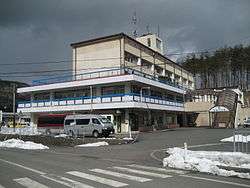 Iwaizumi Town Hall | |||
| |||
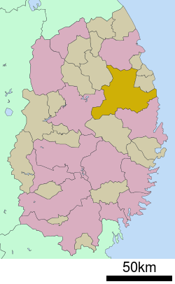 Location of Iwaizumi in Iwate Prefecture | |||
 Iwaizumi | |||
| Coordinates: 39°50′35.3″N 141°47′47″E / 39.843139°N 141.79639°ECoordinates: 39°50′35.3″N 141°47′47″E / 39.843139°N 141.79639°E | |||
| Country | Japan | ||
| Region | Tōhoku | ||
| Prefecture | Iwate | ||
| District | Shimohei | ||
| Area | |||
| • Total | 992.36 km2 (383.15 sq mi) | ||
| Population (March 31, 2017) | |||
| • Total | 9,736 | ||
| • Density | 9.81/km2 (25.4/sq mi) | ||
| Time zone | UTC+9 (Japan Standard Time) | ||
| City symbols | |||
| • Tree | Japanese red pine | ||
| • Flower | Kiri | ||
| • Bird | Copper pheasant | ||
| Phone number | 0194-22-2111 | ||
| Address | Iwaizumi-aze Sohata 59-5, Iwaizumi-chō, Shimohei-gun, Iwate 027-0595 | ||
| Website | Official Website | ||


Iwaizumi (岩泉町 Iwaizumi-chō) is a town located in Iwate Prefecture, Japan. As of 31 March 2018, the town had an estimated population of 9496, and a population density of 9.56 persons per km2 in 4463 households.[1] The total area of the town is 992.36 square kilometres (383.15 sq mi).
Geography
Iwaizumi is in the Kitakami Mountains of northeast Iwate prefecture, east of the prefectural capital of Morioka. It has a small coastline on the Pacific Ocean to the east. The area has numerous limestone caves, including the Ryūsendō.
Neighboring municipalities
Climate
Iwaizumi has a humid climate (Köppen climate classification Cfa) characterized by mild summers and cold winters with heavy snowfall. The average annual temperature in Iwaizumi is 9.5 °C. The average annual rainfall is 1283 mm with September as the wettest month and February as the driest month. The temperatures are highest on average in August, at around 22.3 °C, and lowest in January, at around −2.0 °C.[2]
Demographics
Per Japanese census data,[3] the population of Iwaizumi has declined steadily over the past 40 years, and is now less than half of what it was in the year 1970.
| Census year | Population |
|---|---|
| 1970 | 22,177 |
| 1980 | 18,267 |
| 1990 | 15,164 |
| 2000 | 12,845 |
| 2010 | 10,804 |
History
The area of present-day Iwaizumi was part of ancient Mutsu Province, dominated by the Nambu clan during the Edo period, who ruled Morioka Domain under the Tokugawa shogunate. With the Meiji period establishment of the modern municipalities system, the village of Iwaizumi was created within Kitahei District on April 1, 1889. Kitahei, Nakahei and Higashihei Districts were all merged into Minamihei District on March 29, 1896.
Iwaizumi was elevated to town status on August 1, 1922. On September 30, 1956, Imaizumi annexed the neighboring villages of Akka, Ugei, Okawa and Omoto and on April 1, 1957, annexed the village of Kogawa to reach is present borders.
In August 2016, typhoon Lionrock hit the town with strong winds and heavy rain that caused landslides and flooding. 19 people died, including 9 people who drowned in a nursing home after a river burst its banks.
Economy
The local economy is based on agriculture and to a lesser extent on commercial fishing.
Education
Iwaizumi has ten public elementary schools and five public junior high schools operated by the town government, and one public high school operated by the Iwate Prefectural Board of Education.
Transportation
Railway
The JR East Iwaizumi Line, which connected Iwaizumi with Moichi Station on the Yamada Line, officially closed on April 1, 2014.
Highway
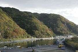
Local attractions
International relations

Noted people from Iwaizumi
- Rika Miura – actress
- Kin Endate – amateur astronomer
References
- ↑ Iwaizumi Town official home page
- ↑ Iwaizumi climate data
- ↑ Iwaizumi population statistics
- ↑ Krejci, Anna (October 22, 2010). "Dells-Iwaizumi mark 20 years of sister city relations". Wisconsin Dells Events. Retrieved July 20, 2013.
External links
![]()
- Official Website (in Japanese)