Fudai, Iwate
| Fudai 普代村 | |||
|---|---|---|---|
| Village | |||
 Fudai Village Hall | |||
| |||
 Location of Fudai in Iwate Prefecture | |||
 Fudai | |||
| Coordinates: 40°00′18.8″N 141°53′9.4″E / 40.005222°N 141.885944°ECoordinates: 40°00′18.8″N 141°53′9.4″E / 40.005222°N 141.885944°E | |||
| Country | Japan | ||
| Region | Tōhoku | ||
| Prefecture | Iwate | ||
| District | Shimohei | ||
| Area | |||
| • Total | 60.66 km2 (23.42 sq mi) | ||
| Population (February 28, 2017) | |||
| • Total | 2,814 | ||
| • Density | 46.4/km2 (120/sq mi) | ||
| Time zone | UTC+9 (Japan Standard Time) | ||
| City symbols | |||
| • Tree | Japanese pagoda tree | ||
| • Flower | Bay Lily | ||
| • Bird | Japanese cormorant | ||
| Phone number | 0194-35-2111 | ||
| Address | Dai-9 jiwari Doya 13-2, Fudai-mura, Shimohei-gun, Iwate 028-8392 | ||
| Website | http://www.vill.fudai.iwate.jp/ | ||


Fudai (普代村 Fudai-mura) is a village located in Iwate Prefecture, Japan. As of 28 February 2017, the village had an estimated population of 2,814, and a population density of 46.4 persons per km2 in 1,157 households.[1] The total area of the village is 69.66 square kilometres (26.90 sq mi).[2]
Geography
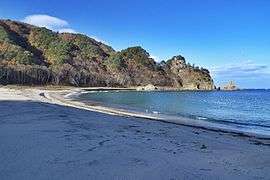
Fudai is a coastal mountainous community situated on the Sanriku Coast ria along the Pacific Ocean in northern Iwate. The southern part of the village, an area called Kurosaki (黒崎), included a part of the Rikuchu Kaigan National Park, which is now part of the Sanriku Fukkō National Park. It features an observation point to view scenic 100-metre (330 ft) seaside cliffs.[3]
Neighboring municipalities
Climate
Fudai has a cold humid climate (Köppen climate classification Cfa) characterized by mild summers and cold winters. The average annual temperature in Fudai is 10.1 °C. The average annual rainfall is 1201 mm with September as the wettest month and February as the driest month. The temperatures are highest on average in August, at around 22.6 °C, and lowest in January, at around -1.1 °C.[4]
Demographics
Per Japanese census data,[5] the population of Fudai has declined over the past 40 years. [6]
| Census Year | Population |
|---|---|
| 1970 | 4,162 |
| 1980 | 4,023 |
| 1990 | 3,909 |
| 2000 | 3,583 |
| 2010 | 3,088 |
History
.JPG)
The area of present-day Fudai was part of ancient Mutsu Province, dominated by the Nambu clan during the Edo period, who ruled Hachinohe Domain under the Tokugawa shogunate. With the Meiji period establishment of the modern municipalities system, the village of Fudai was created within Kitahei District on April 1, 1889. Kitahei, Nakahei and Higashihei Districts were all merged into Minamihei District on March 29, 1896.
In 1953, the national and prefectural governments targeted Fudai for consolidation with its southern neighbor, Tanohata following the Law for the Consolidation of Cities, Towns and Villages ("the great Shōwa mergers").[7] Merger talks continued intermittently between 1955 and 1960. The Tanohata delegation was not in favor of the merger, but because of the pressure from the prefecture to implement the government directive, they felt they were not at liberty to directly reject the proposal. At a party in May 1960 to celebrate the end of the long merger negotiations, the mayor of Tanohata drunkenly insulted the delegates from Fudai in a final effort to scuttle the negotiations.[7] The party was abandoned, and no further serious attempts were made to continue with the merger.[7]
2011 Tsunami
The village was spared from the devastation brought to other coastal communities following the 2011 Tōhoku earthquake and tsunami thanks to a 15.5-metre (51 ft) floodgate that protected the town. The floodgate was built between 1972 and 1984 at a cost of ¥3.56 billion (approximately US$30 million in 2011) under the administration of Kotoku Wamura, the village mayor from 1947 to 1987. Initially derided as a waste of public funds, the floodgate protected the village and the inner cove from the worst of the tsunami waves.[8] After the 2011 tsunami, the villagers gave thanks at Wamura's grave. The village's only casualty was one missing person who went to inspect his boat in the fishing port, located outside of the wall's protection, immediately after the earthquake.[8]
Economy
The local economy is based on commercial fishing and agriculture.
Education
Fudai has one public elementary school and one public junior high school operated by the village government. The village does not have a high school.
Transportation
Railway
Highway
Local attractions
- Rikuchū-Kurosaki Light – one of the "50 Noteworthy Lighthouses of Japan"
References
- ↑ Fudai village official home page
- ↑ "詳細データ 岩手県普代村". 市町村の姿 グラフと統計でみる農林水産業 (in Japanese). Ministry of Agriculture, Forestry and Fisheries. 2016. Retrieved 13 April 2017.
- ↑ "Introducing places of interest: Rikuchukaigan National Park". Ministry of the Environment (Japan). Archived from the original on 8 February 2012. Retrieved 17 May 2011.
- ↑ Fudai climate data
- ↑ Fudai population statistics
- ↑ "Table 2: Population and Households - Prefecture, All Shi, All Gun, Shi, Machi and Mura". 2010 Population Census, Preliminary Counts of the Population and Households. Statistics Bureau, Ministry of Internal Affairs and Communications (Japan). 25 February 2011. Retrieved 17 May 2011.
- 1 2 3 Bailey, Jackson H. (1991). Ordinary people, extraordinary lives : political and economic change in a Tōhoku village. Honolulu: University of Hawaii Press. p. 272. ISBN 978-0-8248-1299-7.
- 1 2 Hosaka, Tomoko A. (13 May 2011). "How one Japanese village defied the tsunami". Seattle Post-Intelligencer via Associated Press. AP. Retrieved 13 May 2011.
External links
![]()
- Official Website (in Japanese)