Mabechi River
| Mabechi River | |
|---|---|
 Mabechi River in Ninohe, Iwate | |
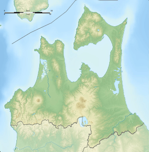 Location of the mouth in Japan  Mabechi River (Japan) | |
| Native name | Japanese: 馬淵川 |
| Country | Japan |
| Physical characteristics | |
| Main source |
Sodeyama Plateau, Iwate Prefecture 1,215 m (3,986 ft) |
| River mouth |
Hachinohe, Aomori Pacific Ocean 0 m (0 ft) 40°32′28″N 141°30′12″E / 40.54111°N 141.50333°ECoordinates: 40°32′28″N 141°30′12″E / 40.54111°N 141.50333°E |
| Length | 142 km (88 mi) |
| Discharge |
|
| Basin features | |
| Basin size | 2,050 km2 (790 sq mi) |
The Mabechi River (馬淵川 Mabechigawa) is a river located in eastern Aomori prefecture, in the Tōhoku region of northern Honshū in Japan.
The river is 142 kilometres (88 mi) long and has a watershed of 2,050 square kilometres (790 sq mi). [1]
The Mabuchi River rises from the Sodeyama Plateau in the Kitakami Mountains of northeastern Iwate Prefecture and flows to the northeast between the Kitakami Mountains and the Ōu Mountains through eastern Aomori Prefecture into the Pacific Ocean at Hachinohe, Aomori. The river flows through scenic Basenkyō Gorge in Ninohe, Iwate, which is located within the Oritsume Basenkyō Prefectural Natural Park.[2] The Port of Hachinohe is located at the mouth of the river. The city of Hachinohe utilises water from the Mabechi River for industrial purposes. [3]
References
- Campbell, Allen; Nobel, David S (1993). Japan: An Illustrated Encyclopedia. Kodansha. p. 904. ISBN 406205938X.
Notes
- ↑ "Mabechigawa" (in Japanese). Ministry of Land, Infrastructure and Tourism. 2007. Retrieved 2 April 2017.
- ↑ "馬仙峡 Basenkyou Basenkyo Gorge". Nippon-Kichi. 2007. Retrieved 12 March 2017.
- ↑ Campbell, Allen; Nobel, David S (1993). Japan: An Illustrated Encyclopedia. Kodansha. p. 904. ISBN 406205938X.
| |||||||||||||||||
| |||||||||||||||||
| |||||||||||||||||
| |||||||||||||||||
| |||||||||||||||||