Kunohe, Iwate
| Kunohe 九戸村 | |||
|---|---|---|---|
| Village | |||
 Kunohe Village Hall | |||
| |||
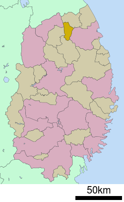 Location of Kunohe in Iwate Prefecture | |||
 Kunohe | |||
| Coordinates: 40°12′40.9″N 141°25′8.3″E / 40.211361°N 141.418972°ECoordinates: 40°12′40.9″N 141°25′8.3″E / 40.211361°N 141.418972°E | |||
| Country | Japan | ||
| Region | Tōhoku | ||
| Prefecture | Iwate | ||
| District | Kunohe | ||
| Area | |||
| • Total | 134.02 km2 (51.75 sq mi) | ||
| Population (October 2016) | |||
| • Total | 5,780 | ||
| • Density | 43.1/km2 (112/sq mi) | ||
| Time zone | UTC+9 (Japan Standard Time) | ||
| City symbols | |||
| • Tree | Japanese red pine | ||
| • Flower | Rhododendron | ||
| • Bird | Copper pheasant | ||
| Phone number | 0195-42-2111 | ||
| Address | Ihonai dai-10 jiwari 11-6, Kunohe-mura, Kunohe-gun, Iwate 028-6502 | ||
| Website | http://www.vill.kunohe.iwate.jp/ | ||


Kunohe (九戸村 Kunohe-mura) is a village located in Iwate Prefecture, Japan. As of 28 February 2017, the village had an estimated population of 5,780, and a population density of 43.1 persons per km2. The total area of the village was 134.05 square kilometres (51.76 sq mi).
Geography
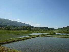
Kunohe is located in north-central Iwate Prefecture, within the Kitakami Mountains, in the river valley of the Niida River. Over 70 percent of the village area is covered by mountains and forests.[1] Portions of the village are within the borders of the Oritsume Basenkyō Prefectural Natural Park.
Neighboring municipalities
Climate
Kunohe has a humid continental climate (Köppen climate classification Dfa ) characterized by mild summers and cold winters with heavy snowfall. The average annual temperature in Kunohe is 8.9 °C. The average annual rainfall is 1280 mm with September as the wettest month and February as the driest month. The temperatures are highest on average in August, at around 22.0 °C, and lowest in January, at around -3.2 °C.[2]
Demographics
Per Japanese census data,[3] the population of Kunohe has declined steadily over the past 40 years.
| Census Year | Population |
|---|---|
| 1970 | 8,775 |
| 1980 | 8,496 |
| 1990 | 7,985 |
| 2000 | 7,324 |
| 2010 | 6,510 |
History
The area of present-day Kunohe was part of ancient Mutsu Province, dominated by the Nambu clan from the Muromachi period, and part of Hachinohe Domain under the Edo period Tokugawa shogunate. During the early Meiji period, the villages of Toda, Ibonai and Esashika were created within Kita-Kunohe District on April 1, 1889, with the establishment of the modern municipalities system. Kita-Kunohe District and Minami-Kunohe Districts merged to form Kunohe District on April 1, 1897. The three villages merged to form the modern village of Kunohe on April 1, 1955.
Economy
The economy of Kunohe is based on agriculture, the production of charcoal and animal husbandry, primarily poultry.
Education
Kunohe has five public elementary schools and one public middle school operated by the village government. There is one public high school operated by the Iwate Prefectural Board of Education.
Transportation
Railway
Kunohe is not served by any passenger train routes.
Highway
- Hachinohe Expressway – Kunohe Interchange
- Japan National Route 340
References
External links
![]()
- Official Website (in Japanese)