Kitzingen (district)
| Kitzingen | |
|---|---|
| District | |
 | |
| Country |
|
| State | Bavaria |
| Adm. region | Lower Franconia |
| Capital | Kitzingen |
| Area | |
| • Total | 684 km2 (264 sq mi) |
| Population (31 December 2017)[1] | |
| • Total | 90,429 |
| • Density | 130/km2 (340/sq mi) |
| Time zone | UTC+01:00 (CET) |
| • Summer (DST) | UTC+02:00 (CEST) |
| Vehicle registration | KT |
| Website | landkreis-kitzingen.de |
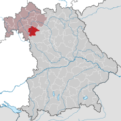
Kitzingen is a Landkreis (district) in Bavaria, Germany. It is bounded by (from the north and clockwise) the districts of Schweinfurt, Bamberg, Neustadt (Aisch)-Bad Windsheim and Würzburg.
History
The district in its present form was established in the administrative reform of 1973. The former district of Gerolzhofen was dissolved, and half of its territory was merged with the Kitzingen district (which had been much smaller before). The city of Kitzingen lost its status as a district-free city and was incorporated into the district.
Geography
The Main River runs through the district from south to north.
Coat of arms
 |
The coat of arms displays:
|
Towns and municipalities

Towns and municipalities in Landkreis Kitzingen
| Towns and Villages | Municipalities | |
|---|---|---|
References
- ↑ "Fortschreibung des Bevölkerungsstandes". Bayerisches Landesamt für Statistik und Datenverarbeitung (in German). September 2018.
External links
| Wikimedia Commons has media related to Landkreis Kitzingen. |
- Official website (German)
This article is issued from
Wikipedia.
The text is licensed under Creative Commons - Attribution - Sharealike.
Additional terms may apply for the media files.