Khan Tengri
| Khan Tengri | |
|---|---|
| Hantengri Peak | |
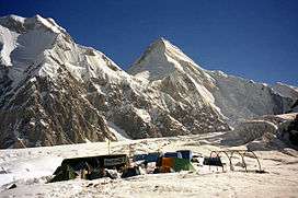
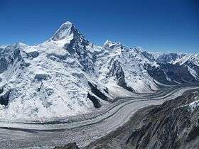 Khan Tengri above North Engilchek Glacier | |
| Highest point | |
| Elevation | 7,010 m (23,000 ft) |
| Prominence | 1,685 m (5,528 ft) [1] |
| Isolation | 19.88 kilometres (12.35 mi) |
| Listing |
Country high point Ultra |
| Coordinates | 42°12′39″N 80°10′30″E / 42.21083°N 80.17500°ECoordinates: 42°12′39″N 80°10′30″E / 42.21083°N 80.17500°E |
| Geography | |
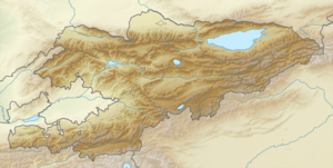 Khan Tengri Location in Kazakhstan, Kyrgyzstan, and Xinjiang respectively 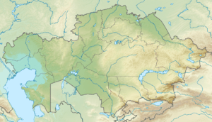 Khan Tengri Khan Tengri (Kazakhstan) 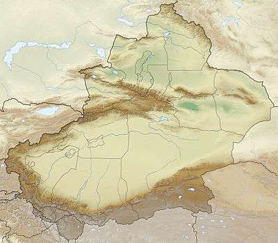 Khan Tengri Khan Tengri (Xinjiang) | |
| Location |
Ak-Suu, Issyk-Kul Region, Kyrgyzstan Raiymbek District, Almaty Region, Kazakhstan Wensu County, Xinjiang, China |
| Parent range | Tian Shan |
| Climbing | |
| First ascent | 1931 Mikhail Pogrebetsky |
| Easiest route | glacier/snow/ice/rock climb |
Khan Tengri (Kazakh: Хан Тәңірі, حان تأڭئرئ; Kyrgyz: Хан-Теңири, حان-تەڭىرى; Uyghur: خانتەڭرى ; simplified Chinese: 汗腾格里峰; traditional Chinese: 汗騰格里峰; pinyin: Hànténggélǐ Fēng, Xiao'erjing: هًا تٍْ قْ لِ فعْ) is a mountain of the Tian Shan mountain range. It is located on the China—Kyrgyzstan—Kazakhstan border, east of lake Issyk Kul. Its geologic elevation is 6,995 m (22,949 ft), but its glacial cap rises to 7,010 m (22,999 ft). For this reason, in mountaineering circles, including for the Soviet Snow Leopard award criteria, it is considered a 7,000-metre peak. The name "Khan Tengri" literally means "King Heaven" in Kazakh and possibly references the deity Tengri. In some other local languages, it is known as Khan Tangiri Shyngy, Kan-Too Chokusu, Pik Khan-Tengry, and Hantengri Feng.
Khan Tengri is the second-highest mountain in the Tian Shan, surpassed only by Jengish Chokusu (means "Victory peak", formerly known as Peak Pobeda) (7,439 m). Khan Tengri is the highest point in Kazakhstan and the third-highest peak in Kyrgyzstan, after Jengish Chokusu (7,439 m) and Avicenna Peak (7,134 m). It is also the world's most northern 7,000-metre peak, notable because peaks of high latitude have a shorter climbing season, generally more severe weather and thinner air.
Features
Khan Tengri is a massive marble pyramid, covered in snow and ice. At sunset the marble glows red, giving it the Kazakh/Kyrgyz name Кантау/Кан-Тоо (blood mountain). Located just across the South Engilchek (or Inylchek) glacier, 16 km north of Jengish Chokusu, Khan Tengri was originally thought to be the highest peak in the Tian Shan because of its dramatic, steep shape, compared to the massive bulk of Jengish Chokusu. This perception was probably also due to Khan Tengri's visibility across the plains of southern Kazakhstan while Jengish Chokusu remains out of view of civilization. Khan Tengri is the highest peak in the rugged Tengri Tag subrange, also known as the Mustag, that also contains Chapayev Peak (6371 m) and Gorky Peak (6050 m). Anatoli Boukreev considered Khan Tengri perhaps the world's most beautiful peak because of its geometric ridges and its symmetry.
History

Although it is almost 430 m (1,500 ft) lower than its neighbor, Khan Tengri was believed to be the highest peak in the range until Jengish Chokusu was surveyed in 1943 and determined to be higher.
Peter Semenov was the first European to see the Tengri Tag and its peak, the colossal Khan Tengri (in 1857).[2]
The first ascent of the peak was made in 1931 by Mikhail Pogrebetsky's Ukrainian team by a route from the south (Kyrgyzstan side), then along the west ridge. M. Kuzmin's team made the first ascent from the north (Kazakhstan side) in 1964. Khan Tengri is one of five peaks that a Soviet mountaineer needed to scale to earn the prestigious Snow Leopard award.
Austrian mountaineer and expedition leader Toni Dürnberger died while descending after having climbed Khan Tengri on 17 August 1992.[3]
The peak appears on the Kyrgyz 100 som bill. In 2004, more than a dozen mountaineers were killed in a large avalanche on the Pogrebetsky route, the most popular route on the mountain.
See also
Footnotes
- ↑ "The Central Asian Republics: Ultra-Prominence Page". Peaklist.org. Retrieved 2014-05-26. This prominence figure is based on the elevation of 6995m.
- ↑ Semenov, Petr Petrovitch. Travels in the Tian'-Shan' 1856-1857. Trans. by Liudmila Gilmour, Colin Thomas and Marcus Wheeler. Edited and annotated by Colin Thomas, pp. 180, 184-185. The Hakluyt Society, London. (1998). ISBN 0-904180-60-3.
- ↑ Video in Gedenken an den österreichischen Bergsteiger Toni Dürnberger
External links
- "Khan Tengri". SummitPost.org.
- Khan Tengri on Peakware
- Khan-Tengri/Kyrgyzstan climbing information
- Khan-Tengri 2007 Polish Expedition
- Alex Gavan's Khan Tengri 2004 Expedition (one of the best personal pages related with this mountain)
- Khan Tengri route maps
| History |
|  | |||||||||
|---|---|---|---|---|---|---|---|---|---|---|---|
| Geography |
| ||||||||||
| Politics | |||||||||||
| Economy | |||||||||||
| Culture |
| ||||||||||