Jabal Sawda
| Jabal Sawda | |
|---|---|
 | |
| Highest point | |
| Elevation | Around 3,000 metres (9,843 ft). |
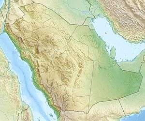
| Coordinates | 18°16′02″N 42°22′05″E / 18.26722°N 42.36806°ECoordinates: 18°16′02″N 42°22′05″E / 18.26722°N 42.36806°E |
| Geography | |
 Jabal Sawda | |
| Parent range | Hejaz Mountains |
Jabal Sawda (Arabic: جبل السودة jabal al-sūda, pronounced [dʒabal asːuːda])is a peak located in Saudi Arabia, with an elevation of around 3,000 metres (9,843 ft).
Most authorities claim that the peak, with a questioned elevation of 3,133 m, is the highest point in Saudi Arabia, but SRTM data indicates an elevation of 2,985 m, with higher elevations elsewhere in the country.
Also known as Mount Souda in Abha (جبل السودة في ابها) is a mountain of Saudi Arabia, located in the Hejaz Mountains at Coordinates 18°16'02"N and 42°22'05"E.
The village of Al Souda is located nearby. That town is a tourist center and has a cable car to the top of the mountain.[1]
Climate
| Climate data for Sawda (2946 m) | |||||||||||||
|---|---|---|---|---|---|---|---|---|---|---|---|---|---|
| Month | Jan | Feb | Mar | Apr | May | Jun | Jul | Aug | Sep | Oct | Nov | Dec | Year |
| Average high °C (°F) | 14.8 (58.6) |
16.1 (61) |
18.0 (64.4) |
20.2 (68.4) |
22.8 (73) |
25.9 (78.6) |
24.8 (76.6) |
24.5 (76.1) |
24.0 (75.2) |
20.0 (68) |
17.0 (62.6) |
15.2 (59.4) |
20.3 (68.5) |
| Daily mean °C (°F) | 8.2 (46.8) |
9.4 (48.9) |
11.5 (52.7) |
13.3 (55.9) |
15.7 (60.3) |
18.2 (64.8) |
18.3 (64.9) |
18.2 (64.8) |
16.3 (61.3) |
12.6 (54.7) |
9.8 (49.6) |
8.2 (46.8) |
13.3 (55.9) |
| Average low °C (°F) | 1.7 (35.1) |
2.7 (36.9) |
5.1 (41.2) |
6.5 (43.7) |
8.6 (47.5) |
10.5 (50.9) |
11.8 (53.2) |
12.0 (53.6) |
8.6 (47.5) |
5.2 (41.4) |
2.7 (36.9) |
1.2 (34.2) |
6.4 (43.5) |
| Average precipitation mm (inches) | 18 (0.71) |
40 (1.57) |
63 (2.48) |
70 (2.76) |
28 (1.1) |
7 (0.28) |
29 (1.14) |
46 (1.81) |
8 (0.31) |
4 (0.16) |
10 (0.39) |
9 (0.35) |
332 (13.07) |
| Source: Climate-data.org | |||||||||||||
See also
References
External links
- (in English) "Jabal Sawdā', Saudi Arabia". Peakbagger.com.
This article is issued from
Wikipedia.
The text is licensed under Creative Commons - Attribution - Sharealike.
Additional terms may apply for the media files.