Nagorno-Karabakh
| Nagorno-Karabakh (Upper Karabakh), Artsakh (Արցախ)
| |
|---|---|
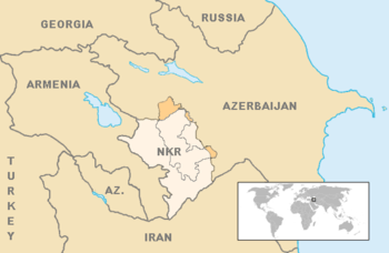
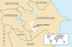 Location and extent of the former Nagorno-Karabakh Autonomous Oblast (lighter color). | |
| Religion | Christianity (Armenian Apostolic Church) |
| Area | |
• Total | 4,400 km2 (1,700 sq mi) |
• Water (%) | negligible |
| Population | |
• 2013 estimate | 146,573[1] |
• 2010 census | 141,400[2] |
• Density | 29/km2 (75.1/sq mi) |
| Time zone | UTC+4 |
| +5 | |
| Driving side | right |
Nagorno-Karabakh (/nəˌɡɔːrnoʊ
Nagorno-Karabakh is a disputed territory, internationally recognized as part of Azerbaijan,[4] but most of the region is governed by the Republic of Artsakh (formerly named Nagorno-Karabakh Republic), a de facto independent state with Armenian ethnic majority established on the basis of the Nagorno-Karabakh Autonomous Oblast of the Azerbaijan Soviet Socialist Republic. Azerbaijan has not exercised political authority over the region since the advent of the Karabakh movement in 1988. Since the end of the Nagorno-Karabakh War in 1994, representatives of the governments of Armenia and Azerbaijan have been holding peace talks mediated by the OSCE Minsk Group on the region's disputed status.
The region is usually equated with the administrative borders of the former Nagorno-Karabakh Autonomous Oblast comprising an area of 4,400 square kilometres (1,700 sq mi). The historical area of the region, however, encompasses approximately 8,223 square kilometres (3,175 sq mi).[5][6]
Etymology
The prefix Nagorno- derives from the Russian attributive adjective nagorny (нагорный), which means "highland." The Azerbaijani names of the region include the similar adjectives dağlıq (mountainous) or yuxarı (upper). Such words are not used in the Armenian name, but they have appeared in the official name of the region during the Soviet era as Nagorno-Karabakh Autonomous Oblast. Other languages apply their own wording for mountainous, upper, or highland; for example, the official name used by the Nagorno-Karabakh Republic in French is Haut-Karabakh, meaning "Upper Karabakh."
The names for the region in the various local languages all translate to "mountainous Karabakh", or "mountainous black garden":
- Armenian: Լեռնային Ղարաբաղ, transliterated Leṙnayin Ġarabaġ (IPA: /lɛrnɑˈjin ʁɑɾɑˈbɑʁ/)
- Azerbaijani: Dağlıq Qarabağ, Дағлыг Гарабағ (mountainous Karabakh; IPA: /dɑɣˈlɯɣ ɡɑˈɾɑbɑɣ/) or Yuxarı Qarabağ, Јухары Гарабағ (upper Karabakh; IPA: /juxɑˈɾɯ ɡɑˈɾɑbɑɣ/)
- Russian: Нагорный Карабах, transliterated Nagornyy Karabakh or Nagornyi Karabah (IPA: /nɐˈɡornɨj kərɐˈbax/)
The Armenians living in the area often refer to Nagorno-Karabakh as Artsakh (Armenian: Արցախ), using the name of the 10th province of the ancient Kingdom of Armenia. Urartian inscriptions (9th–7th centuries BC) use the name Urtekhini for the region. Ancient Greek sources called the area Orkhistene.[7]
History
Antiquity and Early Middle Ages
Nagorno-Karabakh falls within the lands occupied by peoples known to modern archaeologists as the Kura-Araxes culture, who lived between the two rivers Kura and Araxes.
The ancient population of the region consisted of various autochthonous local and migrant tribes who were mostly non-Indo-Europeans.[10] According to the prevailing western theory, these natives intermarried with Armenians who came to the region after its inclusion into Armenia in the 2nd or, possibly earlier, in 4th century BC.[11] Other scholars suggest that the Armenians settled in the region as early as in the 7th century BC.[12]
In around 180 BC, Artsakh became one of the 15 provinces of the Armenian Kingdom and remained so until the 4th century.[13] While formally having the status of a province (nahang), Artsakh possibly formed a principality on its own — like Armenia's province of Syunik. Other theories suggest that Artsakh was a royal land, belonging to the King of Armenia directly.[14] Tigran the Great, King of Armenia, (ruled from 95–55 BC), founded in Artsakh one of four cities named "Tigranakert" after himself.[15] The ruins of the ancient Tigranakert, located 30 miles (48 km) north-east of Stepanakert, are being studied by a group of international scholars.
In 387 AD, after the partition of Armenia between Byzantium and Sassanid Persia, two Armenian provinces Artsakh and Utik became part of the Sassanid satrapy of Caucasian Albania, which, in turn, came under strong Armenian religious and cultural influence.[16][17] At the time the population of Artsakh and Utik consisted of Armenians and several Armenized tribes.[10]
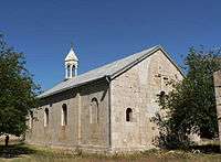
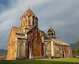
Armenian culture and civilization flourished in the early medieval Nagorno-Karabakh. In the 5th century, the first-ever Armenian school was opened on the territory of modern Nagorno-Karabakh—at the Amaras Monastery—by the efforts of St. Mesrop Mashtots, the inventor of the Armenian alphabet.[18] St. Mesrop was very active in preaching Gospel in Artsakh and Utik. Overall, Mesrop Mashtots made three trips to Artsakh and Utik, ultimately reaching pagan territories at the foothills of the Greater Caucasus.[19] The 7th-century Armenian linguist and grammarian Stephanos Syunetsi stated in his work that Armenians of Artsakh had their own dialect, and encouraged his readers to learn it.[20] In the same 7th century, Armenian[21] poet Davtak Kertogh writes his Elegy on the Death of Grand Prince Juansher, where each passage begins with a letter of Armenian script in alphabetical order.[22][23] The only comprehensive history of Caucasian Albania was written in Armenian, by the historian Movses Kaghankatvatsi.[23]
High Middle Ages
Around the mid 7th century, the region was conquered by the invading Muslim Arabs through the Muslim conquest of Persia. Subsequently, it was ruled by local governors endorsed by the Caliphate. According to some sources, in 821, the Armenian[24] prince Sahl Smbatian revolted in Artsakh and established the House of Khachen, which ruled Artsakh as a principality until the early 19th century.[25] According to other sources, Sahl i Smbatean "was of the Zamirhakan family of kings," and in the year 837-838, he acquired sovereignty over Armenia, Georgia, and Albania.[26][27] The name "Khachen" originated from Armenian word "khach," which means "cross".[28] By 1000 the House of Khachen proclaimed the Kingdom of Artsakh with John Senecherib as its first ruler.[29] Initially Dizak, in southern Artsakh, formed also a kingdom ruled by the ancient House of Aranshahik, descended of the earliest Kings of Caucasian Albania. In 1261, after the daughter of the last king of Dizak married the king of Artsakh, Armenian[30] prince Hasan Jalal Dola, the two states merged into one[25] Armenian[31] Principality of Khachen. Subsequently, Artsakh continued to exist as a de facto independent principality.
Late Middle Ages
.jpg)
.
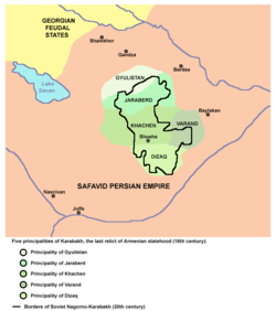
In the 15th century, the territory of Karabakh was part of the states ruled subsequently by the Kara Koyunlu and Ak Koyunlu Turkic tribal confederations. According to Abu Bakr Tihrani, during the period of Jahan Shah (1438–1468), the ruler of Kara Koyunlu, Piri bey Karamanli held the governorship of Karabakh.[34] However, according to Robert H. Hewsen, the Turkoman lord Jahan Shah (1437–67) assigned the governorship of upper Karabakh to local Armenian princes, allowing a native Armenian leadership to emerge consisting of five noble families led by princes who held the titles of meliks.[25] These dynasties represented the branches of the earlier House of Khachen and were the descendants of the medieval kings of Artsakh. Their lands were often referred to as the Country of Khamsa (five in Arabic). In a Charter (2 June 1799) of the Emperor Paul I titled "About their admission to Russian suzerainty, land allocation, rights and privileges", it was noted that the Christian heritage of the Karabakh region and all their people were admitted to the Russian suzerainty.[35] However, according to Robert Hewsen, the Russian Empire recognized the sovereign status of the five princes in their domains by the charter of the Emperor Paul I dated 2 June 1799.[36]
The Armenian meliks were granted supreme command over neighboring Armenian principalities and Muslim khans in the Caucasus by the Iranian king Nader Shah, in return for the meliks' victories over the invading Ottoman Turks in the 1720s.[37] These five principalities [38][39] in Karabakh were ruled by Armenian families who had received the title Melik (prince) and were the following:
- Principality of Gulistan – under the leadership of the Melik-Beglarian family
- Principality of Jraberd – under the leadership of the Melik-Israelian family
- Principality of Khachen – under the leadership of the Hasan-Jalalian family
- Principality of Varanda – under the leadership of the Melik-Shahnazarian family
- Principality of Dizak – under the leadership of the Melik-Avanian family
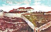
From 1501 to 1736, during the existence of the Safavid Empire, the province of Karabakh was governed by Ziyadoglu Gajar's dynasty. Ziyadoglu Gajar's dynasty ruled the province of Karabakh until Nader Shah took over Karabakh from their rule.[40] The Armenian meliks maintained full control over the region until the mid-18th century. In the early 18th century, Iran's Nader Shah took Karabakh out of control of the Ganja khans in punishment for their support of the Safavids, and placed it under his own control[41][42] In the mid-18th century, as internal conflicts between the meliks led to their weakening, the Karabakh Khanate was formed. The Karabakh khanate, one of the largest khanates under Iranian suzerainty,[43] was headed by Panah-Ali khan Javanshir. For the reinforcement of the power of Karabakh khanate, Khan of Karabakh, Panah-Ali khan Javanshir, built up “the fortress of Panahabad (today Shusha)” in 1751. During that time, Otuziki, Javanshir, Kebirli, and other Turkic tribes constituted majority of the overall population.
Modern era

Karabakh (including modern-day Nagorno-Karabakh), became a protectorate of the Russian Empire by the Kurekchay Treaty, signed between Ibrahim Khalil Khan of Karabakh and general Pavel Tsitsianov on behalf of Tsar Alexander I in 1805, according to which the Russian monarch recognized Ibrahim Khalil Khan and his descendants as the sole hereditary rulers of the region.[44][45][46] However, its new status was only confirmed following the outcome of the Russo-Persian War (1804-1813), when through the loss in the war, Persia formally ceded Karabakh to the Russian Empire per the Treaty of Gulistan (1813),[47][48][49][50] before the rest of Transcaucasia was incorporated into the Empire in 1828 by the Treaty of Turkmenchay, which came as an outcome of the Russo-Persian War (1826-1828).
In 1822, 9 years after passing from Iranian to Russian control, the Karabakh Khanate was dissolved, and the area became part of the Elisabethpol Governorate within the Russian Empire. In 1823 the five districts corresponding roughly to modern-day Nagorno-Karabakh, was 90.8% Armenian.[51][52]
Soviet era

The present-day conflict over Nagorno-Karabakh has its roots in the decisions made by Joseph Stalin and the Caucasian Bureau (Kavburo) during the Sovietization of Transcaucasia. Stalin was the acting Commissar of Nationalities for the Soviet Union during the early 1920s, the branch of the government under which the Kavburo was created. After the Russian Revolution of 1917, Karabakh became part of the Transcaucasian Democratic Federative Republic, but this soon dissolved into separate Armenian, Azerbaijani, and Georgian states. Over the next two years (1918–1920), there were a series of short wars between Armenia and Azerbaijan over several regions, including Karabakh. In July 1918, the First Armenian Assembly of Nagorno-Karabakh declared the region self-governing and created a National Council and government.[53] Later, Ottoman troops entered Karabakh, meeting armed resistance by Armenians.
After the defeat of the Ottoman Empire in World War I, British troops occupied Karabakh. The British command provisionally affirmed Khosrov bey Sultanov (appointed by the Azerbaijani government) as the governor-general of Karabakh and Zangezur, pending final decision by the Paris Peace Conference.[54] The decision was opposed by Karabakh Armenians. In February 1920, the Karabakh National Council preliminarily agreed to Azerbaijani jurisdiction, while Armenians elsewhere in Karabakh continued guerrilla fighting, never accepting the agreement.[53] The agreement itself was soon annulled by the Ninth Karabagh Assembly, which declared union with Armenia in April.[53][55]
In April 1920, while the Azerbaijani army was locked in Karabakh fighting local Armenian forces, Azerbaijan was taken over by Bolsheviks. On 10 August 1920, Armenia signed a preliminary agreement with the Bolsheviks, agreeing to a temporary Bolshevik occupation of these areas until final settlement would be reached.[56] In 1921, Armenia and Georgia were also taken over by the Bolsheviks who, in order to attract public support, promised they would allot Karabakh to Armenia, along with Nakhchivan and Zangezur (the strip of land separating Nakhchivan from Karabakh). However, the Soviet Union also had far-reaching plans concerning Turkey, hoping that it would, with a little help from them, develop along Communist lines. Needing to placate Turkey, the Soviet Union agreed to a division under which Zangezur would fall under the control of Armenia, while Karabakh and Nakhchivan would be under the control of Azerbaijan. Had Turkey not been an issue, Stalin would likely have left Karabakh under Armenian control.[57] As a result, the Nagorno-Karabakh Autonomous Oblast was established within the Azerbaijan SSR on 7 July 1923.
With the Soviet Union firmly in control of the region, the conflict over the region died down for several decades. With the beginning of the dissolution of the Soviet Union in the late 1980s and early 1990s, the question of Nagorno-Karabakh re-emerged. Accusing the Azerbaijani SSR government of conducting forced Azerification of the region, the majority Armenian population, with ideological and material support from the Armenian SSR, started a movement to have the autonomous oblast transferred to the Armenian SSR. The oblast's borders were drawn to include Armenian villages and to exclude as much as possible Azerbaijani villages. The resulting district ensured an Armenian majority.[58] In August 1987, Karabakh Armenians sent a petition for union with Armenia with tens of thousands of signatures to Moscow.[59]
War and secession
On 13 February 1988, Karabakh Armenians began demonstrating in their capital, Stepanakert, in favour of unification with the Armenian republic. Six days later they were joined by mass marches in Yerevan. On 20 February, the Soviet of People's Deputies in Karabakh voted 110 to 17 to request the transfer of the region to Armenia. This unprecedented action by a regional soviet brought out tens of thousands of demonstrations both in Stepanakert and Yerevan, but Moscow rejected the Armenians' demands. On 22 February 1988, the first direct confrontation of the conflict occurred as a large group of Azeris marched from Agdam against the Armenian populated town of Askeran, "wreaking destruction en route". The confrontation between the Azeris and the police near Askeran degenerated into the Askeran clash, which left two Azeris dead, one of them reportedly killed by an Azeri police officer, as well as 50 Armenian villagers, and an unknown number of Azeris and police injured.[60][61] Large numbers of refugees left Armenia and Azerbaijan as violence began against the minority populations of the respective countries.[62]
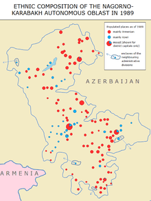
On 29 November 1989, direct rule in Nagorno-Karabakh was ended and the region was returned to Azerbaijani administration.[63] The Soviet policy backfired, however, when a joint session of the Armenian Supreme Soviet and the National Council, the legislative body of Nagorno-Karabakh, proclaimed the unification of Nagorno-Karabakh with Armenia. In 1989, Nagorno-Karabakh had a population of 192,000.[64] The population at that time was 76 percent Armenian and 23 percent Azerbaijanis, with Russian and Kurdish minorities.[64] On 26 November 1991 Azerbaijan abolished the status of Nagorno-Karabakh Autonomous Oblast, rearranging the administrative division and bringing the territory under direct control of Azerbaijan.[65]
On 10 December 1991, in a referendum boycotted by local Azerbaijanis,[61] Armenians in Nagorno-Karabakh approved the creation of an independent state. A Soviet proposal for enhanced autonomy for Nagorno-Karabakh within Azerbaijan satisfied neither side, and a full-scale war subsequently erupted between Azerbaijan and Nagorno-Karabakh, with the latter receiving support from Armenia.[66][67][68][69] According to Armenia's former president, Levon Ter-Petrossian, the Karabakh leadership approach was maximalist and "they thought they could get more."[70][71][72]
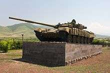
The struggle over Nagorno-Karabakh escalated after both Armenia and Azerbaijan attained independence from the Soviet Union in 1991. In the post-Soviet power vacuum, military action between Azerbaijan and Armenia was heavily influenced by the Russian military. Furthermore, both the Armenian and Azerbaijani military employed a large number of mercenaries from Ukraine and Russia.[73] As many as one thousand Afghan mujahideen participated in the fighting on Azerbaijan's side.[61] There were also fighters from Chechnya fighting on the side of Azerbaijan, as well heavy artillery and tanks provided to Armenia by Russia.[61] Many survivors from the Azerbaijani side found shelter in 12 emergency camps set up in other parts of Azerbaijan to cope with the growing number of internally displaced people due to the Nagorno-Karabakh war.[74]
By the end of 1993, the conflict had caused thousands of casualties and created hundreds of thousands of refugees on both sides. By May 1994, the Armenians were in control of 14% of the territory of Azerbaijan. At that stage, for the first time during the conflict, the Azerbaijani government recognized Nagorno-Karabakh as a third party in the war, and started direct negotiations with the Karabakh authorities. As a result, a cease-fire was reached on 12 May 1994 through Russian negotiation.
Post-1994 ceasefire
Despite the ceasefire, fatalities due to armed conflicts between Armenian and Azerbaijani soldiers continued.[75] On 25 January 2005, the Parliamentary Assembly of the Council of Europe (PACE) adopted PACE Resolution 1416, which condemned alleged ethnic cleansing against Azerbaijanis.[76][77] On 15–17 May 2007 the 34th session of the Council of Ministers of Foreign Affairs of the Organization of Islamic Conference adopted resolution № 7/34-P, considering the occupation of Azerbaijani territory as the aggression of Armenia against Azerbaijan and recognizing the actions against Azerbaijani civilians as a crime against humanity, and condemning the destruction of archaeological, cultural and religious monuments in the occupied territories.[78] The 11th session of the summit of the Organization of the Islamic Conference held on 13–14 March 2008 in Dakar adopted resolution No. 10/11-P (IS). In the resolution, OIC member states condemned the occupation of Azerbaijani lands by Armenian forces and Armenian aggression against Azerbaijan, alleged ethnic cleansing against the Azeri population, and charged Armenia with the "destruction of cultural monuments in the occupied Azerbaijani territories".[79] On 14 March of the same year the UN General Assembly adopted Resolution № 62/243 which "demands the immediate, complete and unconditional withdrawal of all Armenian forces from all occupied territories of the Republic of Azerbaijan".[80] On 18–20 May 2010, the 37th session of the Council of Ministers of Foreign Affairs of the Organization of Islamic Conference in Dushanbe adopted another resolution condemning the aggression of Armenia against Azerbaijan, recognizing the actions against Azerbaijani civilians as a crime against humanity and condemning the destruction of archaeological, cultural, and religious monuments in occupied territories.[81] On 20 May of the same year, the European Parliament in Strasbourg adopted the resolution on "The need for an EU Strategy for the South Caucasus" on the basis of the report by Evgeni Kirilov, the Bulgarian member of the Parliament.[82][83] The resolution states in particular that "the occupied Azerbaijani regions around Nagorno-Karabakh must be cleared as soon as possible".[84] On 26 January 2016, the Parliamentary Assembly of the Council of Europe (PACE) adopted Resolution 2085, which deplored the fact that the occupation by Armenia of Nagorno-Karabakh and other adjacent areas of Azerbaijan creates humanitarian and environmental problems for the citizens of Azerbaijan, condemned alleged ethnic cleansing against Azerbaijanis and Assembly requested immediate withdrawal of Armenian armed forces from the region concerned.[85][86][87]
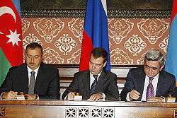
Several world leaders have met with the presidents of Armenia and Azerbaijan over the years, but efforts to maintain the ceasefire have failed.[88]
2 April 2016 saw reports of renewed military activities between Azerbaijani and Armenian forces.[89] The Armenian Defense Ministry alleged that Azerbaijan launched an offensive to seize territory in the region. At least 30 soldiers were killed during the fighting and a Mil Mi-24 helicopter and tank were also destroyed, with 12 of the fallen soldiers belonging to the Azerbaijani forces and the other 18 belonging to the Armenian forces, as well as an additional 35 Armenian soldiers reportedly wounded.[90][91]
Geography
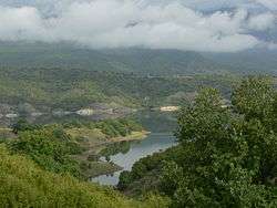
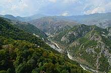
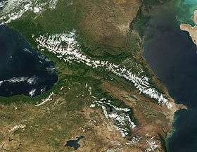
Nagorno-Karabakh has a total area of 4,400 square kilometres (1,699 sq mi).[92] Approximately half of Nagorno-Karabakh terrain is over 950 metres (3,120 ft) above sea level.[93] The borders of Nagorno-Karabakh resemble a kidney bean with the indentation on the east side. It has tall mountain ridges along the northern edge and along the west and a mountainous south. The part near the indentation of the kidney bean itself is a relatively flat valley, with the two edges of the bean, the provinces of Martakert and Martuni, having flat lands as well. Other flatter valleys exist around the Sarsang reservoir, Hadrut, and the south. The entire region lies, on average, 1,100 metres (3,600 ft) above sea level.[93] Notable peaks include the border mountain Murovdag and the Great Kirs mountain chain in the junction of Shusha Rayon and Hadrut. The territory of modern Nagorno-Karabakh forms a portion of the historic region of Karabakh, which lies between the rivers Kura and Araxes, and the modern Armenia-Azerbaijan border. Nagorno-Karabakh in its modern borders is part of the larger region of Upper Karabakh.
Nagorno-Karabakh’s environment vary from steppe on the Kura lowland through dense forests of oak, hornbeam, and beech on the lower mountain slopes to birchwood and alpine meadows higher up. The region possesses numerous mineral springs and deposits of zinc, coal, lead, gold, marble, and limestone.[94] The major cities of the region are Stepanakert, which serves as the capital of the Nagorno-Karabakh Republic, and Shusha, which lies partially in ruins. Vineyards, orchards, and mulberry groves for silkworms are developed in the valleys.[95]
Demographics
The earliest concrete numbers about the population of the whole of Karabakh is from the census of 1823 concerning the abolition of the Karabakh Khanate. In the territory of the former Armenian principalities, 90.8% of villages were recorded as being Armenian, while 9.2% were recorded as Tatar or Kurd.[51][52] The population of the former Armenian principalities accounted for approximately 8.4% of the population of the whole of Karabakh.[96]
In the census of 2015, Artsakh had a population of 145,053, consisting of 144,683 Armenians and 238 Russians, and others.
Transport
| Location | ICAO | DAFIF | IATA | Airport name | Coordinates |
| Stepanakert | UBBS | UB13 | Stepanakert Airport[97] | 39°54′05″N 46°47′13″E / 39.90139°N 46.78694°E |
During rule of the Soviet Union, the Yevlax–Ağdam–Stepanakert line connected the Nagorno-Karabakh Autonomous Region with the main part of Azerbaijan. After the Nagorno-Karabakh war and the abandonment of Ağdam, the line’s service was cut back to service only between Yevlax and Kətəlparaq, without any present section at the Nagorno-Karabakh Republic. The former railway line between Kətəlparaq and Stepanakert has been almost completely destroyed.
The (Tbilisi–Gyumri–)Yerevan–Nakhchivan–Horadiz–Şirvan(–Baku) main railway was also dismantled from the NKR between Ordubad and Horadiz, and a by-line from Mincivan to the Armenian city of Kapan. Currently, the Azerbaijani trains only travel to Horadiz. The Ordubad–Horadiz section has been demolished, leaving the NKR with no intact, active railway line in their territory. The railway at the Nakhchivan Autonomous Republic still operates, but it is separated from the main Azerbaijani lines, and only has connection to Iran.
See also
References
- ↑ "Population of NKR as of 01.01.2013". NKR. 1 January 2013. Retrieved 20 February 2014.
- ↑ "Official Statistics of the NKR. Official site of the President of the NKR". President.nkr.am. 1 January 2010. Retrieved 6 May 2012.
- ↑ "Nagorno-Karabakh". Random House Webster's Unabridged Dictionary.
- ↑ "General Assembly adopts resolution reaffirming territorial integrity of Azerbaijan, demanding withdrawal of all Armenian forces". United Nations. 14 March 2008. Retrieved 30 Aug 2015.
- ↑ Robert H. Hewsen. "The Meliks of Eastern Armenia: A Preliminary Study". Revue des etudes Arméniennes. NS: IX, 1972, pp. 288.
- ↑ Robert H. Hewsen, Armenia: A Historical Atlas. The University of Chicago Press, 2001, p. 264. ISBN 978-0-226-33228-4
- ↑ Strabo (ed. H.C. Hamilton, Esq., W. Falconer, M.A.) . Geography. The Perseus Digital Library. 11.14.4. Retrieved 21 November 2007.
- ↑ Viviano, Frank (March 2004). "The Rebirth of Armenia". National Geographic Magazine.
- ↑ John Noble, Michael Kohn, Danielle Systermans. Georgia, Armenia and Azerbaijan. Lonely Planet; 3 edition (May 1, 2008), p. 307
- 1 2 Hewsen, Robert H. (1982). "Ethno-History and the Armenian Influence upon the Caucasian Albanians". In Samuelian, Thomas J. Classical Armenian Culture. Influences and Creativity. Chicago: Scholars Press. pp. 27–40. ISBN 0-89130-565-3.
- ↑ Hewsen, Robert H. Armenia: a Historical Atlas. Chicago, IL: University of Chicago Press, 2001, p. 32–33, map 19 (shows the territory of modern Nagorno-Karabakh as part of the Orontids' Kingdom of Armenia)
- ↑ R. Schmitt, M. L. Chaumont. Armenia and Iran. Encyclopædia Iranica
- ↑ Hewsen, Robert H. "The Kingdom of Artsakh", in T. Samuelian & M. Stone, eds. Medieval Armenian Culture. Chico, CA, 1983.
- ↑ Hewsen. Armenia, pp. 100–103.
- ↑ History by Sebeos, chapter 26
- ↑ Encyclopædia Britannica "Azerbaijan"
- ↑ Walker, Christopher J. Armenia and Karabagh: The Struggle for Unity. Minority Rights Group Publications, 1991, p. 10
- ↑ Viviano, Frank. "The Rebirth of Armenia", National Geographic Magazine, March 2004, p. 18,
- ↑ Movses Kalankatuatsi. History of the Land of Aluank, Book I, chapters 27, 28 and 29; Book II, chapter 3.
- ↑ Н.Адонц. «Дионисий Фракийский и армянские толкователи», Пг., 1915, 181—219
- ↑ The Oxford History of Historical Writing: 400–1400 / Edited by Sarah Foot, Chase F. Robinson. — Oxford University Press, 2012. — Vol. 2. — p. 189. "The section on Juansers exploits concludes with the earliest piece of secular Armenian poetry since the adoption of Christianity to have reached us, in the form of an abecedarian elegy extolling the prince and bewailing his passing."
- ↑ Movses Kalankatuatsi. History of the Land of Aluank, translated from Old Armenian by Sh. V. Smbatian. Yerevan: Matenadaran (Institute of Ancient Manuscripts), 1984, Elegy on the Death of Prince Juansher
- 1 2 Agop Jack Hacikyan, Gabriel Basmajian, Edward S. Franchuk. The Heritage of Armenian Literature. Wayne State University Press (December 2002), pp. 94–99
- ↑ The Cambridge History of Iran. — Cambridge University Press, 1975. — vol. 4. — p. 506 "He was handed to Afshin's troops by Sahl b. Sunbadh, an Armenian prince in 222/836-7, and executed in Samarra (223/837) while his brother and assistant 'Abd-Allah was delivered to the prince of Tabaristan, Ibn Sharvin, who had him put to death in Baghdad."
- 1 2 3 Robert H. Hewsen, Armenia: A Historical Atlas. The University of Chicago Press, 2001, pp. 119, 155, 163, 264–65.
- ↑ Movses Dasxuranci translated by C. J. F. Dowsett (1961). The History of the Caucasian Albanians By Movses Dasxuranci. London: Oxford University Press. p. 217.
- ↑ Тер-Григорян Т.И. Неизданные страницы "Истории Албанской страны"Моисея Каланкайтукского. Архив Ин-та истории АН Азерб. ССР, № 1386, л.18.
- ↑ Christopher Walker. The Armenian presence in Mountainous Karabakh, in John F. R. Wright et al.: Transcaucasian Boundaries (SOAS/GRC Geopolitics). 1995, p. 93
- ↑ Hewsen, Robert H. "The Kingdom of Artsakh", in T. Samuelian & M. Stone, eds. Medieval Armenian Culture. Chico, CA, 1983
- ↑ Arḡūn Āqā — Encyclopædia Iranica. P. Jackson "It can only have caused resentment among the Muslims, and the Christian author Kirakos, in stark contrast with Jovaynī, has nothing favorable to say concerning Arḡūn’s exactions: his harsh treatment of certain Armenian princes, such as Jalāl of Ḵačen, whom he had executed in 659/1261, made him especially hateful."
- ↑ Encyclopædia Britannica. Armenia:"A few native Armenian rulers survived for a time in the Kiurikian kingdom of Lori, the Siuniqian kingdom of Baghq or Kapan, and the principates of Khachen (Artzakh) and Sasun."
- ↑ Robert H. Hewsen. Russian–Armenian relations, 1700–1828. Society of Armenian Studies, N4, Cambridge, Massachusetts, 1984, p 37
- ↑ George A. Bournoutian. A History of Qarabagh: An Annotated Translation of Mirza Jamal Javanshir Qarabaghi's Tarikh-e Qarabagh. Mazda Publishers, 1994. ISBN 1-56859-011-3, 978-1-568-59011-0
- ↑ Abū Bakr Ṭihrānī. Kitāb-i Diyārbakriyya. (original) کتاب دیاربکریه: از تواریخ قراقوینلو و چغاتای. ویسنده: ابوبکر طهرانی. به تصحیح و اهتمام: نجاتی لوغال، فاروق سومه. تهران : کتابخانه طهوری،۱۳۵۶. p. 138. zero width joiner character in
|title=at position 32 (help) - ↑ Полное Собрание Законов Российской Империи c 1649 года. Том XXV. 1798-1799. СПб.: Печатано в Типографии II Отделения Собственной Его Императорского Величества Канцелярии, 1830, № 18.990, c.674-675. (Complete Collection of Laws of the Russian Empire since 1649. Volume XXV. 1798-1799. SPb .: Printed at the Printing House of the II Branch of His Imperial Majesty's Own Office, 1830, No. 18.990, p.674-675).
- ↑ Robert H. Hewsen. Russian–Armenian relations, 1700–1828. Society of Armenian Studies, N4, Cambridge, Massachusetts, 1984, p 37.
- ↑ Walker, Christopher J. Armenia: Survival of a Nation. London: Routledge, 1990 p. 40 ISBN 0-415-04684-X
- ↑ Raffi, The History of Karabagh's Meliks, Vienna, 1906, in Armenian
- ↑ In English, Raffi, The Five Melikdoms of Karabagh translated by Ara Stepan Melkonian, Garod Books Ltd. 2010, London. ISBN 9781903656570
- ↑ Павлова И.К. Хроника времен Сефевидов. Соч. Мухаммад-Масума Исфахани "Хуласат ас-сийар". М.:Наука, 1993, c.59-61.
- ↑ (in Russian) Abbas-gulu Aga Bakikhanov. Golestan-i Iram; according to an 18th-century local Turkic-Muslim writer Mirza Adigezal bey, Nadir shah placed Karabakh under his own control, while a 19th-century local Turkic Muslim writer Abbas-gulu Aga Bakikhanov states that the shah placed Karabakh under the control of the governor of Tabriz.
- ↑ (in Russian) Mirza Adigezal bey. Karabakh-name, p. 48
- ↑ Bournoutian, George A. (2016). The 1820 Russian Survey of the Khanate of Shirvan: A Primary Source on the Demography and Economy of an Iranian Province prior to its Annexation by Russia. Gibb Memorial Trust. p. xvii. ISBN 978-1909724808.
Serious historians and geographers agree that after the fall of the Safavids, and especially from the mid-eighteenth century, the territory of the South Caucasus was composed of the khanates of Ganja, Kuba, Shirvan, Baku, Talesh, Sheki, Karabagh, Nakhichivan and Yerevan, all of which were under Iranian suzerainty.
- ↑ (in Russian) Просительные пункты и клятвенное обещание Ибраим-хана. Archived 13 June 2003 at the Wayback Machine.
- ↑ Muriel Atkin. The Strange Death of Ibrahim Khalil Khan of Qarabagh. Iranian Studies, Vol. 12, No. 1/2 (Winter – Spring, 1979), pp. 79–107
- ↑ George A. Bournoutian. A History of Qarabagh: An Annotated Translation of Mirza Jamal Javanshir Qarabaghi's Tarikh-e Qarabagh. Mazda Publishers, 1994. ISBN 1-56859-011-3, 978-1-568-59011-0
- ↑ Tim Potier. M1 Conflict in Nagorno-Karabakh, Abkhazia and South Ossetia: A Legal Appraisal. Martinus Nijhoff Publishers, 2001, p. 2. ISBN 90-411-1477-7.
- ↑ Leonidas Themistocles Chrysanthopoulos. Caucasus Chronicles: Nation-building and Diplomacy in Armenia, 1993–1994. Gomidas Institute, 2002, p. 8. ISBN 1-884630-05-7.
- ↑ The British and Foreign Review. J. Ridgeway and sons, 1838, p. 422.
- ↑ Taru Bahl, M.H. Syed. Encyclopaedia of the Muslim World. Anmol Publications PVT, 2003 p. 34. ISBN 81-261-1419-3.
- 1 2 Description of the Karabakh province prepared in 1823 according to the order of the governor in Georgia Yermolov by state advisor Mogilevsky and colonel Yermolov 2nd (Russian: Opisaniye Karabakhskoy provincii sostavlennoye v 1823 g po rasporyazheniyu glavnoupravlyayushego v Gruzii Yermolova deystvitelnim statskim sovetnikom Mogilevskim i polkovnikom Yermolovim 2-m), Tbilisi, 1866.
- 1 2 Bournoutian, George A. A History of Qarabagh: An Annotated Translation of Mirza Jamal Javanshir Qarabaghi's Tarikh-E Qarabagh. Costa Mesa, CA: Mazda Publishers, 1994, page 18
- 1 2 3 "The Nagorno-Karabagh Crisis: A Blueprint for Resolution" (PDF). , New England Center for International Law & Policy
- ↑ Circular by colonel D. I. Shuttleworth of the British Command
- ↑ Conflict in Nagorno-Karabakh, Abkhazia, and South Ossetia: A Legal Appraisal by Tim Potier. ISBN 90-411-1477-7
- ↑ Walker. The Survival of a Nation. pp. 285–90
- ↑ Service, Robert. Stalin: A Biography. Cambridge: Harvard University Press, 2006 p. 204 ISBN 0-674-02258-0
- ↑ Audrey L. Altstadt. The Azerbaijani Turks: power and identity under Russian rule. Hoover Press, 1992. ISBN 0817991824, 9780817991821
- ↑ Black Garden, Thomas de Waal, page 292
- ↑ Elizabeth Fuller, Nagorno-Karabakh: The Death and Casualty Toll to Date, RL 531/88, 14 December 1988, pp. 1–2
- 1 2 3 4 5 de Waal, Thomas (2003). Black Garden: Armenia and Azerbaijan Through Peace and War. New York: New York University Press. ISBN 0-8147-1945-7.
- ↑ Lieberman, Benjamin (2006). Terrible Fate: Ethnic Cleansing in the Making of Modern Europe. Chicago: Ivan R. Dee. pp. 284–92. ISBN 1-5666-3646-9.
- ↑ The Encyclopedia of World History. Houghton Mifflin Harcourt. 2001. p. 906.
- 1 2 Miller, Donald E. and Lorna Touryan Miller. Armenia: Portraits of Survival and Hope. Berkeley: University of California Press, 2003 p. 7 ISBN 0-520-23492-8
- ↑ Roeder, Philip G. (2007). Where nation-states come from: institutional change in the age of nationalism. Princeton University Press. p. 51. ISBN 0-691-13467-7. Retrieved 2011-10-10.
- ↑ Human Rights Watch. Playing the "Communal Card". Communal Violence and Human Rights: "By early 1992 full-scale fighting broke out between Nagorno-Karabakh Armenians and Azerbaijani authorities." / "...Karabakh Armenian forces—often with the support of forces from the Republic of Armenia—conducted large-scale operations..." / "Because 1993 witnessed unrelenting Karabakh Armenian offensives against the Azerbaijani provinces surrounding Nagorno-Karabakh..." / "Since late 1993, the conflict has also clearly become internationalized: in addition to Azerbaijani and Karabakh Armenian forces, troops from the Republic of Armenia participate on the Karabakh side in fighting inside Azerbaijan and in Nagorno-Karabakh."
- ↑ Human Rights Watch. The former Soviet Union. Human Rights Developments: "In 1992 the conflict grew far more lethal as both sides—the Azerbaijani National Army and free-lance militias fighting along with it, and ethnic Armenians and mercenaries fighting in the Popular Liberation Army of Artsakh—began."
- ↑ United States Institute of Peace. Nagorno-Karabakh Searching for a Solution. Foreword Archived 2 December 2008 at the Wayback Machine.: "Nagorno-Karabakh’s armed forces have not only fortified their region, but have also occupied a large swath of surrounding Azeri territory in the hopes of linking the enclave to Armenia."
- ↑ United States Institute of Peace. Sovereignty after Empire. Self-Determination Movements in the Former Soviet Union. Hopes and Disappointments: Case Studies Archived 1 December 2008 at the Wayback Machine. "Meanwhile, the conflict over Nagorno-Karabakh was gradually transforming into a full-scale war between Azeri and Karabakh irregulars, the latter receiving support from Armenia." / "Azerbaijan's objective advantage in terms of human and economic potential has so far been offset by the superior fighting skills and discipline of Nagorno-Karabakh's forces. After a series of offensives, retreats, and counteroffensives, Nagorno-Karabakh now controls a sizable portion of Azerbaijan proper ... including the Lachin corridor."
- ↑ "By Giving Karabakh Lands to Azerbaijan, Conflict Would Have Ended in '97, Says Ter-Petrosian". Asbarez. Asbarez. 19 April 2011.
- ↑ "Ter-Petrosyan on the BBC: Karabakh conflict could have been resolved by giving certain territories to Azerbaijan". ArmeniaNow. ArmeniaNow. 19 April 2011.
- ↑ "Первый президент Армении о распаде СССР и Карабахе". BBC. BBC. 18 April 2011.
- ↑ Human Rights Watch. Seven Years of Conflict in Nagorno-Karabakh. December 1994, p. xiii, ISBN 1-56432-142-8, citing: Natsional'nyi Sostav Naseleniya SSSR, po dannym Vsesoyuznyi Perepisi Naseleniya 1989 g., Moskva, "Finansy i Statistika"
- ↑ Azerbaijan closes last of emergency camps, UNHCR
- ↑ No End in Sight to Fighting in Nagorno-Karabakh by Ivan Watson/National Public Radio. Weekend Edition Sunday, 23 April 2006.
- ↑ Проект заявления по Нагорному Карабаху ожидает одобрения парламентских сил Армении
- ↑ Резолюция ПАСЕ по Карабаху: что дальше?. BBC Russian.
- ↑ Resolutions on Political Affairs Archived 12 October 2007 at the Wayback Machine.. The Thirty-Fourth Session of the Islamic Conference of Foreign Ministers.
- ↑ Resolutions on Political Affairs Archived 12 October 2007 at the Wayback Machine.. Islamic Summit Conference. 13–14 May 2008
- ↑ The text of the resolution № 62/243
- ↑ Resolutions on Political Issues Adopted by the Council of Foreign Ministers (Session of Shared Vision of a More Secure and Prosperous Islamic World) Dushanbe, Republic of Tajikistan 4–6 Jamadul Thani 1431H (18–20 May 2010) Archived 3 March 2016 at the Wayback Machine.
- ↑ "FM: Azerbaijan welcomes resolution 'Need for EU Strategy for South Caucasus' adopted by European Parliament." Trend.az. 21 May 2010.
- ↑ "EU's Ashton Says Nagorno-Karabakh Elections Illegal." RFE/RL. 21 May 2010.
- ↑ Bulgarian MEPs Urge EU to Be Proactive in South Caucasus.
- ↑ "Inhabitants of frontier regions of Azerbaijan are deliberately deprived of water". Parliamentary Assembly of Council of Europe.
- ↑ "PACE Adopts Anti-Armenian Measure, Rejects Another". Armenian Weekly.
- ↑ "Resolution: Inhabitants of frontier regions of Azerbaijan are deliberately deprived of water". sarsang.org. Archived from the original on 2017-03-15.
- ↑ "Azerbaijan military threat to Armenia." The Daily Telegraph. 22 November 2009. Retrieved 23 November 2009.
- ↑ http://lenta.ru/news/2016/04/02/karabah/
- ↑ Hodge, Nathan (April 2, 2016). "A Dozen Dead in Heavy Fighting Reported in Nagorno-Karabakh". Wall Street Journal. Retrieved 2 April 2016.
- ↑ "Dozens killed in Nagorno-Karabakh clashes". www.aljazeera.com. Retrieved 2016-04-03.
- ↑ Country Overview
- 1 2 Zürcher, Christoph (2007). The post-Soviet wars: rebellion, ethnic conflict, and nationhood in the Caucasus. NYU Press. p. 184. ISBN 0814797091.
- ↑ DeRouen, Karl R. (ed.) (2007). Civil wars of the world: major conflicts since World War II, Volume 2. ABC-CLIO. p. 150. ISBN 1851099190.
- ↑ "Nagorno-Karabakh". Britannica. Retrieved 2010-11-30.
- ↑ Описание Карабагской провинции (составленное в 1823 году, по распоряжению главноуправлявщаго в Грузии Ермолова, действительным статским советником Могилевским и полковником Ермоловым П-м. Тифлис: «В типографии управления наместника Кавказского», 1866 (Description of the Karabagh province (compiled in 1823 by order of the chief executive in Georgia Yermolov, the actual state councilor Mogilev and Colonel Ermolov P-m. Tbilisi: "In the printing house of the governor of the Caucasus", 1866.
- ↑ "Airports in Azerbaijan". Worldaerodata.com. Retrieved 2013-08-13.
- Ali; Ekinciel (1 August 2015). Karabakh Diary (1 ed.). Russia: Sage. ISBN 9786059932196.
External links
- Articles and Photography on Artsakh (Nagorno-Karabakh) from UK Photojournalist Russell Pollard
- All UN Security Council resolutions on Nagorno-Karabakh, courtesy U.S. State department
- Nagorno-Karabakh Agreement of 2 November 2008 and country profile from BBC News Online
- Article on the 10 December Referendum from Russia Profile
- The conflict over the Nagorno-Karabakh region dealt with by the OSCE Minsk Conference — Report by rapporteur David Atkinson presented to Political Affairs Committee of the Parliamentary Assembly of the Council of Europe
- Conciliation Resources – Accord issue: The limits of leadership – Elites and societies in the Nagorny Karabakh peace process also key texts & agreements and chronology (in English & Russian)
- Independence of Kosovo and the Nagorno-Karabakh Issue
- Interview with Thomas De Waal
- Radio Free Europe / Radio Liberty. Nagorno-Karabakh: Timeline Of The Long Road To Peace
- Resolution #1416 from the Parliamentary Assembly of the Council of Europe
- USIP — Nagorno-Karabakh Searching for a Solution: Key points, by Patricia Carley, Publication of the United States Institute of Peace (USIP)
- USIP — Sovereignty after Empire Self-Determination Movements in the Former Soviet Union. Case Studies: Nagorno-Karabakh. by Galina Starovoitova, Publication of the United States Institute of Peace (USIP)
- Photo Series Nagorno-Karabakh 2008–2011 – daily life, front line, mine clearance, culture, religion.
| Background | |
|---|---|
| Nagorno-Karabakh War |
|
| Post-war clashes | |
| Main locations | |
| Political leaders | |
| Military leaders |
|
| Peace process | |
| International documents | |