Balsam Lake (Ontario)
| Balsam Lake | |
|---|---|
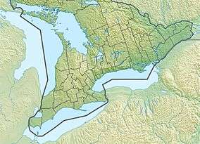 Balsam Lake Location in Southern Ontario | |
| Location | Kawartha Lakes, Ontario |
| Group | Kawartha Lakes |
| Coordinates | 44°34′50″N 78°50′30″W / 44.58056°N 78.84167°W[1]Coordinates: 44°34′50″N 78°50′30″W / 44.58056°N 78.84167°W[1] |
| Primary inflows | Gull River, Staples River, Corben Creek |
| Primary outflows | Rosedale River, Trent Canal |
| Catchment area | 115 km2 (44 sq mi) |
| Basin countries | Canada |
| Max. length | 16 km (9.9 mi) |
| Max. width | 3 km (1.9 mi) |
| Surface area | 48 km2 (19 sq mi) |
| Max. depth | 15.24 m (50.0 ft) |
| Surface elevation | 256.3 metres (841 ft) |
| Islands | Grand Island, Hogg Island, Ball Island, Delamere Island, Ant Island, Cherry Island |
| Settlements | Coboconk |
Balsam Lake is a lake in the City of Kawartha Lakes in Central Ontario, Canada.[1][2][3][4] It is in the Great Lakes Basin, is one of the lakes of the Kawartha Lakes, and is at the summit of the Trent–Severn Waterway.
Geography
Balsam Lake is 16 kilometres (9.9 mi) long and averages 3 kilometres (1.9 mi) wide, though its actual width varies due to the many large bays the carve its shoreline; the total area is 48 square kilometres (19 sq mi) and the watershed area is 115 square kilometres (44 sq mi).[5] The primary inflows are the Gull River at the north and the Staples River at the southwest.[1][2]
The lake is the highest point of the Trent–Severn Waterway at 256.3 metres (841 ft); from here, the waterway descends to Georgian Bay in the northwest, and to Lake Ontario in the southeast.[6] It is the highest point to which a vessel can be navigated from sea level in the Great Lakes-Saint Lawrence River drainage basin.
The main outflow, at the east, is the Rosedale River and Trent Canal leading to Cameron Lake.[1][2]
The village of Coboconk is located on the north side of the lake.
Natural history
Balsam Lake Provincial Park[7] and Indian Point Provincial Park[8] are located on the north shore of the lake.[2]
The lake offers excellent fishing for bass, walleye, and muskie. Mackenzie Bay in West Bay is a popular spot for boats to congregate on a warm summer day.[9]
Map images
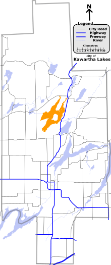 Location of the lake in the City of Kawartha Lakes |
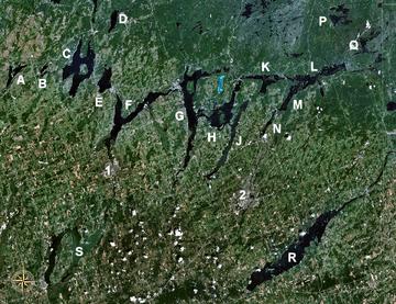 Location of the lake with respect to the other Kawartha lakes; Balsam Lake marked 'C' |
See also
References
- 1 2 3 4 5 "Balsam Lake". Geographical Names Data Base. Natural Resources Canada. Retrieved 2012-06-01.
- 1 2 3 4 "CLAIMaps IV". Ontario Ministry of Northern Development and Mines. 2016. Retrieved 2018-07-06.
- ↑ Map 5 (PDF) (Map). 1 : 700,000. Official road map of Ontario. Ministry of Transportation of Ontario. 2010-01-01. Retrieved 2018-07-06.
- ↑ Restructured municipalities - Ontario map #5 (Map). Restructuring Maps of Ontario. Ontario Ministry of Municipal Affairs and Housing. 2006. Retrieved 2018-07-06.
- ↑ "Balsam Lake Subwatershed". Kawartha Conservation. Retrieved 2018-07-06.
- ↑ Angus, James T. (1999). A Respectable Ditch: A History of the Trent-Severn Waterway, 1833–1920. McGill-Queen's Press. p. 80. ISBN 978-0-7735-1821-6. Retrieved 2009-08-07.
- ↑ "Balsam Lake". Ontario Parks. Retrieved 2018-07-06.
- ↑ "Indian Point". Ontario Parks. Retrieved 2018-07-06.
- ↑ "Fishing Facts for Balsam Lake". Archived from the original on 2012-02-13. Retrieved 2012-10-19.
City of Kawartha Lakes | |||||||
|---|---|---|---|---|---|---|---|
| Towns |  | ||||||
| Villages and unincorporated communities |
| ||||||
| Former townships | |||||||
| Major lakes |
| ||||||
| Topics | |||||||
1) This area lies on the border of an adjacent region, but is part of the Kawartha Lakes census. | |||||||