Homecrest, Brooklyn
Homecrest is a neighborhood situated in the New York City borough of Brooklyn, sometimes considered as part of Sheepshead Bay. It borders Kings Highway to the north, Avenue X to the south, Coney Island Avenue to the west, and Ocean Avenue to the east. Homecrest uses the ZIP Code, 11229. The area is served by Brooklyn Community Board 15.[1] and policed by the NYPD's 61st[2] Precinct.
Demographics
The community has traditionally been home to a large Italian population and has also experienced an influx of people from Latin America, China, Israel, Syria, Russia, and other former Eastern-bloc nations and from South Asia.
Based on data from the 2010 United States Census, the population of Homecrest was 44,316, a decrease of 1,363 (3.0%) from the 45,679 counted in 2000. Covering an area of 688.43 acres (278.60 ha), the neighborhood had a population density of 64.4 inhabitants per acre (41,200/sq mi; 15,900/km2).[3]
The racial makeup of the neighborhood was 79.8% (35,363) White, 1.0% (434) African American, 0.1% (36) Native American, 9.5% (4,215) Asian, 0.0% (5) Pacific Islander, 0.2% (71) from other races, and 1.3% (560) from two or more races. Hispanic or Latino of any race were 8.2% (3,632) of the population.[4]
Structures
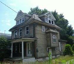
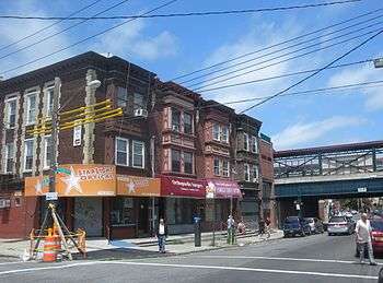
- Residential: In the early 21st century many condominiums were built. Many private residential two-story homes have been renovated into mini-mansions, some estimated at a half-million to a million dollars in estimated value. Just south Of Avenue 'V', one-story bungalow type homes are commonplace, as are rows of one-story brick homes with community backyards and driveways.
- Educational: There are a number of public schools, such as P.S. 255 Barbara Reing School (formerly William E. Kelly until 1994), P.S. 153 Homecrest and J.H.S. 234 W. Arthur Cunningham. Other local Schools include St. Edmund Preparatory High School, Nefesh Academy For Girls Yeshiva, Prospect Park Girls Yeshiva, Windmill Montessori School and Touro College Graduate School Of Education and Psychology.
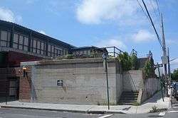
- Transport: Homecrest is served by the B and Q trains of the BMT Brighton Line, with stations located at Kings Highway, Avenue U, and Neck Road. The B3, B7, B36, B49, B68, B82 buses serve the area.
- Shopping: Kings Highway (to the north) is a major shopping street. Coney Island Avenue and Avenue U are also important.
- Parks: William E. Kelly Memorial Park[5] is a NYC P&R Park located along Avenue 'S', E. 14th.-15th. St.'s. It is a large community park featuring courts for tennis, basketball and handball, as well as a playground for kids. Kelly Playground, located at East 16th. Street and Ave. 'S', has basketball and handball courts. Students from the adjacent public schools, as well as local Yeshiva schools, often utilize the playground when school is in session. In the 1960s through 1970s, the playground had a roller hockey rink. Mellett Playground is a NYC Parks & Recreation Playground located along Avenue 'V, E. 13th.-14th. St.'s. It is a smaller community park featuring basketball hoops, a handball court as well as a kids playground area[6].
Health care
Homecrest Health Center (NYC Department of Health and Mental Hygiene) is located at 1601 Avenue S, at E. 16th St. It is a Public Health Facility. Coney Island Hospital, NY Prysbeterian Community, and Beth Israel King Highway Div. serve the community. Many private outpatient medical facilities have also emerged.
Religions
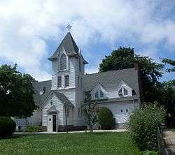
There is a growing population of members of the Jewish faith in the community, served by quite a few Orthodox and Sephardic synagogues. St. Edmunds Roman Catholic Parish serves the community, as does The First Baptist Church Of Sheepshead Bay, The Homecrest Presbyterian Church, and other congregations of various denomination serve the growing Asian population. There is also a Jehovah's Witness Kingdom Hall nearby.
In popular culture
- A Bronx Tale (1993)
- Brooklyn's Finest (2009)
See also
References
- ↑ Brooklyn Community Boards, New York City. Accessed December 31, 2007
- ↑ 61st Precinct, NYPD.
- ↑ Table PL-P5 NTA: Total Population and Persons Per Acre - New York City Neighborhood Tabulation Areas*, 2010, Population Division - New York City Department of City Planning, February 2012. Accessed June 16, 2016.
- ↑ Table PL-P3A NTA: Total Population by Mutually Exclusive Race and Hispanic Origin - New York City Neighborhood Tabulation Areas*, 2010, Population Division - New York City Department of City Planning, March 29, 2011. Accessed June 14, 2016.
- ↑ William E. Kelly Memorial Park
- ↑ "School Playground". Soft Surfaces. Retrieved 19 September 2017.