St. Boswells, Saskatchewan
| St. Boswells, Saskatchewan | |
|---|---|
| Hamlet | |
 St. Boswells, Saskatchewan Map of St. Boswells, 1918  St. Boswells, Saskatchewan St. Boswells, Saskatchewan (Canada) | |
| Coordinates: 50°03′00″N 106°50′02″W / 50.050°N 106.8339°W | |
| Country | Canada |
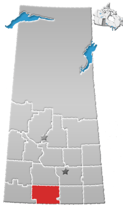
| Province | Saskatchewan |
| Region | Southwest Saskatchewan |
| Census division | 3 |
| Rural Municipality | Glen Bain |
| Established | 1918 |
| Government | |
| • Reeve | Ross Turnbull |
| • Administrator | Marilyn Scheller |
| • Governing body | Glen Bain No. 105[1] |
| Population (2006) | |
| • Total | 0 |
| Time zone | CST |
| Postal code | S0N 2G0 |
| Area code(s) | 306 |
| Highways | Range road 124 |
| [2][3][4][5] | |
St. Boswells is a hamlet in Glen Bain Rural Municipality No. 105, Saskatchewan, Canada. The hamlet is about 8 km east of Highway 19, about 25 km northwest of the town of Gravelbourg. Very little remains of the former village except a well known as the best water around, and sidewalks which mark the once prosperous business section of St. Boswells.
History
St. Boswells was a railroad town founded in 1918, as a Canadian National Railway point along the line from Moose Jaw to Neidpath. Named after Alex Dow's, hometown of St. Boswells, Roxburghshire, Scotland. St. Boswells was chosen as the name for the communities first post office.
See also
References
- ↑ Official website http://www.mds.gov.sk.ca/apps/Pub/MDS/muniDetails.aspx?cat=10&mun=2396 Glen Bain No.
- ↑ National Archives, Archivia Net, Post Offices and Postmasters
- ↑ Government of Saskatchewan, MRD Home, Municipal Directory System, archived from the original on November 21, 2008
- ↑ Canadian Textiles Institute. (2005), CTI Determine your provincial constituency, archived from the original on 2007-09-11
- ↑ Commissioner of Canada Elections, Chief Electoral Officer of Canada (2005), Elections Canada On-line
External links
- Saskatchewan Ghost towns By Johnnie Bachusky
- Horse Shoe Tourism Region
- Saskatchewan City & Town Maps
- Regional GenWeb site (Southwest Region)
- Saskatchewan Gen Web - One Room School Project
- Post Offices and Postmasters - ArchiviaNet - Library and Archives Canada
- Saskatchewan Gen Web Region
- Online Historical Map Digitization Project
- GeoNames Query
- Saskatchewan Cemetery Records
Places adjacent to St. Boswells, Saskatchewan | ||||||||||
|---|---|---|---|---|---|---|---|---|---|---|
| ||||||||||
Coordinates: 50°03′00″N 106°50′02″W / 50.05000°N 106.83389°W
This article is issued from
Wikipedia.
The text is licensed under Creative Commons - Attribution - Sharealike.
Additional terms may apply for the media files.