Grade II* listed buildings in Greater Manchester

There are 236 Grade II* listed buildings in Greater Manchester, England. In the United Kingdom, the term listed building refers to a building or other structure officially designated as being of special architectural, historical or cultural significance; Grade II* structures are those considered to be "particularly significant buildings of more than local interest".[1] In England, the authority for listing under the Planning (Listed Buildings and Conservation Areas) Act 1990[2] rests with English Heritage, a non-departmental public body sponsored by the Department for Culture, Media and Sport.
The metropolitan county of Greater Manchester is made up of 10 metropolitan boroughs: Bolton, Bury, Manchester, Oldham, Rochdale, Salford, Stockport, Tameside, Trafford and Wigan. The Grade II* buildings in each borough are listed separately. Manchester, the world's first industrialised city,[3] has 77 of Greater Manchester's 238 Grade II* listed buildings, the highest number of any borough. Bury has the least, with only eight. The River Irwell forms the boundary between Salford and Trafford, so one listed structure, Barton Swing Aqueduct, has been listed under both Salford and Trafford.
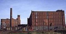
Most of Greater Manchester's listed buildings date from the Victorian and Edwardian periods.[1] According to an Association for Industrial Archaeology publication, Greater Manchester is "one of the classic areas of industrial and urban growth in Britain, the result of a combination of forces that came together in the 18th and 19th centuries: a phenomenal rise in population, the appearance of the specialist industrial town, a transport revolution, and weak local lordship".[4] Much of the region, historically a part of Lancashire, was at the forefront of textile manufacturing from the early 19th century until the early 20th century, and the county includes several former mill towns.[5][6] Greater Manchester has a wealth of industrial heritage, represented by industrial architecture found throughout the county,[6] but many of its Grade II* listed buildings have a municipal, ecclesiastic or other cultural heritage.
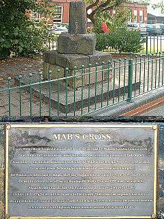
It is uncertain which Grade II* listed structure in Greater Manchester is the oldest. However, three of the 238 buildings date from the 13th century, making them the oldest. Brandlesholme Old Hall in Bury was once an open-hall cruck-framed house, originating in the 13th century, although altered and extended in the 16th century and completely remodelled in 1849.[7] The Church of St Chad in Rochdale has a 13th-century tower (with an 1870 extension).[8] And Mab's Cross in Wigan, the stump of a boundary cross, is probably 13th century in origin.[9] The newest Grade II* listed building in Greater Manchester is the Daily Express Building, designed by Sir Owen Williams in 1939.[10] Due to the heavy impact of the Industrial Revolution on Greater Manchester, just under half of its Grade II* listed buildings (112, 47%) were completed in the 19th century.
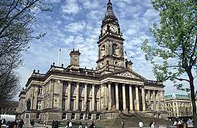
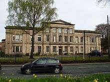
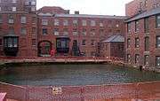
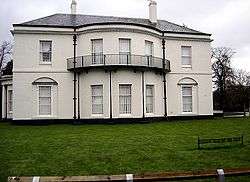
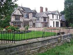
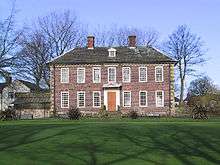
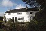
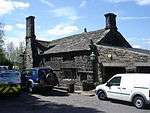
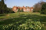
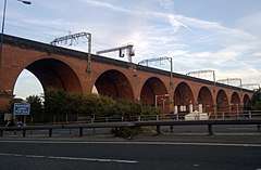
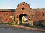
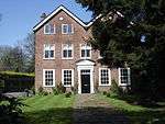
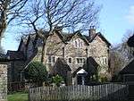
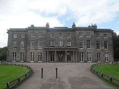
Bolton


.JPG)
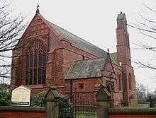
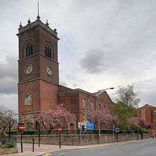
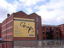
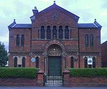
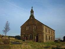
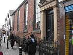
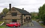
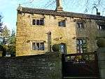
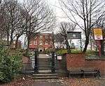
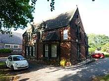
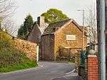
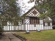
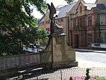
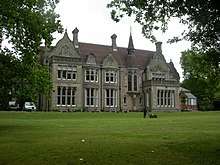
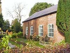
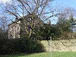
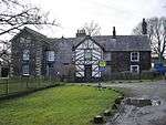
Bury
_-_geograph.org.uk_-_448023.jpg)
.JPG)
.jpg)
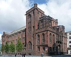
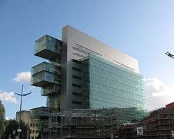
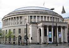
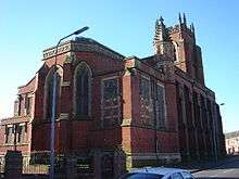
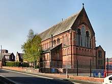
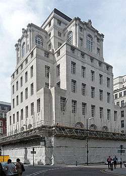
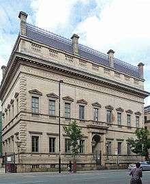
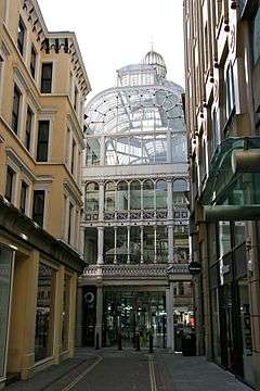
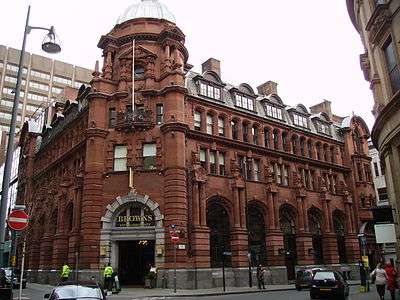
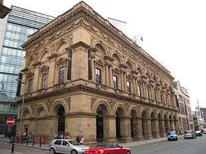
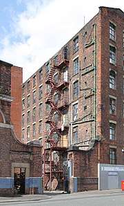
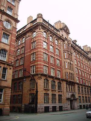
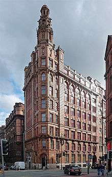
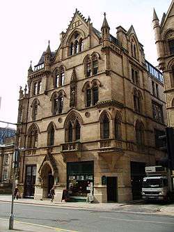
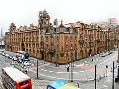
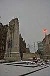
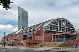
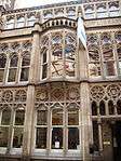
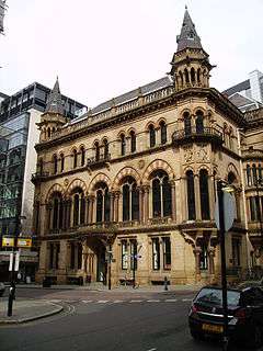
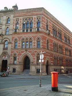
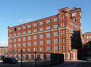
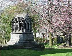
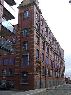
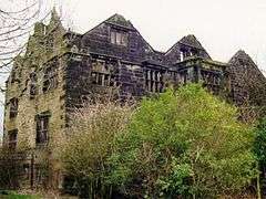
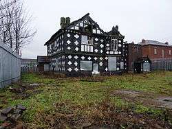
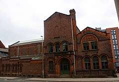
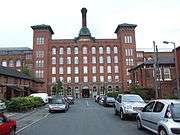
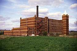
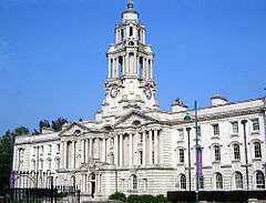
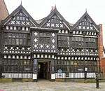
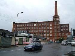
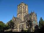
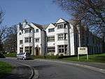
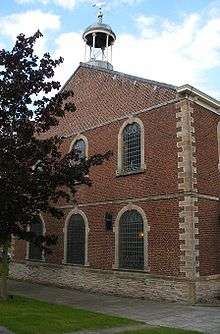
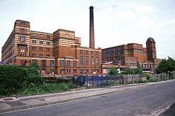
Manchester


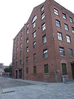


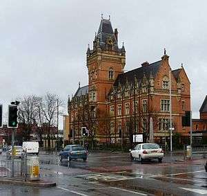
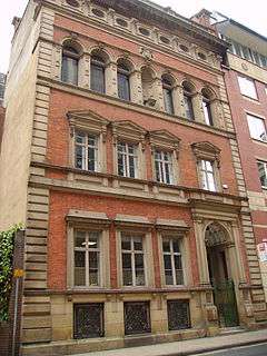


.jpg)


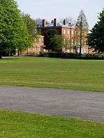


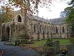
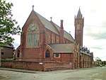
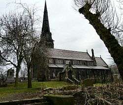
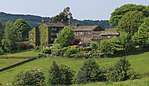
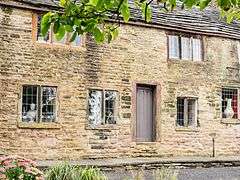
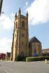
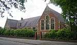
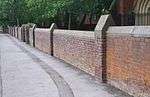
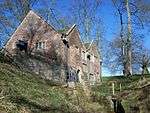
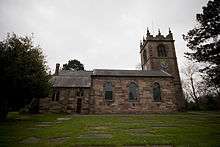
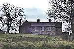
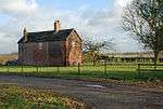
Oldham
_(geograph_2670491).jpg)
.JPG)

.jpg)
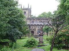
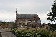
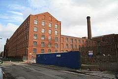
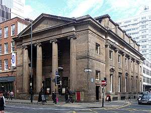
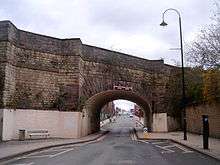
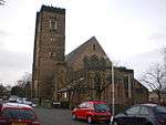
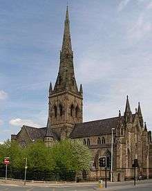
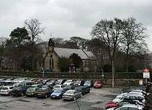
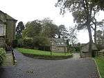
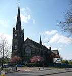
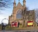
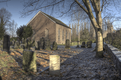
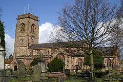
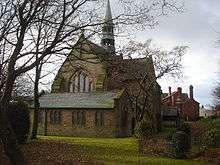
Rochdale

.jpg)


.jpg)


.jpg)
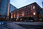
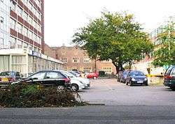
Salford
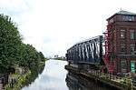

.jpg)

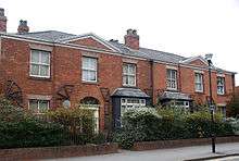
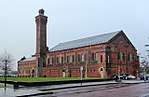
Stockport

.jpg)


.jpg)
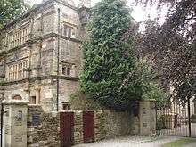
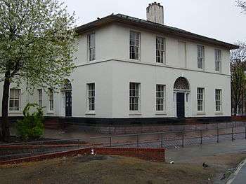
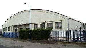
Tameside


.jpg)

.JPG)
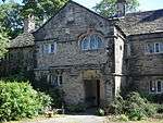
Trafford
.jpg)

.jpg)
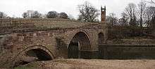
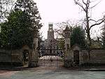
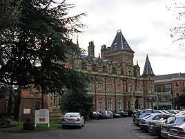
Wigan

.JPG)

.jpg)

See also
| Wikimedia Commons has media related to Grade II* listed buildings in Greater Manchester. |
Notes
- 1 2 3 4 5 6 7 8 9 10 The date given is the date used by Historic England as significant for the initial building or that of an important part in the structure's description.
- 1 2 3 4 5 6 7 8 9 10 Sometimes known as OSGB36, the grid reference is based on the British national grid reference system used by the Ordnance Survey.
- 1 2 3 4 5 6 7 8 9 10 The "List Entry Number" is a unique number assigned to each listed building and scheduled monument by Historic England.
References
- 1 2 "What is a listed building?". Manchester City Council. Retrieved 8 December 2007.
- ↑ "Planning (Listed Buildings and Conservation Areas) Act 1990 (c. 9)". Ministry of Justice. Archived from the original on 2010-04-18. Retrieved 2007-12-17.
- ↑ Kidd, Alan (2006). Manchester: A History. Lancaster, Lancashire: Carnegie Publishing Ltd. ISBN 1-85936-128-5.
- ↑ McNeil and Nevell (2000), A Guide to the Industrial Archaeology of Greater Manchester, p. 2.
- ↑ Cowhig, W.T. (1976). It Happened Round Greater Manchester; Textiles. Greater Manchester Council.
- 1 2 McNeil and Nevell (2000), A Guide to the Industrial Archaeology of Greater Manchester, p. 2–3.
- ↑ "Brandlesholme Old Hall, Bury". Images of England. Retrieved 2008-07-06.
- ↑ "Church of St Chad, Rochdale". Images of England. Retrieved 2008-07-06.
- ↑ "Mab's Cross, Wigan". Images of England. Retrieved 2008-07-06.
- ↑ "Daily Express Building, Manchester". Images of England. Retrieved 2008-07-06.
- ↑ "Brandlesholme Old Hall". Images of England. Retrieved 2008-02-23.
- ↑ "Christ Church, Walshaw". Images of England. Retrieved 2008-02-23.
- ↑ "Dearden Fold Farmhouse". Images of England. Retrieved 2008-02-23.
- ↑ Historic England. "Hey House (44308)". PastScape. Retrieved 2008-02-23.
- ↑ "Lower Chesham". Images of England. Retrieved 2008-02-23.
- ↑ "Presbyterian Chapel, Radcliffe". Images of England. Retrieved 2008-02-23.
- ↑ "Radcliffe Cenotaph". Images of England. Retrieved 2008-02-23.
- ↑ "25 St Ann Street, Manchester". Images of England. Retrieved 2008-05-30.
- ↑ "38 and 42 Mosley Street, Manchester". Images of England. Retrieved 2008-05-28.
- ↑ "Mrs Gaskell's House, 84 Plymouth Grove, Manchester". Images of England. Retrieved 2008-05-29.
- ↑ "Midland Bank, Manchester". Images of England. Retrieved 2008-05-27.
- ↑ "Asia House, Manchester". Images of England. Retrieved 2008-05-29.
- ↑ "The Athenaeum, Manchester". Images of England. Retrieved 2008-05-29.
- ↑ "Barton's Building including Barton Arcade, Manchester". Images of England. Retrieved 2008-05-24.
- ↑ "Beehive Mill, Manchester". Images of England. Retrieved 2008-05-27.
- ↑ "Britannia Hotel, Manchester". Images of England. Retrieved 2008-05-29.
- ↑ "GMB National College, Manchester". Images of England. Retrieved 2008-05-24.
- ↑ "Brookfield Unitarian Church, Manchester". Images of England. Retrieved 2008-05-24.
- ↑ "Brownfield Mill, Manchester". Images of England. Retrieved 2008-05-24.
- ↑ "Christ Church, Moss Side, Manchester". Images of England. Retrieved 2008-05-28.
- ↑ "Church and Friary of St Francis, Manchester". Images of England. Retrieved 2008-05-24.
- ↑ "Church of St. Cross, Manchester". Images of England. Retrieved 2008-05-24.
- ↑ "Church of St. George, Chester Road, Hulme". Images of England. Retrieved 2008-05-24.
- ↑ "Church of St James, Manchester". Images of England. Retrieved 2008-05-30.
- ↑ "Church of St John the Evangelist, Manchester". Images of England. Retrieved 2008-05-30.
- ↑ "Church of St Mary, Manchester". Images of England. Retrieved 2008-05-30.
- ↑ "Church of St. Michael and All Angels, Manchester". Images of England. Retrieved 2008-05-29.
- ↑ "Church of St Nicholas, Manchester". Images of England. Retrieved 2008-05-27.
- ↑ "Listed buildings in Manchester by street (O)". Manchester City Council. Retrieved 2008-07-02.
- ↑ "Church of St Peter, Manchester". Images of England. Retrieved 2008-07-02.
- ↑ "Church of St. Wilfrid, Northenden". Images of England. Retrieved 2008-05-24.
- ↑ "City Police Courts, Manchester". Images of England. Retrieved 2008-05-28.
- ↑ "Clayton Hall, Manchester". Images of England. Retrieved 2008-05-24.
- ↑ "Colonnade by lake to south of Heaton Hall, Manchester". Images of England. Retrieved 2008-05-24.
- ↑ "County Court, Manchester". Images of England. Retrieved 2008-05-29.
- ↑ "Daily Express Building, Manchester". Images of England. Retrieved 2008-05-24.
- ↑ "Dale Warehouse, Manchester". Images of England. Retrieved 2008-05-24.
- ↑ "Manchester Polytechnic, Didsbury School of Education, Manchester". Images of England. Retrieved 2008-05-30.
- ↑ "Doubling Mill and Fireproof Mill, Manchester". Images of England. Retrieved 2008-05-29.
- ↑ "Brookfield Unitarian Church, Manchester". Images of England. Retrieved 2008-05-24.
- ↑ "Church of St. Wilfrid, Manchester". Images of England. Retrieved 2008-05-24.
- ↑ "Former National Westminster Bank, Manchester". Images of England. Retrieved 2008-05-30.
- ↑ "Free Trade Hall, Manchester". Images of England. Retrieved 2008-05-29.
- ↑ "Deansgate Goods Station And attached carriage Ramp, Manchester". Images of England. Retrieved 2008-05-30.
- ↑ "Student Health Centre, Manchester". Images of England. Retrieved 2008-05-29.
- ↑ "Grand Lodge, Manchester". Images of England. Retrieved 2008-05-24.
- ↑ "Temple north east of Heaton Hall, Manchester". Images of England. Retrieved 2008-05-24.
- ↑ "Church of Holy Trinity, Manchester". Images of England. Retrieved 2008-05-29.
- ↑ "Hough End Hall, Manchester". Images of England. Retrieved 2008-05-28.
- ↑ "India House, Manchester". Images of England. Retrieved 2008-05-30.
- ↑ "Former Rochdale Canal Warehouse". Images of England. Retrieved 2011-05-14.
- ↑ "Lancaster House, Manchester". Images of England. Retrieved 2008-05-30.
- ↑ "Lawrence Buildings, Manchester". Images of England. Retrieved 2008-05-28.
- ↑ "London Road Fire Station, Manchester". Images of England. Retrieved 2008-05-28.
- ↑ "War Memorial, Manchester". Images of England. Retrieved 2008-05-30.
- ↑ "Manchester Central Library, Manchester". Images of England. Retrieved 2008-05-30.
- ↑ "G-Mex, Manchester". Images of England. Retrieved 2008-05-30.
- ↑ "Manchester Jewish Museum, Manchester". Images of England. Retrieved 2008-05-24.
- ↑ "Manchester Law Library, Manchester". Images of England. Retrieved 2008-05-27.
- ↑ "Former Reform Club, Manchester". Images of England. Retrieved 2008-05-27.
- ↑ "Manchester Town Hall Extension, Manchester". Images of England. Retrieved 2008-05-27.
- ↑ "103 Princess Street, Manchester". Images of England. Retrieved 2008-05-29.
- ↑ "Memorial Hall, Manchester". Images of England. Retrieved 2008-05-30.
- ↑ "Midland Hotel, Manchester". Images of England. Retrieved 2008-05-29.
- 1 2 "New Mill, Manchester". Images of England. Retrieved 2008-05-27.
- ↑ "Doubling Mill and Fireproof Mill, Manchester". Images of England. Retrieved 2008-05-29.
- ↑ "The Pankhurst Centre, Manchester". Images of England. Retrieved 2008-05-28.
- ↑ "New Mill, Manchester". Images of England. Retrieved 2008-05-27.
- ↑ "Parrs Wood House, Manchester". Images of England. Retrieved 2008-05-30.
- ↑ "Peacock Mausoleum, Manchester". Images of England. Retrieved 2008-05-27.
- ↑ "Platt Hall, Manchester". Images of England. Retrieved 2008-05-29.
- ↑ "Portico Library, Manchester". Images of England. Retrieved 2008-05-28.
- ↑ "Refuge Assurance Company Offices, Manchester". Images of England. Retrieved 2008-05-29.
- ↑ "Rose Hill, Manchester". Images of England. Retrieved 2008-05-28.
- ↑ "Royal Mill, Manchester". Images of England. Retrieved 2008-05-30.
- ↑ "Slade Hall, Manchester". Images of England. Retrieved 2008-05-30.
- ↑ "Smithy Lodge, Manchester". Images of England. Retrieved 2008-05-24.
- ↑ "Church of St James, Manchester". Images of England. Retrieved 2008-05-30.
- ↑ "The Towers (Shirley Institute), Manchester". Images of England. Retrieved 2008-05-30.
- ↑ "Tootal, Broadhurst and Lee Building, Manchester". Images of England. Retrieved 2008-05-29.
- ↑ "Islamic Academy, Manchester". Images of England. Retrieved 2008-05-30.
- ↑ "Victoria Baths, Manchester". Images of England. Retrieved 2008-05-24.
- ↑ "Victoria Mill, Manchester". Images of England. Retrieved 2008-05-28.
- ↑ "Victoria University of Manchester including Christie Library, Whitworth Hall, Manchester". Images of England. Retrieved 2008-05-29.
- ↑ The Buildings of England - Lancashire: Manchester and the South-East, p. 498
- ↑ "Wythenshawe Hall, Manchester". Images of England. Retrieved 2008-05-30.
- ↑ "Church of St Chad, Uppermill". Images of England. Retrieved 2008-02-24.
- ↑ Oldham Metropolitan Borough Council. "Church of St Chad, Uppermill". Oldham.gov.uk. Retrieved 2008-02-24.
- ↑ "Heights Chapel, Saddleworth". Images of England. Retrieved 2008-02-24.
- ↑ "Higher Kinders". Images of England. Retrieved 2008-02-24.
- ↑ Oldham Metropolitan Borough Council. "Higher Kinders". Oldham.gov.uk. Retrieved 2008-02-24.
- ↑ "Shore Mill". Images of England. Retrieved 2008-02-24.
- ↑ "Church of St Anne's, Royton". Images of England. Retrieved 2008-02-24.
- ↑ Oldham Metropolitan Borough Council. "Church of St Anne, Royton". Oldham.gov.uk. Retrieved 2008-02-24.
- ↑ "Church of St Mary and St Peter, Oldham". Images of England. Retrieved 2008-02-24.
- ↑ "Church of St Thomas, Lees". Images of England. Retrieved 2008-02-24.
- ↑ "Foxdenton Hall". Images of England. Archived from the original on 2012-10-05. Retrieved 2008-02-24.
- ↑ "Independent Methodist Chapel, Oldham". Images of England. Retrieved 2008-02-24.
- ↑ "1-5 Hollins Road, previously Hathershaw Hall". Images of England. Retrieved 2008-02-24.
- ↑ The Barton Swing Aqueduct crosses the Manchester Ship Canal and is in the boroughs of both Salford and Trafford. "Barton Swing Aqueduct". Images of England. Retrieved 2008-02-23.
- ↑ "Ackhurst Hall, Wigan". Images of England. Retrieved 2008-05-18.
- ↑ "Administration block at Astley Hospital, Wigan". Images of England. Retrieved 2008-05-18.
- ↑ "Astley Vicarage, Wigan". Images of England. Retrieved 2008-05-23.
- ↑ "Alder House, Wigan". Images of England. Retrieved 2008-05-18.
- ↑ "Chanters Farmhouse, Wigan". Images of England. Retrieved 2008-05-18.
- ↑ "Church of St Michael and All Angels, Wigan". Images of England. Retrieved 2008-05-18.
- ↑ "Chowbent Unitarian Chapel, Wigan". Images of England. Retrieved 2008-05-18.
- ↑ "Barn and stable to east of Winstanley Hall and two attached gateways, Wigan". Images of England. Retrieved 2008-05-23.
- ↑ "Bispham Hall, Wigan". Images of England. Retrieved 2008-05-23.
- ↑ "Bradley Hall Public House, Wigan". Images of England. Retrieved 2008-05-18.
- ↑ "Church of All Saints, Wigan". Images of England. Retrieved 2008-05-18.
- ↑ "Church of St James with St Thomas, Wigan". Images of England. Retrieved 2008-05-23.
- ↑ "Church of St John, Wigan". Images of England. Retrieved 2008-05-18.
- 1 2 3 "Listed Buildings in Wigan Metropolitan Borough Council" (PDF). Wigan Metropolitan Borough Coulcil. Archived from the original (PDF) on 2009-03-27. Retrieved 2007-12-14.
- ↑ "Church of St Mary, Wigan". Images of England. Retrieved 2008-05-18.
- ↑ "Church of St Mary, Wigan". Images of England. Retrieved 2008-05-18.
- ↑ "Church of St Matthew, Wigan". Images of England. Retrieved 2008-05-23.
- ↑ "Church of St Michael, Wigan". Images of England. Retrieved 2008-05-18.
- ↑ "Church of St Peter, Wigan". Images of England. Retrieved 2008-05-18.
- ↑ "Giant's Hall Farmhouse, Wigan". Images of England. Retrieved 2008-05-18.
- ↑ "Gateway and Lodges to Haigh Hall Park, Wigan". Images of England. Retrieved 2008-05-18.
- ↑ "Kirkless Hall and Kirkless Hall farmhouse, Wigan". Images of England. Retrieved 2008-05-18.
- ↑ "Leigh Mill, Wigan". Images of England. Retrieved 2008-05-18.
- ↑ "Light Oaks Hall, Wigan". Images of England. Retrieved 2008-05-18.
- ↑ "Lightshaw Hall, Wigan". Images of England. Retrieved 2008-05-18.
- ↑ "Mab's Cross, Wigan". Images of England. Retrieved 2008-05-18.
- ↑ "Manor House, Wigan". Images of England. Retrieved 2008-05-18.
- ↑ "Morley's Hall, Wigan". Images of England. Retrieved 2008-05-23.
- ↑ "War Memorial south of Church of All Saints with encircling railings, Wigan". Images of England. Retrieved 2008-05-18.
- ↑ "Winstanley Hall, Wigan". Images of England. Retrieved 2008-05-23.
- ↑ "Worthington Hall, Wigan". Images of England. Retrieved 2008-05-18.