Grade II* listed buildings in West Somerset

West Somerset shown within the county of Somerset

West Somerset is a local government district in the county of Somerset which is in South West England. In the United Kingdom, the term listed building refers to a building or other structure officially designated as being of special architectural, historical or cultural significance; Grade II* structures are those considered to be "particularly significant buildings of more than local interest".[1] Listing was begun by a provision in the Town and Country Planning Act 1947. Once listed, severe restrictions are imposed on the modifications allowed to a building's structure or its fittings. In England, the authority for listing under the Planning (Listed Buildings and Conservation Areas) Act 1990 rests with Historic England, a non-departmental public body sponsored by the Department for Digital, Culture, Media and Sport; local authorities have a responsibility to regulate and enforce the planning regulations.[2]

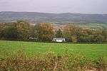
West Somerset is a largely rural area covering 740 square kilometres (290 sq mi).[3] The district has a population, according to the 2011 census, of 35,300,[4] with the largest centres of population in the coastal towns of Minehead and Watchet.[5] The council's administrative headquarters are in the village of Williton.[6]

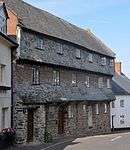
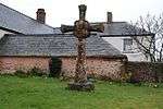
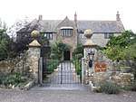
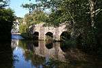
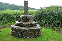
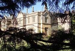
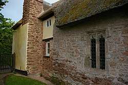
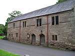
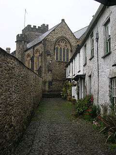
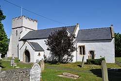
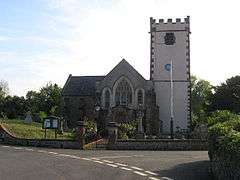
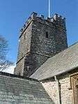
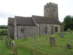
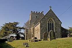
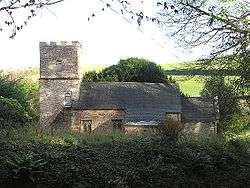
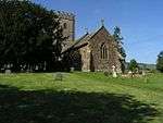
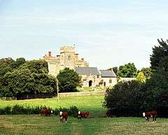
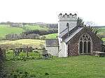
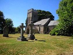
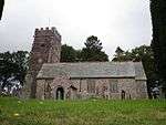
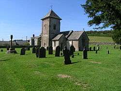
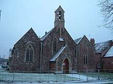
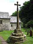
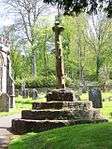
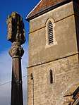
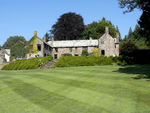
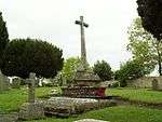
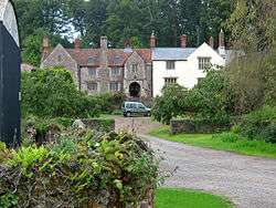
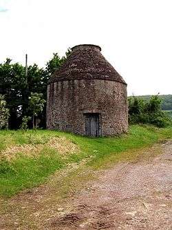
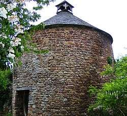
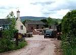
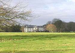
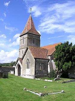
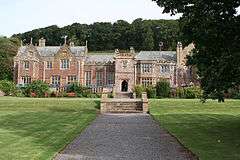
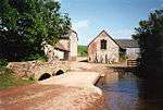
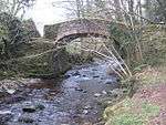
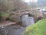
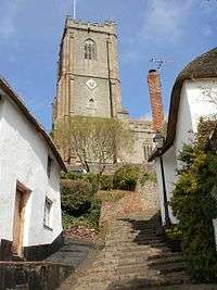
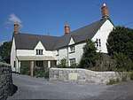
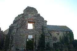
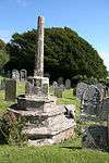
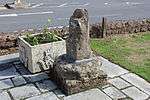
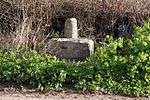
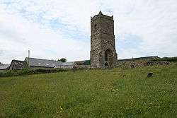
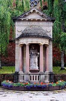
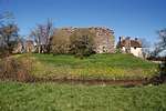
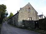
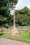
There are 100 Grade II* listed buildings in West Somerset. The list includes a large number of churches and chapels, some of which are Norman. Stogursey Castle is also 12th century in origin.[7] There are several churchyard and village crosses, which were small market crosses, dating from the 13th to 15th centuries. Packhorse bridges over Exmoor streams and some larger ones over rivers in the area are also included. The houses on the list range from the Middle Ages to early 20th century. Agricultural buildings include tithe barns, dovecotes and a watermill.

Buildings

Name Location Type Completed [note 1] Grid ref.[note 2]
Geo-coordinates
Entry number [note 3]ImageRef.
2, The Avenue, Minehead Minehead House 15th century SS969462
51°12′21″N 3°28′36″W / 51.2058°N 3.4767°W / 51.2058; -3.4767 (2, The Avenue, Minehead)
1207003
[8]
4, 6 and 8, Church Street, Dunster Dunster House 15th century SS991436
51°11′00″N 3°26′40″W / 51.1834°N 3.4444°W / 51.1834; -3.4444 (4, 6 and 8, Church Street, Dunster)
1057644
[9]
Allerford New Bridge Allerford Bridge Medieval SS899466
51°12′31″N 3°34′34″W / 51.2085°N 3.5762°W / 51.2085; -3.5762 (Allerford New Bridge)
1058050 [10]
Barn at south entrance to churchyard, Church of St Mary Stogumber Tithe barn 17th century ST098371
51°07′37″N 3°17′23″W / 51.1269°N 3.2897°W / 51.1269; -3.2897 (Barn at south entrance to churchyard, Church of St Mary)
1345646
[11]
Binham Farmhouse Old Cleeve Farmhouse 16th century ST035424
51°10′23″N 3°22′52″W / 51.1731°N 3.3812°W / 51.1731; -3.3812 (Binham Farmhouse)
1345628
[12]
Bury Bridge Brompton Regis Bridge Medieval SS944274
51°02′12″N 3°30′23″W / 51.0367°N 3.5065°W / 51.0367; -3.5065 (Bury Bridge)
1263985
[13]
Butter Cross Dunster Wayside cross Late C14/Early 15th century SS988438
51°11′06″N 3°26′57″W / 51.1851°N 3.4492°W / 51.1851; -3.4492 (Butter Cross)
1345602
[14]
Castle Mill and attached gateway and gate Dunster Watermill Late 17th century SS991433
51°10′49″N 3°26′41″W / 51.1803°N 3.4447°W / 51.1803; -3.4447 (Castle Mill and attached gateway and gate)
1173447
[15]
Causeway Bridge at east entrance to Stogursey Castle Stogursey Causeway 14th century ST203425
51°10′37″N 3°08′29″W / 51.1770°N 3.1413°W / 51.1770; -3.1413 (Causeway Bridge at east entrance to Stogursey Castle)
1295315
[7]
Chantry Stogumber Chantry Early 16th century ST096385
51°08′21″N 3°17′33″W / 51.1393°N 3.2924°W / 51.1393; -3.2924 (Chantry)
1295636 [16]
Chapel Cleeve Hotel Old Cleeve Country house 1818–1823 ST035429
51°10′41″N 3°22′52″W / 51.1780°N 3.3811°W / 51.1780; -3.3811 (Chapel Cleeve Hotel)
1057541
[17]
Chapel of St Leonard Tivington Chapel 14th century SS933450
51°11′41″N 3°31′41″W / 51.1946°N 3.5281°W / 51.1946; -3.5281 (Chapel of St Leonard)
1345394
[18]
Chargot House Luxborough House 1826 SS980371
51°07′28″N 3°27′31″W / 51.1245°N 3.4585°W / 51.1245; -3.4585 (Chargot House)
1057339
[19]
Church House and pound adjoining to the North West Crowcombe House 1515 ST140366
51°07′22″N 3°13′47″W / 51.1229°N 3.2297°W / 51.1229; -3.2297 (Church House and pound adjoining to the North West)
1057446
[20]
Church of All Saints Dulverton Church 15th century SS914280
51°02′28″N 3°32′59″W / 51.0411°N 3.5496°W / 51.0411; -3.5496 (Church of All Saints)
1247824
[21]
Church of Saint Mary Kilve Church 14th century ST146439
51°11′17″N 3°13′21″W / 51.188°N 3.2224°W / 51.188; -3.2224 (Church of Saint Mary)
1345709
[22]
Church of St Andrew Minehead Church 1877–1880 SS967461
51°12′19″N 3°28′44″W / 51.2052°N 3.4789°W / 51.2052; -3.4789 (Church of St Andrew)
1207013
[23]
Church of St Andrew Withypool Church Late medieval SS846355
51°06′29″N 3°38′58″W / 51.1080°N 3.6494°W / 51.1080; -3.6494 (Church of St Andrew)
1057968
[24]
Church of St Bartholomew Rodhuish Chapel 15th century ST012395
51°08′50″N 3°24′49″W / 51.1471°N 3.4136°W / 51.1471; -3.4136 (Church of St Bartholomew)
1175299
[25]
Church of St Ethel Dreda West Quantoxhead Church 1854–1856 ST113420
51°10′13″N 3°16′11″W / 51.1704°N 3.2698°W / 51.1704; -3.2698 (Church of St Ethel Dreda)
1175935
[26]
Church of St George Sampford Brett Church c. 1300 ST089401
51°09′14″N 3°18′12″W / 51.1538°N 3.3033°W / 51.1538; -3.3033 (Church of St George)
1295828
[27]
Church of St Giles Hawkridge Church Norman SS861306
51°03′50″N 3°37′36″W / 51.0638°N 3.6266°W / 51.0638; -3.6266 (Church of St Giles)
1174221
[28]
Church of St John Cutcombe Church 13th and early 14th century SS931392
51°08′33″N 3°31′46″W / 51.1424°N 3.5295°W / 51.1424; -3.5295 (Church of St John)
1174575
[29]
Church of St John Skilgate Church 14th century SS986272
51°02′08″N 3°26′47″W / 51.0355°N 3.4463°W / 51.0355; -3.4463 (Church of St John)
1248077
[30]
Church of St Martin Elworthy Church 13th century ST082349
51°06′24″N 3°18′41″W / 51.1066°N 3.3114°W / 51.1066; -3.3114 (Church of St Martin)
1057601
[31]
Church of St Mary Brompton Ralph Church 15th century ST085323
51°04′59″N 3°18′27″W / 51.0831°N 3.3076°W / 51.0831; -3.3076 (Church of St Mary)
1057972
[32]
Church 0f St Mary Brompton Regis Church 13th century SS951314
51°04′23″N 3°29′53″W / 51.0731°N 3.4981°W / 51.0731; -3.4981 (Church 0f St Mary)
1057978
[33]
Church of St Mary East Quantoxhead Church 14th century ST136436
51°11′08″N 3°14′13″W / 51.1856°N 3.2370°W / 51.1856; -3.2370 (Church of St Mary)
1057410
[34]
Church of St Mary Oare Church 15th century SS802473
51°12′45″N 3°42′59″W / 51.2124°N 3.7164°W / 51.2124; -3.7164 (Church of St Mary)
1345381
[35]
Church of St Mary Magdalene Withiel Florey Church 12th century SS986332
51°05′24″N 3°26′53″W / 51.0899°N 3.4480°W / 51.0899; -3.4480 (Church of St Mary Magdalene)
1057984
[36]
Church of St Mary Magdalene Clatworthy Church 12th century ST052309
51°04′12″N 3°21′13″W / 51.0699°N 3.3535°W / 51.0699; -3.3535 (Church of St Mary Magdalene)
1263926
[37]
Church of St Mary Magdelene Exford Church 15th Century SS857385
51°08′04″N 3°38′03″W / 51.1344°N 3.6341°W / 51.1344; -3.6341 (Church of St Mary Magdelene)
1057319
[38]
Church of St Peter Exton Church Norman SS925337
51°05′33″N 3°32′07″W / 51.0926°N 3.5352°W / 51.0926; -3.5352 (Church of St Peter)
1296311
[39]
Church of St Peter Treborough Church Early 14th century ST010363
51°07′05″N 3°24′54″W / 51.1181°N 3.4149°W / 51.1181; -3.4149 (Church of St Peter)
12954
[40]
Church of St Peter Williton Church 1896 ST075407
51°09′31″N 3°19′24″W / 51.1585°N 3.3234°W / 51.1585; -3.3234 (Church of St Peter)
1174922
[41]
Churchyard Cross About 3 Metres South East Of Porch, Culbone Church Culbone Cross 15th century SS842482
51°13′17″N 3°39′34″W / 51.2214°N 3.6594°W / 51.2214; -3.6594 (Churchyard Cross About 3 Metres South East Of Porch, Culbone Church)
1173301
[42]
Churchyard Cross, 10m south of porch, Church of Saint Mary East Quantoxhead Cross Late 14th century ST136436
51°11′08″N 3°14′13″W / 51.1855°N 3.2370°W / 51.1855; -3.2370 (Churchyard Cross, 10m south of porch, Church of Saint Mary)
1057411
[43]
Churchyard Cross, 2 Metres South Of Porch, Church of The Holy Ghost Crowcombe Cross 14th century ST140366
51°07′23″N 3°13′45″W / 51.1231°N 3.2292°W / 51.1231; -3.2292 (Churchyard Cross, 2 Metres South Of Porch, Church of The Holy Ghost)
1057442
[44]
Churchyard Cross, 7m north of nave, Church of St Mary Holford Cross Late 13th century ST156411
51°09′46″N 3°12′27″W / 51.1629°N 3.2076°W / 51.1629; -3.2076 (Churchyard Cross, 7m north of nave, Church of St Mary)
1345684 [45]
Churchyard Cross, 8 metres east of chancel, Church of St George Bicknoller Cross 14th century ST111394
51°08′50″N 3°16′20″W / 51.1472°N 3.2722°W / 51.1472; -3.2722 (Churchyard Cross, 8 metres east of chancel, Church of St George)
1057466
[46]
Churchyard Cross, in churchyard about 6 metres south of south aisle, Church of St Andrew Old Cleeve Cross Early 14th century ST041419
51°10′06″N 3°22′23″W / 51.1683°N 3.3730°W / 51.1683; -3.3730 (Churchyard Cross, in churchyard about 6 metres south of south aisle, Church of St Andrew)
1057553 [47]
Churchyard Cross, 5m south of porch, Church of St Mary Stringston Cross Late 14th century ST176423
51°10′29″N 3°10′46″W / 51.1748°N 3.1795°W / 51.1748; -3.1795 (Churchyard Cross, 5m south of porch, Church of St Mary)
1308144
[48]
Combe Dulverton Manor house Late 16th century SS912266
51°01′45″N 3°33′10″W / 51.0293°N 3.5528°W / 51.0293; -3.5528 (Combe)
1247793
[49]
Cross in Churchyard South of Church Porch Watchet Cross Probably early 15th century ST064426
51°10′33″N 3°20′20″W / 51.1757°N 3.3390°W / 51.1757; -3.3390 (Cross in Churchyard South of Church Porch)
1057663
[50]
Croydon House Timberscombe House c. 1700 SS962406
51°09′21″N 3°29′05″W / 51.1559°N 3.4846°W / 51.1559; -3.4846 (Croydon House)
1057345 [51]
Dodington Hall Dodington Manor house 15th century ST172405
51°09′29″N 3°11′06″W / 51.1580°N 3.1850°W / 51.1580; -3.1850 (Dodington Hall)
1057421
[52]
Dovecot At Blackford Farm Selworthy Dovecote Late medieval SS924452
51°11′48″N 3°32′25″W / 51.1966°N 3.5402°W / 51.1966; -3.5402 (Dovecot At Blackford Farm)
1345406
[53]
Dovecote Dunster Dovecote Late 16th century SS990437
51°11′02″N 3°26′46″W / 51.1838°N 3.4462°W / 51.1838; -3.4462 (Dovecote)
1057581
[54]
Doverhay Reading Room And Cottage Abutting North End Porlock House Late 15th century SS888467
51°12′33″N 3°35′35″W / 51.2092°N 3.5931°W / 51.2092; -3.5931 (Doverhay Reading Room And Cottage Abutting North End)
1296210
[55]
Fair Garden Farmhouse Wootton Courtenay House 16th century SS932421
51°10′07″N 3°31′41″W / 51.1685°N 3.5280°W / 51.1685; -3.5280 (Fair Garden Farmhouse)
1175358
[56]
Fairfield House Stogursey House Medieval ST187429
51°10′49″N 3°09′49″W / 51.1803°N 3.1637°W / 51.1803; -3.1637 (Fairfield House)
1175243
[57]
Gatehouse and adjoining Gatehouse Cottage Holnicote Estate Cross passage house 16th or 17th century SS910462
51°12′18″N 3°33′39″W / 51.2050°N 3.5607°W / 51.2050; -3.5607 (Gatehouse and adjoining Gatehouse Cottage)
1173887
[58]
Govett Family Chest Tomb, In Churchyard One Metre West Of Porch, Church of St Mary Stringston Chest tomb Early 17th century ST176423
51°10′29″N 3°10′46″W / 51.1748°N 3.1795°W / 51.1748; -3.1795 (Govett Family Chest Tomb, In Churchyard One Metre West Of Porch, Church of St Mary)
1345706
[59]
Halsway Manor Bicknoller Manor house 15th century ST126382
51°08′12″N 3°15′00″W / 51.1366°N 3.2500°W / 51.1366; -3.2500 (Halsway Manor)
1057472
[60]
Hartrow Manor Stogumber Farmhouse Late 18th century ST095347
51°06′18″N 3°17′35″W / 51.1050°N 3.2930°W / 51.1050; -3.2930 (Hartrow Manor)
1057532
[61]
Kentsford Farmhouse Watchet Farmhouse Probably late medieval ST058425
51°10′29″N 3°20′52″W / 51.1748°N 3.3477°W / 51.1748; -3.3477 (Kentsford Farmhouse)
1180276
[62]
Kildare Lodge Inn Minehead House 1903 SS969457
51°12′07″N 3°28′37″W / 51.2020°N 3.4770°W / 51.2020; -3.4770 (Kildare Lodge Inn)
1279930
[63]
Landacre Bridge Withypool Bridge Late medieval SS816361
51°06′44″N 3°41′32″W / 51.1122°N 3.6921°W / 51.1122; -3.6921 (Landacre Bridge)
1058006
[64]
Linhay, barn and farm buildings adjoining on north-east side of foldyard at Bratton Court Minehead Without Farm building 19th century SS946462
51°12′22″N 3°30′35″W / 51.2061°N 3.5096°W / 51.2061; -3.5096 (Linhay, barn and farm buildings adjoining on north-east side of foldyard at Bratton Court)
1175044
[65]
Luttrell Arms Hotel Dunster House Late 15th or early 16th century SS991438
51°11′05″N 3°26′39″W / 51.1848°N 3.4441°W / 51.1848; -3.4441 (Luttrell Arms Hotel)
1057611
[66]
Lynch Chapel Of Ease Selworthy Chapel c. 1530 SS900476
51°13′03″N 3°34′33″W / 51.2174°N 3.5759°W / 51.2174; -3.5759 (Lynch Chapel Of Ease)
1057997
[67]
Manor Farmhouse, Gatepiers, Walls And Railings returned around Forecourt Brompton Ralph Farmhouse c. 1720 enlarged ST089313
51°04′26″N 3°18′05″W / 51.0740°N 3.3014°W / 51.0740; -3.3014 (Manor Farmhouse, Gatepiers, Walls And Railings returned around Forecourt)
1057971 [68]
Marshwood Farmhouse Blue Anchor Farmhouse Late 15th century ST022429
51°10′39″N 3°23′59″W / 51.1774°N 3.3998°W / 51.1774; -3.3998 (Marshwood Farmhouse)
1057364
[69]
Old Manor Guesthouse Dunster House Mid-late 15th century SS995449
51°11′42″N 3°26′23″W / 51.1951°N 3.4397°W / 51.1951; -3.4397 (Old Manor Guesthouse)
1345608
[70]
Old Vicarage Stogumber House Late 16th or early 17th century ST097373
51°07′40″N 3°17′27″W / 51.1278°N 3.2907°W / 51.1278; -3.2907 (Old Vicarage)
1057501
[71]
Packhorse Bridge At NGR SS 8670 3748, about 50m west Of Lyncombe Lyncombe Packhorse bridge 17th or 18th century SS867374
51°07′31″N 3°37′12″W / 51.1254°N 3.6201°W / 51.1254; -3.6201 (Packhorse Bridge At NGR SS 8670 3748, about 50m west Of Lyncombe)
1174159 [72]
Packhorse bridge Horner Packhorse bridge Late medieval SS897455
51°11′55″N 3°34′47″W / 51.1985°N 3.5797°W / 51.1985; -3.5797 (Packhorse bridge)
1057326
[73]
Packhorse Bridge Luccombe Packhorse bridge Late medieval SS898461
51°12′13″N 3°34′40″W / 51.2035°N 3.5777°W / 51.2035; -3.5777 (Packhorse Bridge)
1174852
[74]
Packhorse Bridge Allerford Packhorse bridge Medieval SS905469
51°12′40″N 3°34′08″W / 51.2110°N 3.5688°W / 51.2110; -3.5688 (Packhorse Bridge)
1058014
[75]
Parish Church of St Michael Minehead Church 15th century SS966467
51°12′39″N 3°28′50″W / 51.2109°N 3.4805°W / 51.2109; -3.4805 (Parish Church of St Michael)
1207000
[76]
Pixton Park Dulverton Country house c. 1760 SS924271
51°02′02″N 3°32′05″W / 51.0339°N 3.5347°W / 51.0339; -3.5347 (Pixton Park)
1247974 [77]
Pollard Chest Tomb. In Churchyard about 24m south of Porch, Church of St Mary Kilve Chest tomb 17th century ST146439
51°11′17″N 3°13′21″W / 51.1881°N 3.2224°W / 51.1881; -3.2224 (Pollard Chest Tomb. In Churchyard about 24m south of Porch, Church of St Mary)
1057390 [78]


Prior Family Chest Tomb And encircling Wrought Iron Railings. In Churchyard, 10m south Of South Chapel, Church of St Mary Stringston Chest tomb Early 17th century ST176423
51°10′29″N 3°10′46″W / 51.1748°N 3.1795°W / 51.1748; -3.1795 (Prior Family Chest Tomb And encircling Wrought Iron Railings. In Churchyard, 10m south Of South Chapel, Church of St Mary)
1308149 [79]
Priors Farmhouse including Farm Buildings adjoining to East Stringston Farmhouse 15th century ST177425
51°10′36″N 3°10′41″W / 51.1766°N 3.1780°W / 51.1766; -3.1780 (Priors Farmhouse including Farm Buildings adjoining to East)
1308154
[80]
Priory Cottage, Chantry Cottage and Dairy, abutting South West Corner Of Priory Cottage Kilve House 14th century ST146440
51°11′20″N 3°13′23″W / 51.1889°N 3.2230°W / 51.1889; -3.2230 (Priory Cottage, Chantry Cottage and Dairy, abutting South West Corner Of Priory Cottage)
1175110 [81]
Raleigh's Cross Nettlecombe Cross 13th century ST038344
51°06′04″N 3°22′27″W / 51.1010°N 3.3741°W / 51.1010; -3.3741 (Raleigh's Cross)
1057573 [82]
Remains of Chantry, Abutting East Side of Chantry Cottage Kilve Chantry Early 14th century ST146440
51°11′20″N 3°13′22″W / 51.1889°N 3.2229°W / 51.1889; -3.2229 (Remains of Chantry, Abutting East Side of Chantry Cottage)
1345688
[83]
Remains of Churchyard Cross About 4 Metres East Of South Aisle, Church of All Saints Selworthy Cross 15th century SS919467
51°12′36″N 3°32′51″W / 51.2101°N 3.5476°W / 51.2101; -3.5476 (Remains of Churchyard Cross About 4 Metres East Of South Aisle, Church of All Saints)
1058028
[84]
Remains of churchyard cross West Quantoxhead Cross 15th century ST113419
51°10′13″N 3°16′11″W / 51.1702°N 3.2698°W / 51.1702; -3.2698 (Remains of churchyard cross)
1057387 [85]
Remains of Churchyard Cross, About 15 Metres North of North Aisle Door, Church of St Peter Williton Cross Late 13th century ST075407
51°09′31″N 3°19′25″W / 51.1587°N 3.3237°W / 51.1587; -3.3237 (Remains of Churchyard Cross, About 15 Metres North of North Aisle Door, Church of St Peter)
1057462
[86]
Remains of Churchyard Cross. In Churchyard 2m north-east of Porch, Church of All Saints Dodington, Holford Cross 14th century ST172405
51°09′30″N 3°11′07″W / 51.1583°N 3.1854°W / 51.1583; -3.1854 (Remains of Churchyard Cross. In Churchyard 2m north-east of Porch, Church of All Saints)
1345682
[87]
Remains of churchyard cross about 18m east of Chancel, Church of St Mary Luccombe Cross 15th century SS911445
51°11′23″N 3°33′34″W / 51.1896°N 3.5594°W / 51.1896; -3.5594 (Remains of churchyard cross about 18m east of Chancel, Church of St Mary)
1057329 [88]
Remains of Churchyard Cross. In Churchyard about 18m south of Nave, Church of All Saints Wootton Courtenay Cross Early 15th century SS938434
51°10′48″N 3°31′14″W / 51.1801°N 3.5205°W / 51.1801; -3.5205 (Remains of Churchyard Cross. In Churchyard about 18m south of Nave, Church of All Saints)
1175433
[89]
Remains of Market Cross opposite Egremont Hotel Williton Cross 14th century ST077409
51°09′37″N 3°19′15″W / 51.1602°N 3.3208°W / 51.1602; -3.3208 (Remains of Market Cross opposite Egremont Hotel)
1345670
[90]
Remains of Roadside Cross At NGR ST 0435 4174 Old Cleeve Cross 14th century ST043417
51°10′01″N 3°22′10″W / 51.1669°N 3.3694°W / 51.1669; -3.3694 (Remains of Roadside Cross At NGR ST 0435 4174)
1174166 [91]
Remains of Roadside Cross at NGR ST 0883 4288 Doniford, Williton Cross Early 15th century ST088428
51°10′40″N 3°18′22″W / 51.1779°N 3.306°W / 51.1779; -3.306 (Remains of Roadside Cross at NGR ST 0883 4288)
1057482
[92]
Remains of The Church of St James Upton Church 14th century SS980295
51°03′21″N 3°27′23″W / 51.0558°N 3.4564°W / 51.0558; -3.4564 (Remains of The Church of St James)
1248084
[93]
Remains of Village Cross Stogursey Cross 13th or 14th century ST202428
51°10′47″N 3°08′33″W / 51.1797°N 3.1424°W / 51.1797; -3.1424 (Remains of Village Cross)
1345701 [94]
Statue of Queen Anne Minehead Statue 1719 SS967461
51°12′19″N 3°28′44″W / 51.2053°N 3.4790°W / 51.2053; -3.4790 (Statue of Queen Anne)
1207015
[95]
Steyning Manor Stogursey Cross passage house Late 15th or early 16th century ST219427
51°10′44″N 3°07′04″W / 51.1788°N 3.1178°W / 51.1788; -3.1178 (Steyning Manor)
1057395 [96]
Stogursey Castle Stogursey Castle 12th century ST203425
51°10′37″N 3°08′29″W / 51.1770°N 3.1415°W / 51.1770; -3.1415 (Stogursey Castle)
1057403
[97]
Stoke Pero Church Stoke Pero, Luccombe Church 13th century SS878434
51°10′47″N 3°36′22″W / 51.1797°N 3.6061°W / 51.1797; -3.6061 (Stoke Pero Church)
1174803
[98]
Stone Exford House Mid-late 18th century SS878434
51°08′14″N 3°37′23″W / 51.1372°N 3.6230°W / 51.1372; -3.6230 (Stone)
1345753
[99]
Tithe Barn and Tithe Barn Cottage Selworthy House Late medieval SS918467
51°12′35″N 3°32′58″W / 51.2096°N 3.5495°W / 51.2096; -3.5495 (Tithe Barn and Tithe Barn Cottage)
1057990
[100]
Village Cross, 30m east Of the Carew Arms Crowcombe Cross 14th century ST139367
51°07′25″N 3°13′54″W / 51.1237°N 3.2316°W / 51.1237; -3.2316 (Village Cross, 30m east Of the Carew Arms)
1057441
[101]
Weacombe House West Quantoxhead Country house Mid 18th century ST109406
51°09′28″N 3°16′29″W / 51.1578°N 3.2746°W / 51.1578; -3.2746 (Weacombe House)
1175891 [102]
Willett House Elworthy House c. 1816 ST110345
51°06′13″N 3°16′20″W / 51.1035°N 3.2721°W / 51.1035; -3.2721 (Willett House)
1057561
[103]
Williton Hospital Williton Hospital 1838–1840 ST082414
51°09′52″N 3°18′50″W / 51.1645°N 3.3138°W / 51.1645; -3.3138 (Williton Hospital)
1057488
[104]
Withypool Bridge Withypool Bridge 19th century SS845354
51°06′24″N 3°39′04″W / 51.1067°N 3.6510°W / 51.1067; -3.6510 (Withypool Bridge)
1057969
[105]
Wood Tenament Dulverton Farmhouse 17th century extended SS916279
51°02′25″N 3°32′49″W / 51.0403°N 3.5470°W / 51.0403; -3.5470 (Wood Tenament)
1247931 [106]

See also

Notes

  1. The date given is the date used by Historic England as significant for the initial building or that of an important part in the structure's description.
  2. Sometimes known as OSGB36, the grid reference is based on the British national grid reference system used by the Ordnance Survey.
  3. The "List Entry Number" is a unique number assigned to each listed building and scheduled monument by Historic England.

References

  1. "Listed Buildings". Historic England. Archived from the original on 14 March 2017. Retrieved 23 August 2017.
  2. "Planning (Listed Buildings and Conservation Areas) Act 1990 (c. 9)". Ministry of Justice. Archived from the original on 18 April 2010. Retrieved 17 December 2007.
  3. "West Somerset (Local Authority): Key Figures for Physical Environment". Neighbourhood Statistics. Office for National Statistics. Archived from the original on 29 July 2014. Retrieved 23 April 2009.
  4. "Statistics & Census Information". West Somerset Council. Retrieved 22 October 2017.
  5. "West Somerset Local Planning Authority Area Town and Village Centres Study". West Somerset Council. Retrieved 3 December 2017.
  6. "Contact Us". West Somerset Council. Retrieved 3 December 2017.
  7. 1 2 Historic England. "Causeway Bridge at east entrance to Stogursey Castle (1295315)". National Heritage List for England. Retrieved 3 April 2015.
  8. Historic England. "2, The Avenue (1207003)". National Heritage List for England. Retrieved 3 April 2015.
  9. Historic England. "4, 6 And 8, Church Street (1057644)". National Heritage List for England. Retrieved 3 April 2015.
  10. Historic England. "Allerford New Bridge (1058050)". National Heritage List for England. Retrieved 3 April 2015.
  11. Historic England. "Barn At South Entrance To Churchyard, Church of St Mary (1345646)". National Heritage List for England. Retrieved 3 April 2015.
  12. Historic England. "Binham Farmhouse (1345628)". National Heritage List for England. Retrieved 3 April 2015.
  13. Historic England. "Bury Bridge At Ngr Ss 9445 2745 (1263985)". National Heritage List for England. Retrieved 3 April 2015.
  14. Historic England. "Butter Cross (1345602)". National Heritage List for England. Retrieved 3 April 2015.
  15. Historic England. "Castle Mill and attached gateway and gate (1173447)". National Heritage List for England. Retrieved 3 April 2015.
  16. Historic England. "The Chantry (1295636)". National Heritage List for England. Retrieved 3 April 2015.
  17. Historic England. "Chapel Cleeve Hotel, Balustrade Flanking Entrance Steps And East Wall Terminating Terrace Marked By 2 Steps Fronting Facade (1057541)". National Heritage List for England. Retrieved 3 April 2015.
  18. Historic England. "Chapel of St Leonard (1345394)". National Heritage List for England. Retrieved 3 April 2015.
  19. Historic England. "Chargot House (1057339)". National Heritage List for England. Retrieved 3 April 2015.
  20. Historic England. "Church House and pound adjoining to the North West (1057446)". National Heritage List for England. Retrieved 3 April 2015.
  21. Historic England. "Church of All Saints (1247824)". National Heritage List for England. Retrieved 3 April 2015.
  22. Historic England. "Church of Saint Mary (1345709)". National Heritage List for England. Retrieved 3 April 2015.
  23. Historic England. "Church of St Andrew (1207013)". National Heritage List for England. Retrieved 3 April 2015.
  24. Historic England. "Church of St Andrew (1057968)". National Heritage List for England. Retrieved 3 April 2015.
  25. Historic England. "Church of St Bartholomew (1175299)". National Heritage List for England. Retrieved 3 April 2015.
  26. Historic England. "Church of St Ethel Dreda (1175935)". National Heritage List for England. Retrieved 3 April 2015.
  27. Historic England. "Church of St George (1295828)". National Heritage List for England. Retrieved 3 April 2015.
  28. Historic England. "Church of St Giles (1174221)". National Heritage List for England. Retrieved 3 April 2015.
  29. Historic England. "Church of St John (1174575)". National Heritage List for England. Retrieved 3 April 2015.
  30. Historic England. "Church of St John (1248077)". National Heritage List for England. Retrieved 3 April 2015.
  31. Historic England. "Church of St Martin (1057601)". National Heritage List for England. Retrieved 3 April 2015.
  32. Historic England. "Church of St Mary (1057972)". National Heritage List for England. Retrieved 3 April 2015.
  33. Historic England. "Church of St Mary (1057978)". National Heritage List for England. Retrieved 3 April 2015.
  34. Historic England. "Church of St Mary (1057410)". National Heritage List for England. Retrieved 3 April 2015.
  35. Historic England. "Church of St Mary (1345381)". National Heritage List for England. Retrieved 3 April 2015.
  36. Historic England. "Church of St Mary Magdalene (1057984)". National Heritage List for England. Retrieved 3 April 2015.
  37. Historic England. "Church of St Mary Magdalene (1263926)". National Heritage List for England. Retrieved 3 April 2015.
  38. Historic England. "Church of St Mary Magdalene (1057319)". National Heritage List for England. Retrieved 3 April 2015.
  39. Historic England. "Church of St Peter (1296311)". National Heritage List for England. Retrieved 3 April 2015.
  40. Historic England. "Church of St Peter (1295414)". National Heritage List for England. Retrieved 3 April 2015.
  41. Historic England. "Church of St Peter (1174922)". National Heritage List for England. Retrieved 3 April 2015.
  42. Historic England. "Churchyard Cross About 3 Metres South East of Porch, Culbone Church (1173301)". National Heritage List for England. Retrieved 3 April 2015.
  43. Historic England. "Churchyard Cross, 10 Metres South Of Porch, Church of Saint Mary (1057411)". National Heritage List for England. Retrieved 3 April 2015.
  44. Historic England. "Churchyard Cross, 2 Metres South Of Porch, Church of The Holy Ghost (1057442)". National Heritage List for England. Retrieved 3 April 2015.
  45. Historic England. "Churchyard Cross, 7 metres north of nave, Church of St Mary (1345684)". National Heritage List for England. Retrieved 3 April 2015.
  46. Historic England. "Churchyard Cross, 8 metres east of chancel, Church of St George (1057466)". National Heritage List for England. Retrieved 3 April 2015.
  47. Historic England. "Churchyard Cross, In Churchyard About 6 Metres South Of South Aisle, Church of St Andrew (1057553)". National Heritage List for England. Retrieved 3 April 2015.
  48. Historic England. "Churchyard Cross, 5 metres south of porch, Church of St Mary (1308144)". National Heritage List for England. Retrieved 3 April 2015.
  49. Historic England. "Combe (1247793)". National Heritage List for England. Retrieved 3 April 2015.
  50. Historic England. "Cross In Churchyard South Of Church Porch (1057663)". National Heritage List for England. Retrieved 3 April 2015.
  51. Historic England. "Croydon House (1057345)". National Heritage List for England. Retrieved 3 April 2015.
  52. Historic England. "Dodington Hall (1057421)". National Heritage List for England. Retrieved 3 April 2015.
  53. Historic England. "Dovecot At Blackford Farm (1345406)". National Heritage List for England. Retrieved 3 April 2015.
  54. Historic England. "Dovecote (1057581)". National Heritage List for England. Retrieved 3 April 2015.
  55. Historic England. "Doverhay Reading Room And Cottage Abutting North End (1296210)". National Heritage List for England. Retrieved 3 April 2015.
  56. Historic England. "Fair Garden Farmhouse (1175358)". National Heritage List for England. Retrieved 3 April 2015.
  57. Historic England. "Fairfield House (1175243)". National Heritage List for England. Retrieved 3 April 2015.
  58. Historic England. "Gatehouse And Gatehouse Cottage Adjoining (1173887)". National Heritage List for England. Retrieved 3 April 2015.
  59. Historic England. "Govett Family Chest Tomb, In Churchyard One Metre West Of Porch, Church of St Mary (1345706)". National Heritage List for England. Retrieved 3 April 2015.
  60. Historic England. "Halsway Manor (1057472)". National Heritage List for England. Retrieved 3 April 2015.
  61. Historic England. "Hartrow Manor (1057532)". National Heritage List for England. Retrieved 3 April 2015.
  62. Historic England. "Kentsford Farmhouse (1180276)". National Heritage List for England. Retrieved 3 April 2015.
  63. Historic England. "The Kildare Lodge Inn (1279930)". National Heritage List for England. Retrieved 3 April 2015.
  64. Historic England. "Landacre Bridge (1058006)". National Heritage List for England. Retrieved 3 April 2015.
  65. Historic England. "Linhay, barn and farm buildings adjoining on north-east side of foldyard at Bratton Court (1175044)". National Heritage List for England. Retrieved 3 April 2015.
  66. Historic England. "The Luttrell Arms Hotel (1057611)". National Heritage List for England. Retrieved 3 April 2015.
  67. Historic England. "Lynch Chapel Of Ease (1057997)". National Heritage List for England. Retrieved 3 April 2015.
  68. Historic England. "Manor Farmhouse, Gatepiers, Walls And Railings Returned Around Forecourt (1057971)". National Heritage List for England. Retrieved 3 April 2015.
  69. Historic England. "Marshwood Farmhouse (1057364)". National Heritage List for England. Retrieved 3 April 2015.
  70. Historic England. "The Old Manor Guesthouse (1345608)". National Heritage List for England. Retrieved 3 April 2015.
  71. Historic England. "The Old Vicarage (1057501)". National Heritage List for England. Retrieved 3 April 2015.
  72. Historic England. "Packhorse Bridge At Ngr Ss 8670 3748, About 50 Metres West Of Lyncombe (1174159)". National Heritage List for England. Retrieved 3 April 2015.
  73. Historic England. "Packhorse Bridge At Ngr Ss 8974 4554 (1057326)". National Heritage List for England. Retrieved 3 April 2015.
  74. Historic England. "Packhorse Bridge At Ngr Ss 8987 4608 (1174852)". National Heritage List for England. Retrieved 3 April 2015.
  75. Historic England. "Packhorse Bridge At Ngr Ss 9051 4691 (1058014)". National Heritage List for England. Retrieved 3 April 2015.
  76. Historic England. "Parish Church of St Michael (1207000)". National Heritage List for England. Retrieved 3 April 2015.
  77. Historic England. "Pixton Park (1247974)". National Heritage List for England. Retrieved 3 April 2015.
  78. Historic England. "Pollard Chest Tomb, In Churchyard About 24 Metres South Of Porch, Church of St Mary (1057390)". National Heritage List for England. Retrieved 3 April 2015.
  79. Historic England. "Prior Family Chest Tomb And Encircling Wrought Iron Railings, In Churchyard, 10 Metres South Of South Chapel, Church of St Mary (1308149)". National Heritage List for England. Retrieved 3 April 2015.
  80. Historic England. "Priors Farmhouse Including Farm Buildings Adjoining East (1308154)". National Heritage List for England. Retrieved 3 April 2015.
  81. Historic England. "Priory Cottage, Chantry Cottage And Dairy, Abutting South West Corner Of Priory Cottage (1175110)". National Heritage List for England. Retrieved 3 April 2015.
  82. Historic England. "Raleigh's Cross (1175110)". National Heritage List for England. Retrieved 6 July 2015.
  83. Historic England. "Remains of Chantry, Abutting East Side Of Chantry Cottage (1345688)". National Heritage List for England. Retrieved 3 April 2015.
  84. Historic England. "Remains of Churchyard Cross About 4 Metres East Of South Aisle, Church of All Saints (1058028)". National Heritage List for England. Retrieved 3 April 2015.
  85. Historic England. "Remains of churchyard cross (1057387)". National Heritage List for England. Retrieved 3 April 2015.
  86. Historic England. "Remains of Churchyard Cross, About 15 Metres North of North Aisle Door, Church of St Peter (1057462)". National Heritage List for England. Retrieved 3 April 2015.
  87. Historic England. "Remains of Churchyard Cross, In Churchyard 2 Metres North East of Porch, Church of All Saints (1345682)". National Heritage List for England. Retrieved 3 April 2015.
  88. Historic England. "Remains of Churchyard Cross, In Churchyard About 18 Metres East Of Chancel, Church of St Mary (1057329)". National Heritage List for England. Retrieved 3 April 2015.
  89. Historic England. "Remains of Churchyard Cross, In Churchyard About 18 Metres South Of Nave, Church of All Saints (1175433)". National Heritage List for England. Retrieved 3 April 2015.
  90. Historic England. "Remains of Market Cross, Opposite Egremont Hotel (1345670)". National Heritage List for England. Retrieved 3 April 2015.
  91. Historic England. "Remains of Roadside Cross At Ngr St 0435 4174 (1174166)". National Heritage List for England. Retrieved 3 April 2015.
  92. Historic England. "Remains of Roadside Cross at Ngr St 0883 4288 (1057482)". National Heritage List for England. Retrieved 3 April 2015.
  93. Historic England. "Remains of The Church of St James (1248084)". National Heritage List for England. Retrieved 3 April 2015.
  94. Historic England. "Remains of Village Cross (1345701)". National Heritage List for England. Retrieved 3 April 2015.
  95. Historic England. "Statue Of Queen Anne (1207015)". National Heritage List for England. Retrieved 3 April 2015.
  96. Historic England. "Steyning Manor (1057395)". National Heritage List for England. Retrieved 3 April 2015.
  97. Historic England. "Stogursey Castle (1057403)". National Heritage List for England. Retrieved 3 April 2015.
  98. Historic England. "Stoke Pero Church (1174803)". National Heritage List for England. Retrieved 3 April 2015.
  99. Historic England. "Stone (1345753)". National Heritage List for England. Retrieved 3 April 2015.
  100. Historic England. "The Tithe Barn and Tithe Barn Cottage (1057990)". National Heritage List for England. Retrieved 3 April 2015.
  101. Historic England. "Village Cross, 30 Metres East Of The Carew Arms (1057441)". National Heritage List for England. Retrieved 3 April 2015.
  102. Historic England. "Weacombe House (1175891)". National Heritage List for England. Retrieved 3 April 2015.
  103. Historic England. "Willett House (1057561)". National Heritage List for England. Retrieved 3 April 2015.
  104. Historic England. "Williton Hospital (1057488)". National Heritage List for England. Retrieved 3 April 2015.
  105. Historic England. "Withypool Bridge At Ngr Ss 8452 3545 (1057969)". National Heritage List for England. Retrieved 3 April 2015.
  106. Historic England. "Wood Tenament (1247931)". National Heritage List for England. Retrieved 3 April 2015.

Media related to Grade II* listed buildings in Somerset at Wikimedia Commons

This article is issued from Wikipedia. The text is licensed under Creative Commons - Attribution - Sharealike. Additional terms may apply for the media files.