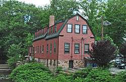
Cranford, New Jersey
| Cranford, New Jersey | |
|---|---|
| Township | |
| Township of Cranford | |
 | |
| Nickname(s): "The Venice of New Jersey" | |
| Motto(s): "Friendship and Progress"[1] | |
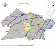 Map of Cranford Township in Union County. Inset: Location of Union County highlighted in the State of New Jersey. | |
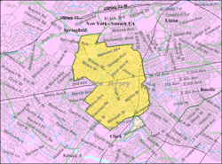 Census Bureau map of Cranford, New Jersey | |
| Coordinates: 40°39′23″N 74°18′17″W / 40.656391°N 74.30483°WCoordinates: 40°39′23″N 74°18′17″W / 40.656391°N 74.30483°W[2][3] | |
| Country |
|
| State |
|
| County | Union |
| Incorporated | March 14, 1871 |
| Government[4] | |
| • Type | Township |
| • Body | Township Committee |
| • Mayor | Thomas H. Hannen Jr. (D, term ends December 31, 2017)[5][6] |
| • Administrator | Terrance Wall[7] |
| • Municipal clerk | Tara Rowley[8] |
| Area[2] | |
| • Total | 4.869 sq mi (12.609 km2) |
| • Land | 4.830 sq mi (12.509 km2) |
| • Water | 0.039 sq mi (0.100 km2) 0.80% |
| Area rank |
281st of 566 in state 10th of 21 in county[2] |
| Elevation[9] | 82 ft (25 m) |
| Population (2010 Census)[10][11][12][13] | |
| • Total | 22,625 |
| • Estimate (2016)[14] | 24,097 |
| • Rank |
112th of 566 in state 8th of 21 in county[15] |
| • Density | 4,684.6/sq mi (1,808.7/km2) |
| • Density rank |
117th of 566 in state 11th of 21 in county[15] |
| Time zone | UTC-5 (Eastern (EST)) |
| • Summer (DST) | UTC-4 (Eastern (EDT)) |
| ZIP code | 07016[16][17] |
| Area code(s) | 908[18] |
| FIPS code | 3403915640[2][19][20] |
| GNIS feature ID | 0882214[2][21] |
| Website |
www |
Cranford is a township in Union County, New Jersey, United States. As of the 2010 United States Census, the township's population was 22,625,[11][12][13] reflecting an increase of 47 (+0.2%) from the 22,578 counted in the 2000 Census, which had in turn declined by 55 (−0.2%) from the 22,633 counted in the 1990 Census.[22]
New Jersey Monthly magazine ranked Cranford as its 34th best place to live in its 2010 rankings of the "Best Places To Live".[23]
History
Cranford was incorporated as a township by an act of the New Jersey Legislature on March 14, 1871, from portions of the Townships of Clark, Linden, Springfield, Union and Westfield. Portions of the township were taken to form Garwood (March 19, 1903) and Kenilworth (March 13, 1907).[24] The township's name is said to derive from the Crane family,[25] including John Crane, who built a mill in 1720 along the Rahway River.[26]
Historic preservation
Historic sites in the township are overseen by the Cranford Historic Preservation Advisory Board, whose purpose is to identify, record and maintain a system for survey and inventory of all building sites, places and landmarks and structures of historical or architectural significance based on the Secretary of the Interior's Standards and Guidelines for Archeology and Historic Preservation.[27]
The Cranford Historical Society, a private entity founded in 1927 and located in Hanson Park on Springfield Avenue, maintains the Crane-Phillips House (c. 1845), located at 124 North Union Avenue, as a museum.[28]
Historic figures
James E. Warner (1866–1933) is a former sheriff of Union County who was the namesake of the James E. Warner Plaza at the Cranford Train Station.[29] Appalled by the growing pollution of the Rahway given the pristine waters of his youth, Sheriff Warner advocated for the preservation of the Rahway River and Rahway River Parkway parkland. One of Sheriff Warner's successful targets in fighting Rahway River pollution was his battle against the discharge of paper makers; one such site is now the regional theater known as the Paper Mill Playhouse in Millburn.[30]
Charles Hansel (1859–1936)[31] was co-founder of the Union County Parks Commission that preserved parkland all along the Rahway River and its tributaries in the 1920s, a greenway now known as the Rahway River Parkway.[32] He was an engineer for the Pennsylvania Railroad and Central Railroad of New Jersey. Hansel lived in the 300 block of North Union Avenue in a home that still stands today, later moving to what is now Gray's Funeral Home, near what is now called Hansel's Dam by Sperry Park. For his Rahway River preservation efforts, a memorial copper plaque was placed to Hansel in Echo Lake Park.[33]
Joshua Bryant (1852–1898) was Cranford's first African-American law enforcement officer and the township's first African-American citizen to hold elective office.[34]
Geography
According to the United States Census Bureau, the township had a total area of 4.869 square miles (12.609 km2), including 4.830 square miles (12.509 km2) of land and 0.039 square miles (0.1 km2) of water (0.80%),[2][3]
There are nine municipalities bordering the township: Garwood and Westfield to the west, Springfield Township to the north, Kenilworth to the northeast, Roselle and Roselle Park to the east, Linden to the southeast, Winfield Park and Clark to the south.
Parks
Township parks
Parks run by the township and overseen by the Cranford Recreation and Parks Department include:[35]
- Adams Park – Adams Avenue and Lambert Street. Morses Creek (New Jersey) dips into Cranford behind this park.
- Buchanan Park – Centennial Avenue and Buchanan Avenue
- Canoe Club – Springfield Avenue and Orange Avenue[36] The Cranford Canoe Club rents canoes and kayaks for trips on the Rahway River in Cranford. The current structure was built as a private canoe club in 1908.[37]
- Community Center – Walnut Avenue
- Josiah Crane Park – Springfield Avenue and North Union Avenue. In 1971, the Cranford Historical Society marked the farm and village home of Josiah Crane Sr. (1791–1873)[38] in a park across from the First Presbyterian Church on the Rahway River. This park now features Cranford's 9/11 Memorial.
- Cranford West – Hope, N.J. Originally the home of the Cranford Boys Club on Silver Lake from the 1920s to the 1960s
- Girl Scout Park – Springfield Avenue and Orange Avenue. This was once the site of a canoe club, later the Neva Sykes Girl Scout House, demolished in the 1950s.
- Hampton Park – Eastman Street and Hampton Street
- Hanson Park – Springfield Avenue and Holly Street. Home of the Hanson Park Conservancy.[39]
- Johnson Park – Johnson Avenue. The Johnson Avenue playground opened in July 1957.[40]
- Lincoln Park – Lincoln Avenue at South Union. What is now Lincoln Park was the Cranford Golf Club in 1899, now moved to Westfield and called the Echo Lake Country Club. The Lincoln Avenue grounds were designed by Willie Dunn. Lincoln Park was also originally a former estate said to have supplied lumber to build the USS Constitution ("Old Ironsides") in the 1700s.[41] The grounds, at the corner of the Old York Road and Benjamin Street, also included the largest sour gum ever recorded in the Northeastern states, known as the Cranford Pepperidge Tree or "Old Peppy." The park has hosted bocce ball tournaments since the mid-1960s.
- Mayor's Park – Springfield Avenue and North Union Avenue
- Memorial Park – Springfield Avenue and Central Avenue
- Roosevelt Park – Orange Avenue and Pacific Avenue
- Sherman Park – Lincoln Avenue East. Former site of Sherman School and located on the Old York Road.[42]
County parks
Parks run by the county inside Cranford's borders (overseen by the Union County, New Jersey Parks and Recreation Department) include:[35][43]
- Lenape Park in Cranford, Kenilworth, Springfield, Union and Westfield.[44] Two tusks from an ancient American mastodon were found in 1936 north of Kenilworth Boulevard in what is now Lenape Park (other sources name the swampy area directly behind what is now the parking lot of Union County College's main building).[45]
- MacConnell Park (formerly known as Liberty Park and frequently misspelled as "McConnell Park") is named after the town's first physician, Joseph Kerr MacConnell. It is located on Eastman Street and was known as the Peninsula during the Victorian era due to its position nearly encircled by the Rahway River.[46]
- Nomahegan Park (off Springfield Avenue across from Union County College) is named for a tributary of the Rahway River that runs through it, to Lenape Park to Echo Lake Park in Westfield and Springfield, called Nomahegan Brook.[47] The name "Nomahegan" has had many different spellings in the historical sources (such as "Normahiggins") and may mean "she-wolf" or "women Mohegans." Federal Writers' Project, The WPA Guide to New Jersey: The Garden State (1939) ("CRANFORD is an old residential town spread along the RAHWAY RIVER PARKWAY, a link of nearly 7 miles joining a series of county parks and playgrounds with the Essex County park system. There are facilities for summer and winter sports, a rifle range, and picnic grove. The Fourth of July canoe regatta is an annual affair. Gardens of fine old Victorian houses line the edge of the parkway on the riverbank. A broadening of the river parkway at the northern end of Cranford is known as NOMAHEGAN PARK. The name Nomahegan is a variation of Noluns Mohegans, as the New Jersey Indians were called in the treaty ending the Indian troubles in 1758. It is translated as women Mohegans or she-wolves and was applied to them in scorn by the fighting Iroquois.").[48]
- Droescher's Mill Park, located near the dam at Droescher's Mill on High Street. Also called Squire Williams Park.
- Mohawk Park is located on Mohawk Drive in Cranford's Sunny Acres (aka Indian Village) section of town.
- Sperry Park (named after William Miller Sperry), located off North Union Avenue. Home of annual rubber duck derby as a fundraiser for Hanson Park further upstream on the Rahway River.
- Unami Park (located at Lexington and S. Union Avenue).[49]
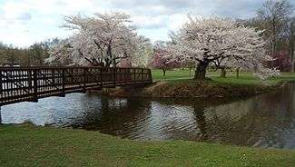
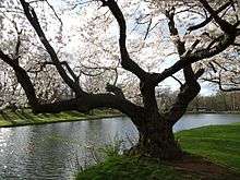
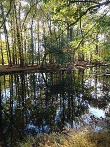
Rahway River Parkway – Cranford Section
The Rahway River Parkway is a greenway of parkland that hugs the Rahway River and its tributaries. It was designed in the 1920s by the Olmsted Brothers firm, who were the sons of the eminent landscape architect Frederick Law Olmsted. The Cranford section follows the banks of the meandering Rahway River as it flows south through Lenape Park, Nomahegan Park, Hampton Park, MacConnell Park, Hanson Park, Sperry Park, Crane's Park, Droescher's Mill Park, and Mohawk Park.[50]
Climate
The climate in this area is characterized by hot, humid summers and generally mild to cool winters. According to the Köppen Climate Classification system, Cranford has a humid subtropical climate, abbreviated "Cfa" on climate maps.[51]
| Climate data for Cranford, New Jersey. | |||||||||||||
|---|---|---|---|---|---|---|---|---|---|---|---|---|---|
| Month | Jan | Feb | Mar | Apr | May | Jun | Jul | Aug | Sep | Oct | Nov | Dec | Year |
| Record high °F (°C) | 73 (23) |
75 (24) |
90 (32) |
97 (36) |
96 (36) |
98 (37) |
105 (41) |
103 (39) |
99 (37) |
88 (31) |
81 (27) |
76 (24) |
105 (41) |
| Average high °F (°C) | 40.1 (4.5) |
43.6 (6.4) |
52.6 (11.4) |
63.9 (17.7) |
73.7 (23.2) |
82.0 (27.8) |
86.7 (30.4) |
84.9 (29.4) |
77.7 (25.4) |
66.4 (19.1) |
55.8 (13.2) |
44.6 (7) |
64.3 (17.9) |
| Average low °F (°C) | 21.5 (−5.8) |
23.3 (−4.8) |
30.5 (−0.8) |
39.3 (4.1) |
49.0 (9.4) |
58.6 (14.8) |
63.7 (17.6) |
62.6 (17) |
55.1 (12.8) |
43.1 (6.2) |
35.1 (1.7) |
26.6 (−3) |
42.4 (5.8) |
| Record low °F (°C) | −10 (−23) |
−6 (−21) |
1 (−17) |
12 (−11) |
24 (−4) |
32 (0) |
42 (6) |
39 (4) |
33 (1) |
22 (−6) |
14 (−10) |
−5 (−21) |
−10 (−23) |
| Average precipitation inches (mm) | 3.72 (94.5) |
3.00 (76.2) |
4.25 (108) |
4.25 (108) |
4.52 (114.8) |
4.32 (109.7) |
5.08 (129) |
4.73 (120.1) |
4.66 (118.4) |
4.31 (109.5) |
4.16 (105.7) |
4.22 (107.2) |
51.22 (1,301) |
| Average snowfall inches (cm) | 6.9 (17.5) |
7.9 (20.1) |
3.7 (9.4) |
0.4 (1) |
0.0 (0) |
0.0 (0) |
0.0 (0) |
0.0 (0) |
0.0 (0) |
0.0 (0) |
0.4 (1) |
4.2 (10.7) |
23.5 (59.7) |
| Source: The Western Regional Climate Center[52] | |||||||||||||
Demographics
| Historical population | |||
|---|---|---|---|
| Census | Pop. | %± | |
| 1880 | 1,184 | — | |
| 1890 | 1,717 | 45.0% | |
| 1900 | 2,854 | 66.2% | |
| 1910 | 3,641 | 27.6% | |
| 1920 | 6,001 | 64.8% | |
| 1930 | 11,126 | 85.4% | |
| 1940 | 12,860 | 15.6% | |
| 1950 | 18,602 | 44.7% | |
| 1960 | 26,424 | 42.0% | |
| 1970 | 27,391 | 3.7% | |
| 1980 | 24,573 | −10.3% | |
| 1990 | 22,633 | −7.9% | |
| 2000 | 22,578 | −0.2% | |
| 2010 | 22,625 | 0.2% | |
| Est. 2016 | 24,097 | [14][53] | 6.5% |
| Population sources: 1880–1920[54] 1880–1890[55] 1890–1910[56] 1910–1930[57] 1930–1990[58] 2000[59][60] 2010[10][11][12][13] | |||
Census 2010
As of the 2010 United States Census, there were 22,625 people, 8,583 households, and 6,154 families residing in the township. The population density was 4,684.6 per square mile (1,808.7/km2). There were 8,816 housing units at an average density of 1,825.4 per square mile (704.8/km2). The racial makeup of the township was 91.85% (20,781) White, 2.62% (592) Black or African American, 0.08% (18) Native American, 2.84% (643) Asian, 0.02% (4) Pacific Islander, 1.03% (234) from other races, and 1.56% (353) from two or more races. Hispanic or Latino of any race were 6.51% (1,474) of the population.[11]
There were 8,583 households out of which 33.4% had children under the age of 18 living with them, 60.2% were married couples living together, 8.4% had a female householder with no husband present, and 28.3% were non-families. 24.8% of all households were made up of individuals, and 13.3% had someone living alone who was 65 years of age or older. The average household size was 2.61 and the average family size was 3.15.[11]
In the township, the population was spread out with 24.2% under the age of 18, 5.8% from 18 to 24, 23.6% from 25 to 44, 29.3% from 45 to 64, and 17.2% who were 65 years of age or older. The median age was 42.8 years. For every 100 females there were 91.7 males. For every 100 females ages 18 and older there were 87.2 males.[11]
The Census Bureau's 2006–2010 American Community Survey showed that (in 2010 inflation-adjusted dollars) median household income was $107,052 (with a margin of error of +/- $5,725) and the median family income was $128,534 (+/- $7,200). Males had a median income of $81,979 (+/- $7,672) versus $61,649 (+/- $4,965) for females. The per capita income for the township was $48,008 (+/- $2,581). About 2.1% of families and 3.3% of the population were below the poverty line, including 3.9% of those under age 18 and 8.5% of those age 65 or over.[61]
Census 2000
As of the 2000 United States Census[19] there were 22,578 people, 8,397 households, and 6,222 families residing in the township. The population density was 4,684.2 people per square mile (1,808.6/km²). There were 8,560 housing units at an average density of 1,775.9 per square mile (685.7/km²). The racial makeup of the township was 93.70% White, 2.58% Black or African American, 0.04% Native American, 2.15% Asian, 0.02% Pacific Islander, 0.67% from other races, and 0.84% from two or more races. 3.89% of the population were Hispanic or Latino of any race.[59][60]
There were 8,397 households out of which 32.9% had children under the age of 18 living with them, 63.0% were married couples living together, 8.8% had a female householder with no husband present, and 25.9% were non-families. 21.9% of all households were made up of individuals and 10.2% had someone living alone who was 65 years of age or older. The average household size was 2.62 and the average family size was 3.09.[59][60]
In the township the population was spread out with 23.3% under the age of 18, 5.3% from 18 to 24, 29.4% from 25 to 44, 24.1% from 45 to 64, and 17.9% who were 65 years of age or older. The median age was 40 years. For every 100 females, there were 90.5 males. For every 100 females age 18 and over, there were 86.2 males.[59][60]
The median income for a household in the township was $76,338, and the median income for a family was $86,624. Males had a median income of $60,757 versus $41,020 for females. The per capita income for the township was $33,283. About 1.0% of families and 2.5% of the population were below the poverty line, including 1.5% of those under age 18 and 6.3% of those age 65 or over.[59][60]
Economy
Cranford has long been considered a center of commerce. The Cranford Business Park on the south side of the township consists of a complex of office buildings housing a variety of major corporations and small businesses. Along North Avenue are a variety of buildings housing doctors and other businesses. Law offices predominate in small buildings around town. Banks are also extremely common throughout the township, which hosts at least half a dozen.
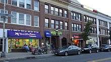
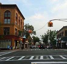
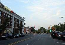
Downtown Cranford is the main retail business district for the township. Consisting of a variety of small family-owned businesses on both sides of the railroad tracks, there has been a debate in the community over the direction of the downtown. With neighboring communities seeing downtown development and a focus on either recruiting chain store or upscale small stores, Cranford has been debating the issue. On the south side of town, the Centennial Avenue Business District is a small shopping district with a mix of neighborhood stores. There is a push to redevelop this business district.
The focus of downtown Cranford has been to recruit more restaurants into the downtown and allow for a nightlife to flourish. On the south side of the community, the Cranford Crossing redevelopment project featured retail space, apartments, and a parking deck. The Riverfront redevelopment project on South Avenue brought in more restaurants and housing into downtown Cranford.[62]
In the 1980s the downtown was renovated to take on a Victorian feel. This included the installation of new light fixtures and brick sidewalks, along with decorative planters and benches. A Victorian street clock was installed in the center of town, allowing for the creation of a small pocket park in the center of the downtown. The clock park has become a popular hangout for teenagers who are walking to and from school.
In the 1980s, Cranford founded the state's first special improvement district, which allows for the downtown district to have a special tax on building and business owners for downtown development and marketing which is managed by the Cranford Downtown Management Corporation.[63] The DMC has used its budget for development projects, to recruit new businesses and to market shopping in Cranford. Various downtown sales and street fairs are administered by the DMC. The DMC is governed by a Board of Directors consisting of business owners and residents, which is appointed by the Township Committee. The DMC Board appoints a DMC Director, who runs the day-to-day operations of the corporation.
Government
Local government
Cranford is governed under the Township form of government. The five-member Township Committee is elected directly by the voters at-large in partisan elections to serve three-year terms of office on a staggered basis, with either one or two seats coming up for election each year as part of the November general election in a three-year cycle.[4][64]
The Committee members elect a chairman of the committee who assumes the title of Mayor and another who is selected as Deputy Mayor. Both positions carry one-year terms. Four of the commissioners take on departmental oversight assignments as Commissioner of Finance, Commissioner of Public Safety, Commissioner of Public Works and Engineering, and Commissioner of Public Affairs. The Mayor of Cranford does not take on a departmental assignment. The commissioners are part-time officials and the township government is run day to day by the Township Administrator and various department heads. The Acting Chief of Police is Joseph Van Bergen.[65]
As of 2017, members of the Cranford Township Committee are Mayor Thomas H. Hannen Jr. (D, term on committee ends December 31, 2018; term as mayor ends 2017), Deputy Mayor Patrick F. Giblin (D, term committee and as deputy mayor ends 2017; elected to serve an unexpired term)), Ann M. Dooley (D, 2019), Andis Kalnins (R, 2017) and Mary O'Connor (R, 2019).[5][66][67][68][69][70]
In January 2016, the Township Committee unanimously appointed John Mallon to fill the seat expiring in December 2016 that had been held by Robert D'Ambola until his resignation from office; Mallon will serve on an interim basis until the November 2016 general election, when voters will select a candidate to serve the balance of the term.[71]
In September 2015, Republican Barbara Bilger was appointed to fill the seat expiring in December 2017 that had been held by Deputy Mayor Lisa Adubato until she resigned from office to take a seat as a judge on New Jersey Superior Court.[72] Bilger served on an interim basis until the November 2015 general election, when voters elected Democrat John Giblin to serve the balance of the term of office.[69]
Women in elected office
As of 2012, eight women have been elected to the Cranford Township Committee and three women have served as Mayor of Cranford. Barbara Brande was the first woman elected to the Township Committee and the first woman mayor of the township. Mayor Brande was elected to the Township Committee in 1974 and reelected in 1977, serving a total of six years. She was Mayor of Cranford in 1977. Carolyn Vollero, who served the longest length of time for a woman on the Township Committee – nine years – was Cranford's second female Mayor in 1994. Barbara Bilger, the township's third female mayor in 2002 and 2004, was also the first woman to serve two terms as the township's mayor. Mayor Bilger is the first Republican woman to serve as a Township Commissioner and as mayor.
Union County Freeholder Bette Jane Kowalski is a Cranford resident and the first woman from Cranford to be elected to the Union County Board of Chosen Freeholders. Freeholder Kowalski was an unsuccessful candidate for Cranford Township Committee in 1999 and served as Union County Freeholder Chairwoman in 2007.
Female township commissioners include:
- Barbara Brande (Democrat) – 1975 to 1980 (Mayor in 1977)
- Sandy Weeks (Democrat) – 1982 to 1984
- Mary Lou Farmer (Democrat) – 1984 to 1986
- Carolyn Vollero (Democrat) – 1988 to 1996 (Mayor in 1994, Deputy Mayor in 1993)
- Barbara Bilger (Republican) – 1990 to 1992, 2002 to 2004 and Sept. 2015 to Nov. 2015 (Mayor in 2002 & 2004, Deputy Mayor in 1992 & 2003)
- Ann Darby (Republican) – 2003 to 2005 (Deputy Mayor in 2004)
- Martha Garcia (Republican) – 2008 to 2010 (Deputy Mayor in 2010)
- Lisa Adubato (Republican) – 2012 to Aug. 2015 (Deputy Mayor in 2014 and 2015 (part))
- Mary O'Connor (Republican) – 2014 to present (Deputy Mayor in 2015 (part) and 2016)
Federal, state and county representation
Cranford is located in the 7th Congressional District[73] and is part of New Jersey's 21st state legislative district.[12][74][75]
New Jersey's Seventh Congressional District is represented by Leonard Lance (R, Clinton Township).[76] New Jersey is represented in the United States Senate by Democrats Cory Booker (Newark, term ends 2021)[77] and Bob Menendez (Paramus, 2019).[78][79]
For the 2018–2019 session (Senate, General Assembly), the 21st Legislative District of the New Jersey Legislature is represented in the State Senate by Thomas Kean Jr. (R, Westfield) and in the General Assembly by Jon Bramnick (R, Westfield) and Nancy Munoz (R, Summit).[80][81] The Governor of New Jersey is Phil Murphy (D, Middletown Township).[82] The Lieutenant Governor of New Jersey is Sheila Oliver (D, East Orange).[83]
Union County is governed by a Board of Chosen Freeholders, whose nine members are elected at-large to three-year terms of office on a staggered basis with three seats coming up for election each year, with an appointed County Manager overseeing the day-to-day operations of the county. At an annual reorganization meeting held in the beginning of January, the board selects a Chairman and Vice Chairman from among its members.[84] As of 2014, Union County's Freeholders are Chairman Christopher Hudak (D, Linden, term ends December 31, 2014),[85] Vice Chairman Mohamed S. Jalloh (D, Roselle, 2015),[86] Bruce Bergen (D, Springfield Township, 2015),[87] Linda Carter (D, Plainfield, 2016),[88] Angel G. Estrada (D, Elizabeth, 2014),[89] Sergio Granados (D, Elizabeth, 2016),[90] Bette Jane Kowalski (D, Cranford, 2016),[91] Alexander Mirabella (D, Fanwood, 2015)[92] and Vernell Wright (D, Union, 2014).[93][94] Constitutional officers elected on a countywide basis are County Clerk Joanne Rajoppi (D, Union, 2015),[95] Sheriff Ralph Froehlich (D, Union, 2016)[96] and Surrogate James S. LaCorte (D, Springfield Township, 2014).[97][98] The County Manager is Alfred Faella.[99]
Politics
As of March 23, 2011, there were a total of 15,649 registered voters in Cranford Township, of which 4,887 (31.2% vs. 41.8% countywide) were registered as Democrats, 3,701 (23.7% vs. 15.3%) were registered as Republicans and 7,046 (45.0% vs. 42.9%) were registered as Unaffiliated. There were 15 voters registered to other parties.[100] Among the township's 2010 Census population, 69.2% (vs. 53.3% in Union County) were registered to vote, including 91.2% of those ages 18 and over (vs. 70.6% countywide).[100][101]
In the 2012 presidential election, Democrat Barack Obama received 6,236 votes (51.0% vs. 66.0% countywide), ahead of Republican Mitt Romney with 5,772 votes (47.2% vs. 32.3%) and other candidates with 141 votes (1.2% vs. 0.8%), among the 12,223 ballots cast by the township's 16,332 registered voters, for a turnout of 74.8% (vs. 68.8% in Union County).[102][103] In the 2008 presidential election, Democrat Barack Obama received 6,513 votes (49.6% vs. 63.1% countywide), ahead of Republican John McCain with 6,371 votes (48.6% vs. 35.2%) and other candidates with 164 votes (1.3% vs. 0.9%), among the 13,120 ballots cast by the township's 16,145 registered voters, for a turnout of 81.3% (vs. 74.7% in Union County).[104] In the 2004 presidential election, Republican George W. Bush received 6,455 votes (50.4% vs. 40.3% countywide), ahead of Democrat John Kerry with 6,160 votes (48.1% vs. 58.3%) and other candidates with 111 votes (0.9% vs. 0.7%), among the 12,795 ballots cast by the township's 15,822 registered voters, for a turnout of 80.9% (vs. 72.3% in the whole county).[105]
In the 2013 gubernatorial election, Republican Chris Christie received 62.5% of the vote (4,926 cast), ahead of Democrat Barbara Buono with 35.9% (2,834 votes), and other candidates with 1.6% (124 votes), among the 8,017 ballots cast by the township's 16,108 registered voters (133 ballots were spoiled), for a turnout of 49.8%.[106][107] In the 2009 gubernatorial election, Republican Chris Christie received 4,787 votes (52.3% vs. 41.7% countywide), ahead of Democrat Jon Corzine with 3,421 votes (37.4% vs. 50.6%), Independent Chris Daggett with 793 votes (8.7% vs. 5.9%) and other candidates with 82 votes (0.9% vs. 0.8%), among the 9,146 ballots cast by the township's 15,871 registered voters, yielding a 57.6% turnout (vs. 46.5% in the county).[108]
Education
The Cranford Township Public Schools are a comprehensive public school system, which is governed by a nine-member elected Board of education. As of the 2014-15 school year, the district and its seven schools had an enrollment of 3,896 students and 328.6 classroom teachers (on an FTE basis), for a student–teacher ratio of 11.9:1.[109] Schools in the district (with 2014-15 from the National Center for Education Statistics[110]) are Bloomingdale Avenue School[111] (224 students in grades K–2), Brookside Place School[112] (363; K–5), Hillside Avenue School[113] (771; K–8), Livingston Avenue School[114] (236; 3–5), Orange Avenue School[115] (799; 3–8), Walnut Avenue School[116] (323; PreK–2) and Cranford High School[117] (1,163; 9–12).[118][119] Cranford High School has a curriculum which has a strong push for technology in the schools, along with stressing service learning. The high school is recognized for its work in service learning and for being a national school of character. Cranford High School was ranked 51st among 328 public high schools in New Jersey in 2012 by New Jersey Monthly magazine after being ranked 13th in 2010[120] and has won a series of national and statewide awards for its innovative curriculum. Lincoln School, which is the home of the district's administrative offices, also houses the district's two alternative education programs, CAP and CAMP.[121]
Cranford hosts several religious and private schools. Saint Michael's School, located in downtown Cranford, is a Roman Catholic parochial school which serves students in Nursery through Grade 8 and is accredited by the Middle States Commission on Elementary Schools, operating under the auspices of the Roman Catholic Archdiocese of Newark.[122][123]
The main campus of Union County College – New Jersey's oldest community college, dating back to 1933 – is located in Cranford.[124] The Cranford campus, one of four county locations, was established in 1956.
Local media
Cranford media includes:
- The Westfield Leader. This locally published weekly newspaper covers all Cranford township committee meetings and offers other Cranford coverage.[125]
- Union News Daily. A news outlet covering Union County news, it has a dedicated Cranford section.[126] It is part of LocalSource and published by Worrall Community Newspapers of Union. The paper's Cranford coverage is also published on a monthly basis as Cranford Life.
- TAP Into Cranford is an online news site devoted to Cranford.[127]
- Cranford Patch is a daily online news source dedicated to local Cranford news.[128]
- Cranford.com has been newly founded in October 2017 as a social website serving Cranford and the surrounding communities as well as promoting local business and charity organizations and local events. You can learn more about many local events, happenings and businesses by visiting Cranford.com. [129] Cranford.com also manages the popular Cranford Web Facebook Page. [130]
- Remaining multi-community newspapers include the Courier News, a daily newspaper based in Bridgewater Township, and The Star-Ledger and the Suburban News based in Newark.[131]
- Cranford Monthly is published by Renna Media, located on Walnut Street in Cranford, NJ.[132] 9,800 newspapers are printed up each month and mailed free.
- Cranford Radio is a podcast of Cranford-themed news interviews hosted by 1010wins' Bernie Wagenblast.
- TV-35. Cranford also has its own channel, TV-35, which airs township committee meetings live each week and is available to cable and Verizon FiOS television subscribers.
The channel was founded in 1986.[133]
- Emergency radio. The township operates a low-power AM radio station at 680 kHz. The station provides information during emergencies in the township.
- Cranfordnj.org is the official website of the Township of Cranford, and has been in operation since October 2017. It promotes downtown businesses on its downtown Cranford section.[134]
As of 2017, local media in New Jersey has undergone dramatic shrinkage.[135] Cranford had long been a newspaper community. The defunct Cranford Chronicle (formerly the Cranford Citizen & Chronicle) was a longtime newspaper serving the Township. Owned by the Ray Family and published in town, the Chronicle served as the center of community journalism. Stu Awbrey purchased the Chronicle and continued as the town's newspaperman. Awbrey sold the paper to Malcolm Forbes, whose publishing company published the paper for several years before the paper changed hands to other community newspaper publication companies. The Chronicle's office left Cranford for Somerville and later Clark. The Chronicle was closed in June 2015.[136]
The defunct Cranford Eagle started publishing in 1999 as another community newspaper. Owned by Worrall Community Newspapers, the Eagle focused solely on Cranford and other neighboring towns. Edited and reported by several people in its history, the Eagle quickly became a fixture in the community.
Transportation
Roads and highways
As of May 2010, the township had a total of 78.60 miles (126.49 km) of roadways, of which 67.25 miles (108.23 km) were maintained by the municipality, 7.77 miles (12.50 km) by Union County and 1.72 miles (2.77 km) by the New Jersey Department of Transportation and 1.86 miles (2.99 km) by the New Jersey Turnpike Authority.[137]
The Garden State Parkway passes through the township, connecting Clark in the south to Kenilworth in the north.[138] The Parkway is accessible at interchange 136 to County Route 607 for Linden / Roselle / Winfield Park and at interchange 137 for Route 28. Interchange 136 is known as the "four corners", where Clark, Winfield, Cranford and Linden meet.[139]
Cranford's Pace Car Program creates safer roads when drivers pledge to "drive within the posted speed limit", "stop at all stop signs", "stop at all red traffic lights", and "yield to pedestrians in crosswalks".
Public transportation
The Cranford station[140] offers service to Newark Penn Station, New York City Penn Station, and points east, along with Raritan, High Bridge and numerous points west on the NJ Transit Raritan Valley Line, formerly the mainline of the Central Railroad of New Jersey.[141] Via Newark Penn Station, Secaucus Junction and NYC Penn Station, connections are possible to all other NJT rail lines (except Atlantic City,) PATH trains, AirTrain Newark to Newark Liberty International Airport, Amtrak regional and long distance trains and the Long Island Rail Road.
NJ Transit also provides bus service on the 112 and 113 routes between Cranford and the Port Authority Bus Terminal in New York City and on the 59 and 66 to Newark. The 56, 57 and 58 routes provide local service.[142]
Newark Liberty International Airport is approximately 13 minutes away in Newark / Elizabeth. Linden Airport, a general aviation facility, is in nearby Linden.
The southern section of the township is bisected by Conrail's freight-only Lehigh Line (jointly owned by CSX and Norfolk Southern) along the tracks of the former Lehigh Valley Railroad. The former Staten Island Railway connects with the Raritan Valley Line in Cranford, reaching the island via the Arthur Kill Vertical Lift Bridge. That line has been rehabilitated and since 2007 between Port Newark and Howland Hook and transports containers from the Howland Hook Marine Terminal, an intermodal freight transport service known as ExpressRail.[143][144]
In film and television
- Several episodes in the third season of the 1990s Nickelodeon television show, The Adventures of Pete & Pete were filmed in Cranford. Episodes of the series were shot at various sites in Cranford, including Brookside Place School, Cranford High School, Orange Avenue Pool and Modern Barber Shop.[145] Scenes for the home of the title characters were filmed at a house at 11 Willow Street.[146]
- Cranford is the setting of the 2005 film Guess Who, starring Bernie Mac and Ashton Kutcher.[147]
- Portions of the films Far from Heaven, Garden State and September 12 were shot in Cranford.[148]
Notable people
People who were born in, residents of, or otherwise closely associated with Cranford include: Frederick W. Beinecke (1887–1971), founder of Yale University's Beinecke Rare Book & Manuscript Library.[149]
- William Sperry Beinecke (born 1914), founder of the Central Park Conservancy and former chairman of S&H Green Stamps.[150]
- Carol Blazejowski (born 1956), member of Basketball Hall of Fame and LGBT community; 1974 Cranford High School graduate.[151]
- Gordon Chalmers (1911–2000), swimmer, swimming coach, and college athletics administrator. He competed in the men's 100 metre backstroke at the 1932 Summer Olympics.[152]
- Curtis G. Culin (1915–1963), sergeant in the 2d Armored Division during World War II who developed the rhino tank to cut through hedgerows during the Battle of Normandy.[153]
- Hugh S. Delano (born 1933), sports journalist for the New York Post and author honored by induction into the Hockey Hall of Fame with the Elmer Ferguson Memorial Award.[154][155]
- William C. Dudley (born 1952), President and CEO of the Federal Reserve Bank of New York and Vice Chairman of the Federal Reserve Open Markets Committee.[156]
- Robert Ferro (1941–1988), LGBT author whose work included a gay coming-of-age novel describing a fictionalized version of Cranford centered around the Rahway River.[157]
- Charles N. Fowler (1852–1932), represented 5th congressional district in the United States House of Representatives from 1895 to 1911.[158]
- Gary Kott, television and advertising writer, who was a writer and supervising producer of The Cosby Show.[159]
- Alice Lakey (1857–1935), clean foods activist.[160]
- Frank Townsend Lent (1855–1919), architect, painter and author.[161]
- May Li (born 1967), finalist in 2006 in China Central Television's Win in China and founder of the non-profit North American Chinese Entrepreneur Association (NACEA).[162]
- Paul J. Lioy (1947–2015), specialist in the field of environmental health and specializing in exposure science who analyzed the effects of dust in the wake of the collapse of the World Trade Center after the September 11 terrorist attacks.[163]
- N. Gregory Mankiw (born 1958), Harvard professor who chaired the Council of Economic Advisers under President George W. Bush.[164]
- Ralph J. Marra Jr. (born c. 1953), former Acting United States Attorney for the District of New Jersey.[165]
- Max R. Marston (1892–1949), winner of the 1923 United States Amateur Championship golf tournament.[166]
- Dean Mathey (1890–1972), tennis player and namesake of Mathey College at Princeton University.[167]
- Victoria Napolitano (née Spellman, born 1988), politician who was chosen as mayor of Moorestown, New Jersey, at age 26, making her the youngest female mayor in state history.[168]
- David Pringle, environmental activist and politician.[169]
- Thomas Sperry (c. 1864–1913), co-founder (the "S") of S&H Green Stamps.[170]
- William Miller Sperry (1839–1927), president of S&H Green Stamps and namesake of the William Miller Sperry Observatory and Sperry Park, who moved to Cranford in 1898.[171]
- David Silverman (born 1966), president of American Atheists.[172]
- James Walter Thompson (1847–1928), namesake of the J. Walter Thompson Company advertising agency.[173]
- Bernie Wagenblast (born 1956), traffic reporter who is the founder and editor of the Transportation Communications Newsletter.[174]
- Jennifer Westhoven (born 1971), business and finance correspondent on HLN's Morning Express with Robin Meade.[175]
- Jordan White (born 1982), rock musician and American Idol contestant.[176][177]
References
- ↑ Kuperinsky, Amy. "'The Jewel of the Meadowlands'?: N.J.'s best, worst and weirdest town slogans", NJ Advance Media for NJ.com, January 22, 2015. Accessed July 12, 2016. "Cranford, in Union County, uses 'Friendship & Progress' — and a crane bird (the town is named for Josiah Crane) — on its township seal, but since it is bisected by the Rahway River, the town is informally known as 'The Venice of New Jersey'."
- 1 2 3 4 5 6 2010 Census Gazetteer Files: New Jersey County Subdivisions, United States Census Bureau. Accessed May 21, 2015.
- 1 2 US Gazetteer files: 2010, 2000, and 1990, United States Census Bureau. Accessed September 4, 2014.
- 1 2 2012 New Jersey Legislative District Data Book, Rutgers University Edward J. Bloustein School of Planning and Public Policy, March 2013, p. 94.
- 1 2 Township Committee, Township of Cranford. Accessed October 3, 2017.
- ↑ 2017 New Jersey Mayors Directory, New Jersey Department of Community Affairs. Accessed May 30, 2017.
- ↑ Township Administrator, Township of Cranford. Accessed October 3, 2017.
- ↑ Township Clerk, Township of Cranford. Accessed October 3, 2017.
- ↑ U.S. Geological Survey Geographic Names Information System: Township of Cranford, Geographic Names Information System. Accessed March 5, 2013.
- 1 2 2010 Populations: Union County, Asbury Park Press. Accessed January 22, 2012.
- 1 2 3 4 5 6 DP-1 – Profile of General Population and Housing Characteristics: 2010 for Cranford township, Union County, New Jersey, United States Census Bureau. Accessed July 17, 2012.
- 1 2 3 4 Municipalities Grouped by 2011–2020 Legislative Districts, New Jersey Department of State, p. 9. Accessed January 6, 2013.
- 1 2 3 Profile of General Demographic Characteristics: 2010 for Cranford township, New Jersey Department of Labor and Workforce Development. Accessed July 17, 2012.
- 1 2 PEPANNRES - Annual Estimates of the Resident Population: April 1, 2010 to July 1, 2016 - 2016 Population Estimates for New Jersey municipalities, United States Census Bureau. Accessed June 16, 2017.
- 1 2 GCT-PH1 Population, Housing Units, Area, and Density: 2010 – State – County Subdivision from the 2010 Census Summary File 1 for New Jersey, United States Census Bureau. Accessed December 11, 2012.
- ↑ Look Up a ZIP Code for Cranford, NJ, United States Postal Service. Accessed July 17, 2012.
- ↑ Zip Codes, State of New Jersey. Accessed September 3, 2013.
- ↑ Area Code Lookup – NPA NXX for Cranford, NJ, Area-Codes.com. Accessed September 3, 2013.
- 1 2 American FactFinder, United States Census Bureau. Accessed September 4, 2014.
- ↑ A Cure for the Common Codes: New Jersey, Missouri Census Data Center. Accessed November 26, 2012.
- ↑ US Board on Geographic Names, United States Geological Survey. Accessed September 4, 2014.
- ↑ Table 7. Population for the Counties and Municipalities in New Jersey: 1990, 2000 and 2010, New Jersey Department of Labor and Workforce Development, February 2011. Accessed July 17, 2012.
- ↑ "Best Places To Live – The Complete Top Towns List 1–100" Archived May 25, 2009, at the Wayback Machine., New Jersey Monthly, February 21, 2008. Accessed December 26, 2008.
- ↑ Snyder, John P. The Story of New Jersey's Civil Boundaries: 1606–1968, Bureau of Geology and Topography; Trenton, New Jersey; 1969. p. 237. Accessed July 17, 2012.
- ↑ Hutchinson, Viola L. The Origin of New Jersey Place Names, New Jersey Public Library Commission, May 1945. Accessed August 28, 2015.
- ↑ Cheslow, Jerry. "If You're Thinking of Living in: Cranford", The New York Times, March 8, 1992. Accessed August 29, 2015. "KNOWN at the turn of the century as the Venice of New Jersey, the Union County Township of Cranford grew up around the meandering Rahway River. In 1720, John Crane of nearby Elizabeth Towne (now Elizabeth) built a grist mill on the north side of a ford in the river and a sawmill on the south side."
- ↑ Cranford Township Code Chapter 6-40.19, Township of Cranford. Accessed November 28, 2016.
- ↑ Home page, Cranford Historical Society. Accessed December 26, 2014.
- ↑ James E. Warner Plaza
- ↑ Report of the State Sewerage Commission to the Legislature
- ↑ Charles Hansel (1859-1936), Flickr. Accessed October 3, 2017.
- ↑ It Takes a Village... and a park commission, Friends of the Rahway River Parkway. Accessed August 14, 2017.
- ↑ Charles Hansel plaque, Accessed October 3, 2017.
- ↑ Fridlington, Robert J. "Remembering Joshua Bryant, a prominent figure in Cranford's history", Cranford Chronicle, February 10, 2012. Accessed October 28, 2016. "Without formal training and despite prevailing attitudes, he became Cranford's first African-American law enforcement officer, the first African-American elected to public office in the township, and an influential figure in local politics."
- 1 2 Parks and Facilities, Township of Cranford. Accessed October 3, 2017.
- ↑ Home Page, Cranford Canoe Club. Accessed November 8, 2016.
- ↑ Fridlington and Fuhro, Cranford Vol. 2 (1996) p. 52.
- ↑ Location of Josiah Crane Park Genealogy of Josiah Crane
- ↑ About, Hanson Park Conservancy. Accessed November 8, 2016.
- ↑ Staff. "Plan Johnson Avenue Playground; Supervised Areas Opening Monday", Citizen and Chronicle, July 3, 1957. Accessed December 1, 2016.
- ↑ A Guide to Union County College's Historic Tree Project, Cranford History. Accessed November 8, 2016.
- ↑ Report of the Survey of the Schools of the Township of Cranford, New Jersey: School Year, 1924-1925
- ↑ Parks, Activities, Locations & Maps, Union County, New Jersey. Accessed November 28, 2016.
- ↑ Lenape Park map, Union County, New Jersey. Accessed November 28, 2016.
- ↑ 1993 Township of Cranford National Resources Inventory, pg. IV-6.
- ↑ McConnell Park map, Union County, New Jersey. Accessed November 28, 2016.
- ↑ Monahegan Park, Union County, New Jersey. Accessed November 28, 2016.
- ↑ Bulletin of the United States Geological Survey, Issues 112-121 (1894) (The "Nomahiggin" or "Normahiggin" is a brook in Westfield and Cranford townships, Union County, tributary to [Rahway River]).
- ↑ Unami Park map, Union County, New Jersey. Accessed November 28, 2016.
- ↑ The Inception of a Parkway, Friends of Rahway River Parkway. Accessed November 28, 2016.
- ↑ Climate Summary for Cranford, New Jersey
- ↑ "Seasonal Temperature and Precipitation Information". Western Regional Climate Center. Retrieved November 9, 2014.
- ↑ Census Estimates for New Jersey April 1, 2010 to July 1, 2016, United States Census Bureau. Accessed June 16, 2017.
- ↑ Compendium of censuses 1726–1905 : together with the tabulated returns of 1905, New Jersey Department of State, 1906. Accessed May 5, 2013.
- ↑ Porter, Robert Percival. Preliminary Results as Contained in the Eleventh Census Bulletins: Volume III – 51 to 75, p. 99. United States Census Bureau, 1890. Accessed July 17, 2012.
- ↑ Thirteenth Census of the United States, 1910: Population by Counties and Minor Civil Divisions, 1910, 1900, 1890, United States Census Bureau, p. 339. Accessed July 17, 2012.
- ↑ Fifteenth Census of the United States : 1930 – Population Volume I, United States Census Bureau, p. 719. Accessed July 17, 2012.
- ↑ New Jersey Resident Population by Municipality: 1930 – 1990, Workforce New Jersey Public Information Network. Accessed June 28, 2015.
- 1 2 3 4 5 Census 2000 Profiles of Demographic / Social / Economic / Housing Characteristics for Cranford township, Union County, New Jersey, United States Census Bureau. Accessed July 16, 2012.
- 1 2 3 4 5 DP-1: Profile of General Demographic Characteristics: 2000 – Census 2000 Summary File 1 (SF 1) 100-Percent Data for Cranford township, Union County, New Jersey, United States Census Bureau. Accessed July 16, 2012.
- ↑ DP03: Selected Economic Characteristics from the 2006–2010 American Community Survey 5-Year Estimates for Cranford township, Union County, New Jersey, United States Census Bureau. Accessed July 17, 2012.
- ↑ Staff. "Garden Communities launches Riverfront at Cranford Station", Cranford Chronicle, May 29, 2013. Accessed November 8, 2016.
- ↑ Walsh, Jeremy. "Committee favors widening Cranford's special improvement district", The Star-Ledger, April 29, 2010. Accessed July 17, 2012. "When the special district was established in 1985 to help make streetscape improvements downtown, it was the first such district in New Jersey."
- ↑ "Forms of Municipal Government in New Jersey", p. 7. Rutgers University Center for Government Studies. Accessed June 3, 2015.
- ↑ Police Department, Township of Cranford. Accessed October 3, 2017.
- ↑ 2017 Municipal User Friendly Budget, Township of Cranford. Accessed October 3, 2017.
- ↑ [ucnj.org/wp-content/uploads/2014/06/2017-Directory.pdf#page=51 Union County 2017 Directory], p. 49. Union County, New Jersey. Accessed October 3, 2017.
- ↑ General Election November 8, 2016 Official Results, Union County, New Jersey, updated November 14, 2016. Accessed January 30, 2017.
- 1 2 November 5, 2015 General Election Official Results, Union County, New Jersey, updated November 9, 2015. Accessed August 3, 2016.
- ↑ November 4, 2014 General Election Official Results, Union County, New Jersey, updated January 7, 2015. Accessed August 3, 2016.
- ↑ Conheeney, Patti. "Cranford Township Committee News", TAP into Cranford, January 31, 2016. Accessed August 3, 2016. "This past Tuesday evening's Cranford Township Committee meeting had a celebratory air to it, with the swearing in of newly appointed Commissioner John Mallon and the recognition of the 2015 Cranford High School state championship football team. Mallon was unanimously appointed by the committee following the resignation of Robert D'Ambola, earlier this month."
- ↑ Hinke, Christina M. "Cranford Republicans Petrucci, Bilger Want To 'Keep Progress Moving'", The Westfield Leader, October 29, 2015. Accessed August 3, 2016. "Road repair and controlling taxes are at the top of residents' concerns, Republican candidates for township committee Barbara Bilger and Michael Petrucci told The Westfield Leader Saturday. Ms Bilger was selected in September to fill the seat of Lisa Adubato, who resigned to become a Superior Court Judge, and is now running to fulfill the unexpired two years left on the term."
- ↑ Plan Components Report, New Jersey Redistricting Commission, December 23, 2011. Accessed January 6, 2013.
- ↑ 2017 New Jersey Citizen's Guide to Government, p. 56, New Jersey League of Women Voters. Accessed May 30, 2017.
- ↑ Districts by Number for 2011–2020, New Jersey Legislature. Accessed January 6, 2013.
- ↑ Directory of Representatives: New Jersey, United States House of Representatives. Accessed January 5, 2012.
- ↑ About Cory Booker, United States Senate. Accessed January 26, 2015. "He now owns a home and lives in Newark's Central Ward community."
- ↑ Biography of Bob Menendez, United States Senate, January 26, 2015. "He currently lives in Paramus and has two children, Alicia and Robert."
- ↑ Senators of the 114th Congress from New Jersey. United States Senate. Accessed January 26, 2015. "Booker, Cory A. - (D - NJ) Class II; Menendez, Robert - (D - NJ) Class I"
- ↑ Legislative Roster 2018-2019 Session, New Jersey Legislature. Accessed January 22, 2018.
- ↑ District 21 Legislators, New Jersey Legislature. Accessed January 22, 2018.
- ↑ Governor Phil Murphy, State of New Jersey. Accessed January 16, 2018.
- ↑ Lieutenant Governor Oliver, State of New Jersey. Accessed January 16, 2018. "Assemblywoman Oliver has resided in the City of East Orange for over 40 years."
- ↑ County Government, Union County, New Jersey. Accessed January 26, 2014.
- ↑ Freeholder Christopher Hudak, Union County, New Jersey. Accessed January 26, 2014.
- ↑ Freeholder Mohamed S. Jalloh, Union County, New Jersey. Accessed January 26, 2014.
- ↑ Bruce Bergen, Union County, New Jersey. Accessed January 26, 2014.
- ↑ Freeholder Vice Chairman Linda Carter, Union County, New Jersey. Accessed January 26, 2014.
- ↑ Freeholder Angel G. Estrada, Union County, New Jersey. Accessed January 26, 2014.
- ↑ Freeholder Sergio Granados, Union County, New Jersey. Accessed January 26, 2014.
- ↑ Freeholder Bette Jane Kowalski, Union County, New Jersey. Accessed January 26, 2014.
- ↑ Freeholder Alexander Mirabella, Union County, New Jersey. Accessed January 26, 2014.
- ↑ Freeholder Vernell Wright, Union County, New Jersey. Accessed January 26, 2014.
- ↑ Board of Chosen Freeholders, Union County, New Jersey. Accessed January 26, 2014.
- ↑ Union County Clerk, Joanne Rajoppi, Union County, New Jersey. Accessed January 26, 2014.
- ↑ Union County Sheriff Ralph Froehlich, Union County, New Jersey. Accessed January 26, 2014.
- ↑ Surrogate, Union County, New Jersey. Accessed January 26, 2014.
- ↑ Elected Officials – Clerk – Sheriff – Surrogate, Union County, New Jersey. Accessed January 26, 2014.
- ↑ County Manager, Union County, New Jersey. Accessed January 26, 2014.
- 1 2 Voter Registration Summary – Union, New Jersey Department of State Division of Elections, March 23, 2011. Accessed May 5, 2013.
- ↑ GCT-P7: Selected Age Groups: 2010 – State – County Subdivision; 2010 Census Summary File 1 for New Jersey, United States Census Bureau. Accessed May 5, 2013.
- ↑ Presidential November 6, 2012 General Election Results – Union County, New Jersey Department of State Division of Elections, March 15, 2013. Accessed May 5, 2013.
- ↑ Number of Registered Voters and Ballots Cast November 6, 2012 General Election Results – Union County, New Jersey Department of State Division of Elections, March 15, 2013. Accessed May 5, 2013.
- ↑ 2008 Presidential General Election Results: Union County, New Jersey Department of State Division of Elections, December 23, 2008. Accessed May 5, 2013.
- ↑ 2004 Presidential Election: Union County, New Jersey Department of State Division of Elections, December 13, 2004. Accessed May 5, 2013.
- ↑ "Governor – Union County" (PDF). New Jersey Department of Elections. January 29, 2014. Retrieved December 24, 2014.
- ↑ "Number of Registered Voters and Ballots Cast – November 5, 2013 – General Election Results – Union County" (PDF). New Jersey Department of Elections. January 29, 2014. Retrieved December 24, 2014.
- ↑ 2009 Governor: Union County, New Jersey Department of State Division of Elections, December 31, 2009. Accessed May 5, 2013.
- ↑ District information for Cranford Public School District, National Center for Education Statistics. Accessed December 7, 2016.
- ↑ School Data for the Cranford Township Public Schools, National Center for Education Statistics. Accessed December 7, 2016.
- ↑ Bloomingdale Avenue School, Cranford Township Public Schools. Accessed August 14, 2017.
- ↑ Brookside Place School, Cranford Township Public Schools. Accessed August 14, 2017.
- ↑ Hillside Avenue School, Cranford Township Public Schools. Accessed August 14, 2017.
- ↑ Livingston Avenue School, Cranford Township Public Schools. Accessed August 14, 2017.
- ↑ Orange Avenue School, Cranford Township Public Schools. Accessed August 14, 2017.
- ↑ Walnut Avenue School, Cranford Township Public Schools. Accessed August 14, 2017.
- ↑ Cranford High School, Cranford Township Public Schools. Accessed August 14, 2017.
- ↑ Schools, Cranford Township Public Schools. Accessed August 14, 2017.
- ↑ New Jersey School Directory for the Cranford Township Schools, New Jersey Department of Education. Accessed December 29, 2016.
- ↑ "The Top New Jersey High Schools: Alphabetical", New Jersey Monthly, September 2012, posted August 16, 2012. Accessed May 5, 2013.
- ↑ Lincoln School, Cranford Township Public Schools. Accessed August 14, 2017.
- ↑ Brochure, St. Michael's School. Accessed May 5, 2013.
- ↑ Union County Catholic Elementary Schools, Roman Catholic Archdiocese of Newark. Accessed July 20, 2016.
- ↑ Discover Union, Union County College. Accessed July 17, 2012.
- ↑ The Westfield Leader (official site)
- ↑ Cranford news, Union News Daily. Accessed August 14, 2017.
- ↑ Home Page, TAP into Cranford. Accessed August 20, 2015.
- ↑ Home Page, Cranford Patch. Accessed August 14, 2017.
- ↑ Home Page, Cranford.com, Your Guide to Everything Cranford. Accessed July 13, 2018.
- ↑ Facebook Page, Cranford Web Facebook Page. Accessed July 13, 2018.
- ↑ Home Page, Suburban News. Accessed August 14, 2017.
- ↑ About, Renna Media. Accessed October 3, 2017.
- ↑ TV-35, Township of Cranford. Accessed October 3, 2017. "TV 35 is Cranford’s local cable access channel that reaches more than 350,000 viewers in Cranford and nine neighboring towns on Comcast."
- ↑ Downtown Cranford, Township of Cranford. Accessed October 3, 2017.
- ↑ Chen, David W. "In New Jersey, Only a Few Media Watchdogs Are Left", The New York Times, January 3, 2017. Accessed August 14, 2017.
- ↑ Staff. "Cranford Chronicle to Cease Publication This Week", TAPintoCranford, May 26, 2015. Accessed August 20, 2015. "According to a press release issued by NJ Advance Media, the Cranford Chronicle will cease publication this week."
- ↑ Union County Mileage by Municipality and Jurisdiction, New Jersey Department of Transportation, May 2010. Accessed July 18, 2014.
- ↑ Garden State Parkway Straight Line Diagram, New Jersey Department of Transportation, January 1997. Accessed October 15, 2014.
- ↑ Travel Resources: Interchanges, Service Areas & Commuter Lots, New Jersey Turnpike Authority. Accessed October 15, 2014.
- ↑ Cranford station, NJ Transit. Accessed October 15, 2014.
- ↑ Raritan Valley Line, NJ Transit. Accessed October 15, 2014.
- ↑ Union County Bus/Rail Connections, NJ Transit, backed up by the Internet Archive as of July 26, 2010. Accessed January 22, 2012.
- ↑ The Port Authority ExpressRail System, Port Authority of New York and New Jersey. Accessed August 29, 2015.
- ↑ Case Study: Staten Island Railroad
- ↑ Antonelli, Toniann. "Lights, Camera...Cranford! A production crew filmed scenes from a commercial in Cranford Tuesday.", Cranford Patch, January 24, 2012. Accessed August 14, 2017. "Several episodes in the third season of the popular 1990's television show, The Adventures of Pete & Pete were filmed in Cranford. One episode was shot at Cranford's Orange Avenue Pool and another at Cranford High School and Brookside Place School. Another episode was filmed at Modern Barber Shop."
- ↑ Thomas, Shea. "Santas move in when TV's 'Pete and Pete' move out", Cranford Chronicle, November 27, 1997. Accessed October 15, 2014. "The house on willow Street is affectionately known as the 'Santa Calus' house and rightfully so – it has 'thousands of Santas' displayed inside... It was used in filming the Nickelodeon program Pete & Pete, as the home of the brothers with a shared name, but the show has been canceled."
- ↑ Kuperinsky, Amy. "N.J. on Netflix: Stay out of the cold and under the covers with this hometown playlist", NJ Advance Media for NJ.com, January 14, 2016. Accessed August 14, 2017. "Guess Who (2005, rated PG-13, 1 hour 45 min.) If you feel like seeing Ashton Kutcher squirm under the death stare of Bernie Mac, this one's for you. Filmed in both Cranford and Madison, the romantic comedy, co-starring Passaic native Zoe Saldana, is a modern-day reboot of the 1967 film Guess Who's Coming to Dinner, which took on interracial dating."
- ↑ Antonelli, Troiann. " Lights...Camera...Joanie's Cafe!Television crews visited a Cranford eatery on Aug. 29 to film a commercial.", Cranford Patch, August 29, 2012. Accessed August 3, 2016. "In addition, Cranford is the setting of the 2005 film, Guess Who starring the late Bernie Mac and Ashton Kutcher. Portions of the movie Garden State, Far From Heaven and September 12 were also shot in town."
- ↑ Sacks, Benjamin. "Frederick W. Beinecke (1887-1971)", Immigrant Entrepreneurship, September 25, 2012. Accessed November 4, 2016. "In 1915 the family moved to a suburban house in Cranford, New Jersey, away from Manhattan's chaotic atmosphere."
- ↑ William Beinecke - 96, Old New York Stories, October 28, 2011. Accessed November 4, 2016. "My father and mother had a home on Prospect Street in Cranford. So we lived in Cranford, New Jersey, in a house, the address was 401 Prospect Street, Cranford, New Jersey and I even remember the phone number. The phone was 47."
- ↑ "Spotlight: Carol Blazejowski", SI for Women, May 28, 1999. Accessed May 4, 2007. "In 1974, while a student at Cranford High (NJ), Blazejowski told the school's athletic director (who was also the coach of the boys' basketball team) that she would play on boys' basketball team if no girls team was created. It wasn't long before Cranford had a girls' basketball team."
- ↑ Gordon Chalmers, Sports-Reference.com. Accessed November 6, 2017.
- ↑ Staff. "Curtis Culin 3d, Invented 'Rhino'; Creator of Tank Attachment at Normandy Is Dead", The New York Times, November 22, 1963. Accessed January 22, 2012.
- ↑ Pitman, John. "Hugh Delano headed for the Hockey Hall of Fame", The Cranford Chronicle, September 19, 1991. Accessed November 3, 2008.
- ↑ Reilly, James. "Cranford sportswriter honored for his career", The Cranford Chronicle, May 25, 1994. Accessed November 3, 2008.
- ↑ Murray, Leslie. "Cranford resident appointed president and CEO of the NY Federal Reserve", The Cranford Chronicle, February 4, 2009. Accessed February 7, 2009.
- ↑ Staff. "Robert Ferro, 46, Dies; Wrote Books on Family", The New York Times, July 12, 1988. Accessed December 17, 2016. "Born in Cranford, N.J., Mr. Ferro graduated from Rutgers University and earned a master's degree from the University of Iowa."
- ↑ Charles Newell Fowler, Biographical Directory of the United States Congress. Accessed August 9, 2007.
- ↑ About, Gary Kott's Creative Warehouse. Accessed July 17, 2012. "I grew up in Cranford, New Jersey – exit 137 on the Garden State Parkway – twenty-one miles from the Lincoln Tunnel and New York City."
- ↑ Burstyn, Joan N. Past and Promise: Lives of New Jersey Women, p. 161. Syracuse University Press, 1996. ISBN 9780815604181. Accessed October 28, 2016. "In 1896 the Lakeys moved to Cranford (Union County), NJ, a quiet town where Lakey could continue her recovery."
- ↑ Brule, M. "From a Home in the Suburbs to a Retreat in the Wilderness: The Domestic Architecture of Frank T. Lent." (2012).xii
- ↑ Chang, Bea. "In China, 'Apprentice' has a serious purpose; Parsippany man, N.J. woman go to Beijing, compete in show meant to boost entrepreneurs", Daily Record (Morristown), July 30, 2006. Accessed July 12, 2015. "For May Li and Kurt Chen, Beijing has changed dramatically since they lived there.... n mid-June, Li, of Cranford, and Chen, of Parsippany, flew to Beijing as two of the six American contestants for a game show called Win in China."
- ↑ Fox, Margalit. "Paul Lioy, Scientist Who Analyzed 9/11 Dust and Its Health Effects, Dies at 68", The New York Times, July 11, 2015. Accessed July 12, 2015. "Paul James Lioy was born on May 27, 1947, in Passaic, N.J. He earned a bachelor's degree in physics from Montclair State College, as it was then known, followed by a master's degree in the field from Auburn University in Alabama and master's and doctoral degrees in environmental science from Rutgers.... From his home in Cranford, N.J., Dr. Lioy could see the plumes of dust that rose from the ruins of the trade center towers on Sept. 11, 2001."
- ↑ Andrews, Edmund L. "Economics Adviser Learns the Principles of Politics", The New York Times, February 26, 2004. Accessed July 17, 2012. "He describes himself as a lifelong Republican, which sets him apart from many Harvard colleagues. He distributed campaign literature for Richard Nixon in the early 1970's, and he grew up in Cranford, a fairly affluent suburb in New Jersey, the son of an engineer and a teacher."
- ↑ Staff. "Federal prosecutor Ralph Marra joins N.J. Sports and Exposition Authority as top lawyer", The Star-Ledger, February 18, 2010. Accessed July 17, 2012. "In a special meeting of the Sports Authority today morning, Marra, 56, of Cranford, was named senior vice president for legal and governmental affairs. He will be paid $190,000."
- ↑ "Marston Will Remain In New Jersey Game", Courier News, April 3, 1918. Max Marston, the Cranford golf star and former New Jersey champion, who was reported to have changed his abode in Cranford to a residence in Philadelphia, comes out with the statement that he has not sworn allegiance to the Quaker town."
- ↑ Dean Mathey (1891–1972), Princeton Area Community Foundation. Accessed November 8, 2016. "Dean Mathey was born in 1891 and raised in Cranford, N.J. where he attended the Pingry School."
- ↑ "National Merit", The Westfield Leader, November 24, 2005. Accessed January 22, 2018. "Union Catholic students Amy Dooley of Carteret, Thomas Fitzgibbon of Fanwood, Bradley Gelles of Edison, Katherine McGhee of Edison and Victoria Spellman of Cranford, have been named Commended Students in the 2006 National Merit Scholarship Program. Each student will be presented with a letter of commendation from the school and National Merit Scholarship Corporation."
- ↑ Alfaro, Alyana. "Pringle Joins Democrats Jockeying to Replace Lance in New Jersey’s 7th District", New York Observer, January 2, 2018. Accessed January 15, 2018. "Pringle lives in Cranford with his wife Laurie and their three children."
- ↑ Staff. "Sperrys Flee From Flames By Ladder; Their Country Home at Cranford, N.J., with Its Valuable Paintings, Destroyed.", The New York Times, June 8, 1912. Accessed October 29, 2008.
- ↑ "William M. Sperry (1839 - 1927), Amateur Astronomers. Accessed November 4, 2016. "William Miller Sperry who came to Cranford in 1898, and two of his brothers Thomas Alexander Sperry and Joseph Austin Sperry, had much to do with the development of the Cranford community as all three maintained a sincere and continuing interest in the civic growth of the area."
- ↑ Woods, Don E. "NJ woman's rejected atheist license plate violates First Amendment, lawsuit argues", South Jersey Times, April 17, 2014. Accessed October 15, 2014. "The Motor Vehicle Commission went through a similar battle last August when David Silverman, president of American Atheists and Cranford resident, attempted to get 'ATHE1ST' as a license plate — with a numeral '1' instead of the letter 'I'."
- ↑ Antonelli, Toniann. " Township Marks 100th Anniversary of 'Cranford's Great Fire';nA century ago, an entire row of businesses known as The Opera House Block was destroyed in a massive fire downtown.", Cranford Patch, February 3, 2012. Accessed November 5, 2016.
- ↑ Staff. "Cranford Resident, Radio Announcer, AirTrain Voiceover - Bernie Wagenblast's Boyhood Dream a Fruitful Career", TAP into Cranford, April18, 2015. Accessed November 19, 2017. "Bernie Wagenblast might not be a household name, but the lifetime Cranford resident’s voice is heard by hundreds of thousands of people everyday. Wagenblast is the announcer voice on many New York subway lines and throughout the Newark and JFK Airport AirTrain systems."
- ↑ Jennifer Westhoven Archived March 24, 2013, at the Wayback Machine., HLN (TV channel). Accessed March 28, 2013. "Westhoven earned a bachelor of arts degree in history and political science from Bryn Mawr College and grew up in Cranford, NJ."
- ↑ Ragonese, Dana. "Cranford native Jordan White featured at Rev It Up concert starring Crystal Bowersox", Cranford Chronicle, August 4, 2011. Accessed February 20, 2013. "At least half of the profits from the concert will go towards juvenile diabetes. The benefit concert will also feature Hawthorne Heights, Carmen Magro, and Cranford, native Jordan White."
- ↑ Staff. "Meet Jordan White", The Valley Beat. Accessed July 17, 2012. "Jordan White was born in Cranford, New Jersey, but raised in Nazareth where he learned to play guitar and classical piano. At age 19, White first began writing songs, by the age of 28 he has landed a song with a national label."
External links
- Cranford Township home page
- Cranford Township Public Schools
- Cranford.com, Your Guide to Everything Cranford
- Cranford Township Public Schools's 2015–16 School Report Card from the New Jersey Department of Education
- School Data for the Cranford Township Public Schools, National Center for Education Statistics
- Hometown Memories – Cranford Page
- Cranford Elks Motorcycle Club
- Cranford Track
- CNN Money Best Places Contender 2005
- NJ Monthly Top Towns 2006 – Ranked 12th
Municipalities and communities of Union County, New Jersey, United States | ||
|---|---|---|
| Cities | 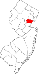 | |
| Boroughs | ||
| Town | ||
| Townships | ||
| Unincorporated communities | ||